Quick Field Data
- UNESCO Inscription: 2008 (Ref. 1274), dual cultural site in eastern Guanajuato State, Mexico; Criteria (ii) and (iv).
- Scale & Footprint: 46.95 hectares uniting 64 blocks (43-hectare core) of San Miguel de Allende's historic centre with the 0.75-hectare Sanctuary of Atotonilco and its 4.5-hectare buffer zone 14 kilometres north.
- Access & Ticketing: Protected by Mexico's Instituto Nacional de Antropología e Historia (INAH); central civic streets are open to pedestrians, while museums and Atotonilco's retreat sanctuary follow posted parish schedules.
- Arrival Logistics: Closest major flights arrive at Guanajuato International Airport (BJX), 74 kilometres west. Overland routes connect southeast toward Mexico City (241 kilometres straight-line, 274 kilometres by road).
Chichimeca Frontier Outpost, Silver Roads, and Independence Roots
Rising in eastern Guanajuato within Mexico's Bajío highlands, San Miguel de Allende sits 86 kilometres from Querétaro, 97 kilometres from Guanajuato capital and 274 kilometres by road from Mexico City. Before Spanish arrival, the Chichimeca village of Itzcuinapan occupied these arid hills until Miguel Palanca built a modest chapel dedicated to the Archangel Michael. Forced indigenous mine labour ignited fierce resistance across the Chichimeca War (1540 to 1590), including Guamare raids in 1551 that combined with chronic water shortages to drive settlers out. In 1555, friar Bernardo Cossin and indigenous leader Fernando de Tapia refounded the town as both military outpost and mission one mile east beside two freshwater springs, Batán and Izcuinapan, which supplied drinking water until the 1970s.
Once rich silver veins opened in Guanajuato and Zacatecas during the mid-16th century, caravan traffic bound for Mexico City funnelled straight through San Miguel. Viceroys granted cattle lands to Spanish settlers while offering indigenous communities limited self-rule and tax exemptions to stabilise the contested northern highway. This strategic crossroads forged a colonial melting pot where Spaniards, Creoles and Amerindians shared urban spaces, markets and textile workshops, with local weavers claiming invention of the traditional serape. By the mid-18th century, provisioning mining camps and hosting wealthy hacienda owners raised San Miguel's population to 30,000, outgrowing contemporary Boston (16,000) and New York (25,000).
San Miguel de Allende's national renown deepened dramatically at the outbreak of Mexico's War of Independence in 1810. Native sons Juan Aldama and Ignacio Allende, born facing the central square, joined Miguel Hidalgo y Costilla and Josefa Ortiz de Domínguez in conspiring against colonial rule in Mexico City. When royalists uncovered the plot, warning couriers rode straight through San Miguel north to Dolores, prompting Hidalgo's Grito de Dolores on 15 and 16 September 1810. Marching first south to Atotonilco, Hidalgo adopted a banner bearing the Virgin of Guadalupe before entering San Miguel to free prisoners and commission officers, making it the first town to break from Spain.
Post-war agricultural decline and 19th-century Liberal-Conservative conflicts eroded prosperity across Guanajuato even after state legislators elevated the town to city status in 1826, renaming it San Miguel de Allende in honour of Ignacio Allende. Late 19th-century dams, aqueducts, rail links and fruit orchards under Porfirio Díaz brought temporary revival before silver exhaustion and the Mexican Revolution emptied streets again. An early 20th-century influenza epidemic nearly turned the hillside settlement into a ghost town. Fortunately, its neglected stone palaces survived unaltered until Mexico's post-Revolution laws and Instituto Nacional de Antropología e Historia (INAH) oversight shielded historic buildings from demolition.
Baroque Mansions, Parroquia Spires, and Atotonilco Sanctuary Murals
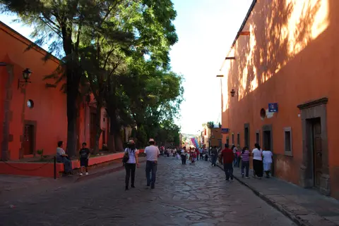
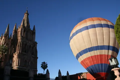
Walking the 64 blocks mapped on any san miguel de allende mexico map reveals coherent urban growth anchored around a 16th-century colonial plan. Civic and religious landmarks rise smoothly from Mexican Baroque into Neoclassical refinement and late 19th-century Neo-Gothic drama. Early worship centred on the Parroquia de San Miguel Arcángel, built between 1680 and 1685 before receiving its famous soaring pink stone facade in the late 19th century, adjacent to the 1742 San Rafael Church (Santa Escuela). Franciscan builders added the Templo de San Francisco between 1779 and 1799, while wealthy estate owners raised sprawling two-storey stone mansions far grander than usual for medium-sized Latin American towns.
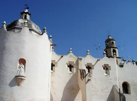
Fourteen kilometres north through dry mesquite, sweet acacia and thistle scrubland stands the second component of the UNESCO listing, the Sanctuary of Jesús Nazareno de Atotonilco. Founded in the 18th century by Oratorian Father Luis Felipe Neri de Alfaro in a thermal spring landscape compared by believers to Jerusalem, the compound originally drew irrigation from 27 freshwater springs. Thermal springs still rise one kilometre from the sanctuary and feed Balneario La Gruta spa nearby. Officially titled Santuario de Dios y de la Patria, the rural village shrine draws up to 5,000 pilgrims and art visitors weekly for worship and penance.
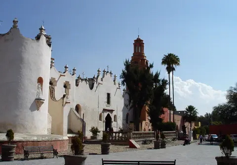
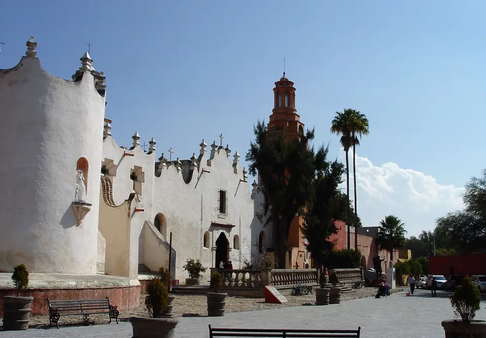
From the road, Atotonilco projects severe monastic simplicity: plain 10-metre perimeter walls, 12-metre cupolas and a 20-metre clock tower give the sanctuary a fortress-like profile. Oriented east-west toward Jerusalem behind a shaded former cemetery atrium, its mixtilíneo entry arch sits flanked south by the Casa de Ejercicios retreat quarters and north by Santa Escuela de Cristo. Step inside the single dome-less nave, however, and an explosion of Mexican folk Baroque murals leaves scarcely a bare centimetre across ceilings, arches and side chapels. Painted primarily over thirty years by Miguel Antonio Martínez de Pocasangre with José María Barajas, the vivid walls blend European Flemish prints brought from Belgium with indigenous artistic sensitivity.
Guided directly by verses composed by Father Neri along ceiling arches, the painted sequence traces human struggle from the Last Judgment through Christ's Passion toward divine glory. Visitors pass painted scenes from Gethsemane, the Jordan River and Pilate's trial, passing the Neoclassical stone-and-gold Señor de la Columna altarpiece before reaching the main 1812 to 1820 presbytery housing Father Neri's 1748 Seville-carved Nazareno sculpture. Behind the altar rises the circular Camarín de la Gloria (1740 to 1748), topped by a sunlit dome ringed by Apostle statues and monastic founders. North and south flanks shelter six chapels and chambers, including the 1759 to 1763 Belén Chapel, the 1763 Rosary Chapel depicting the naval Battle of Lepanto and Pocasangre's self-portrait, the dark Capilla de Soledad and the 1754 Loreto Chapel.
Twentieth-Century Art Schools, Real Estate Growth, and INAH Rules
San Miguel's modern transformation began in 1937 when American writer-artist Stirling Dickinson partnered with Peruvian intellectual Felipe Cossío del Pomar to build an art colony inside Mexico's quiet Bajío hills. Securing an old convent barracks from Mexican President Lázaro Cárdenas, they opened the Escuela de Bellas Artes in 1938, thriving today as Centro Cultural El Nigromante. During the 1940s, Dickinson, Cossío del Pomar and former Guanajuato governor Enrique Fernández Martínez founded the Instituto Allende. Once post-World War II United States G.I. Bill benefits allowed former soldiers to study abroad, enrolment surged and celebrated Mexican painters including José Chávez Morado and David Alfaro Siqueiros taught inside San Miguel's studios.
International creative life steadily shifted local livelihoods away from quiet farming toward hospitality, galleries and a booming expatriate property market. During the 1950s and 1960s, bohemian gatherings and film-industry visits championed by Cantinflas drew visitors from Canada, Europe and the United States, while authorities even policed counterculture styles in the 1970s. Today, strong foreign demand for renovated colonial houses has pushed historic real estate values higher than many homes in Mexico City, pricing out budget backpackers. Balancing cosmopolitan dining, art festivals like the Desfile de los Locos parade and residential affordability against historic preservation remains an ongoing local discussion.
Strict federal and municipal protections preserve historic stonework across San Miguel's 43-hectare core and Atotonilco's 0.75-hectare sanctuary precinct. Under Mexico's national monument laws administered by INAH, property owners must follow restoration standards governing stone facades, lime plaster colours, signage and courtyard heights across all 64 protected blocks. Even where late 20th-century renovations converted ruins into boutique inns or language schools, traditional mason methods maintain coherent street silhouettes. At Atotonilco, conservation specialists monitor delicate oil paintings by Rodríguez Juárez and folk Baroque murals by Pocasangre against humidity, candle smoke and heavy weekly foot traffic.
Travellers asking about san miguel de allende mexico safe conditions should keep regional context and official guidance clearly in mind. While the compact historic centre remains pedestrian-friendly and heavily patrolled around civic squares, visitors travelling across Guanajuato State should always consult current national government travel advisories before driving rural highways or planning intercity trips. Pairing daytime visits to Atotonilco with well-lit evening walks in central San Miguel helps visitors enjoy living Baroque plazas responsibly. Preserving both tangible colonial stone and intangible religious and craft traditions keeps both linked towns vital.
Access Zones in San Miguel de Allende and Atotonilco
Dividing a visit between San Miguel's walkable hillside streets and rural Atotonilco 14 kilometres north links colonial urban planning cleanly with Jesuit-inspired mural art. Verify parish liturgy schedules before entering Atotonilco's retreat chapels or San Miguel's active parish churches.
| Complex Zone | Key Highlights | Access & Ticket Rule |
|---|---|---|
| Jardín Principal and Parroquia | Central plaza, Parroquia de San Miguel Arcángel (1680 to 1685 with Neo-Gothic facade), San Rafael and municipal palace. | Open pedestrian plaza and free church entry outside mass hours; observe modest dress and quiet inside worship spaces. |
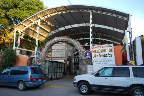
| Colonial Mansions and Arts Quarter | 64-block historic grid, Templo de San Francisco, Centro Cultural El Nigromante, Instituto Allende and craft markets. | Public cobbled streets and cultural courtyards; check local gallery admissions and studio event calendars directly. |
| Atotonilco Nave and Glory Chamber | Fortress exterior, Pocasangre folk Baroque ceiling murals, Señor de la Columna altarpiece and Camarín de la Gloria dome. | Located 14 kilometres north of town; modest sanctuary entry, though flash photography and retreat closures apply regularly. |
| Atotonilco Side Chapels and Springs | Rosary Chapel, Belén Chapel, Capilla de Soledad, Loreto Chapel and nearby Bajío thermal springs toward La Gruta. | Check sanctuary attendants for chapel access between active spiritual retreats; nearby thermal baths operate separate tickets. |
Three Folk Baroque and Urban Details Across the Two Zones
- Flemish-Inspired Folk Baroque Ceilings at Atotonilco: Tilt your gaze skyward along the main sanctuary nave. Miguel Antonio Martínez de Pocasangre turned Belgian prints into dense biblical scenes framed directly by Father Neri's poetic verses.
- Battle of Lepanto Vault and Self-Portrait in Rosary Chapel: Inside Atotonilco's 1763 Rosary Chapel, trace Spanish and Ottoman coats of arms painted on naval galleons beside a rare self-portrait where Pocasangre emphasised his indigenous features.
- Oversized Baroque-to-Neoclassical Town Mansions: Stroll streets around Calle Hernández Macías and the main square to notice towering carved-stone doorways and multi-courtyard footprints unusually grand for a highland Mexican trading town.
Best Time to Visit San Miguel de Allende From Guanajuato and Mexico City
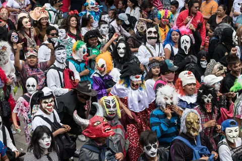
Deciding the best time to visit san miguel de allende mexico depends largely on balancing Bajío highland weather with cultural calendar peaks. Set on an elevated central Mexican plateau, sunny dry-season months make walking uneven colonial cobblestones comfortable between morning museum stops and courtyard galleries, while summer brings afternoon rains across surrounding fields. Mid-September draws huge crowds commemorating Independence ties around Miguel Hidalgo and Ignacio Allende, while June sees lively costumed celebrations such as the Desfile de los Locos on San Antonio de Padua's feast day.
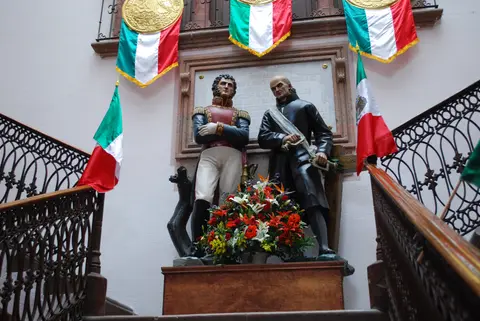
Organising san miguel de allende mexico things to do over two to three unhurried days lets visitors explore historic architecture together with contemporary art roots. Spend day one walking the 64-block colonial core from the Parroquia and municipal palace portraits of Allende and Hidalgo to Centro Cultural El Nigromante and traditional crafts markets. Dedicate a quiet half-day morning north along the rural valley road to study Atotonilco's 18th-century ceiling murals before weekly retreat groups crowd the narrow nave.
Understanding how to get to san miguel de allende mexico helps link central Mexico routes cleanly by air or highway coach. Most international travellers land at Guanajuato International Airport (BJX), 74 kilometres west, before transferring east into the Bajío hills. Overland buses and regional highways also connect directly from Mexico City (241 kilometres southeast straight-line, 274 kilometres by road) as well as Querétaro (86 kilometres) and Guanajuato city (97 kilometres). Discover more Spanish colonial towns and mural sanctuaries across Latin America inside our UNESCO World Heritage Atlas.