Quick Field Data
- UNESCO Inscription: 2008 (Ref. 1290), natural biosphere reserve straddling Michoacán and Mexico State, Mexico; Criterion (vii).
- Scale & Footprint: 13,551.552 hectares across five core reserve nuclei within the enlarged 56,259-hectare Monarch Butterfly Biosphere Reserve (buffered by 42,707 hectares), protecting eight of fourteen major eastern overwintering colonies.
- Access & Ticketing: Managed federally with community ejidos across Ocampo, Angangueo and State of Mexico municipalities; check official sanctuary trail gates and guide rules upon arrival.
- Arrival Logistics: Closest commercial airport is Adolfo López Mateos International Airport (TLC) near Toluca, 76 kilometres southeast. Larger hubs at Mexico City Benito Juárez (MEX, 122 kilometres) and Felipe Ángeles (NLU, 126 kilometres) serve Mexico City (116 kilometres southeast).
Four-Generation Migration and Oyamel Fir Winter Colonies in Mexico
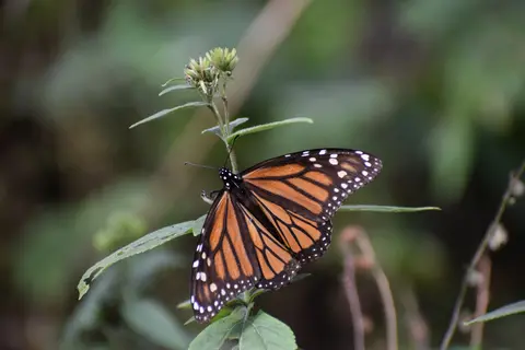
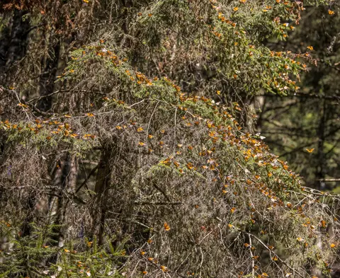
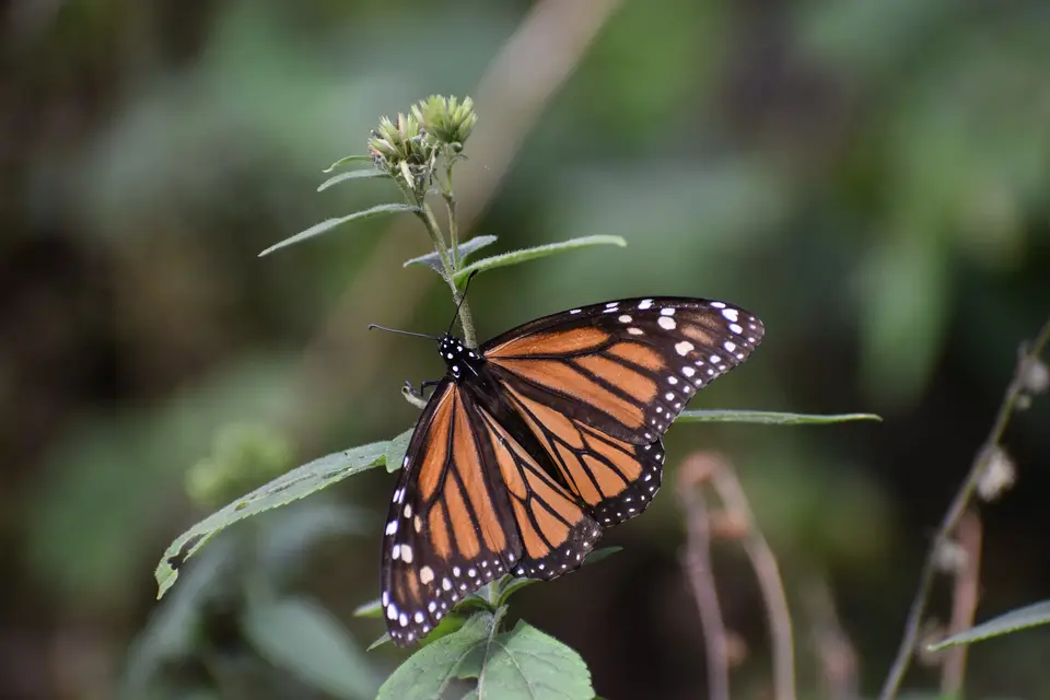
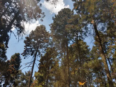
Stretching across rugged mountain slopes roughly 100 kilometres northwest of Mexico City, this reserve straddles Michoacán and Mexico State. It shields the main winter refuge of eastern North America's monarch butterfly (Danaus plexippus). Every autumn, tens to hundreds of millions, and in peak years up to one billion, butterflies complete a continental flight from breeding meadows as far north as eastern Canada. Arriving between October and March, monarchs settle inside small pockets of high-altitude woodland rather than dispersing evenly across the 56,259-hectare biosphere. Their dense roosts bend evergreen fir boughs downward under collective insect weight and paint sunlit pine-oak clearings deep orange.
Spring initiates an eight-month multi-generational cycle across North America. Departing Mexican mountain slopes in March, overwintering monarchs fly northward to lay eggs on milkweed before dying, giving rise to four successive generations born and dying along the route to eastern Canada and back. Against ordinary insect lifespans, fourth-generation monarchs hatched thousands of kilometres north never encountered the Mexican roost trees of their ancestors. Yet guided by mysterious biological navigation, these fresh autumn migrants converge precisely upon the same volcanic ridges inside central Mexico's Trans-Mexican Volcanic Belt pine-oak ecoregion.
Scientists only pinpointed these remote mountain hibernation grounds in 1975, triggering decades of conservation decrees. President José López Portillo issued initial legal protection in 1980 following sustained migration research. On 9 October 1986, prompted by Mexican poet Homero Aridjis and the Group of 100, President Miguel de la Madrid created the Monarch Butterfly Special Biosphere Reserve across 16,110 hectares. That 1986 decree covered Sierra Chincua, Sierra El Campanario, Cerro Chivatí-Huacal, Cerro Pelón and Cerro Altamirano, banning logging permanently inside 4,491 core hectares. In September 2000, presidential decrees expanded protection to 56,259 hectares containing 13,552 core hectares. Later in 2008, when Homero Aridjis acted as Mexico's ambassador to UNESCO, all 21 World Heritage Committee members agreed unanimously to inscribe the reserve as a natural heritage site.
Across central Mexico's mountains sit fourteen major overwintering colonies representing over half the eastern monarch population. Eight colonies lie inside the five protected World Heritage nuclei, sheltering an estimated 70 percent of all eastern overwintering monarchs within dense clusters holding six to sixty million butterflies per hectare. Because monarchs pack so tightly, colonies proper occupy tiny winter forest plots measured in hectares rather than wide valleys. Winter counts dropped from roughly 1.1 billion monarchs in 1996 down to 33 million across seven sites in 2013 to 2014. Colonies later rebounded toward nine reserve plots covering 2.10 hectares in 2020 (around 105 million individuals) and rose from 0.90 hectares in 2023 to 2024 up to 1.79 hectares in 2024 to 2025.
Basalt Ridges, Altitude Forest Belts, and Trans-Volcanic Wildlife
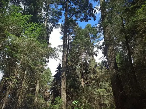
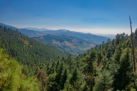
Mountain topography across the monarch butterfly biosphere reserve michoacán and Mexico State spans elevations rising past 2,700 metres above sea level in Michoacán and climbing higher across oyamel belts. Geologically, basalt rock outcrops cut by northeast-to-southwest faults, fissures and cliffs have replaced older volcanic cones and ancient lava flows. Because volcanic soils remain highly permeable, surface water stays scarce across upper slopes, collecting mainly in small ponds and seasonal arroyos. Temperate yet moist sub-climates transition smoothly from cool semi-moist lower slopes to cold semi-moist summits with mean maximum temperatures near 22 degrees Celsius and summer rains.
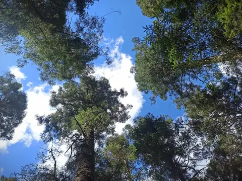
Distinct forest zones shift steadily with elevation across these volcanic slopes. Below 2,400 metres lie meadows mixed with junipers, cedars, farms and rural village gardens. Holm oak woodlands thrive up to 2,900 metres above sea level, mingling with pine stands between 1,500 and 3,000 metres across broad mid-mountain ridges. Above 2,400 up to 3,600 metres grows drought-resistant oyamel fir (Abies religiosa), whose dense overlapping boughs create indispensable thermal blankets sheltering butterflies from freezing nights and occasional winter rains. Climate models warn that warming temperatures could shrink or threaten oyamel fir belts late in the 21st century.
Beyond overwintering insects, rugged mountain habitats sustain diverse fauna ranging from subtropical valleys to sub-arctic summits, including regional endemics. White-tailed deer (Odocoileus virginianus), coyotes (Canis latrans), long-tailed weasels (Neogale frenata) and grey foxes (Urocyon cinereoargenteus) patrol pine-oak understorey paths around native rabbits. Overhead circle ravens (Corvus corax), turkey vultures (Cathartes aura), great horned owls (Bubo virginianus) and seasonal hummingbirds with native reptiles and amphibians. Maintaining continuous forest cover across Ocampo, Angangueo, Zitácuaro and Contepec in Michoacán plus Donato Guerra, Villa de Allende and Temascalcingo in Mexico State shields this whole mountain ecosystem.
On crisp winter mornings when sunlight warms perched butterflies, millions stir simultaneously across the forest canopy. Their combined wingbeats fill quiet clearings with a soft rushing murmur resembling gentle light rain as streams of butterflies glide downhill to sip moisture from damp arroyos and mineral soils. Afternoon clouds send flocks cascading back onto heavy oyamel boughs before temperatures drop toward freezing after dusk. Every winter colony depends directly on undamaged surrounding trees buffering cold mountain winds.
Otomi and Mazahua Stewardship, Illegal Logging, and Milkweed Loss
Human land history deeply shapes daily protection across these privately and communally held rural mountains. Heavy 19th-century colonial logging stripped timber across central valleys until post-Mexican Revolution land reforms returned extensive forest grants to indigenous Otomi and Mazahua communities. Historically, these communities governed upper mountain ranges communally under sustainable collective use while dividing lower hillsides into family garden plots. Federal biosphere decrees overlapping communal forests sometimes sparked tensions with farmers, private landowners and indigenous residents needing viable non-timber livelihoods.
Because intact oyamel canopy creates the fragile microclimate protecting monarchs from lethal frosts, small-scale illegal logging remains a severe threat inside core and buffer zones. Unmanaged winter storms in Michoacán during 2002 and severe droughts across Texas during 2011 also struck migrating colonies hard before out-of-control tourism compounded ecological strain. Tragic regional violence further underscored conservation stakes when prominent sanctuary defender Homero Gómez González disappeared in January 2020, pointing to organised crime pressures in surrounding highlands. Meanwhile, rising visitor numbers demand careful trail control so dust, foot noise and crowded horse paths never disturb resting clusters.
Equally critical pressures strike far north of Mexico across monarch spring and summer breeding grounds. Conservation scientists largely link the long decline from 1996 highs to widespread adoption of herbicide-resistant genetically modified soybean and corn crops across the United States Corn Belt, reaching 93 percent of soybean acreage and 85 percent of corn acreage by 2013. Intensive herbicide spraying eradicated wild milkweed plants, the sole host plant monarch caterpillars can consume. Recognising continent-wide interdependence, Homero Aridjis, Group of 100 and scientists appealed directly to President Enrique Peña Nieto, President Barack Obama and Prime Minister Stephen Harper ahead of summits in Toluca (2014) and Ottawa (2016).
Binational initiatives including the 2014 North American Leaders' working group and the United States Pollinator Health Task Force targeted 225 million butterflies occupying six hectares by 2020, backing habitat restoration with Mexican forest patrols. Within Mexico itself, deforestation around northwest hibernation zones even pushed small groups of butterflies to colonise emerging sites such as Atlautla's Joya Redonda sanctuary 80 kilometres southeast of Mexico City, where local volunteers helped colonised trees climb from four in 2021 to 42 by 2023. Inside the UNESCO reserve, sustainable ecotourism benefit-sharing with local ejidos remains vital so forest protection rewards host villages directly. Supporting guided community walks gives rural stewards lasting incentives to guard oyamel trees against chainsaws.
Access Zones Across the Monarch Butterfly Biosphere Reserve
Checking a monarch butterfly biosphere reserve map clarifies how five separated volcanic sanctuary zones sit across Michoacán and western Mexico State. Always hire authorised local ejido trail guides and follow strict silence, path and flash-free rules inside active roosting zones.
| Complex Zone | Key Highlights | Access & Ticket Rule |
|---|---|---|
| El Rosario Sanctuary (Ocampo) | Michoacán's most visited oyamel fir slopes cradling dense winter butterfly clusters above 2,700 metres. | Steep footpath climbs from ejido trailheads; purchase official sanctuary gate wristbands and hire local community guides. |
| Sierra Chincua (Angangueo) | High-altitude volcanic ridge trails and open meadows beside historic Michoacán mining settlements. | Accessible by walking or rented horse paths with ejido guides; keep quiet and stay strictly behind roped cluster boundaries. |
| Cerro Pelón Sanctuary | Rugged southern Michoacán and State of Mexico border slopes housing secluded seasonal colonies. | Steep mountain hikes from community access points; verify seasonal trail conditions locally before climbing high ridges. |
| Piedra Herrada and Western Nuclei | Oyamel fir groves in Mexico State near Valle de Bravo and Donato Guerra within the eastern reserve wing. | Closest sanctuaries for day drives from Toluca or Mexico City; follow local ejido trail schedules and forest conservation fees. |
Three Microclimate and Forest Details at Overwintering Sanctuaries
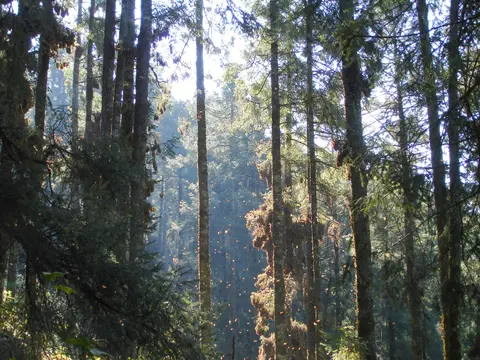
- Thermal Blanket Effect of Dense Oyamel Fir Boughs: Stand inside mature Abies religiosa stands above 2,400 metres to feel how interlocking evergreen needles trap daytime warmth and shield sleeping butterfly clusters against freezing winter rain.
- Sunlight-Triggered Wing Activity and Arroyo Drinking: Notice how shaded clusters hang motionless like dry brown bark at dawn before bright midday sun warms wings enough for millions to lift off toward damp creek beds.
- Permeable Basalt Faults and Dry Ridge Hydrology: Observe dry volcanic pine-oak ridges rising above scarce small arroyos, showing why untouched high-altitude forest humus matters for retaining regional moisture across Michoacán.
When to Visit the Monarch Butterfly Reserve From Mexico City
Pinpointing the best time to visit monarch butterfly biosphere reserve aligns directly with the October-to-March wintering season. While butterflies arrive in late autumn and linger until late March, mid-winter sunny days between January and early March generally offer stable dry skies and active midday flight displays as rising temperatures coax colonies out of torpor. Travellers checking monarch butterfly biosphere reserve when to visit notices should also inspect local sanctuary announcements, because cold foggy mornings keep clusters folded tightly against trunks until noon sun breaks through.
Planning monarch butterfly biosphere reserve from mexico city trips works smoothly either as long guided excursions or two-day stays based around Michoacán mountain towns like Angangueo or Mexico State's Valle de Bravo. Travellers comparing monarch butterfly biosphere reserve tours and reading monarch butterfly biosphere reserve reviews often prefer two-day visits to avoid rushing high-altitude climbs above 2,700 metres on the same day as highway driving. Packing warm layers, sturdy dusty-trail boots and plenty of water keeps strenuous uphill climbs comfortable across thin mountain air.
International flyers land fastest via Adolfo López Mateos International Airport (TLC) near Toluca, 76 kilometres southeast. Major hubs Mexico City Benito Juárez (MEX, 122 kilometres) and Felipe Ángeles (NLU, 126 kilometres) also serve Mexico City (116 kilometres southeast). Browse more seasonal migrations inside our UNESCO World Heritage Atlas.