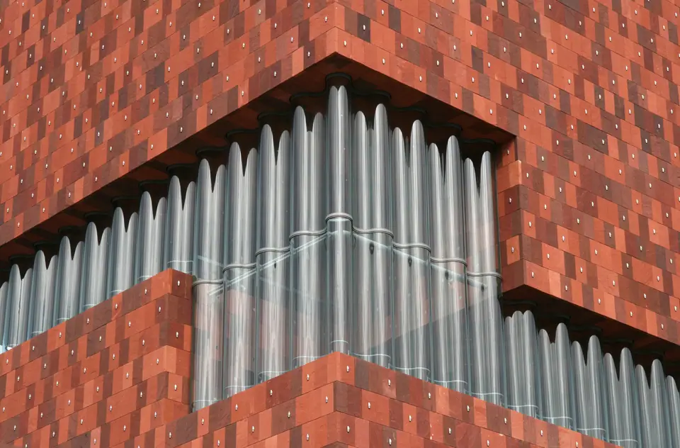
Photo: Till Niermann · CC BY-SA 3.0
Central Station, the Diamond Quarter and the Eilandje
Antwerp's railway hub, the Square Mile diamond streets, 1843 Zoo, Berchem rail fringe, red-sandstone MAS and Red Star Line piers.
Few European cities compress contrasting trades as tightly as Antwerp along the corridor linking Koningin Astridplein to northern docks. Seconds outside railway doors sit bollard-guarded diamond streets, kosher bakeries and an 1843 zoological garden. Roughly 2.9 kilometres northwest along river quays, Napoleon's old harbour basins anchor Het Eilandje's red-sandstone MAS tower and ocean-liner sheds. Walking or riding a tram between both poles reveals a clear link from pocket gemstones to deepwater cargo.
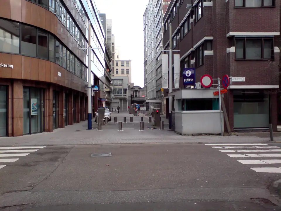
Rough diamonds behind Central Station security bollards
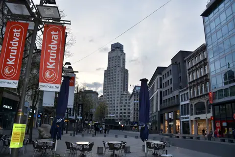
Immediately southwest of Antwerpen-Centraal and a five-minute walk from Meir lies Antwerp's compact Square Mile district. Its grid spans Hoveniersstraat, Schupstraat, Rijfstraat, Pelikaanstraat and Lange Kievitstraat. Diamond cutting started locally in the fifteenth century and accelerated when Lodewyk van Berken invented the scaif polishing wheel for symmetrical facets. Just eight years after the 1576 Spanish Fury, local cutters founded Antwerp's first diamond guild in 1584.
Today four private exchanges under the Antwerp World Diamond Centre (AWDC) anchor roughly 380 cutting workshops. Those bourses serve 1,500 diamond firms, 3,500 specialised brokers, merchants and cutters, and around 30,000 total sector workers. Industry data places Antwerp's rough-diamond share at 84 per cent in 2012, roughly 85 per cent in sector overviews and over 80 per cent in 2017. Retractable bollards, cameras and police guard Hoveniersstraat; private exchanges do not admit drop-in visitors, though retail jewellers welcome browsers along Pelikaanstraat.
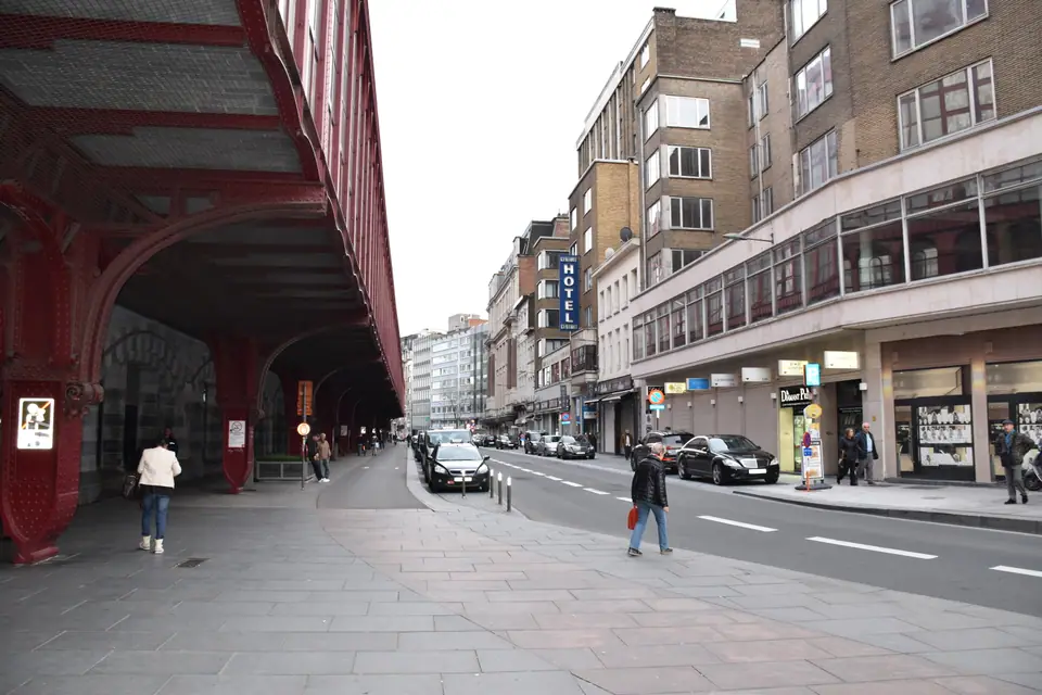
Pelikaanstraat, Lange Kievitstraat and Shabbat rhythms
From the late 1800s, Hasidic Jewish families shaped a tight-knit merchant and residential quarter along Pelikaanstraat, Lange Kievitstraat and Belgielei. Virtually every diamond office, kosher bakery and Jewish bookseller trades briskly from Sunday morning through Friday afternoon. Doors then shut completely from Friday dusk through Saturday night for Shabbat. Dress respectfully and avoid intrusive photography when strolling these residential blocks. Wartime Holocaust deportations taking over 25,000 Jews and Roma eastward to Auschwitz are documented south at Mechelen's Kazerne Dossin in our excursions guide.
Antwerp Zoo beside the iron train shed
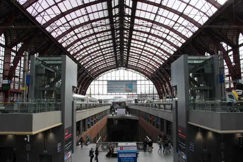
Directly east across Koningin Astridplein stands Antwerp Zoo, opened on 21 July 1843 as one of the world's oldest scientific zoos. Its grounds predated the 1905 Central Station concourse next door by more than sixty years. Caring for more than 5,000 animals across over 950 species behind historic Art Nouveau gates and landscaped aviaries, its enclosures share boundary walls with main railway platforms. Train arrivals reach the gate within minutes without boarding a city tram.
Berchem gateway and the southern Zurenborg fringe
One suburban train stop south along the main rail trunk sits constituent district Berchem, counting 43,325 residents. Local commuters and Mechelen-bound regional services pause here moments before entering Antwerpen-Centraal's vaulted hall. Most leisure visitors pass Berchem by train or step off southern trams when walking between Cogels-Osylei's Art Nouveau townhouses and Groen Kwartier courtyard cafés. Regional trains connect Berchem to central platforms in minutes.
Bonaparte Dock and the rebirth of Het Eilandje
North of historic quays sits Het Eilandje ("little island"), shaped around harbour locks and timber basins dug under Napoleon Bonaparte around Bonaparte Dock and Willemdok. Once lined with shipping offices and bond warehouses, those brick basins now hold yacht marinas, waterfront benches and converted harbour lofts. Flat stone quays link calm yacht piers cleanly with brick dockland sheds. De Lijn Tram 7 connects historic central streets straight north to the marina in roughly 15 minutes, detailed in our transport guide.
Red Indian sandstone and glass panorama inside the MAS
Rising 60 metres above the medieval Hanzehuis trading footprint, Museum aan de Stroom (MAS) opened on 17 May 2011 to designs by Neutelings Riedijk Architects. Stacked gallery boxes clad in hand-laid Indian red sandstone twist upward behind undulating glass curtain walls. Free public escalators carry visitors past dock views up to an open rooftop lookout terrace. Ticketed museum lifts open 8 exhibition floors exploring Antwerp's river and global maritime trade.
| District landmark | Key date and scale |
|---|---|
| Antwerp Diamond Exchanges (AWDC) | Four bourses, 380 workshops, 1,500 firms and over 80% rough share. |
| Antwerp Zoo | Opened 21 July 1843; 5,000+ animals across 950+ species. |
| MAS (Museum aan de Stroom) | Opened 17 May 2011; 60 metres tall on Hanzehuis site. |
| Red Star Line Museum | Opened 28 September 2013 on Montevideostraat; 2 million passengers. |
| Sint-Annatunnel | Opened 1933; 572 metres beneath the Scheldt. |
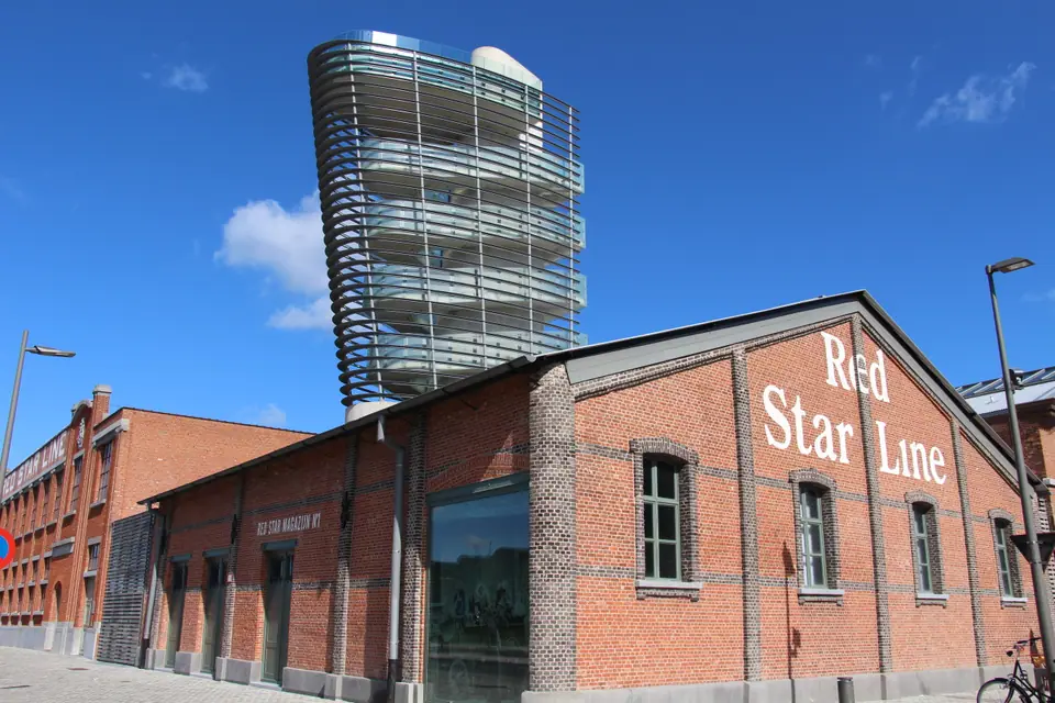
Two million departures from the Red Star Line sheds
Walk northwest across Willemdok to Montevideostraat for the Red Star Line Museum, opened on 28 September 2013 inside brick embarkation halls. Roughly two million ocean-liner emigrants stepped through this inspection complex bound for North America. Permanent exhibitions trace passenger departures from Montevideostraat piers onto transatlantic Red Star Line ships. An exterior observation tower frames broad Scheldt curves next to historic Montevideo sheds, new home since October 2025 to two-Michelin-star restaurant The Jane.
Tracing wealth from pocket stones to deepwater cargo
Linking Koningin Astridplein to northern basins explains Antwerp's commercial adaptability across centuries of trade. Pocket diamonds needed zero maritime river depth during two centuries of Dutch river blockade. Once Belgium arranged the 1863 Scheldt toll buyout, steam shipping rebuilt Het Eilandje docks. Pedestrians and cyclists later gained the 572-metre Sint-Annatunnel crossing opened in 1933 to reach Linkeroever. Follow our three-day Antwerp route to connect both ends cleanly. Weigh dock apartments against station hotels in our district stay guide.
Where it is
- 1Central Station, the Diamond Quarter and the Eilandje
- Brussels Airport (BRU) · about 37 km from here in a straight line
- Directions in Google Maps
Stations and taxi ranks: OpenStreetMap. Airports: OurAirports. Distances are in a straight line.
Traveller tips
Real advice from people who have been to Antwerp. Every tip is read by our team before it goes live.
No tips yet. Been here? Yours could be the first.
Thank you! Your tip will appear here after a quick review.
More in Antwerp
Continue exploring Antwerp with related neighbourhood, food, and planning guides