Photo: Kora27 · CC BY-SA 4.0
Sandstone Towers of the Bastei Above the Elbe
Just half an hour up the Elbe by S-Bahn S1 and cable reaction ferry, sheer Bastei sandstone pillars rise 194 metres above the river inside Saxon Switzerland National Park.
Thirty minutes south-east of Dresden's baroque domes, broad Elbe meadow bends pinch tightly between vertical grey sandstone cliffs and dark pine gorges. Established on 12 September 1990 across roughly 93.5 square kilometres in two protected zones, Saxon Switzerland National Park (Nationalpark Sächsische Schweiz) forms Germany's only rocky canyon national park beside Czech Bohemian Switzerland across the frontier. Instead of riding summit tour buses straight into crowded upper car parks, independent rail walkers climb calmly from river level through shaded canyons. Follow four classic trail stops from Hauptbahnhof platform to clifftop ridge.
Board the S1 Up the Elbe to Kurort Rathen
Skip upper coach parks and take the canyon train. S-Bahn line S1 turns this short rail ride into a moving geological preview. Trains depart every thirty minutes from Meissen through Dresden-Neustadt and Dresden Hauptbahnhof south-east toward Schöna. Beyond Pirna, flat urban meadows vanish swiftly beneath wooded cliffs and working quarry walls. Left-hand seats heading upriver look across barges and Schloss Pillnitz vineyard terraces, while right-hand windows watch sheer sandstone walls rise below Königstein Fortress. Step down cleanly at Kurort Rathen roughly 30 to 35 minutes past Hauptbahnhof onto cobbled riverfront lanes using any VVO regional ticket, Dresden Regio Card, or Deutschlandticket. Clear bright mornings deliver far cleaner valley views than overcast mist-bound afternoons.
Cross on the Cable Ferry and Climb to the Bastei Bridge
Every walker crosses the Elbe before climbing stone steps. Kurort Rathen's rail platform sits on the left bank opposite the timber spa village and Bastei cliffs. Walk down the cobbled slipway to board the historic Gierseilfähre, a silent yaw-rope reaction ferry tethered upstream by heavy overhead cable. High steel lines keep the wooden ferry safely clear of passing river barges as Elbe currents push the hull across without engine roar. Remember one important fare rule before boarding: VVO rail passes and the Deutschlandticket do not cover the Kurort Rathen crossing. Keep euro cash or a card handy for the separate onboard ferry fare.
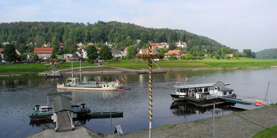
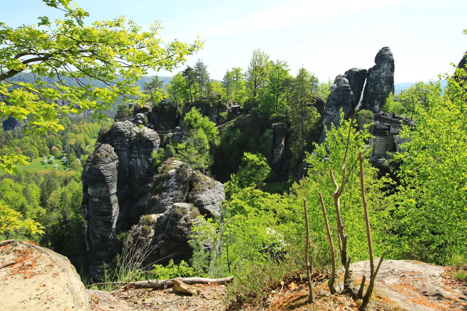
From Niederrathen timber cottages, follow clear yellow and blue signs climbing cool oak and beech switchbacks past carved stone viewing niches. Early starts put walkers on clifftop ledges cleanly ahead of midday bus crowds reaching summit gates. Spanned originally by wood in 1824 and replaced in 1851 by a surviving seven-arch stone viaduct measuring 76.5 metres long, the Bastei Bridge (Basteibrücke) links vertical rock pillars roughly 194 metres above the Elbe (305 metres above sea level). Crossing the viaduct and main ridge ledges stays completely free and open all year. Morning river mist often hugs wooded valleys below while sunlit sandstone arches shine brightly overhead.
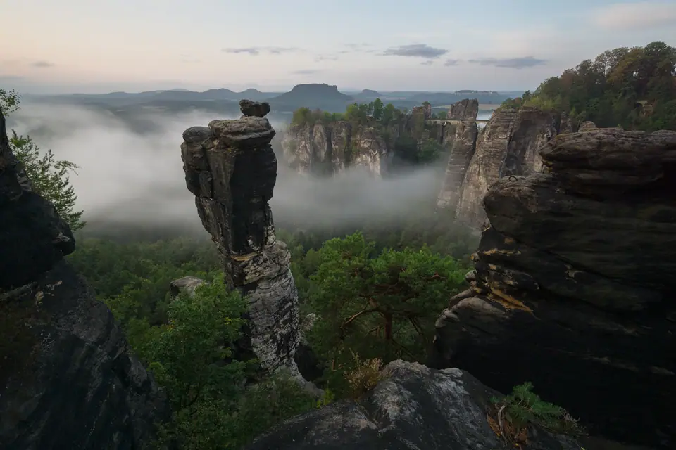
Read the Felsenburg Neurathen Notice and Viewpoints
Respect active rock safety closures immediately beside the bridge. Clinging straight onto sheer needles next to the arches sit the open-air castle ruins of Felsenburg Neurathen. Walkers historically crossed medieval rock cisterns and watchtower ledges via bolted iron catwalks. Anyone recalling older trips must adjust trail goals before climbing. Felsenburg Neurathen has remained closed since September 2023 due to tiny monitored rock movements beneath steel walkways. Park authorities keep those ruins shut until further notice on regional alerts. Thankfully, sturdy sandstone railings on the Bastei Bridge itself, Ferdinandstein spur, and broad terraces facing Lilienstein's flat table summit stay wide open above crooked rock chimneys.
Descend the Schwedenlöcher Steps or Push to Schrammsteine
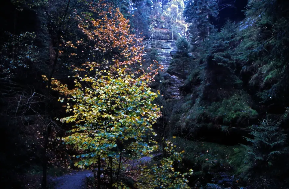
Loop northward through cool canyon moss instead of retracing uphill steps. Villagers once sheltered livestock inside the narrow Schwedenlöcher ravine during the Thirty Years' War. More than 700 steep stone and metal stairs drop steadily between dripping fern ledges and sheer canyon walls. Shaded rock pools offer welcome cool relief on hot afternoons before opening onto leafy Amselgrund valley past Amselsee rowboats back into Kurort Rathen. Fit hikers wanting a longer ridge outing ride S-Bahn S1 ten minutes further east to Bad Schandau (roughly 33 kilometres from Dresden and six short of the Czech border). From Bad Schandau, iron ladders scale the jagged Schrammsteine crest, or historic town transit runs on the 1898 Kirnitzschtal tram and 50-metre 1904/1905 Ostrau cliff lift. Allow generous afternoon margin so late river ferry waits never rush stony descents.
Park Rules, Footwear and Königstein Variations
Safe valley outings depend on solid boots and forest awareness. Across the wider mountains runs the 116-kilometre Malerweg (Painters' Way) passing landmarks near Großer Zschirnstein (562 metres tall inside the adjacent protection zone). One S1 halt before Rathen towers Königstein Fortress (documented since 1233/1241), drawing roughly 700,000 yearly guests onto a 9.5-hectare cliff plateau 240 metres above the river housing a 152.5-metre 16th-century well. Pack drinking water and waterproof layers, since ridge cafés fill fast around midday and village kiosks shut cleanly on quiet weekdays. Back down beside Rathen meadows, riverside gardens plate warm apple strudel while paddle steamers glide smoothly from timber jetties. Prepare carefully and follow park law.
- Wear sturdy lugged-sole boots: Wet pine needles, moss, and slick carved steps inside the Schwedenlöcher catch flat city trainers fast after any summer shower.
- Obey signed core-zone paths (Wegegebot): Inside protected Kernzone wilderness sectors stay strictly on marked routes, keep dogs leashed, and leave drones packed away.
- Follow strict fire and camping rules: Open flames, cigarettes, and wild camping stay completely banned across park woods (outside regulated climbers' Boofen shelters) to stop forest fires.
- Confirm final ferry and steamer timings: Check VVO rail schedules and Sächsische Dampfschifffahrt dock signs beforehand, or pair an active paddle-steamer cruise upriver with an evening S1 train back to town.
Where it is
- 1Sandstone Towers of the Bastei Above the Elbe
- Dresden Airport (DRS) · about 29 km from here in a straight line
- Václav Havel Airport Prague (PRG) · about 97 km from here in a straight line
- Directions in Google Maps
Stations and taxi ranks: OpenStreetMap. Airports: OurAirports. Distances are in a straight line.
Traveller tips
Real advice from people who have been to Dresden. Every tip is read by our team before it goes live.
No tips yet. Been here? Yours could be the first.
Thank you! Your tip will appear here after a quick review.
More in Dresden
Continue exploring Dresden with related neighbourhood, food, and planning guides