


























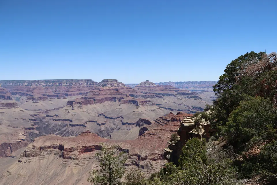
Walking the South Rim Trail: Mather Point, Yavapai Geology Museum and Trail of Time
Walking the flat, paved Rim Trail along the South Rim from Mather Point past the 1928 Yavapai Geology Museum and the Trail of Time to Grand Canyon Village.
When you drive through the South Entrance Gate of Grand Canyon National Park along Arizona State Route 64, follow the main park signs past Tusayan straight to the four large, complimentary car parks (Lots 1 through 4) surrounding the Grand Canyon Visitor Center Plaza. Instead of circling the busy historic village loops looking for kerbside spaces, leaving your vehicle here for the day is the smartest first move on the South Rim, as explained in our South Rim shuttle and parking guide. From the back of the Visitor Center Plaza, a level, tree-lined path leads two hundred metres through fragrant pinyon and juniper pines to the canyon railing, where the forest floor drops away for 1.6 vertical kilometres at Mather Point.
Mather Point: Your First Panorama Across One-Quarter of the Canyon
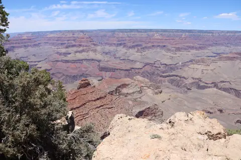
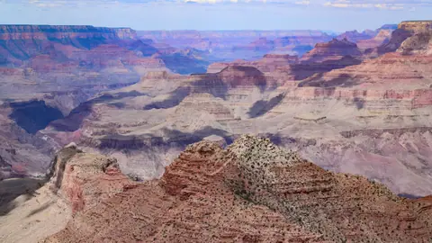
Named in honour of Stephen Tyng Mather, the conservationist who served as the first Director of the National Park Service from 1917 to 1929, Mather Point sits at 2,170 metres (7,120 feet) elevation and acts as the central orientation overlook of the South Rim. Two narrow, railed Kaibab Limestone promontories jut straight out over the chasm alongside a stepped stone amphitheatre, giving visitors a 180-degree panorama covering more than one-quarter of the visible Grand Canyon:
- Reading the Buttes and Temples from East to West: looking to your right (east), you can trace Vishnu Temple and the flat-topped mesa of Wotans Throne. Looking straight ahead across the abyss toward the higher North Rim (at 2,400 metres elevation), your eye follows the dark gash of the Inner Gorge and the green corridor of Bright Angel Canyon, flanked by the red-and-buff sandstone pyramids of Isis Temple, Cheops Pyramid and Buddha Temple. Below the rim to the left, you can spot the switchbacks of the Bright Angel Trail crossing the broad olive-green platform of the Tonto Plateau.
- Beating the Midday Crowds on the Amphitheatre: because Mather Point is the closest viewpoint to the main car parks and shuttle hub, hundreds of visitors gather on the two rock tips around midday. If you arrive at sunrise (check our sunrise and dark-sky photography guide) or step two hundred metres west along the cliff path toward Yavapai Point, the railing opens up into quiet pine-shaded alcoves.
Walking 1.1 Kilometres West on the Paved Rim Trail to Yavapai Point
While many short-stay visitors photograph Mather Point and walk back to their cars, turning left (west) along the cliff edge puts you onto the central paved section of the South Rim Trail. Stretching for twenty-one kilometres in total from the South Kaibab Trailhead to Hermits Rest, the central 4.3-kilometre corridor between Mather Point, Yavapai Point and Grand Canyon Village is completely paved, level, and accessible to wheelchairs and strollers.
The fifteen-minute (1.1-kilometre) level walk from Mather Point to Yavapai Point hugs the limestone rim away from road traffic. Because Yavapai Point projects further north into the central bend of the gorge, it unlocks three inner-canyon landmarks hidden behind cliffs at Mather Point:
- The 1928 Yavapai Geology Museum (Complimentary Entry): perched directly on the cliff lip of Yavapai Point is a low-profile native stone observation station erected in 1928 by pioneer park naturalists and geologists to explain how the canyon formed. Step inside its climate-controlled gallery to stand before floor-to-ceiling picture windows fitted with engraved sightlines and three-dimensional topographic relief models.
- Seeing the Colorado River and Suspension Bridges Below: looking down through the Yavapai Point windows (or from the outdoor terrace railings), you have an unobstructed line of sight 1,460 vertical metres straight down into the black metamorphic rock of the Inner Gorge. Here you can clearly see the emerald ribbon of the Colorado River, the twin spans of the Black Bridge (used by hikers and mules on the South Kaibab Trail) and the Silver Bridge (used by Bright Angel hikers), and the green cottonwood trees of Phantom Ranch at the mouth of Bright Angel Creek.

The Trail of Time: Walking Backwards Through Two Billion Years (2.1 km Flat)
Continuing west from the Yavapai Geology Museum toward historic Grand Canyon Village (Verkamp's Visitor Center, Hopi House and El Tovar), the paved Rim Trail becomes the Trail of Time, the largest outdoor geological timeline exhibition on Earth. Designed by geologists from the University of New Mexico and Arizona State University, this flat 2.1-kilometre walk turns the canyon edge into a physical walk through deep earth history:
- One Metre Equals One Million Years: after passing an initial introductory Million Year Trail that bridges human history and the six-million-year carving of the gorge, brass markers embedded in the pavement every metre count backwards at a scale of one metre per one million years, stretching back to 1,840,000,000 years ago (1.84 billion years), the age of the oldest Elves Chasm Gneiss and Vishnu Schist at the bottom of the canyon.
- Touching Actual Boulders from Every Canyon Stratum: lined up along the stone wall beside the path stand pedestals topped with unpolished rock specimens hoisted up from every geological layer visible across the chasm. You can run your hand over 270-million-year-old fossilised marine sponges in the cream Kaibab Limestone, wind-blown desert dunes preserved in the 280-million-year-old Coconino Sandstone, red mudstones of the Hermit Shale and Supai Group, 340-million-year-old Redwall Limestone cliffs, 500-million-year-old Cambrian Tapeats Sandstone, and pink Zoroaster Granite veins intruded into black Vishnu Schist.
- Viewing Tubes and the Great Unconformity: roadside viewing tubes along the trail point directly across the canyon to the exact cliff bands corresponding to each rock sample, including the Great Unconformity, where over one billion years of missing rock record sits between tilted ancient basement rocks and flat-lying horizontal sediments above.

Connecting to Grand Canyon Village and the Free Shuttle Return
The Trail of Time concludes right at the eastern entrance to the Grand Canyon Village Historic District beside 1906 Verkamp's Visitor Center, the 1905 Hopi House and the pine-log dining room of the El Tovar Hotel. Walking the entire paved promenade from the Visitor Center Plaza out to Mather Point, across to Yavapai Geology Museum, and down the Trail of Time into Grand Canyon Village covers roughly 3.5 kilometres (2.2 miles) on flat pavement and takes ninety minutes to two hours. Once you finish exploring the village lodges, simply board the complimentary Blue Route (Village) Shuttle Bus at any village stop, which loops back to the Visitor Center car parks in ten minutes.
Traveller tips
Real advice from people who have been to Walking the South Rim Trail: Mather Point, Yavapai Geology Museum and Trail of Time. Every tip is read by our team before it goes live.
No tips yet. Been here? Yours could be the first.
Thank you! Your tip will appear here after a quick review.
More in Grand Canyon
Continue exploring Grand Canyon with related neighbourhood, food, and planning guides
Hermit Road (The West Rim Drive): Riding the Free Red Shuttle to Hopi Point & Hermits Rest
Grand Canyon, United States
Grand Canyon Day Trips: Horseshoe Bend, Antelope Canyon and More
Grand Canyon, United States
Driving Desert View Drive (East Rim, Highway 64): Grandview, Moran, Lipan & 1932 Watchtower
Grand Canyon, United States
Bucket-List Adventures: South Rim Helicopter Flights, Smooth-Water Rafting & Mule Rides
Grand Canyon, United States
