











Dobrota Promenade: Captain's Palaces, Churches & Swimming Pontas
Self-guided walk along Kotor's sunny Dobrota waterfront promenade: 18th-century Baroque captain's palaces, St Eustace, St Matthew's and stone swimming pontas.
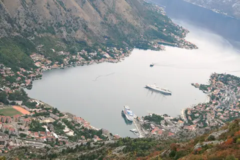
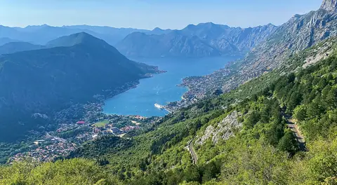
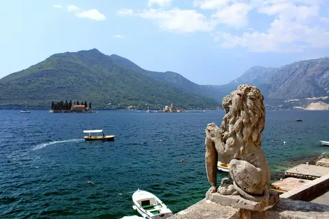
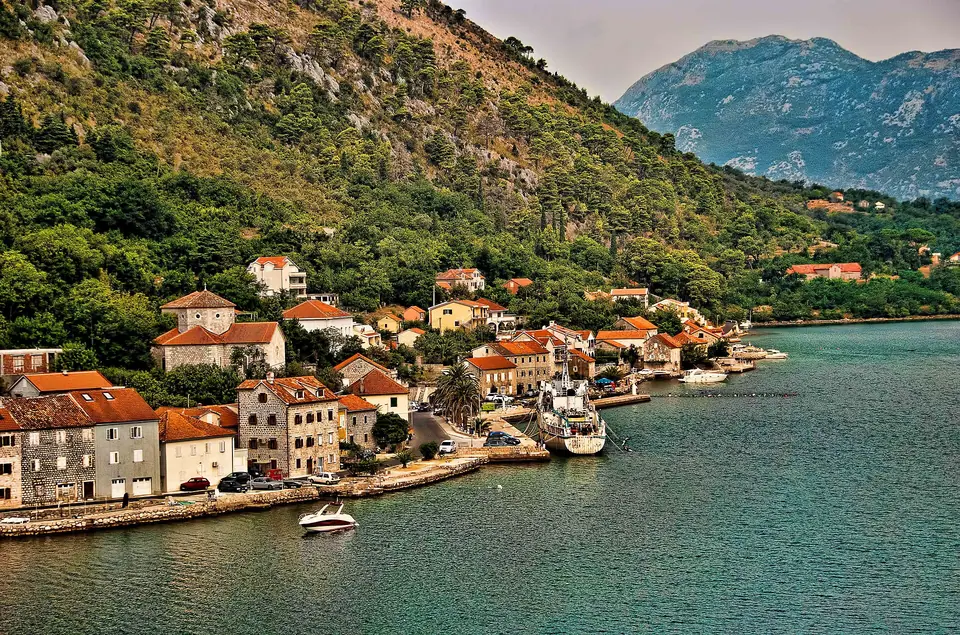
Dobrota begins 500 metres north of Kotor's River Gate and stretches for 7 kilometres along the sunny eastern shoreline of the inner bay toward Ljuta. While tourists crowd into the walled alleys of Stari Grad, a narrow, largely car-free lower coastal lane (Donji Put) hugs the water's edge through Dobrota. Along the way, it passes 18th-century Baroque sea captains' palaces (palaci), fortified stone docks (mandraći), two monumental waterfront churches, and dozens of stone jetties known locally as pontas. Because Dobrota faces west-southwest across the fjord, it enjoys three more hours of afternoon sunshine than the opposite shore of Muo and Prčanj. A late-afternoon walk, swim, and waterside dinner here ranks among the top experiences in our Kotor things to do guide.
| Dobrota Walk Segment | Distance from River Gate | Key Landmarks Passed | Walking Time (One Way) |
|---|---|---|---|
| 1. Kamp to St Matthew's Church. | 0.5 km to 1.8 km. | Kotor Beach, Kamp boardwalk, St Matthew's (1670) & Tripković Palace. | 20 to 25 min flat. |
| 2. St Matthew's to St Eustace (Sveti Stasije). | 1.8 km to 4.2 km. | Radoničić, Milošević & Dabinović ("Kokotova Kula") Palaces, St Eustace. | 35 to 40 min flat. |
| 3. Sveti Stasije to Ljuta River. | 4.2 km to 6.8 km. | Ivanović Palace, pine-shaded pontas & Stari Mlini trout springs. | 35 to 40 min flat. |
Why Dobrota's Palaces Have Fortified Towers & Enclosed Harbours
During the 1700s, Dobrota home-ported more than half of the entire merchant fleet of Boka Kotorska , over 35 armed sailing ships manned by patrician clans such as the Tripković, Dabinović, Ivanović, Radoničić and Kamenarović families. These clans held a lucrative monopoly transporting wheat, olive oil and cheeses between the Ottoman Peloponnese, Apulia and the Venetian Lagoon. Because Ottoman corsairs from Ulcinj and Bar frequently raided the coast by night, Dobrota's captains designed their three-storey Baroque stone residences as self-contained maritime fortresses:
- The Belvedere & Rifle Loopholes. Each palace rises to a central four-sided roof gable (vidikovac or belvedere) where captains' wives watched for returning sails. Meanwhile, the ground-floor corners feature angled stone musket slits (puškarnice) to defend the doorway.
- The Enclosed Mandrać (Boat Basin). Projecting into the bay in front of each palace is a stone jetty (ponta) enclosing a sheltered rectangular stone boat harbour called a mandrać. Here, the family's longboats were locked safely behind iron chains at night and where the captain stepped directly from his ship into his ground-floor tavern (konoba).
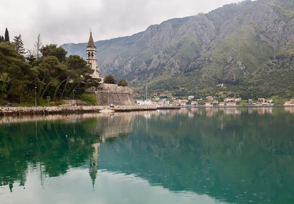
Landmark-by-Landmark Walk: St Matthew's, Tripković Palace & Kokotova Kula
Start your walk at the northern bridge outside Kotor's River Gate and follow the waterfront path past the small pebble crescent of Kotor Beach into the lower lane of Dobrota:
- Church of St Matthew (Crkva Svetog Mateja, 1670) at 1.5 km. This church was built on a raised stone terrace overlooking the bay after the 1667 earthquake destroyed its medieval predecessor. Inside, this Baroque parish church houses a prized Giovanni Bellini workshop painting of the Madonna and Child with Saints above its marble side altar.
- Tripković Palace (late 18th century) at 2.1 km. One of the grandest secular buildings in Boka, featuring a monumental rusticated stone terrace, an L-shaped enclosed mandrać harbour and a terraced garden backed by an aqueduct wall.
- Dabinović Palace / "Kokotova Kula" (Rooster's Tower) at 2.8 km. Built in the mid-1700s by the Dabinović captains, this four-storey stone mansion was nicknamed after the decorative metal weathervane rooster perched atop its corner watchtower. Although damaged in the 1979 earthquake, its stone facade and waterfront jetty remain deeply atmospheric.
- Church of St Eustace (Crkva Svetog Stasija, 1773) at 4.0 km. Recognisable from across the bay by its soaring 40-metre multi-tiered stone bell tower (completed in the 19th century). Inside, St Eustace safeguards 17th-century Venetian paintings and a collection of precious handmade Dobrota lace (Dobrotska čipka) stitched by sailors' wives from flax linen threads.
Swimming Etiquette on Dobrota's Stone Pontas & Pebble Coves
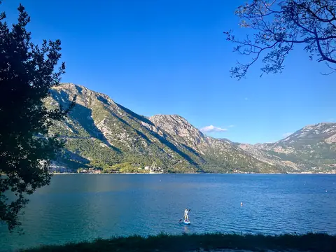
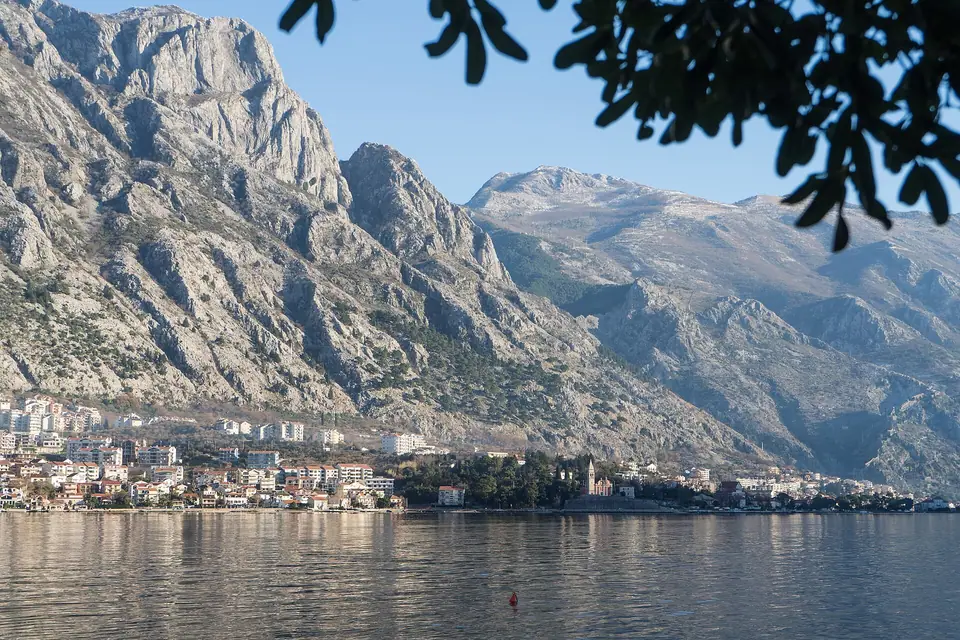
Because Kotor Old Town has no sandy beach inside its harbour, Dobrota's 5-kilometre chain of stone pontas serves as Kotor's primary summer swimming ground. Understanding which pontas are public versus private ensures a relaxed afternoon:
- Public vs Hotel Pontas. Under Montenegrin maritime domain law (Morsko Dobro), the shoreline path itself is public for pedestrians. Dozens of unadorned concrete and rough-stone pontas with metal swim ladders are freely used by locals and visitors who lay down a towel on the warm stone slabs. However, pontas directly in front of 5-star boutique hotels (such as Huma Kotor Bay, Forza Mare or Palazzo Radomiri) are leased concessions. They are fitted with cushioned loungers and parasols reserved for hotel guests or paying day-pass visitors (€25 to €50 per sunbed set as of November 2026).
- Freshwater Karst Springs (Vrulje). As you swim along the Dobrota and Ljuta shoreline, you will feel patches of icy, crystal-clear mountain water upwelling from submerged limestone springs (vrulje) on the seabed. This keep Dobrota's water cleaner and far more transparent than the inner port basin near the cruise pier.
- Return by Bus or Taxi. After walking 4 to 6 km north to Sveti Stasije or the Ljuta River mouth, you do not need to walk back. Simply climb the short stone staircases connecting the lower waterfront lane up to the main Adriatic Highway. Here, the hourly Blue Line bus (€1.50 cash) or a local radio taxi (€5 to €7 as of November 2026) returns you to Kotor's Sea Gate in 8 minutes.
4. Where to Eat, Drink & Watch the Sunset Along Dobrota & Ljuta.
Dobrota's lower coastal road faces directly west toward the wooded ridge of Mount Vrmac. Consequently, it is the finest place in the entire municipality to linger over a late-afternoon coffee, cocktail, or seafood dinner as the sun sinks into the bay. Roughly 1.5 kilometres north of the River Gate near Kamp and St Matthew's sits a lively strip. Casual waterside cafés and beach bars serve iced espressos and local Nikšićko draft beer (€3.00 to €4.50 as of November 2026) right on the stone jetties. Further north around Sveti Stasije, Konoba Portun sets its tables on a historic stone pier jutting over the water. The kitchen serves whole grilled Adriatic sea bream and homemade fish soup while fishing skiffs glide past at dusk.
If you continue walking to the northern end of the promenade at Ljuta (6.8 kilometres from Kotor), Here you reach the mouth of the cold Ljuta karst river and the baroque 18th-century Church of St Peter. Right beside the old stone watermills where freshwater meets the sea sits the renowned waterfront terrace of Stari Mlini, set beneath centuries-old weeping willows and stone bridges. Afterward, hop on a €6.00 local taxi or €1.50 Blue Line bus for the ten-minute ride back to Kotor's Sea Gate.
For architecture lovers, walking the Dobrota promenade at golden hour reveals subtle stone details that are easy to miss from a passing boat. Look for carved family crests above the main portals, wrought-iron balcony railings imported from 18th-century Venice, and stone bollards worn smooth by centuries of mooring ropes. Several historic palaces have been sensitively converted into small heritage hotels and music academies while preserving their original ground-floor boat arches.
The lower coastal lane through Dobrota is flat and paved from end to end. It is therefore the best route in the Kotor area for an early-morning run, a family walk with a stroller, or a relaxed afternoon bicycle ride away from main highway traffic.
Where it is
- 1Dobrota Promenade
- Tivat Airport (TIV) · about 6 km from here in a straight line
- Directions in Google Maps
Traveller tips
Real advice from people who have been to Kotor. Every tip is read by our team before it goes live.
No tips yet. Been here? Yours could be the first.
Thank you! Your tip will appear here after a quick review.
More in Kotor
Continue exploring Kotor with related neighbourhood, food, and planning guides