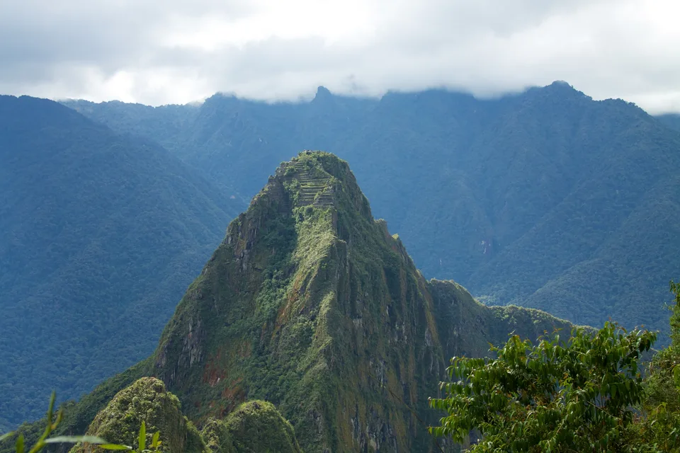
Photo: McKay Savage from London, UK · CC BY 2.0
Huayna Picchu and Machu Picchu Mountain: Trail Comparison and Booking Guide
Compare Huayna Picchu and Machu Picchu Mountain before booking your tickets. Review trail steepness, summit elevations, official circuit rules, and safety tips for climbing either peak.
Choosing Between the Twin Summits
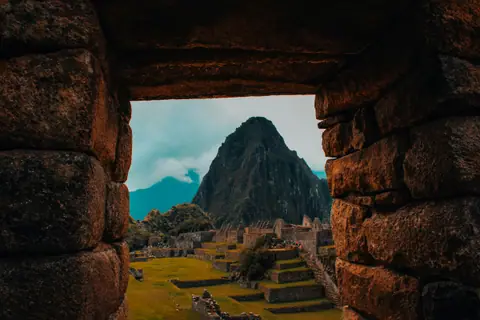
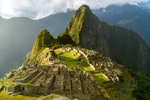
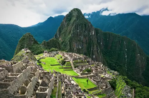
Towering over the ancient stone citadel of Machu Picchu, two iconic peaks tempt hikers seeking panoramic vantages. Huayna Picchu forms the dramatic green spire that appears behind the ruins in classic photographs. Machu Picchu Mountain stands directly opposite, rising higher into the Andean clouds. Selecting the right summit determines your physical challenge, your permitted vantage points, and which archaeological sectors you can explore.
Permit regulations govern access strictly. Hikers cannot simply choose a mountain on the morning of their visit. Each climb requires a specific combination ticket purchased well in advance. Understanding trail gradients, exposure to heights, and route rules ensures you book the ascent that matches your stamina.
Huayna Picchu: The High Priest Trail
Huayna Picchu rises to an elevation of 2,693 metres above sea level, standing roughly 260 metres above the citadel floor. The trail hugs sheer granite cliffs where the Urubamba River loops far below. Incan stonemasons carved narrow staircases straight into the living rock face. Archaeological studies indicate the summit once accommodated high priests and ceremonial quarters, providing sweeping surveillance over the sacred valley.
This ascent is famous for its extreme vertical pitch. Certain sections require ascending stone steps pitched at severe angles. Steel hand cables anchored into rock faces offer support during exposed climbs. Near the summit, hikers negotiate the infamous flight of steps wedged above sheer drops. The experience demands sure footing and a calm nerve. If you suffer from severe vertigo, this trail will prove deeply uncomfortable.
Beyond the raw adrenaline, the trail features rare stone architecture. The path passes agricultural terraces clinging to vertical precipices. Hikers also pass cavern entrances leading down toward the Temple of the Moon, a subterranean stone shrine constructed inside natural granite caves.
Machu Picchu Mountain: The Panoramic High Ridge
Machu Picchu Mountain offers a contrasting hiking profile. Reaching a summit of 3,061 metres above sea level, it stands more than 600 metres higher than the central citadel ruins. The Incas built this wide ceremonial route as an expansive pilgrimage trail toward the clouds.
The path is considerably longer than Huayna Picchu. It consists of thousands of stone stairs that ascend through high cloud forest. While the stairs are steep and relentlessly uphill, the path lacks the sheer vertical drops found on the companion peak. The trail remains broader throughout, making it an excellent choice for travellers who prefer avoiding dizzying cliff edges.
At the apex, an Incan stone shelter rewards hikers with a sweeping panoramic view. On clear days, you see the entire mountain saddle spread out below. The main citadel appears as a compact stone puzzle set between rolling Andean ridges.
Comparing the Summit Trails
Choosing between these two legendary ascents requires balancing trail geometry, elevation gain, and vertigo tolerance. Review this structural comparison before securing permits.
| Feature | Huayna Picchu | Machu Picchu Mountain |
|---|---|---|
| Summit Elevation | 2,693 metres (8,835 feet) | 3,061 metres (10,042 feet) |
| Trail Profile | Exposed rock staircases, sheer cliff drops, steel cable supports | Continuous stone steps, broader path, minimal cliff exposure |
| Physical Demand | Intense vertical agility, steady nerve, quick steep climb | High aerobic stamina, sustained uphill pacing, longer ascent |
| Citadel Perspective | Dramatic close-up vantage overlooking urban sectors from the north | Expansive birds-eye panorama looking down from the south |
| Historical Features | Precision terraces, priest quarters, Temple of the Moon cavern | Stone ceremonial trail, summit mountain watchman shelter |
| Official Circuit Tie-In | Requires specific circuit permit for northern ruins access | Requires upper terrace circuit permit for southern viewpoints |
Official Ticket Circuits and Regulations
The Ministry of Culture manages access to both peaks through dedicated circuit tickets. You cannot climb either mountain with a standard general entry pass. To ensure entrance, study our comprehensive Machu Picchu tickets guide before completing any reservations.
Ticket allocations for Huayna Picchu sell out months ahead of peak travel periods. If you miss out on booking Huayna Picchu, Machu Picchu Mountain permits often remain available longer. Keep in mind that mountain tickets tie directly to specific walking circuits in the main ruins below. Huayna Picchu tickets restrict you to lower architectural zones, whereas mountain tickets permit access to classic upper terraces.
Review our broader Machu Picchu travel guide to understand how timing rules coordinate with transport schedules. Park rangers record your details at summit control checkpoints. If hikers fail to return past the checkpoint before mandatory afternoon cut-offs, park staff initiate search procedures.
Weather, Footwear, and Essential Preparation
Mountain conditions vary dramatically between the dry winter months and the wet summer season. Heavy precipitation exceeds 300 millimetres per month between December and March. Rain renders stone staircases slick and hazardous. Check our guide on the best time to visit Machu Picchu to avoid poor trail conditions.
Solid footwear with deep rubber lugs is mandatory for either ascent. Smooth running shoes slip easily on wet Incan granite. Pack lightweight trekking poles equipped with rubber tips, as bare metal tips remain prohibited to protect historic stone. Dressing in breathable moisture-wicking layers keeps you comfortable during the physical ascent. Consult our advice on what to wear to Machu Picchu for tailored clothing checklists.
Acclimatisation is vital before attempting either mountain climb. Machu Picchu sits at a lower altitude than Cusco, yet sustained uphill exertion rapidly triggers breathlessness. Spend two full days at intermediate elevations before tackling the stairs. Carry adequate drinking water in reusable flasks, as single-use plastic bottles are forbidden inside the national sanctuary.
Where it is
- 1Huayna Picchu and Machu Picchu Mountain
- Alejandro Velasco Astete International Airport (CUZ) · about 78 km from here in a straight line
- Directions in Google Maps
Stations and taxi ranks: OpenStreetMap. Airports: OurAirports. Distances are in a straight line.
Traveller tips
Real advice from people who have been to Machu Picchu. Every tip is read by our team before it goes live.
No tips yet. Been here? Yours could be the first.
Thank you! Your tip will appear here after a quick review.
More in Machu Picchu
Continue exploring Machu Picchu with related neighbourhood, food, and planning guides