























Sierra Norte Hiking Guide: Pueblos Mancomunados & Cuajimoloyas (2026)
How to hike the 3,000-metre cloud forests of Oaxaca's Sierra Norte (Pueblos Mancomunados) in 2026: booking Expediciones Sierra Norte, the Cuajimoloyas suspension bridge, and Benito Juárez trails.
Just ninety minutes northeast of Oaxaca de Juárez's dry cactus valley, the road climbs over a 3,200-metre (10,500-foot) mountain pass into a completely different ecological world. The cool, mist-shrouded pine, oak, and bromeliad cloud forests of the Sierra Norte (Sierra Juárez). Here, eight self-governing Zapotec communities form the Pueblos Mancomunados eco-tourism cooperative (including Benito Juárez, Cuajimoloyas, La Nevería, Latuvi, and Lachatao). Since 1994, they have protected 29,000 hectares of forest linked by royal stone mule paths (Caminos Reales). Whether you come for a single-day ridge hike across the suspension bridge of Benito Juárez and Cuajimoloyas or a multi-day village-to-village trek sleeping in log cabins with wood-burning fireplaces. The Sierra Norte is Mexico's gold standard for Indigenous-owned sustainable tourism. Pair this trekking guide with our Oaxaca packing and cold-weather layer guide and 3-day itinerary.
| Sierra Norte Hike / Village | Elevation | Distance & Duration | Highlights |
|---|---|---|---|
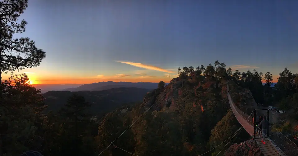
| 1. Benito Juárez Viewpoint & Suspension Bridge.. | 2,950 m to 3,050 m. | 4 km loop (1.5 to 2 hours). | 150-metre canyon suspension bridge (Puente Colgante) & panoramic valley lookout. |
| 2. Benito Juárez to La Nevería & Latuvi Trail.. | 3,000 m down to 2,450 m. | 9 to 14 km point-to-point (3.5 to 5 hours). | 16th-century pre-Hispanic & colonial stone Camino Real through giant bromeliad oaks and trout streams. |
| 3. Cuajimoloyas & El Mirador del Yaa-Cuetzi.. | 3,180 m to 3,250 m. | 5 to 8 km canyon rim hike (2.5 to 3 hours). | Highest village in the cooperative; wild mushroom festival (July to Aug), zip-line, dramatic rock cliffs. |
How the Community Eco-Tourism System & Guide Rules Work (2026)
Because the forests of the Pueblos Mancomunados are communal Indigenous territory (bienes comunales) governed by traditional Zapotec assembly rule (Usos y Costumbres), all hiking trails, wooden cabins, trout restaurants. In addition, local forest guides are 100% owned and operated by the village communities themselves:
- Mandatory Local Community Registration & Guide Rule. To protect hikers from getting lost in rapid afternoon cloud-forest fog and to safeguard rare orchids and wildlife (including pumas and over 400 bird species). Visitors must register at the village eco-tourism office (Oficina de Ecoturismo) upon arrival in Benito Juárez, Cuajimoloyas, or Lachatao. As of November 2026, the community conservation entry fee is 50 to 100 MXN per person. Hiring an official local Zapotec village guide for a half-day or village-to-village hike costs roughly 450 to 700 MXN total for your group (split among 1 to 5 hikers).
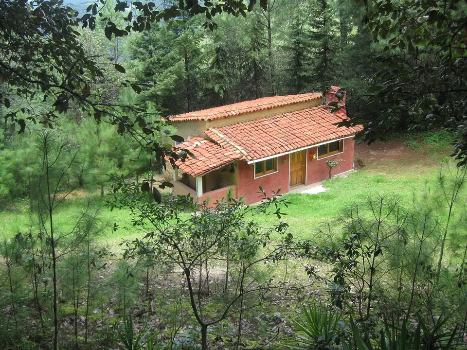
- Where to Book in Downtown Oaxaca City: Before heading up the mountain, visit the cooperative's official downtown office, Expediciones Sierra Norte, located on Calle M. Bravo 210 (just two blocks west of Templo de Santo Domingo; `sierranorte.org.mx`). Their bilingual staff can reserve your village eco-cabins (around 800 to 1,300 MXN per cabin per night with a stacked supply of firewood for your indoor hearth). Arrange a private mountain transfer, or book you onto a shared day-hike departure.
How to Get to Cuajimoloyas & Benito Juárez on a Budget
If you are travelling independently on a budget rather than booking a private car through Expediciones Sierra Norte, a dedicated community rural bus and colectivo network connects Oaxaca City with the mountains:
- To Cuajimoloyas (3,180 m). Walk or take a 60-MXN yellow taxi to the Combis / Autobuses a Cuajimoloyas terminal on Calle Zaragoza (near Periférico / Central de Abastos, wait at the Monumento a Juárez on the eastern highway exit). Community minibuses depart daily around 07:30, 09:00, and 14:00, climbing past El Tule. Teotitlán into the clouds of San Antonio Cuajimoloyas in 90 minutes (65 to 80 MXN each way as of November 2026, the final afternoon return bus back to Oaxaca departs Cuajimoloyas around 16:00 to 16:30).
- To Benito Juárez (2,980 m). Take a maroon Tlacolula colectivo (35 MXN) to the Sunday market town of Tlacolula. From the mountain transport stand two blocks behind the market board a shared collective pickup or suburban van (70 MXN, 45 minutes) up the pine-forested dirt road to Benito Juárez.
The Classic Hike: Benito Juárez Suspension Bridge to La Nevería & Latuvi
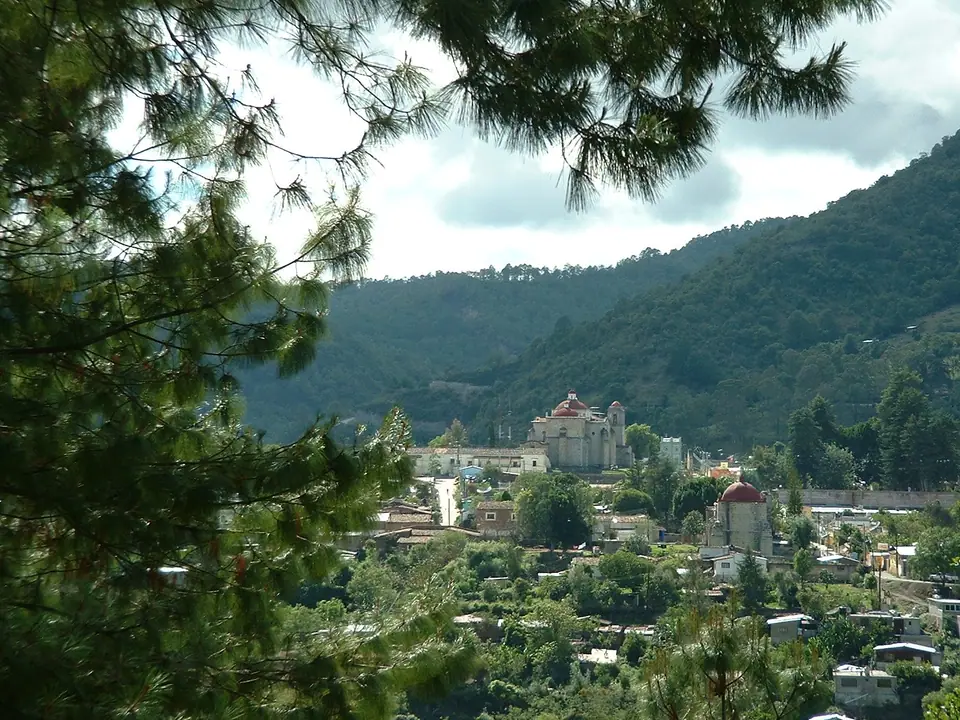
The single most popular day trek in the Sierra Norte begins at the eco-tourism office in Benito Juárez (2,980 m). First, walk 20 minutes through fragrant pine woods to the Mirador de Benito Juárez. Here a 150-metre-long pedestrian suspension bridge (Puente Colgante, 30 MXN toll) sways 50 metres above a deep mountain gorge with views all the way back down to the Tlacolula Valley. From Benito Juárez, follow your local village guide down the ancient cobbled Camino Real (Royal Road)., the pre-Hispanic and colonial trade trail where indigenous porters once carried blocks of mountain snow packed in ferns down to the colonial elite of Oaxaca City. From the natural ice pits of La Nevería ("The Icebox", 2,750 m). Descending through giant ancient oaks draped in crimson Tillandsia bromeliads, agaves, and wild dahlias brings you into Santa Martha Latuvi (2,450 m) in 3.5 to 4 hours. There you can feast on fresh rainbow trout (trucha al mojo de ajo). Warm black bean soup, and handmade blue-corn tortillas cooked over a clay comal stove before catching a afternoon pickup back down to Tlacolula.
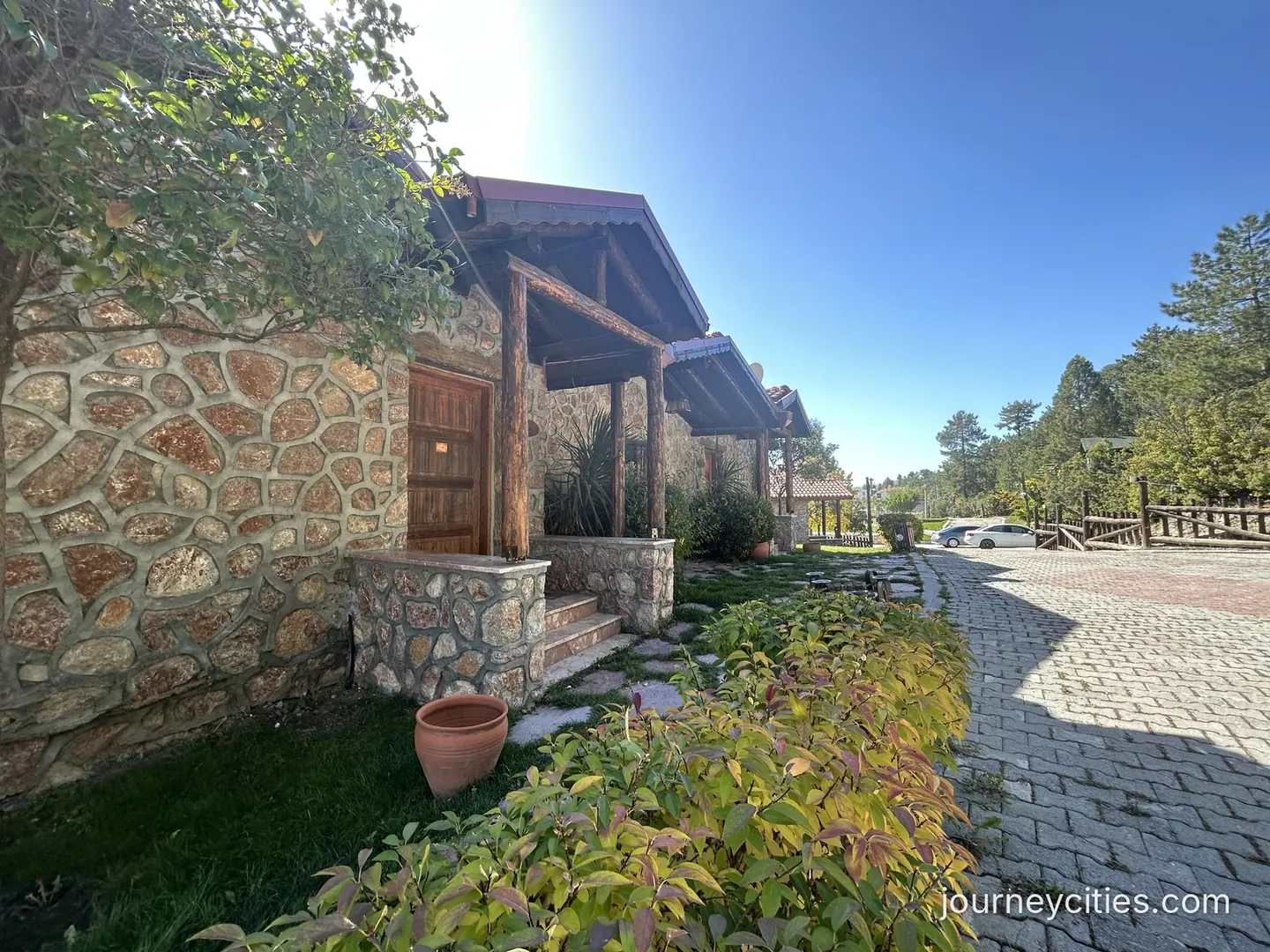
If you have two full days to spare in your Oaxaca itinerary, booking an overnight village-to-village trek through Expediciones Sierra Norte is even more rewarding than a single day hike. Hike the 14-kilometre forest trail from Benito Juárez through La Nevería to Latuvi on Day 1 and sleep inside a brick cabin with a pine-log fireplace at 2,500 metres. At dawn, you wake to mist rising across the valley over hot café de olla. In addition, continue on Day 2 along the pre-Hispanic stone path to the historic mining village of Santa Catarina Lachatao (home to a restored colonial church and a hilltop sacred Zapotec lookout at Cerro del Jaguar). The cooperative even offers a luggage-transfer option where a local driver transports your main suitcase from cabin to cabin while you hike with only a light daypack.
Each village restaurant inside the Pueblos Mancomunados serves hearty highland comfort food cooked over wood fires. It includes warm pumpkin-flower quesadillas, wild mushroom soup foraged from the surrounding oak woods in July and August. In addition, steamed tamales wrapped in corn husks. Because evenings at 3,000 metres drop below 8°C rapidly after sunset, the community eco-cabins provide thick hand-loomed wool blankets from Teotitlán del Valle together with dry pine kindling so guests can light a warm fire before dinner.
Where it is
- 1Sierra Norte Hiking
- Xoxocotlán International Airport (OAX) · about 32 km from here in a straight line
- Directions in Google Maps
Traveller tips
Real advice from people who have been to Oaxaca. Every tip is read by our team before it goes live.
No tips yet. Been here? Yours could be the first.
Thank you! Your tip will appear here after a quick review.
More in Oaxaca
Continue exploring Oaxaca with related neighbourhood, food, and planning guides
Oaxaca 3-Day Itinerary: Monte Albán, Santo Domingo, Hierve el Agua & Markets
Oaxaca, Mexico
Monte Albán Guide 2026: Shuttle Bus, Zapotec Pyramids, Los Danzantes & Tips
Oaxaca, Mexico
Santo Domingo Church, Ethnobotanical Garden & Calle Alcalá Guide (2026)
Oaxaca, Mexico
Hierve el Agua, Mitla & Tule Tree Day Trip Guide (Tlacolula Valley 2026)
Oaxaca, Mexico