Quick Field Data
- UNESCO Inscription: 2006 (Ref. 1209), cultural landscape in Jalisco's Valles Region; Criteria (ii), (iv) and (v)
- Scale & Footprint: 35,019 hectares (reported as 34,658 hectares in nomination summaries) spanning Tequila, Amatitán, El Arenal and Magdalena between Tequila Volcano and the Rio Grande canyon, incorporating 60 historic and operating distilleries
- Access & Ticketing: Open agricultural roads cross the blue agave plantations freely; guided entry to historic distilleries (such as La Rojeña and La Perseverancia), Quinta Sauza and the National Museum of Tequila (MUNAT) requires booked tickets checked via each estate's official site
- Arrival Logistics: Direct passenger flights land at Guadalajara International Airport (GDL), 57 kilometres southeast of the Tequila valley; Santiago de Tequila lies roughly 60 kilometres west of Guadalajara by highway, and overland routes link east to Mexico City (508 kilometres)
Teuchitlán Terraces and Volcanic Foothills Around Tequila
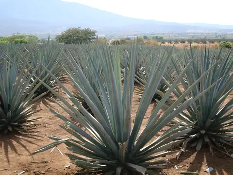
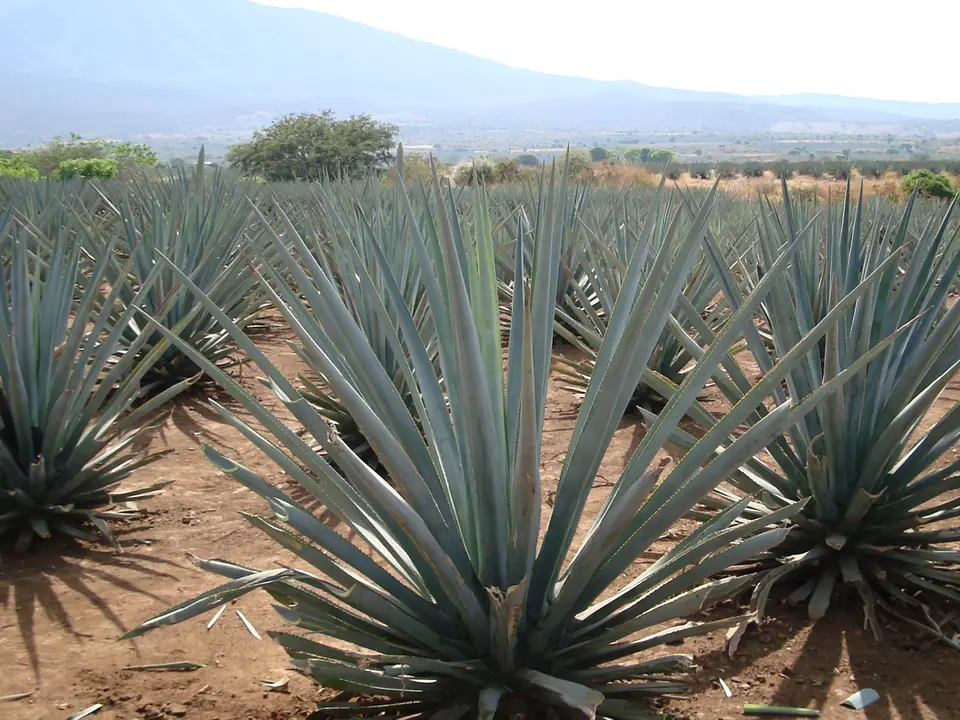
Stretching from Tequila Mountain's volcanic flanks down to the Rio Grande River gorge in western Jalisco, 35,019 hectares of cultivated Agave azul tequilana Weber shape one of Mexico's most integrated agricultural zones. Long before European copper stills reached western Mexico, Mesoamerican groups worked this fertile volcanic valley for at least 2,000 years. Early Middle Formative communities linked to the shaft-tomb tradition gave way to the Teuchitlán tradition between AD 200 and 900. Builders left monumental circular guachimontón complexes at Huitzilapa to the west and Amatitán to the east, backed by residential platforms, ceremonial mounds, temples, ball courts and stepped stone hillside terraces.
Those ancient terraces anchored continuous land use centred on wild and domesticated maguey. Indigenous families harvested the heavy starchy piña core, roasting it slowly for sweet food while drawing sap for fermented drinks similar to modern pulque. They extracted leaf fibres for coarse cloth, anchored sloping topsoil against rain erosion and used sturdy stalks in rural house building. During the Epiclassic period, severe drought pushed central Mexican settlers out of the Bajío into the Tequila basin. By Postclassic times, Caxcan, Cora and Huichol communities farmed and traded around the major pre-Hispanic settlement of Teochtinchán rather than the modern valley town.
Demand for processed agave moved along long-distance pre-Columbian exchange networks, with archaeological studies tracing trade in agave products across as much as 450 kilometres eastward from Arizona's Grand Canyon to consumers on the Colorado Plateau. Following the Spanish conquest of the Aztec Empire, European expeditions pushed west into what colonial administrators named Nueva Galicia. After initial fortification and peaceful surrender at local settlements, Franciscan friars founded Santiago de Tequila (from Nahuatl Tequillan or Tecuila, meaning place of tribute) in 1530 by relocating indigenous inhabitants down from Chiquihuitillo Mountain, known today as Tequila Volcano.
Peace in Nueva Galicia lasted barely a decade. In 1541, indigenous communities across Tlaltenango, Xochipila, Nochictlán and Teocaltech rose against Spanish rule, with Tecoxines and Caxcanes from Tequila fortifying Tequila Mountain itself. Friar Juan Calero of the nearby monastery climbed the mountain to negotiate and was killed under arrows and stones before his body was hung on a local stone idol, and Friar Antonio de Cuéllar of Etzatlán monastery also perished trying to broker peace. By October 1541, Viceroy Antonio de Mendoza marched directly from Mexico City, capturing rebel chief Diego Zacatecas during a parley and forcing him to end the uprising and accept Christianity as the price of release.
Colonial Distillation, Old Haciendas, and Protected Origin
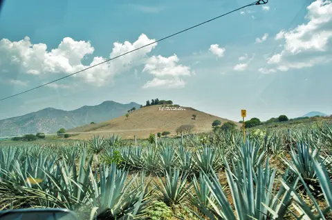
Once colonial administration consolidated over Jalisco's Valles Region, European pot-still technology merged directly with indigenous fermented mescal juice. Because contaminated town water routinely sickened colonial garrisons, by 1546 soldiers were ordered to mix drinking water with locally produced agave alcohol. In 1600, Pedro Sánchez de Tagle established the region's first large-scale distilling operation and introduced systematic plantation cultivation of native blue agave across broad hillsides, laying the foundation for commercial estates.
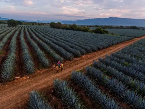
Over the 18th and 19th centuries, rural haciendas and urban factory compounds transformed rolling volcanic slopes into an unbroken agro-industrial belt uniting the municipalities of Tequila, El Arenal, Amatitán and Magdalena. Land tenure across the 35,019-hectare zone remains split today among three distinct systems: 22 percent private land (housing many rural haciendas), 44 percent common ejido land farmed by local communities and 34 percent mixed productive associations combining private investment with communal holdings. Sixty factory complexes stand inside the inscribed property, with most active urban distilleries concentrated inside Tequila, Amatitán and El Arenal while rural estates remain in private hands.
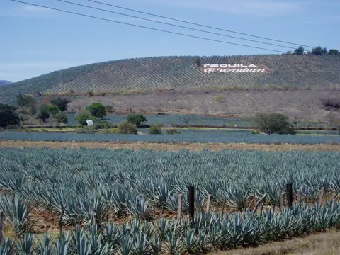
Several surviving distilleries preserve unbroken lineages back to colonial and early republican booms. La Rojeña opened in 1795, El Tigre (now La Constancia) followed in 1823 and Destiladora de Occidente (Tequila D'Reyes) opened in 1840. Later arrivals included La Perseverancia (Tequila Sauza) in 1873, El Llano (Tequila Azteca) in 1876 and La Mexicana (Tequila Orendain) in 1879. Prestige grew during the 19th century after Mexican travellers in Europe discovered strong foreign appetite for the Jalisco spirit and promoted it back home. In 1873, Jalisco's former mezcal wine was formally named Tequila to distinguish it from southern mezcal made in states such as Oaxaca.
Long-established distilleries inside the Tequila valley historically produced roughly 500 to 1,000 litres per day, an artisanal scale far outstripped once international demand surged from the 1980s onward. Legal protection evolved alongside commercial expansion while keeping output locally anchored. Since 1974, Mexican federal law restricts the Tequila name to certified blue agave spirits made across Jalisco, Michoacán, Nayarit, Guanajuato and certified parts of Tamaulipas. Declaration of Origin rules limit production to fifteen authorised company frameworks and require agave harvested inside the inscribed zone to supply local distilleries. Heritage safeguards operate across three tiers of Mexican law. The 1972 Federal Law Regarding Artistic, Historical and Archaeological Monuments and Sites joins environmental and settlement statutes to protect pre-20th-century monuments. Jalisco's state Cultural Patrimony laws enforce the Tequila Master Plan across the Valles Region. Meanwhile, municipal plans in Tequila, Amatitán and El Arenal work under the Instituto Nacional de Antropología e Historia (INAH) to manage urban growth and channel tourism revenue toward lower-income communities.
Township Landmarks From Santiago de Tequila to Amatitán
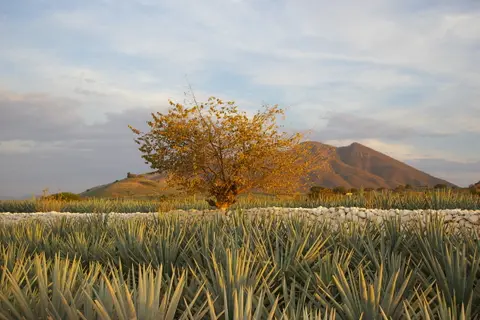
Santiago de Tequila, home to 26,809 residents in the 2010 census or roughly 73 percent of its municipality, concentrates colonial stone landmarks within walking distance of brick distillery chimneys. Earlier, suppressing an early 19th-century revolt led by a figure called The Gold Mask earned Nueva Galicia governor José Fernando de Abascal y Sousa promotion to Viceroy of Peru. During the Mexican War of Independence, Rafael Pérez marched into town with 200 men under José María Mercado. Tequila gained formal city status in 1874 after Sixto Gorjón and roughly 50 local police and townspeople defended it in 1873 against bandit leader Manuel Lozada, known as The Tiger of Alicia. Mexico's federal government later named Tequila a Pueblo Mágico in 2003.
At the town plaza rises the 18th-century parish church of Our Lady of the Purísima Concepción, built by architect Martín Casillas with warm local stone, a tall bell tower and inverted truncated pyramid pilasters called estípite framing its two-level portal. Supported by Doric columns around curved vegetable reliefs, the upper crown shelters a niche sculpture of Archangel Michael, while the side entrance frames Tuscan columns and a relief cross. Inside the single nave stand a Neoclassical main altar and an 1865 image of Our Lady of the Conception.
Secular distillery estates display matching architectural craft. Built in the 1830s, Quinta Sauza welcomes visitors past an exterior garden with carved stone fountains, atrium carvings depicting the Passion of Christ, facade reliefs of plants and an inner courtyard chapel decorated with serpent and botanical motifs. Nearby, the 1873 La Perseverancia distillery houses a sweeping 1969 mural by artist Gabriel Flores illustrating the full cultivation and distillation cycle, paired with a museum opposite the municipal palace displaying vintage machinery and regional crafts.
Cultural institutions extend beyond the factory gates. Built first as the Eduardo González Primary School in 1933 on land set aside by Cipriano Rosales, one landmark became a vocational high school in 1979 before closing in the 1980s. Restored and reopened in 2000, it now houses the National Museum of Tequila (MUNAT), the world's first museum devoted exclusively to the spirit. Ten kilometres outside town toward Balneario La Toma in Agua Caliente stands the Sanctuary of Saint Toribio Romo González. It marks where the Cristero War martyr, later canonised by Pope John Paul II, was captured and shot.
Access Zones Across the Tequila Agave Valley
Visitors can combine walkable town plazas and open agricultural roads with guided distillery tours and Teuchitlán archaeological complexes across Jalisco's Valles Region.
| Complex Zone | Key Highlights | Access & Ticket Rule |
|---|---|---|
| Santiago de Tequila Historic Core | 18th-century Purísima Concepción church, Quinta Sauza gardens, MUNAT museum and historic urban compounds including La Rojeña and La Perseverancia | Public plazas and church exteriors are free; distilleries and MUNAT sell timed tour tickets checked via official estate websites |
| El Arenal & Amatitán Distillery Belt | Working hacienda distilleries, brick chimneys, historic stone kilns and dense agave rows climbing valley foothills | Open rural roads permit roadside stops; working factory interiors require advance booking with individual producers |
| Guachimontones & Teuchitlán Mounds | Circular stepped mounds, agricultural terraces and ancient ball courts dating from AD 200 to 900 near Huitzilapa and Amatitán | Protected archaeological zones managed under federal heritage rules; confirm current entry passes through official INAH channels |
| Tequila Volcano & Rio Grande Canyon Rim | Volcanic slopes where indigenous rebels stood in 1541, mixed ejido agave plots and viewpoints above the Rio Grande gorge | Public secondary roads cross common and private farmland; keep off fenced cultivation terraces and respect harvest crews |
Three Agricultural and Architectural Details Across Tequila
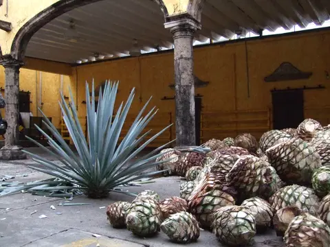
- Contour-Planted Blue Agave Rows: Driving between El Arenal and Tequila, trace how neat geometric rows of spiky Agave tequilana curve strictly along slope contours rather than running straight downhill. That planting pattern follows pre-Hispanic terrace logic, trapping seasonal rainfall in volcanic soil while stopping gully erosion on steep volcano flanks.
- Stone Crusher Mills and Painted Hacienda Chapels: Inside 19th-century compounds such as La Perseverancia and Quinta Sauza, pair inspection of volcanic stone crushing mills, brick roasting ovens and copper stills with close examination of courtyard serpent reliefs and Gabriel Flores's 1969 distillery mural.
- Estípite Facades and Civic Heraldry: Outside Tequila's main church and municipal palace, spot the inverted-pyramid estípite pilasters carved into quarry stone. Beside them appears the municipal coat of arms adopted on 31 December 1983, uniting the Latin motto ALMA LAETA NOBILIS with the parish bell tower, distillery chimneys, blue agave plant and Tequila Volcano.
Planning Harvest-Season Visits Around Tequila and Guadalajara
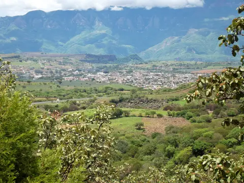
Agave harvesting continues year-round as field workers trim heavy piñas across valley plots in every season. Visiting from late November through mid-December pairs estate tours with Tequila's annual National Festival, featuring charreada horsemanship, float parades, mariachi music and patronal feasts honouring Our Lady of the Purísima Concepción. Stay two days in Santiago de Tequila or commute 57 kilometres west from Guadalajara International Airport (GDL) to combine historic distillery courts with El Arenal, Amatitán and Teuchitlán's circular mounds. Continue overland to Mexico's central highlands via our Mexico City destination guide or explore additional agricultural landscapes in the UNESCO World Heritage Atlas.