Quick Field Data
- UNESCO Inscription: 2016 (Ref. 1518), cultural archaeological site in Kars Province, eastern Türkiye; Criteria (ii), (iii) and (iv).
- Scale & Footprint: 250.7 hectares spanning a triangular volcanic tufa plateau at roughly 1,340 metres elevation above the Akhurian River (Arpaçay Creek) and Bostanlar Creek valleys.
- Access & Ticketing: Protected as a 1st Degree Archaeological Conservation Site under Türkiye's Ministry of Culture and Tourism; confirm current entry passes and visiting procedures through official national museum channels before travelling.
- Arrival Logistics: Travellers approaching Ani ruins, Kars, Turkey cover 42 kilometres east from rail-linked Kars. Across the closed border in Armenia, Zvartnots International Airport (EVN) sits 81 kilometres away and Shirak International Airport (LWN) lies 37 kilometres northeast with limited scheduled flights, while overland routes extend north to Tbilisi (171 kilometres).
Bagratid Capital Rise and Silk Road Crossroads at Ani
Positioned roughly 400 metres from the closed Ani Turkey Armenia border, the ruins stand on a wind-swept triangular spur cut naturally by steep river gorges. The Akhurian River, known locally as Arpaçay Creek and tributary to the Araks, guards the eastern precipice. To the west, the Bostanlar or Tsaghkotsadzor valley drops sharply away beneath exposed volcanic cliffs. Directly opposite across the Akhurian canyon sits the Armenian village of Kharkov in Shirak Province, separated by the sealed international frontier.
Inhabited since the Bronze Age and supporting nearly 2,500 years of continuous settlement, this easily defended plateau commanded fertile river approaches at a key threshold where Silk Road caravans entered Anatolia. Early Armenian chroniclers Yeghishe and Ghazar Parpetsi first recorded Ani in the fifth century as a strong hilltop fortress held by the Kamsarakan dynasty. Historians link its name to the ancient fortress-city and pre-Christian sanctuary of Ani-Kamakh in Upper Armenia's Daranaghi district. Earlier texts also preserve the name Khnamk, examined by Armenologist Heinrich Hübschmann, while some Islamic scholarship suggests ties to the Iranian goddess Anahita. Modern Kars itself thrives on regional livestock markets, cheese production and national railway connections, serving also as an important border military garrison.
By the early ninth century, the Bagratuni dynasty absorbed former Kamsarakan holdings in Arsharunik and Shirak and secured autonomy from Umayyad and Arab rule under King Ashot the First and his son Smbat the First. Earlier Bagratuni leader Ashot Msaker (806 to 827) received the title of ishkhan of Armenia from the Caliphate in 804, while Bagratid sub-kingdoms expanded across Kars, Lori, Syunik, Artsakh and Vaspurakan. Before crowning Ani medieval city, Kars served as the Bagratid capital from 929 after earlier courts at Bagaran (40 kilometres south) and Shirakavan (25 kilometres northeast). In 961, King Ashot the Third transferred the royal capital from Kars to Ani. Urban expansion accelerated rapidly under King Smbat the Second (977 to 989), reaching its apogee under King Gagik the First (989 to 1020), joined in 992 by the Armenian Catholicosate and the royal Bagratuni mausoleum.
Although Ani lay outside earlier caravan tracks, Bagratid wealth turned the plateau into an international market trading with the Byzantine Empire, Persian lands, Arab states, southern Russia and Central Asia. Chroniclers celebrated the capital as the city of forty gates and the city of 1,001 churches. Excavations have revealed 50 churches, 33 cave chapels and 20 smaller chapels across the plateau and surrounding slopes. While medieval writer Matthew of Edessa estimated a peak population near 100,000 and historian Lucy Der Manuelian questions that scale, excavator Nikolai Marr noted dense suburbs packed directly outside the city walls. Historian Hakob Manandyan concluded Ani's population clearly exceeded contemporary cities in Western Europe.
Dynastic succession rivalry weakened the kingdom after 1020 when Hovhannes-Smbat (1020 to 1041) split rule with his younger brother Ashot the Fourth and willed Ani to Byzantine Emperor Basil the Second. When Hovhannes-Smbat died in 1041, Emperor Michael the Fourth claimed sovereignty. Despite fierce resistance under King Gagik the Second (1042 to 1045), Ani surrendered to Byzantium in 1046 after Gagik was detained in Constantinople. Two decades later, in 1064, Seljuk Sultan Alp Arslan besieged the fortified plateau for 25 days before storming its ramparts. Historian Sibt ibn al-Jawzi preserved an eyewitness account describing streets blocked with bodies and at least 50,000 prisoners marched from the captured city. In 1072, Seljuk rulers sold Ani to the Shaddadids, a Muslim Kurdish dynasty that governed largely through conciliation and intermarried with Bagratuni nobles.
Christian, Seljuk and Georgian Builders on the Tufa Plateau
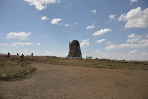
Centuries of shifting sovereignty turned Ani ruins, Turkey into an extraordinary open workshop of cross-cultural masonry. Whenever Shaddadid governors clashed with the predominantly Christian Armenian townspeople, citizens appealed to the Kingdom of Georgia, whose armies entered Ani five times between 1124 and 1209, especially in 1124, 1161, 1174 and 1199. After Queen Tamar captured the plateau in 1199, she granted governorship in 1201 to generals Zakare and Ivane. Under the Zakarian dynasty during Georgia's Golden Age, merchants revived caravan traffic, reinforced city defences and commissioned fresh stone churches.
Across three distinct topographical zones, surviving remains document Zoroastrian, Christian and Muslim builders working on shared civic ground. Inside the southern citadel stand ruins of the Kamsarakan palace, the Palace church, Midjnaberd church, Sushan Pahlavuni church, Karamadin church and the church with Six Apses. Between the inner citadel and outer northern fortifications spreads the walled urban core. Here rise the Ani Cathedral ruins, the Fire Temple, the Ramparts of Smbat the Second, the Emir Ebu'l Muammeran Complex, the Seljuk Palace, domestic foundations, bazaar lanes and the Silk Road Bridge over the Akhurian River.
Architectural prestige focuses above all on the Cathedral of Ani and Bagratid vaulting design. Completed under royal patronage, the cathedral combines clustered stone piers and pointed arches that carried ribbed stone vaults roughly two centuries before comparable early Gothic framing appeared in Western Europe. Neighbouring churches display nearly every plan developed in Armenian architecture between the fourth and eighth centuries. These stood beside Islamic portal carvings, polychrome stonework and Seljuk geometric motifs developed with masons drawing on Caucasian, Iranian, Turkestan and Khorasan building schools.
Prosperity shattered across the thirteenth and fourteenth centuries. Rum Seljuk armies pillaged the town in 1217 and 1220 before Mongol forces failed to take the plateau in 1226 and sacked Ani completely in 1236. During the 1238 to 1239 campaign, Queen Rusudan evacuated Tbilisi for Kutaisi while Mongol general Toghta under Chaghatai forced Zakarian atabeg Avag to surrender at Kayan fortress and march with combined troops against defender Shahnshah Zakarian at Ani. A devastating earthquake struck in 1319 while Silk Road trade shifted elsewhere. Following Ilkhanid rule until Abu Sa'id Bahadur Khan's death in 1335, brief Georgian recoveries under George the Fifth and Bagrat the Fifth alternated with Jalayirid, Chobanid and Timurid occupations between 1335 and 1404 until Ani stood abandoned by the seventeenth and eighteenth centuries.
Volcanic Stone Masonry, Cave Valleys and Conservation Challenges
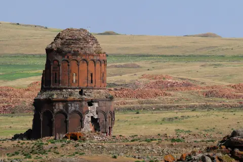
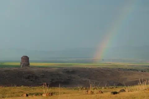
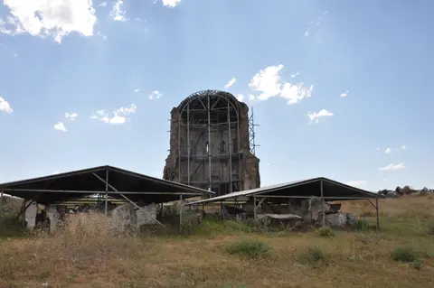
Walk across the open steppe plateau today and the complete absence of modern development leaves every stone tower sharply visible above hidden subterranean networks. Beneath the 250.7-hectare archaeological zone, rock-carved tunnels, cisterns, dwellings and cave chapels honeycomb the volcanic tufa cliffs descending into Bostanlar Creek and Arpaçay Creek. Above ground, warm red, ochre and dark grey-black volcanic stone gives ruined domes and bastions crisp sculptural edges against the open sky.
Severe eastern Anatolian winters at 1,340 metres elevation, seismic fault activity and flawed past repairs still leave every standing monument structurally fragile. Freeze-thaw water penetration and poorly matched twentieth-century cement patches have stressed mortar beds and wall cores. Heritage reports also identify landscape pressure from stone quarrying on the eastern bank of Arpaçay Creek and unsuitable grazing inside Bostanlar Creek's rock-cut caves. Since 1988, Türkiye has shielded the plateau under National Law 2863 through a 1st Degree Archaeological Conservation Site core and surrounding 3rd Degree Archaeological Conservation Site buffer.
Site oversight rests with the Ministry of Culture and Tourism through the Kars Regional Council for Conservation of Cultural Heritage, Erzurum Directorate of Surveying and Monuments and Directorate of Kars Museum. Guided by the 2011 Conservation Oriented Development Plan, priorities were formalised in the 30 March 2015 Management Plan and the 3 February 2016 Strategic Conservation Master Plan. Between 2015 and 2020, conservation targets centred on emergency seismic stabilisation, removing unsuitable earlier restoration materials and conducting contextual street excavations. Plans also prioritised Heritage Impact Assessments, upgraded research and visitor amenities and stronger community integration with nearby Ocaklı Village.
Access Zones Across the Ani Archaeological Plateau
Marked pedestrian paths link the northern fortified gates with citadel foundations and canyon viewpoints across a broad grassland without internal vehicle transport. Walking from the main gate near Ocaklı Village toward the southern citadel takes steady pacing across rolling grassy turf, rewarding unhurried halts beside every standing monument and gorge overlook. Sturdy walking shoes handle uneven volcanic rubble, stepped earth paths and slick frost patches around shaded canyon edges well.
| Complex Zone | Key Highlights | Access & Ticket Rule |
|---|---|---|
| Ramparts of Smbat II & Main Gates | Tenth-century double stone city walls, flanking towers and northern caravan entrance. | Entry runs through the main visitor gate adjacent to Ocaklı Village with standard site ticketing. |
| Walled City Monument Plateau | Ani Cathedral ruins, Fire Temple, Seljuk Palace, Emir Complex and market traces. | Open pedestrian trails link standing monuments while unstable interiors remain fenced off for safety. |
| Southern Citadel Spur | Kamsarakan palace foundations, Palace church, Midjnaberd and Sushan Pahlavuni church remains. | Accessible on foot along the southern ridge path overlooking the river confluence. |
| Bostanlar & Akhurian Gorge Slopes | Rock-carved cave chapels, underground tunnels and Silk Road Bridge abutments. | Viewed from marked canyon trails; border zone fencing restricts direct descent to the river bank. |
Three Structural and Carving Details to Spot at Ani
- Clustered Piers and Pointed Arches in Ani Cathedral: Study the surviving eastern and northern bays inside the Cathedral of Ani to trace bundled masonry shafts rising toward pointed transverse arches. Masons shaped lightweight volcanic tufa to channel heavy roof loads down tall piers long before similar vaulting spread in Western Europe.
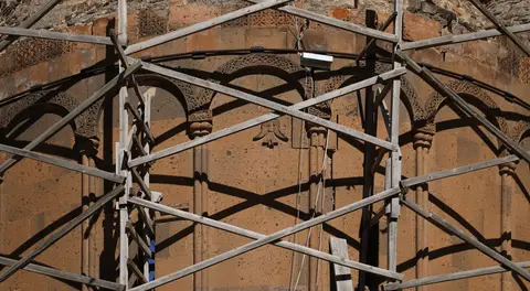
- Polychrome Tufa Courses on the Ramparts of Smbat II: Near the main northern gate, examine how medieval masons alternated dark black and warm red volcanic blocks in rhythmic bands. Builders also inset carved animal and geometric plaques straight into thick defensive ashlar bastions.
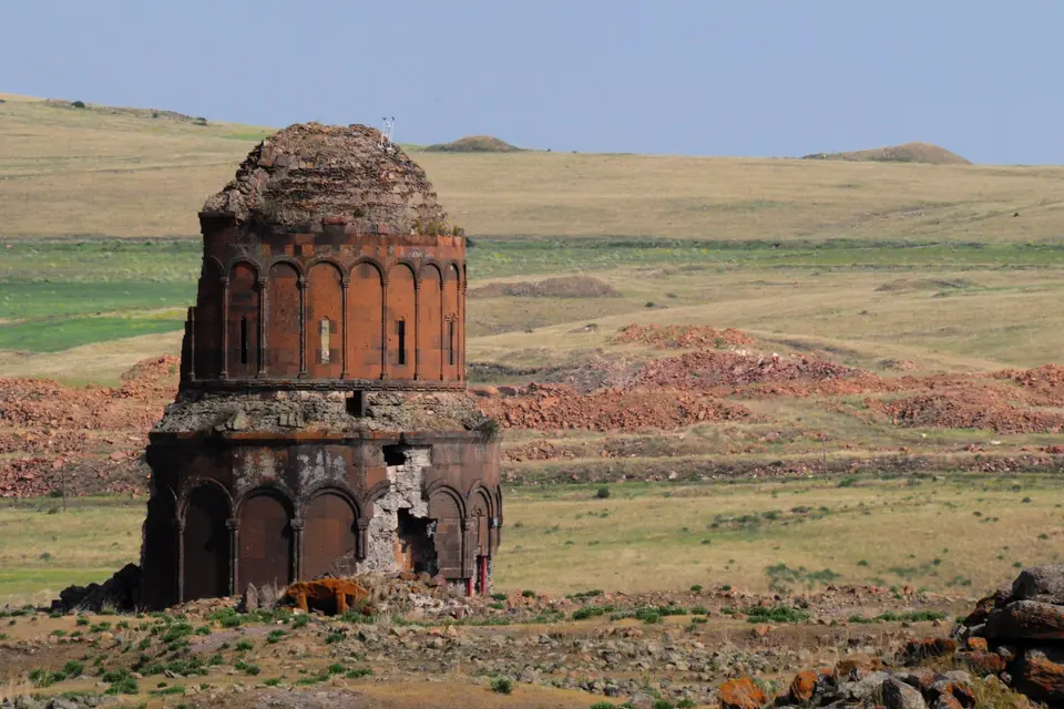
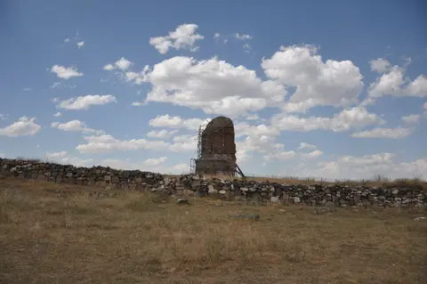
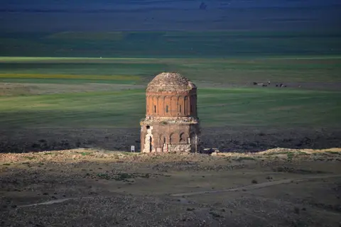
- Sliced Rotunda Wall of the Church of the Holy Redeemer: Look at the surviving half-cylinder wall of this eleventh-century circular church, where exterior blind arcades and high drum windows expose both the inner rubble-concrete core and finely cut volcanic facing blocks.
Planning High-Plateau Travel Between Kars and Tbilisi
Late spring through early autumn brings calmer walking weather across Kars Province, avoiding severe winter blizzards at 1,340 metres while keeping steppe paths firm under clear daylight. Morning light sharpens red and black volcanic ashlar masonry across standing churches before afternoon wind rises across the exposed river plateau. When you plan to visit Ani ruins, pack windproof layers, sun protection and sufficient water, as shade is sparse across the 250.7-hectare plateau and local Kars cheeses and markets lie back in town. Because the nearby frontier crossing over the Akhurian River remains shut, travellers cannot enter directly from Shirak Province or Zvartnots International Airport (EVN). Plan rail or road travel via Kars on the Turkish side before continuing overland north toward Tbilisi or exploring further regional monuments in the UNESCO World Heritage Atlas.