Quick Field Data
- UNESCO Inscription: 1994 (Ref. 614), historic Ottoman caravan town in Karabük Province, northern Türkiye; Criteria (ii), (iv) and (v).
- Scale & Footprint: 193 hectares encompassing the historic districts of Çukur, Kıranköy and Bağlar across sheltered mountain ravines at 508 metres elevation.
- Access & Ticketing: Open historic streets, bazaars and hillside overlooks; caravanserai courtyards, Turkish baths and house museums post individual admission fees locally.
- Arrival Logistics: Major commercial flights arrive at Esenboğa International Airport (ESB), 128 kilometres south near Ankara, while closer Zonguldak Çaycuma Airport (ONQ) lies 57 kilometres northwest with limited flights. Nearest city guide Eskisehir sits 246 kilometres southwest.
Silk Road Caravan Inns and the 14th-Century Ottoman Town Core
Set in a dry rain-shadow ravine roughly 100 kilometres south of the Black Sea coast, Safranbolu stands 200 kilometres north of Ankara in northern Türkiye. Located at 508 metres elevation just nine kilometres north of Karabük city (population 52,999 in 2022), the district belonged to Kastamonu Province until 1923 and Zonguldak Province until Karabük Province was created in 1995. Historic Greek records knew the settlement as Theodoroupolis, Dadybra and Saphrampolis, while earlier Turkish sources named it Zalifre and Taraklıborlu. Its present name combines saffron with the Greek word polis, city, reflecting centuries as a centre for growing and trading saffron, still cultivated 22 kilometres east at Davutobası village.
After Turkish conquest in the eleventh century, Safranbolu developed into a vital trading post and became a major caravan station on the main East-West trade route from the thirteenth century until railways arrived in the early twentieth century. Monumental civic buildings dating to 1322 remain standing today, led by the Old Mosque, Old Bath and Süleyman Pasha Medrese. Centuries later, native figure Karabaşzade Hüseyin Efendi (known as Cinci Hoca, mentor to Sultan İbrahim) patronised major seventeenth-century structures including Cinci Han caravanserai, while fellow native Safranbolulu İzzet Mehmet Pasha served as Ottoman Grand Vizier from 1794 to 1798. Local chronicles also recall fierce resistance against Suleiman II, whose four-month siege damaged homes and poisoned water supplies before famine forced a negotiated evacuation.
During its seventeenth-century peak, caravan prosperity shaped public baths, inns and timber-framed houses whose design standards influenced towns throughout the Ottoman Empire. Once overland caravan routes collapsed in the nineteenth century, industrialisation around the nearby Karabük steel works shifted urban growth onto a plateau two kilometres west, forming today's New Town. That spatial separation spared the old ravine from wholesale demolition, leaving 1,008 registered historical artefacts intact. Within the Old Town survive 25 mosques, five tombs, eight historical fountains, five Turkish baths and three caravanserais. They stand beside one historical clock tower, one sundial, one private museum, hundreds of traditional houses and surrounding ancient mounds, rock tombs and stone bridges.
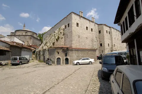
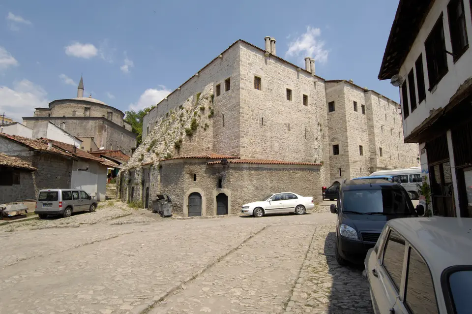
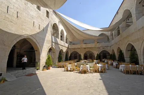
Caravan inns anchored long-distance commerce through northern Anatolia before modern roads bypassed ravine crossings. Built under Cinci Hoca during the seventeenth century, stone-walled Cinci Han offered pack animals and travelling merchants thick masonry security, vaulted lower stables and upper gallery rooms arranged around a courtyard fountain. Neighbouring mosques, medrese study rooms and stone Turkish baths served both passing caravans and local guilds working leather, copper and textiles inside narrow Çarşı lanes.
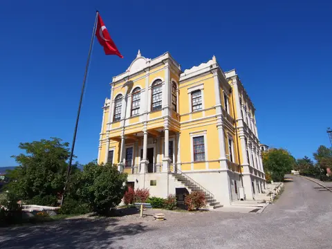
Prominent civic landmarks also climb the ridge rising above the lower bazaar valley. Constructed atop the old administrative hill, the restored Old Government House overlooks the dense roofscape near the eighteenth-century clock tower and sundial terrace. Modern Safranbolu honours notable figures beyond Ottoman statesmen, including film producer Türker İnanoğlu and sports journalist Ali Gümüş. The town also maintains cultural sister-city links with Yelabuga in Russia and Ohrid in North Macedonia.
Çukur, Kıranköy, and Bağlar: Three Districts Shaping Safranbolu
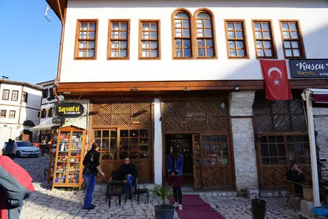
Safranbolu's urban plan divides naturally into three historic quarters defined by canyon geometry and community life. At the bottom lies triangular Çukur, enclosed by two converging streams around the central market square. Reflecting classic Anatolian urban zoning, workshops and guild rows crowd the Çarşı commercial core while surrounding residential lanes hold half-timbered houses built behind tall stone garden walls.
Higher up sits Kıranköy, formerly the non-Muslim Greek Orthodox quarter documented in the 1881 to 1893 Ottoman census showing 49,197 Muslims and 3,326 Greeks across the wider kaza of 52,523 residents. Echoing contemporary European town plans, Kıranköy's artisans and shopkeepers constructed solid masonry stone houses rising directly above street-level workshops and shops. Farther up the sunny, south-facing northwest slope stretches Bağlar, meaning The Vineyards, which served as Safranbolu's summer resort of detached mansions set inside broad gardens and orchards. Separating seasonal living from crowded winter trade floors let prosperous households move uphill during warm summer harvests while keeping business anchored inside Çukur year-round.
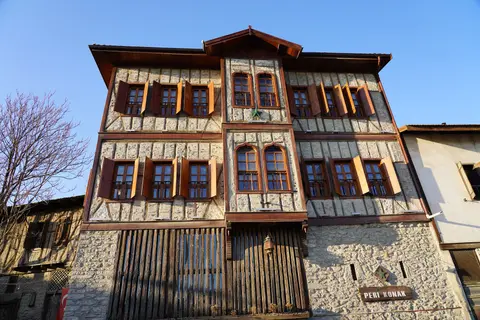
Narrow lanes across Çukur and Kıranköy curve along natural topographic contours, widening subtly at street corners beneath projecting upper house consoles. Because street fronts lack ground-floor windows, mortared masonry facades act like unbroken extensions of garden walls to guard family privacy. Inside upper living quarters, main reception rooms open off a central connecting hall called a sofa and feature panelled built-in timber cupboards, fireplaces, wooden shelves, benches and lavishly carved or painted ceilings. Outdoors, cobblestone street surfaces slope gently inward toward central channels to drain mountain storm runoff cleanly without eroding house foundations.
Traditional Ottoman house planning separated seasonal household needs cleanly inside each compound. Ground-floor stone yards stored winter provisions, pack animals and firewood safely away from upper family parlours catching southern mountain breezes. Elevated wooden lattice windows allowed residents to look out over narrow cobblestone lanes without exposing interior domestic life to passers-by below. Older half-timbered walls packed varied infill materials between timber frames, letting flexible wood joints absorb seasonal humidity shifts and regional earthquakes gracefully. Timber brackets and projecting upper bays squared off interior floor plans even where steep ravine lanes twisted below.
Preserving Timber-Framed Mansions Against Commercial Pressure
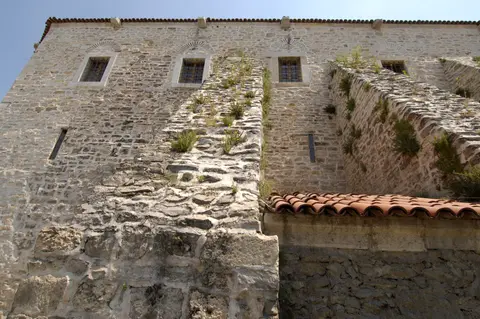
Designated an urban and natural conservation site under Turkish National Conservation Law No 2863, historic Safranbolu is managed by the Municipality of Safranbolu under supervision of the Regional Conservation Council. Every physical alteration or change of function inside registered mansions and protected alleys requires Regional Conservation Council approval under a binding conservation plan reinforced by a buffer zone adopted in 2008. Conservation training receives direct local support from Safranbolu's Faculty of Architecture, a specialised restoration Vocational High School and local civil heritage organisations.
Tourism investment has revitalised dozens of empty timber-framed mansions by adapting them into boutique hotels, restaurants and visitor houses, helping finance structural upkeep across the 193-hectare core. Yet UNESCO evaluations flag persistent threats to domestic authenticity: excessive souvenir stalls crowding Çarşı bazaar streets, modern interior alterations inside commercialised houses, physical wear on aging timber joints and a shrinking number of master craftspeople skilled in traditional Ottoman carpentry and lime plasterwork.
Sustaining historic roofs, timber infill walls and stone cobbles therefore relies on steady revenue from tourism reinvestment matched with strict municipal inspection. By pairing practical university engineering research with traditional restoration schooling inside town, Safranbolu preserves its pre-industrial caravan character far more intact than most former Silk Road market stations across Anatolia. Careful monitoring also prevents heavy delivery traffic and unregulated shop signage from overwhelming narrow historic bazaar lanes. Fire-safety coordination across dense timber-framed districts remains another operational priority for municipal planners and property owners.
Together, national conservation legislation, regional council oversight and university training keep traditional Ottoman domestic crafts active inside a living Black Sea town. Homeowners seeking repair grants follow approved timber joinery, lime-plaster and clay roof-tile specifications so restored guesthouses remain faithful to seventeenth- and nineteenth-century building methods.
Access Zones Across the Historic City of Safranbolu
Exploring Safranbolu rewards slow walking between the sunken Çukur bazaar, hillside Kıranköy and the Old Government House ridge, as narrow cobblestone alleys restrict vehicle traffic. Following elevated ridge lanes linking Kıranköy with Bağlar also reveals dramatic canyon views looking straight down onto Çukur's terracotta roofs and Cinci Han masonry. Confirm museum hours locally before entering restored mansions.
| Complex Zone | Key Highlights | Access & Ticket Rule |
|---|---|---|
| Çukur & Çarşı Core | 1322 Old Mosque, Old Bath, Süleyman Pasha Medrese, 17th-century Cinci Han caravanserai and timber-framed bazaar lanes. | Market alleys and mosque courtyards open freely; Cinci Han, baths and private house museums require admission fees. |
| Old Government House Ridge | Hilltop Old Government House overlooking the old quarters, historical clock tower and sundial terrace. | Public viewpoints open daily; indoor town history exhibitions inside the restored government building follow posted hours. |
| Kıranköy Historic Quarter | Upper-slope masonry stone residences built over traditional craft workshops and former neighbourhood streets. | Open residential and commercial streets on foot; check individual historic churches or cafés locally. |
| Bağlar (The Vineyards) | Northwest hillside summer district of detached garden mansions, shaded orchards and wide residential lanes. | Public avenues open year-round; many mansions operate as private homes or boutique accommodation. |
Three Ottoman Vernacular Details Inside Safranbolu
- Inward-Sloping Cobblestone Drainage Streets: Look down along narrow lanes in Çukur to notice stone paving dipping gently toward a central gutter channel engineered to evacuate mountain storm runoff safely.
- Corbelled Console Overhangs on Timber Facades: Walk beneath upper house storeys to inspect wooden diagonal struts supporting projecting bay windows that square off interior rooms above winding alleys.
- Windowless Stone Garden Walls at Street Level: Observe how tall mortared stone ground walls merge naturally with courtyard garden barriers, shielding household privacy before timber-framed upper rooms open to sunlight.
Navigating Safranbolu's Ravines, Saffron Villages, and Transit
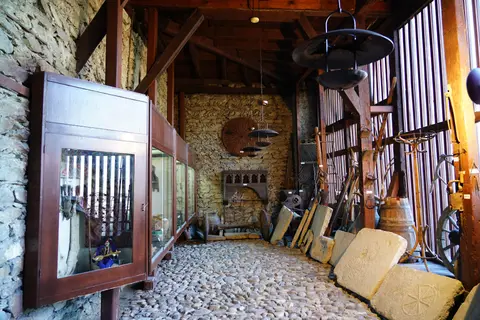
Travellers locating Safranbolu on a Türkiye map find the historic quarters packed inside ravines two kilometres east of the modern plateau town and nine kilometres north of Karabük. Moving between Çukur, Kıranköy and Bağlar involves steady climbs over smooth pitched cobbles, so supportive walking shoes make exploring things to do in Safranbolu, Türkiye far easier across a one- or two-day stay. Beyond the central mosques, caravanserais and restored mansions, short local excursions reach saffron fields at Davutobası 22 kilometres east as well as ancient rock tombs and historic stone bridges around the district.
Spending two unhurried days lets visitors walk Çarşı lanes early in the morning before market stalls crowd narrow streets, climb toward the Old Government House viewpoint by late afternoon and stroll quiet garden avenues up in Bağlar. Local guesthouses operating inside restored timber mansions give travellers direct experience of central sofa halls, carved timber cupboards and painted upper-floor ceilings while supporting ongoing building care. Checking local heritage museum hours and caravanserai admission notices locally helps sequence indoor courtyard stops cleanly around ravine walks. Pairing historic mosque visits with shaded canyon bridge crossings illustrates how steep Black Sea valleys shaped every corner of daily Ottoman town life. Rain-shadow valleys stay comparatively dry compared with the damp Black Sea coast, though spring and autumn bring mildest walking weather across steep cobbled hills.
Intercity coaches link Karabük and Safranbolu regularly with Ankara, 200 kilometres south across northern Anatolian mountain passes, while air travellers usually fly into Esenboğa International Airport (ESB), 128 kilometres south. Closer Zonguldak Çaycuma Airport (ONQ) lies 57 kilometres northwest near the Black Sea coast with limited scheduled flights, and wider overland routes west connect toward Eskisehir (246 kilometres southwest). Local minibuses connect the New Town plateau bus hub quickly with Çukur bazaar and Bağlar uphill avenues. Browse more historic Ottoman and Anatolian sites inside our UNESCO World Heritage Atlas.