Quick Field Data
- UNESCO Inscription: 2015 (Ref. 1446), cultural archaeological and pilgrimage sanctuary in Jordan Valley, Jordan; Criterion (iii).
- Scale & Footprint: 294.155-hectare core reserve administered by the Baptism Site Commission inside a wider 533.7-hectare archaeological zone linking Tell al-Kharrar and the River Jordan Zor belt.
- Access & Ticketing: Protected under Jordan's Antiquities Law No. 21/1988, Jordan Valley Authority Laws and Baptism Site Commission By-Laws; purchase official gate tickets at the single controlled entrance for guided walking or shuttle loops.
- Arrival Logistics: Queen Alia International Airport (AMM) sits 44 kilometres east near Amman, while Ben Gurion International Airport (TLV) lies 66 kilometres west across the border; road routes run south to Petra (168 kilometres).
Wadi al-Kharrar, Elijah's Hill, and Early River Pilgrimage
Positioned along the green riverbanks of the Jordan Valley nine kilometres north of the Dead Sea and ten kilometres southeast of Jericho, Al-Maghtas preserves one of Christianity's oldest riverside pilgrimage landscapes. Inscribed by UNESCO in 2015, the 294.155-hectare sanctuary inside Jordan lies within a broader 533.7-hectare archaeological zone linking two excavation areas via the short spring-fed brook called Wadi al-Kharrar. Eastward rises Tell al-Kharrar, known traditionally as Jabal Mar Elias (Elijah's Hill). Two kilometres west sits the verdant Zor river belt holding the ancient Churches of Saint John the Baptist.
Multiple ancient names and manuscript traditions converge upon this strategic river ford beside the historic road connecting Jerusalem and Jericho toward Madaba, Mount Nebo and the King's Highway. In Arabic, Al-Maghtas translates directly as site of immersion. Two passages in the Gospel of John (John 1:28 and John 10:40) locate John the Baptist's ministry at Bethany beyond the Jordan (from Hebrew bēṯ 'ăniyāh, meaning house of the poor). Most English translations, including Douay-Rheims, NIV, NASB, NLT, RSV, IBS and Darby, distinguish this east-bank Bethany from Bethany on the Mount of Olives. Because 3rd-century Roman Christian scholar Origen found no town named Bethany east of the Jordan, he proposed amending the reading to Bethabara (House of the Ford or Place of Crossing).
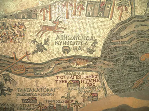
Origen's Bethabara identification entered the Geneva Bible and King James Version following the Textus Receptus. It drew support from New York and Moscow uncials, Ephraemi and Athos texts, minuscule 1, family 13, Eusebius, John Chrysostom, Old Syriac, Aramaic Peshitta, Armenian and Georgian manuscripts, the Talmud and the 6th-century Madaba Mosaic Map. Writing in 1915, historical geographer G. A. Smith argued that Bethany (House of the Ship) and Bethabara (House of the Ford) referred to the same crossing. Hebrew Bible texts identify this crossing with Joshua leading the Israelites across dry Jordan riverbed stones behind priests carrying the Ark of the Covenant (Joshua 3). In 2 Kings 2, Prophet Elijah and Elisha halted the river waters here before Elijah ascended into heaven in a whirlwind from Tell al-Kharrar.
Historical scholars and ICOMOS evaluators note that archaeological remains alone cannot conclusively verify Jesus stepped into these exact pools, yet Christian reverence remains strong. Thirteen official authentication testimonials from international church denominations affirm Al-Maghtas as the traditional eastern baptism site. Gospel accounts (John 3:23) note John baptising in springs like Aenon near Salim (aenon meaning spring) as well as in the river, matching spring-fed Wadi al-Kharrar. Believers visit year-round, and thousands gather each 6 January for Epiphany liturgies.
Roman Pools, Byzantine Basilicas, and Shifting River Banks
Archaeological excavations across Tell al-Kharrar and the Zor floodplain trace human settlement far older than Roman Judea. Small agricultural groups settled along Wadi al-Kharrar during the Chalcolithic period around 3500 BC before renewed habitation appeared in the Hellenistic era. Later Roman and early Byzantine trenches reveal plastered water-collection pools displaying both Jewish ritual bath (mikveh) traits resembling Second Temple Qumran pools and expansive steps built for early Christian baptism.
Open Christian monument construction accelerated across the Jordan Valley once Christianity gained Roman imperial tolerance and official state status in the 4th century. Possibly beginning in the 2nd to 3rd centuries and flourishing strongly in the 5th to 6th centuries, builders raised stone sanctuaries at Tell al-Kharrar. On Elijah's Hill, architects built a walled Byzantine monastery archaeologists named the Monastery of Rhetorios after a Greek mosaic inscription found on site. Surrounding rock-cut hermit caves, gravity-fed water conduits, chapels and a pilgrim lodging station sheltered resident monks and visitors arriving from Jerusalem across the ford.
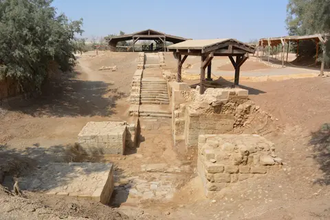
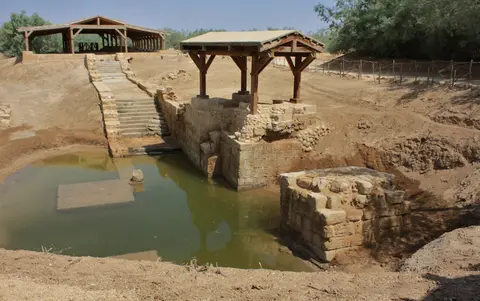
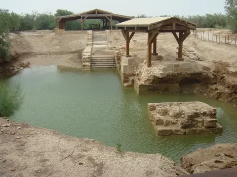
Down along the lower eastern riverbank between 491 and 518 AD, Byzantine Emperor Anastasius I Dicorus raised the first basilica dedicated to Saint John the Baptist, featuring a cruciform baptismal pool set upon heavy masonry piers against seasonal river surges. Repeated earthquakes and floods destroyed that riverside church twice, requiring three reconstructions until a major 6th- or 7th-century flood toppled the pier-supported chapel completely. Because east-bank waters proved unstable, pilgrimage focus shifted onto the drier western bank (Qasr el-Yahud) by the 6th century. Following the Sasanian conquest of Jerusalem in 614, further quakes and Muslim capture in 637, monumental east-bank building ceased, though pilgrim devotion continued down to the 15th century.
Over recent decades, excavations revealed how tightly these two zones functioned as one connected monastic circuit. Pilgrims crossing eastward first venerated the riverfront churches of John the Baptist before walking uphill along Wadi al-Kharrar toward Elijah's Hill to visit hermit caves and chapels. Stone-lined channels carried springwater into plastered cisterns and baptismal basins along the slope, leaving clear physical proof of shared Byzantine liturgy and hydraulic planning across two kilometres of valley wilderness.
Demining After 1994 and Preserving the Zor Wilderness
Modern regional warfare sealed Al-Maghtas away from pilgrims and excavators for nearly thirty years after 1967. During the Six-Day War, both banks of the River Jordan became an active militarised frontline heavily seeded with landmines. Following the 1994 Israel-Jordan peace treaty, Jordanian demining led by H.R.H. Prince Ghazi cleared the eastern valley, opening the sanctuary for systematic digs, basic timber shelters and historic papal visits by Popes John Paul II, Benedict XVI and Francis.
Strict Jordanian legislation guards both excavated masonry and the natural riverside thickets cited in Gospel descriptions of a desert wilderness. Designated an antique site under Antiquities Law No. 21/1988 (Article 3, Paragraph 8), Jordan Valley Authority Laws and Baptism Site Commission By-Laws overseen by a board appointed by King Abdullah II and chaired by Prince Ghazi, the 294.155-hectare reserve sits under a strict construction moratorium. Only minimal shelters built from local timber and natural reed materials shade exposed walls. Gate ticket revenues directly fund conservation staff executing a Management Plan adopted in May 2015 on five-year review cycles.
Balancing active pilgrimage for roughly 81,000 annual guests (2016 data, mostly European, American and Arab visitors) with archaeological authenticity demands constant restraint. Earlier conservation used locally matched limestone and reassembled stone fragments to clarify ruined walls and pools for visitors without weakening spiritual credibility. New denominational churches receive building plots strictly outside protected borders subject to Heritage Impact Assessments, leaving core wilderness views intact. World Heritage monitors also urge cooperative protection across the western riverbank at Qasr al-Yahud (placed on Palestine's 2015 Tentative List) so surrounding sightlines across the Jordan Valley remain unspoiled.
Active ecclesiastical guardianship adds an informal layer of traditional protection beyond statutory law. Because multiple Christian churches share reverence for the riverbanks, site managers coordinate liturgy timings, shelter maintenance and visitor trails so active prayer coexists cleanly with quiet conservation across every season. In November 2015, digital mapping through Google Street View also expanded global virtual access to the excavated riverbank trails without increasing physical foot traffic inside delicate reed thickets.
Access Zones Across Al-Maghtas on the Eastern Jordan Bank
Visitor circulation inside Bethany Beyond the Jordan runs through one single entrance gate and guided footpaths or site shuttles protecting the quiet reed beds. Check official Baptism Site Commission gate notices for current admission rules, shuttle schedules and dress requirements before arrival.
| Complex Zone | Key Highlights | Access & Ticket Rule |
|---|---|---|
| Visitor Entrance and Outer Church Plots | Ticketing centre, interpretive displays and modern denominational churches placed outside protected core limits. | Single controlled entry gate; purchase official admission tickets before boarding mandatory guided walks or site shuttles. |
| Tell al-Kharrar (Jabal Mar Elias) | 5th-century Monastery of Rhetorios mosaics, hermit caves, early Roman-Byzantine pools and Elijah's Ascension hill. | Guided pedestrian trail framed by natural timber shelters; stay on marked walkways around exposed limestone foundations. |
| Wadi al-Kharrar Pilgrim Trail | Two-kilometre green corridor along the seasonal brook linking Tell al-Kharrar westward toward the Jordan River. | Shaded boardwalks and footpaths preserve the quiet Zor wilderness; private vehicles are barred from core ruins. |
| River Jordan Baptismal Pools (Zor Zone) | Excavated Churches of Saint John the Baptist (491 to 518 AD), cruciform baptismal pool and riverfront access steps. | Active pilgrimage zone facing Qasr al-Yahud across the river; follow modesty guidelines and official riverbank safety barriers. |
Three Archaeological and Landscape Details at Al-Maghtas
- Pier Foundations of Emperor Anastasius's River Church: Examine heavy stone pier supports built beside the Zor floodplain to lift the 5th-to-6th-century Church of Saint John the Baptist above seasonal River Jordan surges.
- Plastered Pools Linking Mikveh and Baptismal Forms: Look into the early plastered basins at Tell al-Kharrar where stepped masonry bridges Second Temple Jewish ritual immersion geometry and later Byzantine cruciform fonts.
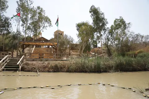
- Simple Timber Canopies Preserving the Zor Wilderness: Observe how lightweight reed and wooden roofs shade fragile Byzantine mosaic patches without blocking natural vistas across Jordan Valley tamarisk and reed thickets.
Guided Shuttles, Epiphany Crowds, and Dead Sea Connections
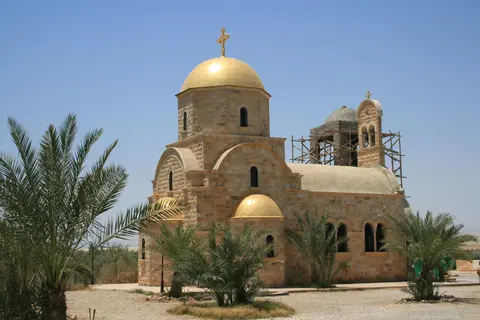
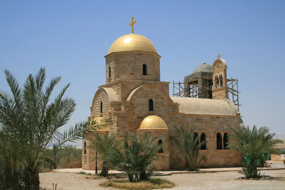
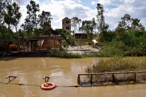
Planning an Al-Maghtas tour from Amman or nearby Dead Sea resorts works cleanly as a half-day heritage excursion shaped around clear site logistics. Because private cars park at the outer gatehouse, every guest obtains official Al-Maghtas tickets before joining organised site shuttles or guided walks tracing Tell al-Kharrar west down Wadi al-Kharrar to the riverbank steps. Travellers asking whether visitors can get baptised in the Jordan River find dedicated waterfront steps near the modern Greek Orthodox Church of Saint John the Baptist, while Epiphany on 6 January brings large annual pilgrim gatherings. Reading Al-Maghtas reviews and visitor notes beforehand highlights how calm guided group pacing protects quiet prayer spaces along the shaded brook.
Studying Al-Maghtas photos paired with historical maps shows how closely the sanctuary integrates natural reeds, desert marl hills and stone churches within one quiet valley bowl. Moving smoothly from Elijah's Hill down to the muddy Jordan River banks reveals why pilgrims across millennia regarded this green oasis beside desert cliffs as a natural threshold between Transjordan and Jerusalem. Combining Tell al-Kharrar's monastic shelters with riverside contemplation gives visitors full perspective on both biblical and Byzantine chapters.
Morning or late-afternoon visits avoid intense Jordan Valley midday sun, especially outside cool winter months when Dead Sea basin temperatures climb rapidly. Modest attire covering shoulders and knees respects Christian pilgrims conducting riverside prayers and immersions beside the narrow stream. Picking up an Al-Maghtas map leaflet at the visitor desk clarifies how Jordan's eastern bank faces Qasr al-Yahud across the narrow river channel, explaining why travellers researching the baptism site on the Jordan River book separate entry permits for Jordan versus West Bank shores.
Queen Alia International Airport (AMM) offers primary international air entry 44 kilometres east of Al-Maghtas, while Ben Gurion International Airport (TLV) lies 66 kilometres west across the river valley. Highway links also connect the Jordan Valley southward past Madaba and the King's Highway toward Petra (168 kilometres south), making Al-Maghtas a logical northern opening stop on Jordan itineraries. Explore other sacred riverside monuments across the Middle East in our UNESCO World Heritage Atlas.