Quick Field Data
- UNESCO Inscription: 2011 · Criteria (iii), (v) and (vii) · Mixed Heritage · Ref. 1377
- Scale & Footprint: 74,179.7 hectares (rounded to 74,200 hectares in site surveys) within Jordan's largest desert wadi system of 720 square kilometres, surrounded by a protective buffer zone extending up to 5 kilometres around Rum Village
- Access & Ticketing: Managed as a Special Regulation Area under the Aqaba Special Economic Zone Authority (ASEZA), with all visitor entry, desert tracks and authorised Bedouin camp permits registered at the main Wadi Rum Visitor Centre
- Arrival Logistics: Located 60 kilometres east of Aqaba and 40 kilometres from King Hussein International Airport (AQJ), with regional connections 77 kilometres south of Petra
Nubian Sandstone Stratigraphy, Aquifers and Aeolian Erosion
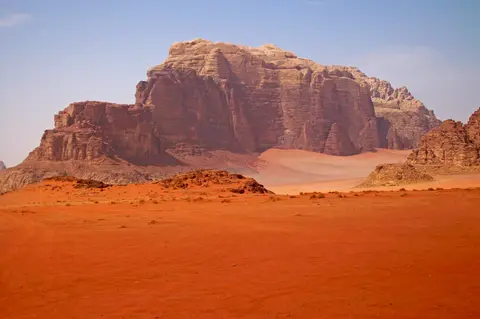
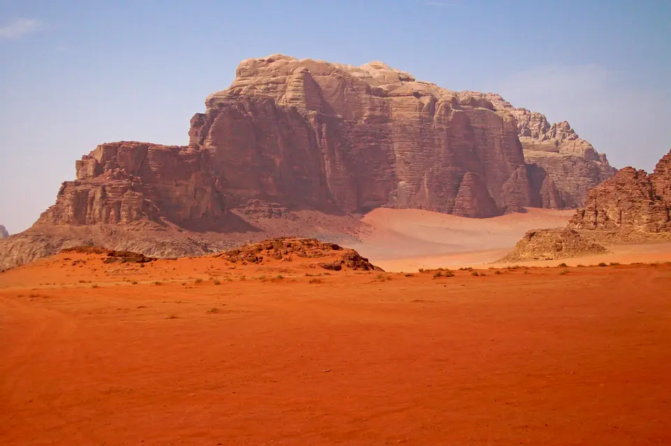
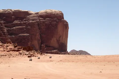
East of the Great Rift Valley and immediately south of the central Jordanian plateau escarpment, the Wadi Rum Protected Area encompasses 74,179.7 hectares of desert canyons, natural rock bridges, and steep-sided massifs running toward the Saudi Arabian border. Traditionally known in Arabic as the Valley of the Moon, it is also linked by scholars to the ancient name Iram of the Pillars. Geologically, the valley lies within southern Jordan's Sandstone Mountain and Valley Region. Rapid tectonic uplift and intersecting fault lines split flat-bottomed basins filled with alluvial fans, salt pans, and wind-blown dunes from towering rock walls. The defining cliffs are carved from iron-rich, erosion-resistant Umm Ishrin Sandstone, the thickest unit in the Lower Palaeozoic to Upper Cretaceous Nubian Sandstone sequence.
Vertical stratigraphy controls both scenery and human survival across the basin. Beneath the Umm Ishrin Sandstone sits the Salib Arkosic Formation, which rests directly atop the eroded plutonic granitoids of the Aqaba Complex, while younger Disi and Umm Sahn sandstones cap higher formations. Along the geological boundary between porous sandstones and impermeable underlying crystalline rocks, groundwater collects in aquifers that emerge as precious springs along eastern mountain slopes. One famous seepage, Ain Shalaaleh, issues from a shaded rock crevice above Rum Village beneath Nabataean inscriptions and lush crevice ferns; T. E. Lawrence described the spout emerging thinner than a wrist from the overhanging roof fissure into a shallow pool ringed by green ferns and grasses.
Wind and salt weathering over millions of years continuously reshape these iron-stained monoliths, driven both by arid desert erosion and wetter prehistoric climates. Aeolian systems across Wadi Rum produce crescent-shaped barkhan dunes, climbing sand ramps sweeping right up cliff shoulders, and echo dunes piled on the leeward side of rock walls. Inside canyon walls and overhanging boulders, severe salt crystallisation and biological weathering excavate dense networks of honeycomb tafoni cavities with dramatic landslides and towering natural rock arches. Directly above the central valley, Jabal Ram (Jebel Rum) rises to 1,734 metres opposite Jebel um Ishrin. Thirty kilometres south of Rum Village stands Jordan's highest summit, Jabal Umm ad Dami, at 1,840 metres (measured at 1,854 metres by radar topography and first identified by Zalabieh Bedouin Difallah Ateeg). On clear mornings, its ridge reveals views toward the Red Sea and the Saudi frontier.
Twelve Millennia of Petroglyphs, Ramesses Cartouches and Nabataean Trade
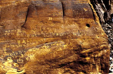
Beneath its geological scale, Wadi Rum holds an uninterrupted 12,000-year record of human passage and settlement across 154 documented archaeological sites. Combined surveys have catalogued roughly 25,000 petroglyphs and 20,000 ancient inscriptions incised onto cliff ledges, fallen boulders and shaded canyon alcoves. Engraved hunting and pastoral scenes show humans, ibex and antelopes spanning Neolithic to Nabataean horizons, while Thamudic, Nabataean and early Arabic inscriptions in four distinct scripts reveal widespread literacy among mobile pastoral tribes. Inside narrow Khaz'ali Canyon (Siq al-Khazali), dense walls of Thamudic engravings depict human figures and antelopes sheltered out of midday glare.
Archaeological and historical evidence links Wadi Rum directly into ancient Near Eastern state networks. Excavations and regional research place the area within the Kingdom of Edom between the thirteenth and sixth centuries BC, positioned along overland trade arteries connecting southern Arabia to the Levant and near copper-working sites extending toward Wadi Feynan. In April 2025, the Jordanian Ministry of Tourism and Antiquities announced a major archaeological discovery inside Wadi Rum. Researchers identified the first royal Egyptian hieroglyphic inscription found in the valley, bearing two royal cartouches displaying the birth and throne names of Pharaoh Ramesses III. This find provides physical evidence of Egyptian military or commercial expeditions passing between Egypt, the southern Levant, and the Arabian Peninsula.
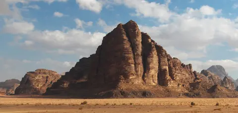
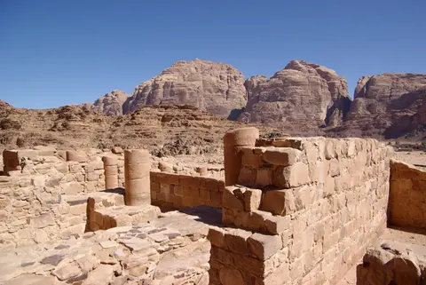
During the classical era, Nabataean engineers constructed water catchment systems, dams and rock-cut cisterns along cliff bases to sustain caravans and terraced cultivation despite arid conditions that had intensified since the third millennium BC. Walking distance from the modern Rest House near Rum Village stand the stone foundations of a Nabataean temple discovered in 1933 and completely excavated by French archaeologists by 1997. Many visitors also recognise Wadi Rum through British officer T. E. Lawrence, who repeatedly crossed the valley during the Arab Revolt from 1917 and described how parallel red cliff walls capped by grey shallow domes ran forward like a giant canyon avenue for miles above the sandy floor. At the cliff seepage of Ain Shalaaleh, Lawrence recorded Nabataean carvings and an incised monogram directly above the cold spring jetting from a roof fissure into a shallow frothing pool bordered by thick green ferns and grasses. In the 1980s, a towering massif originally known as Jabal al-Mazmar (Mountain of the Plague) was popularly named the Seven Pillars of Wisdom after Lawrence's post-war book, even though the title in his manuscript referred elsewhere.
Zalabieh Bedouin Heritage, Climbing Routes and Desert Regulation
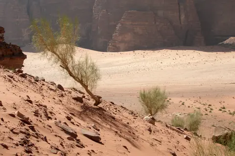
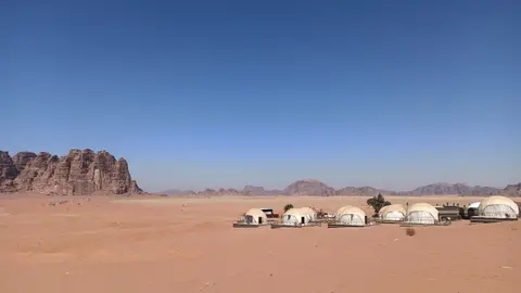
Today the valley remains closely bound to the Zalabieh Bedouin community, who settled permanently around Rum Village around 1980. Initially living in goat-hair tents, the population numbered roughly 700 to 800 residents, around 80 percent of whom were retired army or police personnel. Traditional Bedouin values stress deep tribal solidarity, derived from the Arabic root meaning clear and obvious desert life (badiya), while camels remain central cultural symbols celebrated through competitive desert races. Rum Village has since grown to include concrete dwellings, one school for boys and one for girls, local shops, and Desert Patrol headquarters. Tourism took off internationally after David Lean filmed Lawrence of Arabia across Wadi Rum in 1962. Later shoots included Prometheus, The Last Days on Mars (2013), The Martian (2015), Theeb, Rogue One, Aladdin (2019), and Star Wars: The Rise of Skywalker. Recent productions span Dune (2021), Moon Knight (2022), John Wick: Chapter 4 (2023), Dune: Part Two, and Aadujeevitham (2024), earning the Jordanian Royal Film Commission recognition from the Location Managers Guild in 2017. By 2017, annual visitation reached 162,000 travellers. Bedouin-operated four-wheel-drive routes, camel rides, overnight desert camps, and the annual Jabal Ishrin marathon (coordinated by Dima and Lama Hattab) sustain local livelihoods and give residents direct economic incentives to safeguard the reserve.
Rock climbing forms a distinct chapter of Wadi Rum's living heritage. Local Bedouin elders navigated vertical canyon chimneys and slab ledges along traditional Bedouin Roads for generations. In 1949, Sheikh Hamdan took surveyors to the summit of Jabal Ram, and in November 1952 he guided Charmian Longstaff and Sylvia Branford on the first recorded European ascent. Beginning in 1984, British climbers Howard, Baker, Taylor, and Shaw retraced historic Bedouin lines including Hammad's Route and Sheikh Kraim's Hunter's Slabs and Rijm Assaf on Jebel Rum. Later ascents were opened by French guide Wilfried Colonna, the Swiss Remy brothers, and Haupolter and Precht. Tony Howard published the first climbing guidebook, Treks and Climb in Wadi Rum, in 1987. Today a new-routes logbook kept at the Wadi Rum Guest House documents online Bedouin route surveys by Lien and Gilles Rappeneau and bolted climbs such as the 450-metre (1,480-foot) Guerre Sainte line on Jebel Nassarani North in 2000.
Formal conservation began in 1978, leading to establishment under Jordan's cabinet decision 27/11/3226 of 1997 and extension decision 224/11/1/986 of 2002. The reserve is also protected under Antiquities Law No. 21 of 1988 and integrated into the Aqaba Special Economic Zone Authority land-use plan. Dedicated rangers and archaeological partners oversee continuous inventory surveys and preventive conservation across both the 74,179.7-hectare core and its 5-kilometre buffer zone around Rum Village. Work aims to curb proliferating four-wheel-drive tyre tracks, unmanaged tourism infrastructure, urban expansion of Rum Village, groundwater pumping, local firewood gathering, artefact removal, and modern graffiti defacing fragile prehistoric petroglyphs.
Complex Access Zones and Desert Tracks in Wadi Rum
Wadi Rum operates through regulated entry gates and locally licensed Bedouin transport networks protecting soft desert sands and dispersed rock art sites.
| Complex Zone | Key Highlights | Access & Ticket Rule |
|---|---|---|
| Visitor Centre & Seven Pillars Gateway | Northern canyon portal, orientation displays, views toward the Jabal al-Mazmar (Seven Pillars of Wisdom) sandstone buttresses | Mandatory registration and protected-area entry fee checkpoint; private rental cars stop near the visitor hub or village perimeter |
| Rum Village & Nabataean Temple Zone | Zalabieh Bedouin settlement, Desert Patrol station, excavated Nabataean sanctuary foundations and Ain Shalaaleh spring | Accessible on foot from Rum Village; guided four-wheel-drive transfer recommended beyond village streets |
| Central Canyon & Petroglyph Circuit | Khaz'ali Canyon Thamudic engravings, Khor al Ajram, climbing dunes, natural sandstone bridges and desert camp valleys | Visited with licensed local Bedouin guides via designated desert tracks; off-track driving and rock art contact strictly prohibited |
| Southern Massifs & Jabal Umm ad Dami | High granite-basement border peaks reaching 1,840 metres, remote southern wadis and traditional mountain climbing routes | Requires dedicated full-day guided four-wheel-drive support or licensed mountain guides; register ascents in the climbing log |
Three Geological and Epigraphic Features to Spot on Site in Wadi Rum
Paying close attention along shaded canyon walls and mountain bases reveals how Wadi Rum's rock layers and human records interlock:
- Lithologic Contact Springs at Ain Shalaaleh: Trace the base of the towering Umm Ishrin cliffs behind Rum Village where red sandstone meets underlying arkosic and granitic strata; water trapped along this geological boundary emerges cleanly into a small fern-rimmed pool beneath incised Nabataean symbols.
- Honeycomb Tafoni Weathering Pockets: Inspect sheltered sandstone faces inside narrow gullies and overhangs where salt crystallisation and wind scouring have hollowed dense lattice networks of fist-sized pits across hard iron-rich rock beds.
- Incised Multi-Script Walls in Khaz'ali Canyon: Step into the cool shaded fissure of Siq al-Khazali to compare deep prehistoric animal and human figures beside crisp Thamudic and Nabataean desert script lines. Ancient caravanners used these shady canyon acoustics and water pockets as roadside rest stops.
Seasonal Timing and Linking Wadi Rum with Petra
Wadi Rum experiences an arid desert climate where scarce annual rain falls mainly during intense winter thunderstorms when cold Eastern Mediterranean upper-air troughs meet Red Sea thermal lows and subtropical moisture, occasionally triggering flash floods inside narrow gorges. Spring and autumn provide mild daytime hiking weather and crisp starry nights across desert camps, while winter nights near the high granite slopes turn cold and summer midday temperatures restrict outdoor walking to early morning and late afternoon hours.
Positioned 40 kilometres from Aqaba's King Hussein International Airport (AQJ) and 77 kilometres south of Jordan's rose-red Nabataean capital, Wadi Rum forms the natural desert extension to our Petra destination guide, connecting two vital nodes of the ancient caravan world. Continue exploring Middle Eastern heritage sites across our UNESCO World Heritage Atlas.