Quick Field Data
- UNESCO Inscription: 2011 (Ref. 1295), cultural maritime fortress on Mombasa Island, Kenya; Criteria (ii) and (iv).
- Scale & Footprint: 2.36 hectares covering the coral-stone fort, deep defensive moat, coastal perimeter and submerged offshore archaeological zone bordering Mombasa Old Town.
- Access & Ticketing: Administered by the National Museums of Kenya under the National Museums and Heritage Act 2006; check official NMK notices at the entrance gate for current Fort Jesus Mombasa tickets, prices and charges.
- Arrival Logistics: Moi International Airport (MBA) sits ten kilometres west on the Mombasa mainland, with coastal rail and domestic flights linking northwest to Nairobi (442 kilometres).
Renaissance Proportions on a Mombasa Coral Spur
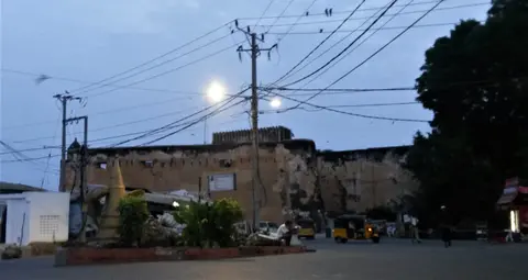
Perched squarely atop a rugged spur of fossilised coral rock at the southern edge of Mombasa Island, Fort Jesus dominates the maritime entrance to Mombasa's Old Port. Known locally in Swahili as Ngome la Yesu la Mombasa and in Portuguese as Forte Jesus de Mombaça, it was built between 1593 and 1596 by order of King Felipe II of Spain, who also ruled as King Filipe I of Portugal and the Algarves. Held by Portugal for roughly a century, it marks the first successful attempt by a Western power to command Indian Ocean trade routes previously shaped by Eastern influence. Inscribed by UNESCO in 2011, the 2.36-hectare site encloses the fortress, its deep landward moat and underwater archaeological remains immediately offshore.
Italian military architect Giovanni Battista Cairati drafted Fort Jesus as his final overseas commission while serving as Chief Architect for Portuguese eastern possessions. Inspired by Italian architectural theorist Pietro Cataneo and directed on the ground by master builder Gaspar Rodrigues, Cairati engineered the first European-style cannon-resisting fort raised outside Europe and Portugal's sole fortified outpost along the Swahili Coast. Reflecting late Renaissance belief that perfect geometric harmony echoes human proportions, an aerial view traces a human figure lying on its back facing the sea. The ground plan pairs a near-square central court with four angular corner bulwarks and five bastions overall, meeting modern artillery needs cleanly.
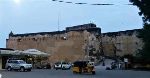
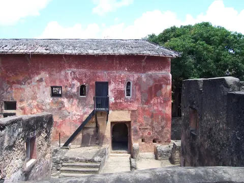
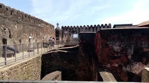
While military geometry came from Renaissance Milan, physical wall construction relied directly upon Swahili masonry expertise, local building stone and regional coastal labour. Swahili craftsmen cut dense coral stone blocks and burned lime mortar to anchor massive defensive curtains straight into the living reef ridge. Original Portuguese ramparts stood 15 metres tall before later Omani Arab forces added another three metres atop the parapet upon capture, creating today's imposing 18-metre coral-stone walls rising sheer above ocean surf and dry moat.
Nine Changes of Power Across Portuguese, Omani, and British Rule
Over nearly three centuries following completion in 1596, Fort Jesus Mombasa changed hands at least nine times between 1631 and 1875 as African, Arab, Swahili, Persian, Turkish and European forces fought over East African shipping. Portuguese mastery broke first in 1631 when Sultan Yusuf ibn al-Hasan of Mombasa seized the stronghold. After Portuguese fleets recaptured the citadel in 1632, engineers refurbished its ramparts and added stronger outer fortifications that made direct assault far harder. Those upgraded coral-stone defences deterred attackers until Omani Arab armies commanded by Saif bin Sultan laid siege to Mombasa Island in 1696.
That famous Omani siege dragged on for roughly two to nearly three years until the surviving garrison capitulated in 1698, ending lasting Portuguese dominance along the Swahili coast. Although Portuguese ships briefly reoccupied Fort Jesus between 1728 and 1729 with backing from coastal Swahili city-states, local rulers governed the citadel from 1741 until 1837, when Omani troops returned and converted the interior into barracks. Even through repeated artillery sieges, structural modifications and changing flags, Cairati's original Renaissance plan survived largely unchanged beneath successive additions.
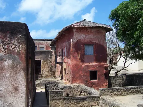
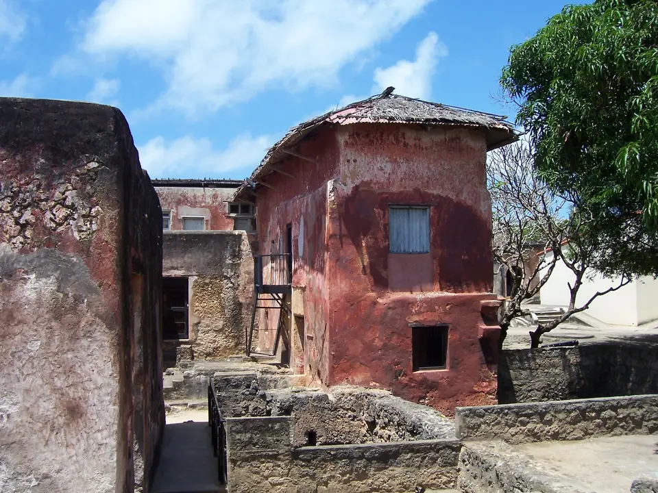
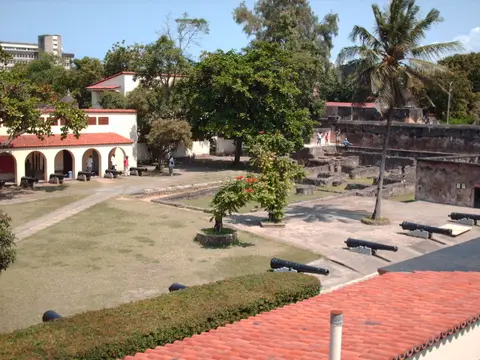
Omani rule wove East African and Islamic domestic architecture straight into European military stonework. Standing courtyard buildings preserve Oman House, residence of the Omani sultan-appointed governor overseeing the East African coast, beside a former meeting hall supported by five stone pillars symbolising Islam's five pillars. Carvers engraved Koranic verses directly onto wooden doorposts and ceiling beams, while builders excavated a 76-foot (23-metre) courtyard well yielding salty water used solely for washing beside the earlier open Portuguese rainwater cistern. Surviving artillery traces shifting coastal ballistics directly along the parapets: longer-barrelled Portuguese cannons fired up to 200 metres, whereas shorter British guns mounted later achieved a 300-metre range.
British imperial administration altered the fortress's role again in 1895 following establishment of the East Africa Protectorate (which later became the Colony and Protectorate of Kenya in 1920). Finding the thick 18-metre coral-stone walls already impenetrable, British colonial officials converted Fort Jesus into a coastal prison operating until 1958. Only when late-colonial stewardship shifted toward heritage preservation did the monument leave behind penal duties for public scholarship.
Together, those alternating sieges turned Fort Jesus into an unmatched stone archive of Indian Ocean peoples. African, Arab, Turkish, Persian and European sailors, merchants, soldiers and builders left successive inscriptions, artillery pieces and domestic structures inside one compact coastal enclosure. Visitors walking along upper ramparts today see straight across the harbour bar where Portuguese, Omani and Swahili vessels manoeuvred for naval advantage across three turbulent centuries.
From Colonial Prison to Coastal Archaeology and Conservation
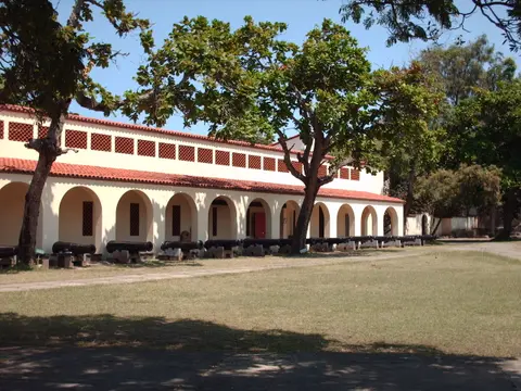
Conversion from working jail to Kenya's foremost historical museum began in 1958, when authorities gazetted Fort Jesus as a historical monument and Kenya National Park covering the fort plus a 100-metre surrounding strip. British archaeologist James Kirkman excavated the moat and courtyards systematically between 1958 and 1971, cross-referencing Chinese porcelain, Islamic ceramics and structural footings with colonial documents to trace centuries of Indian Ocean maritime life. Kirkman's fieldwork established clear stratigraphic chronologies across every courtyard layer, separating 16th-century Portuguese footings from 18th-century Omani renovations and 19th-century prison alterations. Today, Fort Jesus Museum operates under the National Museums and Heritage Act 2006 through the National Museums of Kenya (NMK), housing an on-site Conservation Lab, Education Department, active research programmes and an Old Town Conservation Office.
Adjacent Mombasa Old Town acts legally as the fort's protective buffer zone, connecting Swahili-Omani coral-rag lanes directly with coastal fortifications along an otherwise unbuilt stretch of Mombasa Island shoreline. Conservators repair weathered stonework strictly using traditional coral stone and lime mortar rather than modern Portland cement, keeping original form, design and materials intact. Key long-term management priorities focus on halting wave erosion along coastal bedrock, preventing visually intrusive modern buildings nearby and resolving a persistent mapping discrepancy between Mombasa Old Town's designated municipal Conservation Area and UNESCO's formal buffer zone boundary. Strengthening NMK staffing, coastal rock stabilisation and regular facade monitoring across narrow Old Town streets remains crucial to keeping Mombasa Island's historic skyline intact and visually cohesive for future generations of visitors and local researchers.
Active conservation education also ties the monument closely to modern coastal society across Mombasa Island. Through museum outreach led by NMK specialists, local schoolchildren, artisan masons and tourism guides examine archaeological finds firsthand while keeping traditional coral-lime masonry skills alive across Old Town buildings. Maintaining continuous maintenance schedules protects delicate carved timber beams, plastered rainwater cisterns and exposed coral ramparts against humid equatorial sea air year-round. Visitors stepping past the moat gate notice immediately how museum galleries, ongoing archaeological displays and open coastal battlements preserve both European and East African maritime memory side by side.
Access Zones Inside Fort Jesus and Mombasa Old Town
Walking counterclockwise from the main moat entry bridge across the central courtyard to the seaward bastions lets visitors trace every military and domestic layer cleanly. Confirm official Fort Jesus Mombasa prices, ticket categories and opening policies at the National Museums of Kenya gatehouse before stepping inside.
| Complex Zone | Key Highlights | Access & Ticket Rule |
|---|---|---|
| Perimeter Moat and Outer Coral Walls | 1593 to 1596 Portuguese lower masonry topped by three-metre Omani height extensions and corner bastions. | Ticketed main gate sits beside the landward moat bridge; keep inside marked viewing paths along upper parapets. |
| Central Courtyard and Oman House | Omani governor residence, 76-foot salty well, Portuguese rainwater cistern, Koranic beams and five-pillar hall. | Included with standard museum entry ticket; follow posted signage inside active excavation and gallery rooms. |
| Seaward Battlements and Cannons | 200-metre-range Portuguese guns, 300-metre-range British cannons and views over Old Port underwater remains. | Exposed sunlit rampart walkways above ocean cliffs; wear sun protection and stay clear of crumbling cliff edges. |
| Mombasa Old Town Buffer Quarter | Historic coral-rag townhouses, carved wooden doors and maritime lanes linking Fort Jesus to Mombasa Old Port. | Open public historic neighbourhood managed with NMK Old Town Conservation Office; dress modestly out of respect. |
Three Defensive and Cultural Details Inside the Bastions
- Three-Metre Omani Wall Extension Seam: Look along the outer 18-metre coral walls to spot where Omani masons raised three vertical metres of stonework above Cairati's original 15-metre Portuguese ramparts.
- Koranic Carvings and Five-Pillar Hall Masonry: Inspect wooden doorposts and ceiling beams inside courtyard chambers where Omani Arabic scripture sits steps from the Portuguese open rainwater cistern.
- Portuguese Versus British Cannon Range Contrasts: Compare longer Portuguese barrels (200-metre range) mounted near older gun ports against shorter, higher-velocity British artillery (300-metre range) added later along seaward parapets.
Visiting Fort Jesus Mombasa From Moi Airport and Nairobi
Checking Fort Jesus Mombasa location before arrival shows how closely Kenya's foremost coastal citadel connects with shaded lanes in Mombasa Old Town. Positioned on the eastern shore of Mombasa Island overlooking the Old Port entrance, the monument rewards early morning or late-afternoon visits when sea breezes cool open battlements and courtyard displays. Guests researching Fort Jesus Mombasa charges or resident versus foreign Fort Jesus Mombasa tickets should verify official National Museums of Kenya fee schedules at the gatehouse upon arrival rather than trusting unverified third-party pages. Reviewing recent Fort Jesus Mombasa photos before arrival also helps orient visitors toward the seaward coral spur, moat bridge and Oman House galleries. Visitors inspecting the entrance museum galleries can also learn how coral stone masonry repairs protect exposed outer ramparts against ocean spray and humid tropical rainstorms.
Setting aside two to three unhurried hours lets visitors explore courtyard museum collections excavated by James Kirkman, Oman House woodwork and upper cannon parapets before walking out into Mombasa Old Town's historic streets under NMK conservation guidance. Morning sunlight brightens the seaward coral cliffs beside the Old Port, while late-afternoon light sharpens geometric bastion shadows across the moat. Combining the citadel ramparts with a calm walk through Old Town timber balconies provides full context for Mombasa's historic harbour.
Moi International Airport (MBA) handles direct flights just ten kilometres west on the Mombasa mainland, connecting straight across island crossings to Old Town roads. Inland travellers heading from Kenya's capital at Nairobi (442 kilometres northwest) connect smoothly by frequent flights or overland transport linking central highlands to the Swahili Coast. Walking inside the 2.36-hectare enclosure links 16th-century European Renaissance engineering, 17th-century coastal sieges, 18th-century Swahili-Omani craftsmanship and modern Kenyan heritage care within one compact harbour peninsula. Spending unhurried daylight hours tracing courtyard rooms, shaded corridors and coral ramparts clarifies why Fort Jesus remains Mombasa's premier historical destination. Pairing coastal heritage in Mombasa with wildlife parks or urban stops inland creates a balanced Kenyan route bridging ocean forts and highland plains. Explore additional Indian Ocean forts and Swahili heritage sites across Africa inside our UNESCO World Heritage Atlas.