Quick Field Data
- UNESCO Inscription: 2011 (Ref. 1060), serial natural site spanning Baringo and Nakuru counties in Kenya's Rift Valley; Criteria (vii), (ix) and (x)
- Scale & Footprint: 32,034 hectares combining three inter-linked soda lakes: Lake Bogoria (10,700 hectares), Lake Nakuru (18,800 hectares) and Lake Elementaita (2,534 hectares)
- Access & Ticketing: Protected as Lake Nakuru National Park (Kenya Wildlife Service), Lake Bogoria National Reserve (Baringo County) and Ramsar wetland sanctuaries around Soysambu Conservancy; park vehicle and visitor passes are issued at official gates and KWS portals
- Arrival Logistics: Major domestic flights reach Eldoret International Airport (EDL), 119 kilometres northwest of the central basin, while paved highway A104 connects all three lakes directly north from Nairobi (145 kilometres to the core system, 164 kilometres to Nakuru and 120 kilometres to Elementaita)
Tectonic Half-Grabens and Soda Chemistry in the Great Rift
Strung along Kenya's faulted Gregorian Great Rift Valley floor between steep volcanic escarpments, Lake Bogoria (10,700 hectares), Lake Nakuru (18,800 hectares) and Lake Elementaita (2,534 hectares) preserve three connected remnants of one vast ancient lake. Roughly 10,000 years ago during the wetter late Pleistocene and early Holocene, all three basins joined as a single deep freshwater body. Elevated gravel and conglomerate shorelines still trace terraces roughly 9 metres above modern Lake Bogoria beside lacustrine sediments across the Nakuru-Elmenteita plain. As regional climate dried and rift evaporation intensified, water shrank into three closed endorheic pans rich in dissolved sodium carbonate and bicarbonate salts.
Northmost in Baringo County, 120 kilometres north of Nakuru city and 240 kilometres north of Nairobi, Lake Bogoria occupies an asymmetric half-graben fault basin roughly 20 kilometres long by 10 kilometres wide. Missionary James Hannington recorded it in 1885 as Lake Hannington. Divided into three lobes by shallow tectonic sills at Nyalibuch and Mwanassis, the lake measures up to 17.6 kilometres long and 0.5 to 3.6 kilometres wide. Its 700-square-kilometre catchment has its lowest drainage divide at 999 metres near Loboi village. Reaching 10 to 12 metres deep across 3,000 to 3,300 hectares normal surface area, Bogoria serves as a vital drought refuge when shallower pans dry. It receives water from the Waseges (Sandai) and diverted Loboi rivers alongside roughly 200 hot springs and at least 10 shoreline geysers erupting up to 5 metres high above 96 to 99 degrees Celsius.
Farther south near Nakuru town at 1,754 metres elevation lies shallow Lake Nakuru, historically fluctuating between 5 and 45 square kilometres inside the 188-square-kilometre Lake Nakuru National Park gazetted in 1961. Just southeast between Nakuru and Lake Naivasha sits Lake Elementaita (also spelled Elmenteita, from the Maasai muteita meaning dust place for its January-to-March aridity). Normally under one metre deep, it is rimmed by white trona-encrusted mudflats beside the southern Kekopey hot springs and dark volcanic peaks of the Elmenteita Badlands.
Cyanobacteria Blooms, Lesser Flamingos, and Pelican Breeding
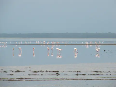
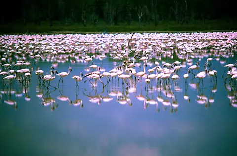
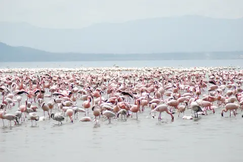
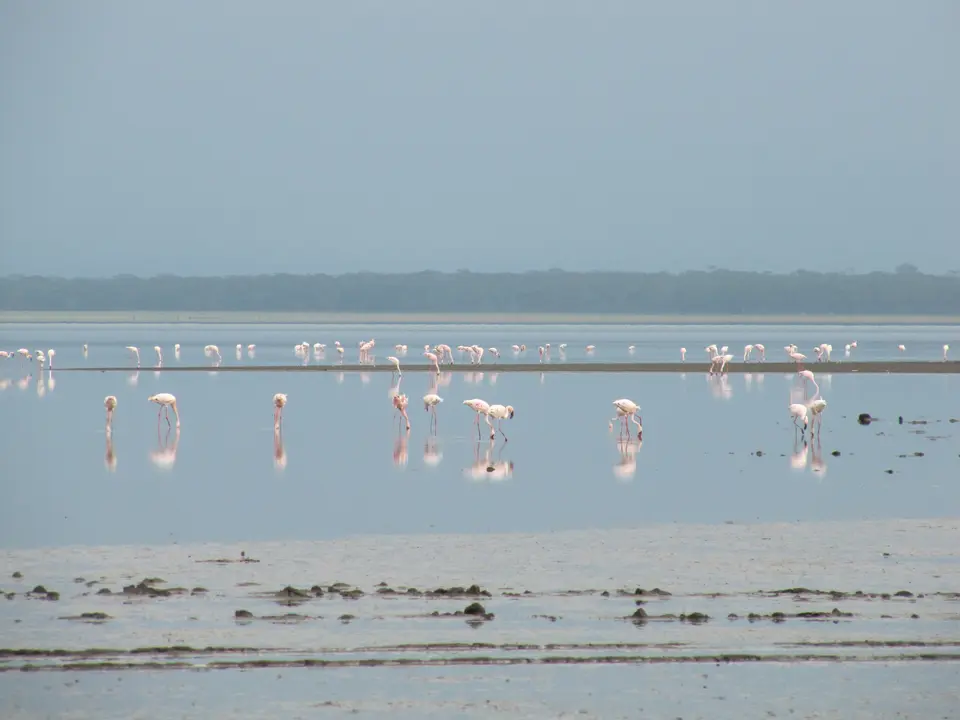
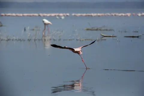
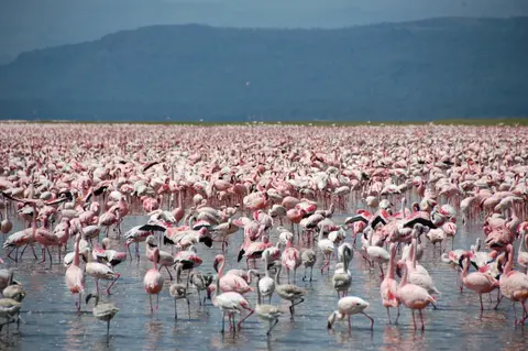
Extreme alkalinity, reaching pH 9.3 to 10.6 with sodium carbonate-bicarbonate-chloride brine exceeding 100 grams per litre around Bogoria's Loburu Delta, eliminates most submerged plants and large predatory fish. Instead, the warm soda pans act as open-air bioreactors for microscopic blue-green cyanobacteria. Chief among them is Spirulina platensis alongside microbial mats of Phormidium, Pseudanabaena, Synechococcus and Calothrix nourished by bird droppings and silica- and nitrate-rich geothermal springs. That algal biomass anchors a hyper-productive food web powering one of Earth's largest bird congregations. Across the three lakes, roughly 1.5 million to 4 million lesser flamingos (Phoeniconaias minor) shuttle continuously with shifting bloom density, joined by taller, darker greater flamingos feeding on crustaceans and insect larvae.
Scientists calculate that Lake Nakuru's flamingos alone consume roughly 250,000 kilograms of algae per hectare annually, alongside microscopic rotifer zooplankton such as Brachionus species. Beyond flamingos, the three-lake corridor anchors the Rift Valley's main breeding and nesting ground for great white pelicans and sustains 13 globally threatened bird species. It also forms a vital African-Eurasian flyway hub used by over 100 migratory species moving between northern breeding grounds and African winter wetlands. Over 400 resident and migrant bird species populate the Nakuru-Elmenteita basin. These range from African spoonbills, pied avocets, black-necked grebes, little grebes, yellow-billed storks and black-winged stilts to grey-headed gulls, gull-billed terns, African fish eagles, goliath herons, Verreaux's eagles, hamerkops and pied kingfishers.
Surrounding shorelines pack terrestrial sanctuaries beside the water, complemented around Lake Bogoria by six distinct wetland types mapped across fault springs and deltas. Boiling proximal hot springs above 40 to 99 degrees Celsius carry carbonate and siliciclastic crusts with microbial mats, feeding downstream Cyperus laevigatus marshes in shallow 30-to-40-degree-Celsius sheets. Circular 15-metre artesian blister mounds one to 2 metres high, studied by Ashley and colleagues in 2002, carry short graminoids such as Pycreus mundtii and Leersia hexandra. Nearby grow Typha domingensis and floating Cyperus papyrus swamps up to 1.5 metres deep. Seasonal Kesubo floodplain grasses grazed by cattle border hypersaline littoral mudflats near pH 10 where Spirulina platensis dominates. Radiocarbon-dated to 700 years old along a north-south horst block framed by Acacia scrub and Sporobolus spicata grasses, Loboi Swamp shrank from 6 kilometres in 1969 to 3.5 by 0.5 kilometres in 2001. It still holds semi-permanent reeds and papyrus, while nearby Campground Wetlands divide faulted volcanic uplands from alluvial sediments. Around Lake Nakuru, a 188-kilometre anti-poaching fence leaves a vital 12.1-kilometre southeastern gap adjoining Soysambu Conservancy toward Lake Naivasha. The park protects over 25 eastern black rhinos and roughly 70 southern white rhinos (2009 data) alongside Rothschild's giraffes relocated from western Kenya since 1977. Cape buffalo, waterbuck, eland, African wild dogs, lions, leopards, hyenas and tree-climbing pythons also inhabit the reserve. Across Lake Elementaita, Baron Delamere's 190-square-kilometre Soysambu ranch and Galbraith Cole's Kekopey estate still support over 12,000 wild zebra, gazelle, eland and warthogs across two-thirds of the lakefront. These grounds lie near the Kariandusi prehistoric site where Louis Leakey unearthed stone handaxes in 1928.
Rising Rift Water Levels and Catchment Conservation
Despite Ramsar status across all three lakes (Elementaita listed in 2005 alongside Bogoria and Nakuru) and national or county management, catchment pressures reshape these small basins rapidly. Lake Bogoria receives roughly 700 millimetres of rain on the Loboi plain and 1,200 millimetres in adjacent highlands, while semi-arid evaporation exceeds 2,500 millimetres yearly. Water balances therefore swing sharply across El Niño and Indian Ocean Dipole cycles. Farm conversion, forest clearing, groundwater pumping, siltation and urban effluent from growing Nakuru city periodically degraded cyanobacterial blooms. Since 1991, these shifts have triggered mass flamingo deaths and movements toward Lakes Elementaita, Simbi Nyaima, Bogoria and Tanzania's Lake Natron. In 2024, Kenyan court orders directed Nakuru officials and water plants to clean up sewage discharges.
Human ecological introductions altered bird dynamics as well. After alkaline Lake Magadi tilapia (Alcolapia grahami) were stocked into Lake Nakuru and Lake Elementaita in the early 1960s (1962 at Elementaita), fish-eating pelicans, herons and cormorants surged. These predators began taking flamingo eggs and chicks, shifting major breeding colonies south toward Lake Natron. Around Lake Bogoria, shoreline wetlands including Loboi Swamp, Kesubo floodplain marshes, Campground artesian blister mounds and Loburu Delta rely on fragile fault-line springs and ephemeral streams such as the Emsos and Parkirichai. Following Waseges river diversions, 700-year-old Loboi Swamp shrank from 6 kilometres long in 1969 to 3.5 by 0.5 kilometres in 2001.
Over the past decade, rising waters have dominated news across the Rift floor. Shifts in Indian Ocean moisture patterns, including a strong positive Indian Ocean Dipole bringing wet early 2020 rains, combined with degraded watershed soils unable to absorb heavy runoff. Between 2011 and 2021, Lake Nakuru expanded 37 percent from 40 or 43 square kilometres to 68 square kilometres, submerging the main park gate, flooding 677 households and displacing wildlife. Meanwhile, Lake Bogoria swelled from 3,300 hectares to 4,690 hectares during 2020 rains, drowning shoreline geysers and reshaping flamingo feeding shallows across all three reserves.
Access Zones Across Lakes Bogoria, Nakuru, and Elmenteita
Spaced roughly along the paved Nairobi-Nakuru-Baringo Rift corridor, each lake offers distinct geothermal geology, bird habitats and safari terrain under separate conservation gates.
| Complex Zone | Key Highlights | Access & Ticket Rule |
|---|---|---|
| Lake Nakuru National Park (18,800 ha) | Baboon Cliff viewpoint, black and white rhino sanctuary, Rothschild's giraffes, euphorbia-acacia woods and shifting flamingo flocks | Managed by Kenya Wildlife Service; park entry requires paid vehicle and visitor permits at active perimeter gates above flooded shorelines |
| Lake Bogoria National Reserve (10,700 ha) | Loburu Delta hot springs, 10 geothermal geysers, three-lobed tectonic basin, drought-refuge flamingo flocks and Loboi Swamp | Managed by Baringo County reserve authorities; entry passes payable at park gates with strict heat safety distances around boiling vents |
| Lake Elementaita & Kekopey Springs (2,534 ha) | Shallow trona mudflats, southern Kekopey hot springs, reed beds for night herons and pelicans, and Elmenteita Badlands | Observed from A104 highway escarpment vistas, lakeside lodges or permitted access tracks without disturbing nesting shorelines |
| Soysambu Conservancy & Kariandusi | 190-square-kilometre western lakefront wildlife ranch housing over 12,000 animals and Leakey's 1928 prehistoric handaxe site | Soysambu requires private conservancy booking; Kariandusi Archaeological Museum charges National Museums of Kenya site admission |
Three Geothermal, Algal, and Wildlife Details Around the Rift Lakes
- Boiling Loburu Geysers vs Alkaline Shore Brine at Bogoria: Walking cautiously beside Lake Bogoria National Reserve's western Loburu Delta, look for 96-to-99-degree-Celsius hydrothermal vents ringed by bright microbial mats metres from 28-to-33-degree lake water. Shifting lake levels alternately submerge and expose individual spouting geysers.
- Pleistocene Strandlines Nine Metres Above Current Shores: Scanning steep gravel benches around Lake Bogoria and sediment terraces linking Elementaita to Nakuru, trace the ancient high-water shelves formed roughly 10,000 years ago when all three separate soda lakes formed one deep freshwater basin.
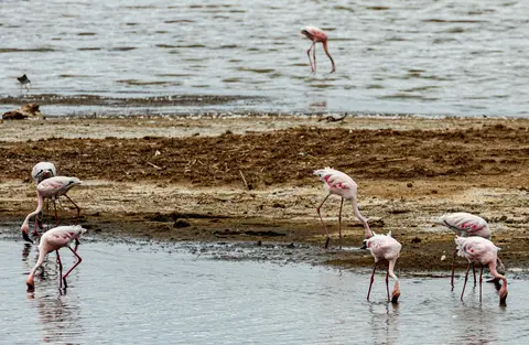
- Swinging Flamingo Densities and Submerged Park Gates: From Baboon Cliff above Lake Nakuru, look down at shifting fuchsia ribbons of Spirulina-grazing flamingos beside flooded tree stumps along the shoreline. These drowned trunks mark the 2011-to-2021 expansion from 43 to 68 square kilometres that pushed birds and rhinos onto higher ground.
Migratory Bird Cycles and Circuits Between Nakuru and Nairobi
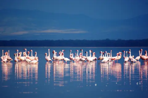
Northern winter months pack lakeshores with migrant waders and resident African waterbirds. Around Lake Elementaita, drier January-to-March conditions expose bright trona salt flats and gather birds near permanent springs at Kekopey and Lake Bogoria. Lake Nakuru's 12.1-kilometre southeastern boundary with Soysambu Conservancy remains the sole wildlife corridor linking south toward Lake Naivasha. Seasonal coordination across all three reserves, plus transnational cooperation toward Tanzania's Lake Natron, therefore remains vital for rhinos and birds. Plan three to four days travelling north on Kenya's paved A104 escarpment road from Nairobi (145 kilometres to the central cluster), or flying via Eldoret International Airport (EDL, 119 kilometres northwest). Split nights between Nakuru's sanctuary and geothermal Bogoria before exploring wider East African landmarks in the UNESCO World Heritage Atlas.