Quick Field Data
- UNESCO Inscription: 1997 (Ref. 800; Biosphere Reserve since April 1978), natural mountain and wildlife corridor across Meru, Embu, Kirinyaga, Nyeri and Tharaka Nithi counties; Criteria (vii) and (ix)
- Scale & Footprint: 217,711 hectares combining Mount Kenya National Park (established 1949), surrounding Mount Kenya Forest Reserve above 2,000 to 2,500 metres and the northern Lewa Wildlife Conservancy and Ngare Ndare Forest Reserve linked by a 9.8-kilometre wildlife corridor
- Access & Ticketing: Managed jointly by Kenya Wildlife Service (KWS), Kenya Forest Service (KFS) and Lewa Wildlife Conservancy trustees; park entry permits, conservation fees and guided climbing registrations must be arranged through official KWS and conservancy portals
- Arrival Logistics: Jomo Kenyatta International Airport in Nairobi (NBO, 159 kilometres southwest, or 150 to 193 kilometres by highway) serves as the primary international passenger gateway. Smaller domestic bush flights also use Nanyuki Civil Airport (NYK), a limited airstrip 40 kilometres from the northern approaches.
Glaciated Volcanic Plugs Above the Kenyan Equator
Standing just 16.5 kilometres south of the equator and roughly 480 kilometres inland from the Indian Ocean coast, Mount Kenya rises 5,199 metres as Africa's second highest mountain and the namesake of the nation. Unlike volcanic cones that still keep broad crater rims, Mount Kenya is an ancient extinct stratovolcano born roughly 3 million years ago (active between 3.1 and 2.6 million years ago) after the opening of the East African Rift. Before deep glacial erosion stripped away its summit crown, geologists estimate the prehistoric cone towered between 6,000 and 7,000 metres high (around 6,500 metres in World Heritage assessments), surpassing modern Mount Kilimanjaro.
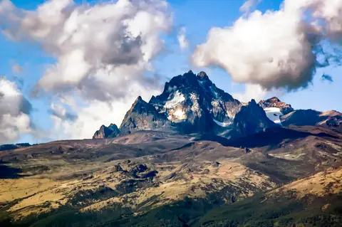
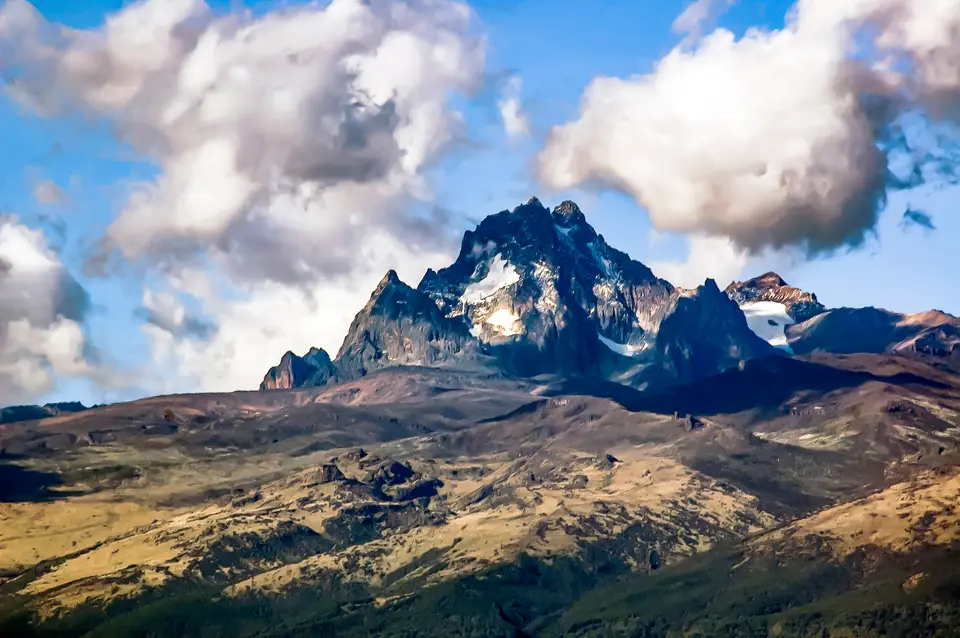
Repeated ice ages carved the exposed central core into dramatic alpine spires of basalts, rhomb porphyrites, phonolites, trachytes and kenyte, a volcanic rock first identified here by geologist John Walter Gregory in 1900. Twin summit pinnacles Batian (5,199 metres) and Nelion (5,188 metres) stand barely 250 metres apart across the 5,144-metre Gate of the Mists, flanked by trekking peak Point Lenana (4,985 metres). Surrounding horns include Point Piggot (4,957 metres), Point Dutton (4,885 metres), Point John (4,883 metres), Point John Minor (4,875 metres) and Krapf Rognon (4,800 metres). Slightly lower peaks add Point Peter (4,757 metres), Point Slade (4,750 metres) and Midget Peak (4,700 metres). Beyond the central plug, satellite cones on the northeast flank include parasitic twin peaks Terere (4,714 metres) and Sendeyo (4,704 metres), The Hat (4,639 metres) and flat-topped Ithanguni, which once carried its own ice cap.
Two distinct glacial advances sculpted the upper mountain, leaving moraine debris down to 3,300 metres, roughly 20 glacial tarns and high moraine ridges between 3,950 and 4,800 metres. That sculpting divides Mount Kenya's topography sharply: lower unglaciated foothills hold river-carved V-shaped valleys, while upper moorlands form broad flat-bottomed U-shaped glacial troughs radiating from the peaks. Joseph Thomson described the massif scientifically in 1883, and Sámuel Teleki and Ludwig von Höhnel explored partway up in 1887. Gregory confirmed it as an extinct glaciated volcano at 5,000 metres on Lewis Glacier in 1893, and mountaineers first summited in 1899 before full surveys in 1966. Today the park receives over 16,000 visitors annually.
Clocked clockwise from the north, Mount Kenya's remaining ice bodies (Northey, Krapf, Gregory, Lewis, Diamond, Darwin, Forel, Heim, Tyndall, Cesar and Josef, counted as 11 or 12 dwindling glaciers across surveys) no longer descend below 4,650 metres. Even in winter, melting outpaces fresh snow accumulation on Lewis Glacier, the largest sheet. Covering roughly 0.7 square kilometres in the 1980s, total glacier surface fell to just 10 percent of that 1980s area in a 2024 scientific study, raising expectations that Mount Kenya's ice may vanish completely before 2050.
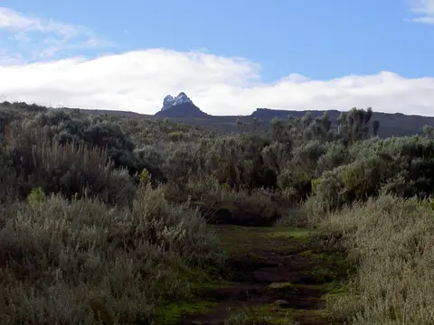
Altitudinal Vegetation Zones and the Lewa Elephant Corridor
Serving as a critical water tower feeding rivers across central Kenya, Mount Kenya stacks stark ecological bands across every rise in elevation. Below 2,500 metres, drier northern and western slopes support cedar (Juniperus procera) and Podocarpus woodland, while wetter southwestern and northeastern faces sustain broadleaved Cassipourea malosana montane rainforest. Between 2,500 and 3,000 metres, dense mountain bamboo thickets mingle with Podocarpus milanjianus before opening above 3,000 metres into sweeping Afro-alpine grasslands, misty sedges, boggy glades and moorlands studded with endemic giant lobelias and tree-like giant senecios. Continuous plant cover ends near 4,500 metres, though hardy vascular plants cling to rock crevices above 5,000 metres.
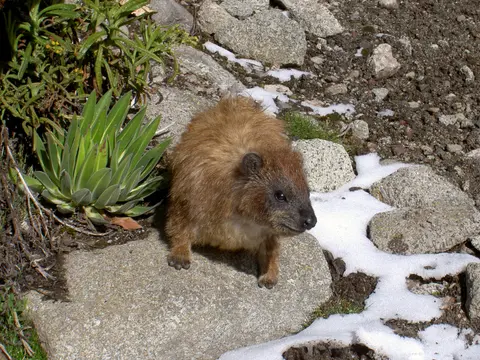
Mammal and bird communities track these altitude zones tightly. Lower forest and bamboo belts shelter African elephants, black rhinoceroses, leopards, giant forest hogs, sunis, black-fronted duikers, white-tailed mongooses and tree hyraxes. Higher open moorlands support common duikers, localised Mount Kenya mouse shrews, a distinct alpine subspecies of rock hyrax and endemic mole-rats burrowing up to 4,000 metres across northern valleys and the Hinder Valley. Birdlife spans local Mount Kenya green ibises, Ayres hawk eagles, Abyssinian long-eared owls, scaly francolins, Rüppell's robin-chats, bright sunbirds, scarce swifts and near-endemic alpine swifts.
Crucial ecological resilience comes from the northern extension connecting Mount Kenya National Park and Forest Reserve across a 9.8-kilometre wildlife corridor inside the buffer zone to Lewa Wildlife Conservancy and Ngare Ndare Forest Reserve (LWC-NNFR). Bridging Afro-tropical mountain forest with semi-arid East African savanna across flat volcanic Laikipia plains, this corridor protects historic dry-season elephant migration routes between Mount Kenya and the Somali-Maasai ecosystem stretching onward through Samburu National Park, Shaba National Reserve, Buffalo Springs and the Matthews Range. Lewa and Ngare Ndare also harbour the world's largest resident population of endangered Grevy's zebra, giving lowland wildlife vertical mobility as warming temperatures gradually push montane forest bands higher upslope.
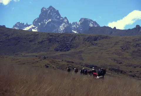
Sacred Mountain Traditions and Perimeter Fence Management
Kenya's government gazetted the national park in April 1949 to boost tourism, preserve scenic beauty, conserve mountain biodiversity and guard central Kenya's water catchment. Long before then, surrounding farming and pastoral communities revered Mount Kenya as a sacred dwelling of divinity. Kikuyu farmers across fertile southern and western volcanic soils call it Kĩrĩnyaga or Mwene Nyaga, literally Owner of the Ostriches, likening dark summit rock and white glaciers to a feeding ostrich's black feathers and white tail. They regard its snowy crown (Ira) as the earthly throne of God Ngai, where tribal forebear Gĩkũyũ first climbed to meet the Creator, and traditionally built house doors facing the peaks.
Southeast slopes belong to Embu communities and neighbouring Mbeere and Akamba settlers, where Embu speakers name the peak Kĩ nyaga (God Murungu or Mwene Njeru) and orient doorways toward the summit. Along northern, eastern and northwestern flanks, Ameru farmers and herders call it Kirimaara, meaning mountain with white features. Farther southeast, Kamba communities knew it as Ki nyaa, which missionary Johann Ludwig Krapf heard from elders in Kitui and transcribed as Kenya, giving the modern republic its name. On the northern plains, semi-nomadic Maasai herders call the striated massif Ol Donyo Keri (mountain of stripes) and invoke it in traditional blessings alongside Mount Kilimanjaro and the Ngong Hills.
Designated a UNESCO Biosphere Reserve in April 1978 before World Heritage listing of the park and forest reserve in 1997, the 217,711-hectare property sits under Kenya's Mount Kenya Ecosystem Management Plan. KWS, KFS, Lewa trustees and Community Forestry Associations (CFAs) enforce national statutes including the Wildlife Act, Environment Management and Coordination Act 1999, Water Act 2002 and Forest Act 2005. Authorities halted natural forest conversion into commercial plantations, though earlier unplanted clearings remain grass-covered grazing patches. Ongoing threats include illegal grazing, firewood collection, severe human-wildlife crop raids along crowded agricultural foothills and moorland wildfires addressed under the Mount Kenya Hotspot Strategic Fire Plan.
To stop elephants and buffalo from wandering out of woodland belts into neighbouring smallholder plots, Kenya's government partnered with non-profit Rhino Ark Trust to enclose the mountain forest edge with a non-lethal five-strand electrified fence carrying mild deterrent shocks. By 2021, engineers had erected 250 kilometres out of the planned 450-kilometre perimeter barrier. Maintaining both that protective outer fence and the open 9.8-kilometre northern elephant corridor remains vital to keeping Mount Kenya ecologically connected with northern Laikipia savannas.
Access Zones Across Mount Kenya National Park and Forest Reserve
Because Mount Kenya spans steep glacial summits, dense encircling rainforests and arid northern savanna plains, visitor entry routes split neatly among mountain climbing gates, forest nature reserves and lowland wildlife conservancies.
| Complex Zone | Key Highlights | Access & Ticket Rule |
|---|---|---|
| Central Peaks & Glacial Valleys (Batian, Nelion, Lenana) | Volcanic plug spires at 5,199 and 5,188 metres, 4,985-metre trekking summit, 20 glacial tarns and receding Lewis and Tyndall glaciers | Requires official KWS multi-day park passes; Batian and Nelion demand technical rock-climbing gear while Point Lenana is a non-technical trek |
| National Park Approach Gates (Sirimon & Trail Corridors) | Bamboo zones, giant lobelias, giant senecios, rock hyraxes and flat-bottomed U-shaped moorland valleys | Managed by Kenya Wildlife Service with licensed mountain guides, porters and registered gate entry permits |
| Mount Kenya Forest Reserve & Ngare Ndare Forest | Montane cedar, podocarp and Cassipourea woodland below 2,500 metres, CFA buffer trails and elephant movement belts | Managed by Kenya Forest Service and local community associations; day entry passes issued at reserve stations |
| Lewa Wildlife Conservancy & 9.8-km Corridor | Semi-arid Laikipia grasslands, world's largest resident Grevy's zebra population and seasonal elephant migration corridor | Private non-profit conservancy access limited to pre-booked safari guests and official conservancy permits |
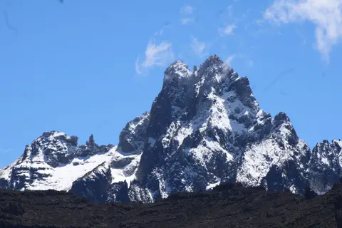
Three Alpine, Glacial, and Cultural Details on Mount Kenya
- V-Shaped River Gorges vs U-Shaped Glacial Troughs: Ascending above 3,000 metres on approach trails, watch the valley profile shift beneath your boots. Lower unglaciated forest slopes drop into steep, narrow V-shaped canyons cut by running streams, whereas upper moorlands broaden into wide, flat-bottomed U-shaped bowls carved by ancient ice sheets and ringed by moraines down to 3,300 metres.
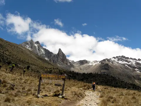
- Kenyte Lava Crystals and Dwindling Ice Faces: Along moraines approaching Lewis Glacier or Mackinder's Camp, inspect dark volcanic boulders for pale diamond-shaped feldspar phenocrysts inside kenyte rock first named by John Walter Gregory in 1900. Notice also how high moraine rims lie well below modern ice at 4,650 metres.
- Giant Afro-Alpine Rosettes and Traditional Doorways: Across misty high moorlands between 3,000 and 4,500 metres, spot giant lobelias and giant senecios surviving nightly equatorial frosts. Lower down across fertile foothills, notice how rural Kikuyu and Embu homesteads orient traditional doorways directly toward the white-tipped summit spires.
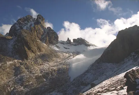
Equatorial Climbing Windows and Approaches From Nairobi
Equatorial weather makes climbing logistics more predictable during Mount Kenya's two drier windows between rainy seasons, though night frosts persist year-round above 3,300 metres and moorland fire risk demands campsite caution. Mountain Club of Kenya photo comparisons since the 1899 first ascent confirm that crampons remain advisable on steeper upper snow and glacier sections despite rapid thinning. Most international travellers arrive through Jomo Kenyatta International Airport in Nairobi (NBO, 159 kilometres southwest) and continue north by highway to park trailheads. Small domestic bush flights also use Nanyuki Civil Airport (NYK), a limited airstrip 40 kilometres from northern approaches. Allow four to five days for acclimatised Point Lenana treks via northern gates, adding time in Ngare Ndare or Lewa along the elephant corridor. You can also explore wider Rift Valley sites in the UNESCO World Heritage Atlas.