


























Quick Field Data
- UNESCO Inscription: 1980 · Criterion (x) · Included on the Danger List since 1997
- Scale & Footprint: 600,000 hectares (6,000 km2) split between a 600 km2 highland sector in the Mitumba Mountains and a 5,400 km2 western lowland rainforest linked by a 7.4 km wide ecological corridor
- Access & Ticketing: Managed by the national conservation authority; all visits and gorilla tracking excursions require advance permits and armed ranger escorts from the highland station near Bukavu
- Arrival Logistics: Located in South Kivu Province near the western shore of Lake Kivu and the Rwandan frontier, accessed via Bukavu town west of Kigali
Volcanic Peaks and Six Altitudinal Forest Belts
Spanning 600,000 hectares (6,000 km2 / 2,300 sq mi) west of Bukavu and Lake Kivu in South Kivu Province of the Democratic Republic of the Congo, Kahuzi-Biega National Park occupies a critical biogeographical hinge where the volcanic highlands of the Albertine Rift drop westward into the equatorial Congo Basin. Altitude shapes every habitat here. Named after two dormant volcanoes that dominate its eastern horizon, Mount Kahuzi at 3,308 m (10,853 ft) alongside Mount Biéga at 2,790 m (9,150 ft), the park is divided into two distinct physiographic zones. In the east, a 600 km2 (230 sq mi) mountainous sector rises within the Mitumba Mountains of the Great Rift Valley, while to the west, a vast 5,400 km2 (2,100 sq mi) lowland rainforest sector stretches toward Kisangani and drains westward through the Luka and Lugulu river valleys before they flow into the Lualaba River. Connecting these two zones is a narrow 7.4 km (4.6 mi) wide ecological corridor that allows wildlife to migrate across the entire altitudinal gradient.
Because continuous forest vegetation climbs uninterrupted from 600 metres (2,000 ft) in the western basin to more than 2,600 metres (8,500 ft) and up to 3,308 metres on the volcanic summits, Kahuzi-Biega is one of the very few protected areas in Sub-Saharan Africa preserving every stage of the lowland-to-highland ecological transition. Sustained by 1,800 mm (71 in) of annual rainfall and cool highland temperatures ranging between a minimum of 10.4 °C (50.7 °F) and an average maximum of 18 °C (64 °F), the terrain supports six primary vegetation types along with rare hydromorphic swamps and peat bogs as well as riparian forests across all elevations.
In the western sector below 1,200 metres, dense Guineo-Congolian wet equatorial rainforest dominates, grading into a transition forest belt from 1,200 m (about 3,900 ft) up to 1,500 m (around 4,900 ft). Above 2,000 metres (6,600 ft) in the eastern Mitumba range, Albertine Rift montane rainforest and high-altitude swamp forest flourish up to 2,400 metres (7,900 ft), succeeded from 2,350 m (about 7,710 ft) up to 2,600 m (around 8,500 ft) by dense stands of mountain bamboo forest. Above 2,600 metres on the upper cones of Mount Kahuzi and Mount Biéga, the canopy opens into subalpine heather and dry savanna with grasslands hosting the endemic giant groundsel subspecies Dendrosenecio erici-rosenii.
This vertical mosaic sustains extraordinary biological endemism across both flora and fauna. Designated by the IUCN and WWF in 1994 as a global centre of plant diversity with at least 1,178 documented plant species in the highland zone alone, the park also shelters 136 mammal species, 349 bird species (including 42 regional endemics identified by the Wildlife Conservation Society in 2003), and 147 freshwater fish species identified in a 2020 survey across its three drainage basins, including 11 species found exclusively within the Lowa River basin alongside 7 previously undescribed species. Alongside the eastern chimpanzee and olive baboon as well as colobus monkeys and Cercopithecinae such as Hoest's and Hamlyn's monkeys, the forest harbours rare Central African mammals including Genetta victoriae (the giant forest genet) alongside Genetta piscivora (the aquatic genet), the needle-clawed bushbaby, Maclaud's horseshoe bat, the Ruwenzori otter shrew, the Mount Kahuzi climbing mouse, Alexander's bush squirrel, bongo, giant forest hog, forest buffalo, hippopotamus, and forest elephant.
Colonial Reserves and Adrien Deschryver to Protect Grauer's Gorilla
Formal conservation in the highlands began on 27 July 1937, when the Governor General of the Belgian colonial administration established the Mount Kahuzi Zoological and Forest Reserve to protect the montane bamboo and forest habitats on the volcano's slopes. Three decades later, in November 1970, Belgian conservationist Adrien Deschryver championed the creation of Kahuzi-Biega National Park, bringing the highland reserve under the national conservation institute and pioneering habituated observation of the park's flagship primate, the eastern lowland gorilla (Gorilla berengei graueri), also known as Grauer's gorilla.
Initially confined to the 600 km2 eastern mountain sector where gorillas forage in bamboo and montane forest between 2,100 and 2,400 metres above sea level, the park was expanded five years later in 1975 to encompass 6,000 km2 (2,300 sq mi) by adding the vast western lowland rainforest and the 7.4 km connecting corridor. That 1975 boundary extension secured the full altitudinal range of Grauer's gorilla and led to UNESCO World Heritage listing under Criterion (x) in 1980. However, the 1975 expansion also incorporated inhabited lowland and forest territories of the Shi and Tembo alongside Rega communities as well as indigenous Batwa (Twa) residents, resulting in forced evacuations of roughly 13,000 people and sparking long-running land-rights conflicts that were later examined under the African Charter in 2022 and June 2024, alongside 1999 community cooperation plans employing Twa trackers in park protection.
Beginning in the 1990s, regional political instability in the Albertine Rift, massive refugee movements near Bukavu and Lake Kivu, armed militia incursions, wildlife exploitation, and illegal artisanal mining of coltan inside the forest damaged the deep forest cover and prompted UNESCO to place Kahuzi-Biega on the UNESCO Danger List in 1997. Before the 1990s conflicts, approximately 600 eastern lowland gorillas inhabited the highland sector, alongside some 250 individuals noted in early UNESCO assessments. By the 2008 status report, the highland population had fallen to 125 gorillas, though dedicated ranger surveillance despite difficult living conditions documented in 2015 and 2016 surveys allowed a census survey conducted in April 2011 with Wildlife Conservation Society support to record at least 181 gorillas in the park. Keeping the narrow 7.4 km ecological corridor intact between the 600 km2 Mitumba mountain sector and the 5,400 km2 lowland rainforest remains the decisive conservation priority so that Grauer's gorillas, forest elephants, and eastern chimpanzees can move safely across all six vegetation belts.
Field Logistics in the Highland Sector Near Bukavu
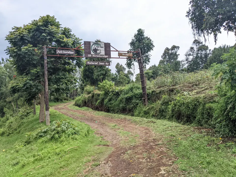
Because the remote 5,400 km2 western lowland sector lacks visitor infrastructure and faces ongoing security challenges, all traveller access concentrates in the 600 km2 eastern highland sector in the Mitumba Mountains west of Bukavu and Lake Kivu. Here, national park rangers guide visitors along montane rainforest and bamboo trails to observe habituated family groups of eastern lowland gorillas, mountaineering routes up the dormant volcanic cones, and Important Bird Area habitats designated by BirdLife International hosting species such as the threatened Albertine owlet and Rockefeller's sunbird alongside the African green broadbill, yellow-crested helmet shrike, and Congo peafowl.
- Bukavu approach and highland ranger station briefing: Base yourself in the lakeside town of Bukavu on the southwestern shore of Lake Kivu near the Rwandan border and travel west into the Mitumba Mountains to the Kahuzi-Biega highland park entrance. Every visitor must register at the park headquarters for a mandatory safety and conservation briefing before setting out with armed park rangers and trackers who monitor the daily movements of habituated eastern lowland gorilla groups across the 2,100 to 2,400-metre forest belt.
- Tracking Grauer's gorillas and ascending Mount Kahuzi and Mount Biéga: Follow park trackers through dense montane rainforest and hydromorphic swamp clearings into bamboo stands (2,350 to 2,600 m) to spend a strictly regulated observation period with an eastern lowland gorilla family. Fit trekkers can arrange separate ranger-escorted day ascents up the volcanic slopes of Mount Kahuzi (3,308 m) or Mount Biéga (2,790 m), passing through bamboo and subalpine heather above 2,600 metres to view giant Dendrosenecio erici-rosenii groundsels and panoramic vistas across Lake Kivu and the Albertine Rift.
- Dry-season timing and regional Lake Kivu routing: Plan highland treks for the drier months when steep clay forest paths are firmer underfoot, though rain showers can occur at any time given the 1,800 mm annual rainfall, so waterproof boots and gaiters are essential on the muddy slopes. Verify current security advisories and permit availability in Bukavu well in advance, and combine your research with our UNESCO World Heritage Atlas and our Kigali guide across the Rwandan border.
