


























Quick Field Data
- UNESCO Inscription: 1981 · Criteria (vii), (x)
- Scale & Footprint: 1.5 million hectares (14,763 to 15,000 square kilometres) of savannah across eastern Mara Region and northeastern Simiyu Region in northern Tanzania
- Access & Ticketing: Administered by the Tanzania National Parks Authority (receiving roughly 350,000 visitors per year); entry requires daily conservation permits purchased electronically at park gates or airstrips, with vehicle travel restricted to designated tracks
- Arrival Logistics: Bordered by the Ngorongoro Conservation Area to the southeast and Kenya's Maasai Mara National Reserve to the north, accessible via the southern highway corridor through Ngorongoro or regional bush airstrips at Seronera and the Western Corridor
Volcanic Ash Plains, Granite Kopjes, and Ecosystem Boundaries
Stretching across 14,763 to 15,000 square kilometres (1.5 million hectares) of northern Tanzania across the eastern Mara Region and northeastern Simiyu Region, Serengeti National Park forms the core of a broader savannah ecosystem whose name derives from the Maasai word siringet, meaning endless plains. First proposed as a national park in 1930 by Major Richard Hingston on a mission for the Empire fauna preservation society (SPFE), the territory was proclaimed a national park in 1940, placed under the Serengeti National Park Board of Trustees in 1948, and given finalized boundaries in 1951. In 1959, the same year Bernhard Grzimek and his son Michael produced the influential book and documentary Serengeti Shall Not Die, an 8,300-square-kilometre (3,200-square-mile) eastern sector was split off and re-established as the Ngorongoro Conservation Area to protect traditional grazing practices of the resident Maasai people. In 1981, when the park covered 12,950 square kilometres (5,000 square miles), it was inscribed on the World Heritage List, and since 1966 ecological research has been anchored by the Serengeti Research Institute at Seronera.
Beneath the flat horizon of the Serengeti lies an ancient geological foundation that directly controls why the southeastern plains remain treeless while the western and northern zones support woodlands and gallery forests. The deep basement complex consists of Archaean Nyanzian System greenstones (2.81 to 2.63 billion years in age) and Archaean granite-gneiss plutons (2.72 to 2.56 billion years in age), joined in the east by quartzite and granite of the Neoproterozoic Mozambique Belt and linear ridges of sandstone, shale, and siltstone from the Neoproterozoic Ikorongo Group. Uplifted 180 million years ago and subsequently weathered by heat and wind, the ancient granite-gneiss plutons protrude above the flat grasslands today as isolated rocky outcrops known as kopjes (or koppies), which function as thermal lookouts and micro-habitats for leopards, lions, and three species of hyraxes.
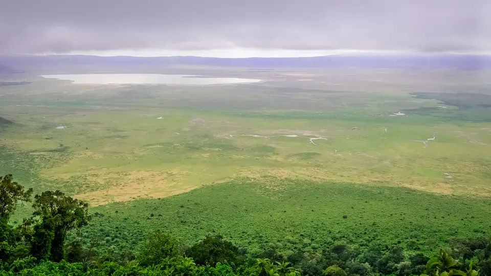
Overlying this ancient bedrock in the eastern and southeastern plains are fertile layers of volcanic ash ejected by the Kerimasi Volcano 150,000 years ago and by Holocene eruptions of the active Ol Doinyo Lengai volcano. Because Ol Doinyo Lengai erupts natrocarbonatite lava, rapid chemical weathering transforms the ash deposits into calcareous tuff and a shallow, impenetrable calcitic hard-pan soil (vertisols). Prevented by this shallow hard-pan from sinking deep taproots, trees cannot colonise the southeastern plains; instead, the mineral-rich volcanic soil produces nutrient-dense short grasslands that burst into growth during the rains. Westward across the central Seronera valley and the Western Corridor, the Grumeti and Mara rivers join the Mbalageti and Orangi channels flowing toward Lake Victoria in the west, whereas the Oldupai River drains east into the Olbalbal Swamps, creating riverine gallery forests and woodlands bordered by the Maswa alongside the Ikorongo and Grumeti Game Reserves, the Loliondo Game Control Area, and Kenya's Maasai Mara National Reserve to the north.
The 800-Kilometre Great Migration and Predator-Prey Dynamics
That geological division between nutrient-rich southeastern volcanic short-grass plains and permanent northwestern rivers drives the Great Migration, an 800-kilometre (500-mile) clockwise circuit that constitutes the largest annual animal migration on Earth. Depending on the survey period, the broader ecosystem supports between 1.5 million and 2 million western white-bearded wildebeests alongside 250,000 to 300,000 Grant's plains zebras and 500,000 to 900,000 Thomson's gazelles, joined by 7,000 common elands, 27,000 topis, 18,000 hartebeests, and 70,000 African buffalos (which recovered from poaching declines between 1976 and 1996 to reach 28,524 individuals within the park by 2008). Between January and March, herds congregate on the calcareous short-grass plains straddling the southern Serengeti and northern Ngorongoro Conservation Area, where roughly half a million blue wildebeest calves are born within a few weeks. Volcanic ash feeds the entire cycle.
When the seasonal rains end in March and the shallow volcanic vertisols dry out, the 1.5 million wildebeests and 250,000 plains zebras march northwest toward the central woodlands and pass through the Western Corridor in April and May. Pushing northward toward the permanent waters of the Maasai Mara in Kenya during the dry season, the herds must force their way across the deep channels of the Grumeti River and the Mara River, where roughly 3,000 Nile crocodiles wait at steep river bends. High water and sheer bank congestion make these crossings lethal: for every wildebeest captured by crocodiles, 50 drown in the crush, contributing to an annual toll of roughly 30,000 plains zebras and 250,000 wildebeests lost to drowning alongside predation and thirst, exhaustion, and disease before the herds turn south again in late October.
Sustained by this moving biomass and abundant resident ungulates, including 3,520 to 4,000 Masai giraffes (down from 10,750 in 1977) alongside 15,000 common warthogs, 3,000 waterbucks, and 500 hippopotamuses, the Serengeti supports the world's densest concentration of large mammalian carnivores. Together with the Maasai Mara, the park has formed a designated Lion Conservation Unit since 2005, hosting between 3,000 and 4,000 lions (which rebounded after a 1994 canine distemper outbreak killed one-third of the population), alongside 1,000 African leopards (Panthera pardus, reaching dry-season densities of 5.41 individuals per 100 square kilometres) plus 225 cheetahs (Acynonix jubatus) and 3,500 spotted hyenas. Four IUCN Red List threatened megafauna anchor conservation efforts: the African bush elephant (Loxodonta africana, recovering from 1980s poaching to exceed 2,700 to 5,000 individuals by 2014) alongside the critically endangered eastern black rhinoceros (Diceros bicornis, poached down to roughly 10 animals during the 1980s and numbering between 70 and 200 animals browsing on Indigofera alongside Acacia and Crotalaria shrubs) plus the cheetah and the African wild dog (reintroduced in 2012 after disappearing in 1991, with 300 individuals across the ecosystem). Over 500 bird species, five endemic to Tanzania, inhabit the park, led by Africa's largest population of Masai ostrich alongside secretarybirds and kori bustards plus southern ground hornbills, martial eagles, lesser flamingos, and shoebills, while olive baboons alongside vervet monkeys and mantled guereza inhabit the Grumeti gallery forests.
Tracking the Herds Across the Serengeti Sectors
Because the Serengeti covers nearly 15,000 square kilometres of open plains alongside granite kopjes and river valleys, wildlife viewing depends entirely on matching your sector base to the seasonal position of the 800-kilometre migration loop. While the central Seronera valley supports dense year-round populations of resident lions, leopards, and elephants along permanent waterholes, the migrating wildebeest and zebra herds shift hundreds of kilometres between January and November.
Use these three logistical principles to position your vehicle safaris across the park's distinct ecological zones.
- Match your sector to the annual migration calendar: Focus on the southeastern volcanic short-grass plains bordering the Ngorongoro Conservation Area between January and March for the calving season, move into the Western Corridor along the Grumeti River during April and May as the columns trek northwest, and position yourself in the northern Mara River sector between July and October to witness river crossings past the 3,000 resident Nile crocodiles before the herds return south in late October.
- Scan the central Seronera kopjes and riverine forests: Regardless of the season, dedicate at least two days to the central Seronera valley around the Serengeti Research Institute, where granite-gneiss kopjes rise like islands above the grass and gallery forests line the waterways. Early morning and late afternoon drives along these river loops offer the most reliable sightings of African leopards resting in acacia canopies, cheetahs hunting on open plains, black rhinoceroses browsing in protected sectors, and herds of elephants and buffalos.
- Combine overland routes with regional bush airstrips: Most travellers enter from the southeast via the Ngorongoro Conservation Area highway corridor and either loop back overland or fly out from bush airstrips serving Seronera alongside the Western Corridor and the northern Mara border. Remember that cross-border vehicle entry directly into Kenya's Maasai Mara National Reserve is restricted inside the parks, and explore further East African savannah reserves in our UNESCO World Heritage Atlas.
