


























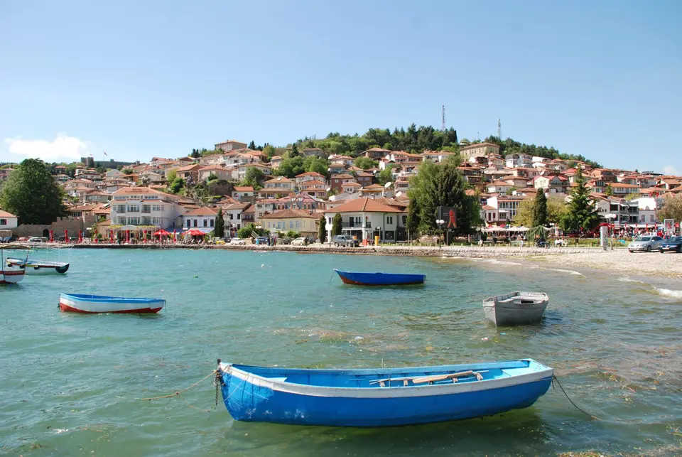
Quick Field Data
- UNESCO Inscription: 1979 (extended in 1980 and 2019) · Criteria (i), (iii), (iv), (vii)
- Scale & Footprint: 94,729 hectares encompassing the 358-square-kilometre Lake Ohrid basin (69 percent in North Macedonia, 31 percent in Albania) and 87.53 kilometres of shoreline
- Access & Ticketing: Open lakeshore promenades, Struga, Pogradec, and historic Ohrid streets are freely accessible, while individual churches, monastery complexes, and icon galleries charge modest entry fees
- Arrival Logistics: Centred on the lakeside towns of Ohrid and Struga in southwestern North Macedonia and Pogradec in eastern Albania, linked by border roads along the historic Roman Via Egnatia corridor
Tectonic Graben Hydrology and Subaquatic Karst Springs
The protected Ohrid region spans 94,729 hectares across the mountainous frontier of southwestern North Macedonia and eastern Albania. At its core lies Lake Ohrid (known locally as Ohridsko Ezero and Liqeni i Ohrit), the deepest and oldest tectonic lake in the Balkans. Formed within the Dessaret group of north-to-south grabens alongside Lake Prespa, the Korçë basin, and Lake Ioannina, the basin originated when central Balkan tectonics shifted from compression to extension around 6 million years ago, leaving Pliocene lake sediments between 3 and 5 million years old. Resting at an elevation of 693 metres, the lake covers 358 square kilometres, stretches 30.4 kilometres in length (with maximum basin axes reaching 36.4 by 16.8 kilometres), and holds 55.49 cubic kilometres of water across a mean depth of 155 metres and a maximum depth of 288 metres. Its 87.53-kilometre shoreline is divided between North Macedonia (56.02 kilometres, or 64 percent of the shore and 69 percent of the surface) and Albania (31.51 kilometres, or 36 percent of the shore and 31 percent of the surface).
While most lakes rapidly fill with river silt and disappear, Lake Ohrid has survived continuously for two to three million years through a combination of active tectonic subsidence and subterranean karst hydrology. The water is exceptionally deep. The active graben leaves fresh fault scarps, stepped hillsides, a hydrothermal field near Kosel, and frequent seismic shocks, including an earthquake on 18 February 1911 that reached 6.6 in magnitude from a 15-kilometre focal depth. Equally critical is its 2,600-square-kilometre drainage catchment. Roughly 50 percent of all incoming water arrives via underground karstic springs along the eastern shore, including more than 20 percent that percolates from Lake Prespa, situated 10 kilometres to the southeast at an altitude 150 metres higher. Because this water filters through limestone channels beneath Galičica National Park before emerging at Biljana's springs and subaquatic vents, it carries minimal sediment and keeps phosphorus concentrations down to 4.5 micrograms per litre.
This natural karst filtration gives the oligotrophic water a visual transparency of up to 22 metres and a hydraulic residence time of roughly 70 years, balanced by 40 percent evaporation and northern outflow via the Black Drin River toward the Adriatic Sea. Driven by wind forcing and Earth rotation, surface waters circulate in a counter-clockwise Ekman pattern. During average winters, convective cooling mixes only the upper 150 to 200 metres, while deeper waters remain stratified by salinity and experience a complete vertical overturn only once every 7 years, maintaining dissolved oxygen above 6 milligrams per litre at the bottom. This stable, oxygen-rich abyssal zone shelters more than 200 endemic species dating from the Tertiary period, spanning 20 phytoplankton and sessile algae species such as Cyclotella fottii, two charophyte plants including Chara ohridana, five zooplankton species like Cyclops ochridanus, eight cyprinid fish such as Pachychilon pictum, two famous predatory trout (the Ohrid trout Salmo letnica and Belvica Salmo ohridanus), and 176 benthic species including Ochridagammarus solidus and 50 endemic gastropod snails out of 68 recorded species, alongside 21 native fish and 72 mollusc species in total.
Prehistoric Pile Dwellings, Slavic Monasteries, and Byzantine Icons
Human settlement along these clear littoral waters stretches back to the dawn of European agriculture. In the shallow coastal zones, three prehistoric pile-dwelling sites preserve timber posts and waterlogged artefacts. Near the Lin Peninsula in Pogradec on the Albanian shore, underwater excavations by specialists from Albania and the University of Bern confirmed a pile-dwelling village over 8,500 years old that cultivated crops between 8,000 and 9,000 years ago, predating comparable Swiss alpine lake villages by more than 2,000 years. Centuries later, the Roman Empire routed the Via Egnatia highway just past the basin to link Durrës on the Adriatic coast with Thessalonika and Constantinople, and builders in the middle of the 6th century erected an Early Christian church on the small Lin Peninsula.
On the northeastern shore, the town of Ohrid rose between the 7th and 19th centuries into a major ecclesiastical and architectural centre. Here stands St Pantelejmon, the oldest Slav monastery, alongside cliffside and hillside churches housing more than 800 Byzantine-style icons painted from the 11th century through the late 14th century. Further along the lakefront, the monastery of St Naum rises near the eastern karst springs, while the rock sanctuary of the Black Madonna lies southwest of Struga. High on the ridge of Galicica Mountain separating the Ohrid and Prespa basins, stone fortifications from the Macedonian Front of the First World War still cut across the alpine slopes.
Modern socio-economic pressures have tested the resilience of both the architectural fabric and the littoral wetlands. Although North Macedonia's lake sector was inscribed in 1979, extended to Ohrid's cultural monuments in 1980, joined to the Ohrid-Prespa Transboundary Reserve in 2014, expanded to the Albanian shore in 2019, and recognised as a Ramsar site in 2021, the basin catchment population has grown by 100,000 over the past half-century to reach 170,000 residents (including 131,000 lakeshore inhabitants: 88,000 in North Macedonia and 43,000 in Albania). Struga Marsh was largely drained for farming during the 1940s and once more in the 1960s when the Sateska River was rerouted into the lake, leaving the 63.97-hectare Studenchishte Marsh near Ohrid as the last intact coastal reed-bed buffer for wintering Dalmatian pelicans, ferruginous ducks, pygmy cormorants (Microcarbo pygmaeus), red-crested pochards (Netta rufina), and goosanders (Mergus merganser). Commercial yields of endemic trout dropped so sharply from overfishing that a seven-year fishing moratorium was imposed in 2004 before quota fishing resumed in 2012. Meanwhile, hydropower dams on the Black Drin River block the natural migration of the European eel from the Sargasso Sea, and a 3.5-fold rise in sediment phosphorus over the past century prompted a 2017 joint Reactive Monitoring Mission involving IUCN, ICOMOS, and the World Heritage Centre (adopted at the 41st Session in Krakow with 19 recommendations), alongside the 2018 Lake Ohrid Ecosystem Protection Declaration endorsed by 45 members of the Society of Wetland Scientists.
Traversing the Cross-Border Lakeshore
Exploring the Lake Ohrid basin today means following the 87.53-kilometre perimeter road that connects the tiered stone alleys of Ohrid and the Black Drin outflow at Struga with the quiet western peninsula of Lin and Pogradec in Albania. In 2010, NASA even named Ohrid Lacus on Saturn's moon Titan after this ancient tectonic basin.
- Entry and Route in Old Town Ohrid: Begin your walk on the stepped cobbles of historic Ohrid, ascending through residential quarters built between the 7th and 19th centuries to inspect the oldest Slav monastery at St Pantelejmon and the galleries holding more than 800 Byzantine-style icons from the 11th to the 14th century. From the upper ramparts, look down into waters clear to 22 metres before walking east toward the reed belts of Studenchishte Marsh and Biljana's springs.
- Tickets, Interiors and Viewpoints at St Naum: Drive south along the Macedonian shore through the foothills of Galičica National Park to reach St Naum monastery, where icy underground watercourses from Lake Prespa bubble directly into the basin. Climb the mountain switchbacks up Galicica Mountain to view the Macedonian Front trenches and observe how the 150-metre elevation drop between the Prespa and Ohrid grabens drives the subterranean karst filtration system.
- Timing and Onward Connections across Albania: Cross the southwestern border into Albania to visit the 6th-century Early Christian church ruins and the 8,500-year-old prehistoric pile-dwelling waters at the Lin Peninsula before continuing through Pogradec and looping north to the Black Madonna near Struga. Summer weekends bring heavy visitor traffic, so travel in spring or autumn for quiet lakeside paths, and connect your Balkan route across North Macedonia and Albania with our UNESCO World Heritage Atlas and our nearest regional city guide to Corfu across the Ionian coast.
