Quick Field Data
- UNESCO Inscription: 2019 (Ref. 1308), mixed cultural and natural serial site across Rio de Janeiro and São Paulo states, Brazil; Criteria (v) and (x).
- Scale & Footprint: 173,164.18 hectares (150,392 hectares in nomination summaries) spanning Paraty Historic Centre, Morro da Vila Velha, Serra da Bocaina, Cairuçu, Ilha Grande and Praia do Sul.
- Access & Ticketing: Historic Paraty is car-free and free to walk (deliveries Wednesdays only); ICMBio and state INEA parks govern forest trails, Ilha Grande ferries and restricted reserves.
- Arrival Logistics: Major flights use Rio de Janeiro Galeão Airport (GIG), 138 kilometres east, or Santos Dumont Airport (SDU), 144 kilometres east. Rio de Janeiro sits 143 kilometres away (258 kilometres by highway).
Colonial Paraty, the Caminho do Ouro, and Cachaça Distilleries
Positioned just five metres above Atlantic tides where forested mountains of the Serra do Mar rise 1,300 to 2,000 metres behind the bay, Paraty began as Guaianás coastal territory. Tupinologist Eduardo Navarro traces the name to Old Tupi parati'y, meaning river of the paratis, after Brazilian mullet that still enter local rivers to spawn today. Portuguese settlers built a village in 1597 and established the town formally in 1667 as Rio de Janeiro state's southernmost and westernmost municipality. Municipal heraldry adopted in 1960 reflects this blended past across four quarters depicting Guaianás feathered headdress and arrows, the 1646 Remédios royal seal, a bay outline with a silver mullet and colonial wrought-iron balconies flanked by coffee and sugarcane around dates 1660 and 1844. Its 1967 flag further pairs colonial green and yellow royal stripes with three triangular stars echoing strong Masonic presence in town architecture.
Discovering huge gold deposits in Minas Gerais in 1696 transformed the quiet harbour into an essential colonial export hub. Enslaved workers and mule trains climbed the Caminho do Ouro (Gold Trail), a 1,200-kilometre track paved over steep inclines with heavy stone slabs linking Diamantina, Ouro Preto and Tiradentes down to Paraty's port. Outbound ships carried gold toward Rio de Janeiro and Lisbon, while inbound vessels unloaded mining tools and enslaved Africans. Two excavated stone segments of the Gold Trail survive near town inside Serra da Bocaina National Park.
Pirate attacks among the islands and coves of Angra dos Reis Bay eventually pushed colonial authorities to construct a safer overland road from Minas Gerais directly to Rio de Janeiro, sending Paraty into quiet isolation by the late 18th century. While Paraíba do Sul coffee exports revived shipping briefly before inland railways undercut coastal boats, sugarcane distillation endured unbroken since the 1500s. Favoured by humid coastal fermentation conditions, over 150 cachaça stills ran locally by 1820, earning Paraty cachaça a Protected Indication of Provenance in 2007.
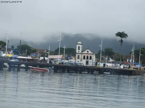
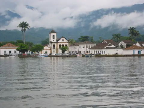
Two centuries off Brazil's main transport grid preserved colonial streetscapes untouched until the paved Rio-Santos highway opened in the 1970s. Four major baroque churches anchor the pedestrianised centre. Capela de Santa Rita (1722) served freed enslaved people and now houses the Museum of Sacred Art, while Igreja de Nossa Senhora do Rosário e São Benedito (1725) was built by enslaved Africans and hosts December São Benedito feasts. Nearby stand Capela de Nossa Senhora das Dores (1800, renovated 1901) and Igreja Matriz Nossa Senhora dos Remédios, begun in 1646 on land donated by Maria Jácome de Melo on condition builders protected indigenous inhabitants and finished in 1873. Smaller chapels survive at Capela da Generosa (1901, tied to folk legend around drowned fisherman Teodoro) and early colonial ruins at Paraty-Mirim.
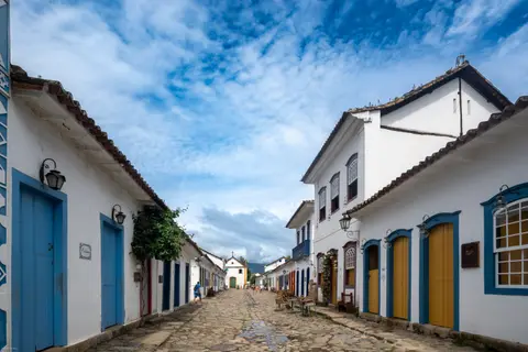
Walking historic lanes today highlights how colonial town planning responded directly to daily Atlantic tides and merchant shipping needs. Ground-floor doorways sit raised slightly above rough cobble paving while upper-storey painted shutters frame small plazas facing the harbour pier. Because motor vehicles stay barred except for midweek supply deliveries on Wednesdays, Paraty's historic streets retain quiet acoustic character rarely found in busy Brazilian coastal resorts.
Atlantic Forest Endemism From Ilha Grande Peaks to Mangrove Bays
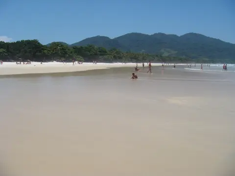
Stretching around the town and across Ilha Grande Bay, the six protected components form a green natural amphitheatre spanning four altitudinal classifications of Brazil's Atlantic Forest hotspot. Coastal plains sustain mangroves and sandy restinga habitats before forest tiers climb steeply above 2,000 metres across Serra da Bocaina and São Paulo's neighbouring Serra do Mar State Park. That southern overlap represents the sole protected corridor along the entire Atlantic coast preserving an unbroken ecological gradient from shoreline to summit. Across the reserve sit at least 11 Key Biodiversity Areas sheltering 36 rare plant species, 29 of which grow nowhere else on Earth.
Zoological richness matches botanical endemism across both mountain and marine layers. Field records confirm 450 bird species, accounting for 45 percent of all Atlantic Forest avifauna and 57 percent of its endemic birds. Surveys also list 125 frog and toad species (34 percent of Atlantic Forest anurans), at least 27 reptile species and 150 mammals including wide-ranging jaguar, cougar, white-lipped peccary and the endangered Southern Muriqui primate. On the mainland municipality, more than 80 percent of Paraty's 924.295 square kilometres lies inside conservation units including Cairuçu, Tamoios Ecological Station, Juatinga Ecological Reserve and Baía de Paraty-Saco do Mamanguá environmental zones.
Lying 12 kilometres off Angra dos Reis and 243 kilometres from São Paulo, forested Ilha Grande spans 193 square kilometres and rises to 1,031 metres at Pico da Pedra D'Água. Because Brazil barred unauthorised entry for nearly a century while operating an immigration quarantine post and the maximum-security Cândido Mendes prison until 1994, 87 percent of Ilha Grande remains protected today. Ilha Grande State Park covers 62.5 percent of the island, paired with Praia do Sul Biological Reserve and the 2014 Aventureiro Sustainable Development Reserve inside the 12,400-hectare Tamoios Environmental Protection Area created in 1982.
Wildlife diversity across Ilha Grande illustrates how intact forest habitat nourishes coastal islands. BirdLife International designates the island an Important Bird Area holding 110 bird species including bare-throated bellbird, red-browed amazon, solitary tinamou and azure-shouldered tanagers. Twenty terrestrial mammal species share the island, ranging from brown howler monkeys, black-tufted marmosets, capybaras and coatimundis to three genera of cave-roosting bats, joined by 40 to 50 reptiles and amphibians and 400 to 500 invertebrates. Smaller woodland fauna includes red-rumped agoutis, crab-eating foxes, raccoons, opossums and hairy dwarf porcupines, plus broad-snouted caimans, torrent frogs and venomous Yarará lanceheads. Offshore currents mix equatorial, subtropical and temperate waters frequented by hawksbill turtles, corals, rough-toothed dolphins, humpback whales, southern right whales, Bryde's whales, orcas and Magellanic penguins.
Caiçara, Quilombola, and Guarani Heritage Under Multi-Tier Protection
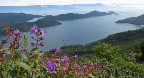
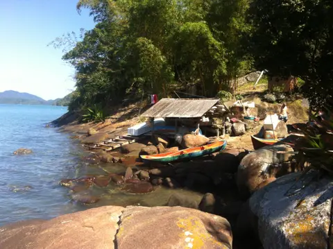
Living communities maintain ancestral coastal livelihoods across bays, forests and mountain valleys inside the heritage boundaries. Guarani indigenous villages, Afro-Brazilian Quilombola settlements established by descendants of enslaved people and Caiçara artisanal fishers continue traditional agriculture, wooden boatbuilding, fishing and seasonal community festivals. Strengthening traditional community participation in tourism benefits remains essential to preserving intact cultural landscapes across all six protected units.
Three layers of Brazilian heritage and environmental law safeguard the site's cultural and natural components. State Law-Decree 1.450 of 1945 placed Paraty's urban fabric under federal supervision by IPHAN, which actively protects historic streets and Defensor Perpétuo Fort (now a museum on Morro da Vila Velha). Meanwhile, ICMBio oversees Serra da Bocaina National Park while Rio de Janeiro state institute INEA manages Ilha Grande State Park, Praia do Sul Biological Reserve and Cairuçu Environmental Protected Area. Managers balance growing visitor arrivals from Rio de Janeiro and São Paulo against severe natural hazards, including the deadly 1 January 2010 mudslides on Ilha Grande that killed at least 19 people, plus buffer-zone nuclear energy facilities and oil-industry vessel traffic along Ilha Grande Bay.
Access Zones Across Paraty Brazil and Ilha Grande
Linking mainland cobblestone plazas, fjord coves and roadless Ilha Grande trails mixes highway arrivals with small boats and forest footpaths. Confirm INEA trail rules, boat schedules and biological reserve bans locally before heading out across the bay.
| Complex Zone | Key Highlights | Access & Ticket Rule |
|---|---|---|
| Paraty Historic Centre | 18th-century whitewashed houses, four colonial churches, Museum of Sacred Art and Defensor Perpétuo Fort. | Free car-free cobblestone streets (Wednesday deliveries only); museums and the headland fort set separate daytime ticket rules. |
| Serra da Bocaina National Park | Excavated stone slabs of the Caminho do Ouro, steep waterfalls and high Atlantic Rainforest peaks. | Public trail access inside federal park grounds; hire certified local guides for upper Gold Trail and mountain routes. |
| Cairuçu and Saco do Mamanguá | Tropical sea fjord below Pico do Pão de Açúcar, traditional Caiçara villages and Paraty-Mirim chapel ruins. | Reached by local coastal roads to Paraty-Mirim or bay boats; respect indigenous, Quilombola and Caiçara settlement borders. |
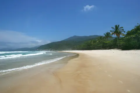
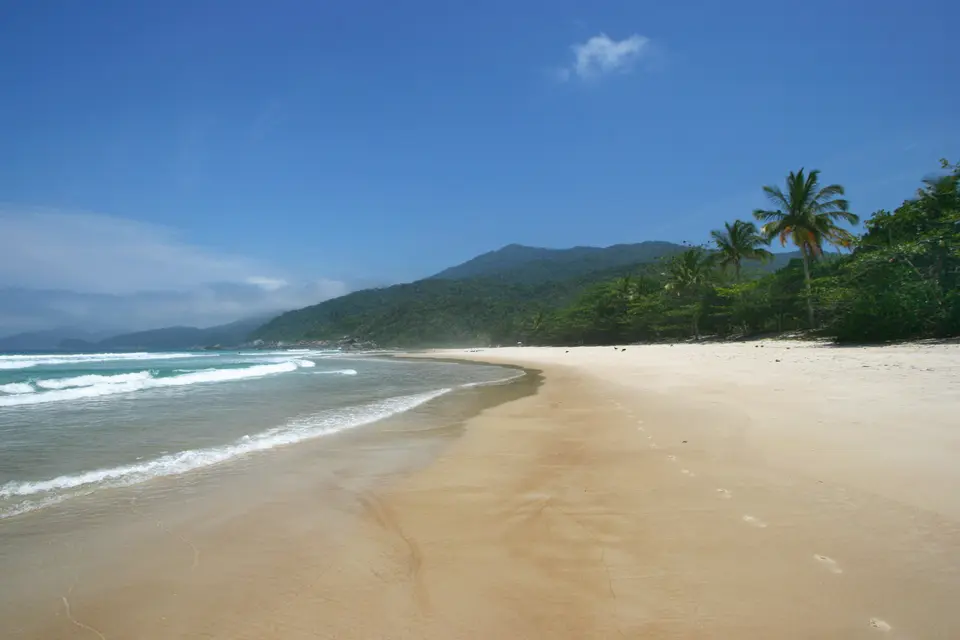
| Ilha Grande and Lopes Mendes | Vila do Abraão village, 150 kilometres of car-free trails, Pico da Pedra D'Água and Lopes Mendes surf beach. | Passenger ferries cross from Angra dos Reis to Vila do Abraão; Praia do Sul Biological Reserve remains closed to general entry. |
Three Historic and Ecological Details From Paraty's Cobblestones to Lopes Mendes
- Uneven Stone Street Paving and Horse-Cart Lanes: Walking historic Paraty shows rough hand-laid colonial cobbles angled gently toward central gutters to drain rain and tides. Banning private cars and trucks preserves quiet lanes shared by pedestrians, bicycles and traditional horse carts.
- Interlocking Quarry Slabs of the Caminho do Ouro: Hiking excavated trail segments inland near Serra da Bocaina reveals heavy flat stones fitted tightly by enslaved labour so gold-laden mule columns kept traction up mud-slick mountain slopes.
- Car-Free Rainforest Corridor to Lopes Mendes: Trekking roughly two hours east across southern Ilha Grande from Vila do Abraão (home to around 2,000 people) shows how barring motor vehicles preserved continuous canopy holding bare-throated bellbirds, howler monkeys and tanagers right down to Atlantic surf.
When to Visit Paraty Brazil and Travel Routes From Rio de Janeiro
Deciding when to visit Paraty Brazil depends largely on its humid tropical monsoon rainfall pattern. Daytime highs hover comfortably between 23 and 29 degrees Celsius with lows from 11 to 19 degrees Celsius, while ocean waters stay warm between 21.8 and 26.3 degrees Celsius year-round. January marks the wettest month, averaging 19 rainy days and heightened mudslide caution on steep rainforest tracks, whereas drier winter and shoulder periods bring clearer views across Serra da Bocaina and calmer bay crossings.
Visitors asking how far is Paraty from Rio find that the broader UNESCO centroid lies 143 kilometres west of Rio de Janeiro (138 kilometres from Galeão GIG and 144 kilometres from Santos Dumont SDU), while the coastal highway drive to Paraty town measures 258 kilometres. Passenger ferries cross 12 kilometres from Angra dos Reis to Ilha Grande, connecting directly to Vila do Abraão where park headquarters and guest lodgings serve around 2,000 residents. Splitting four or five days between Paraty's colonial streets and Ilha Grande's rainforest paths lets travellers experience both cultural and natural heritage unhurriedly. Exploring mainland waterfalls, cachaça stills and coastal boat loops before crossing to car-free island beaches avoids rushed logistics across winding coastal roads. Carrying waterproof footwear and light rain protection handles sudden coastal downpours smoothly without interrupting mountain hikes. Combining colonial urban heritage with deep Atlantic rainforest trails lets travellers experience how human history and coastal ecosystems remain tightly woven across southeastern Brazil. Explore more South American mixed heritage sites inside our UNESCO World Heritage Atlas.