Quick Field Data
- UNESCO Inscription: 2004 (Ref. 1142), serial cultural landscape across Wakayama, Nara, and Mie prefectures; Criteria (ii), (iii), and (iv).
- Scale & Footprint: 506.4 hectares comprising 242 nominated elements across three core sacred zones (Yoshino and Omine, Kumano Sanzan, and Koyasan) joined by 307 kilometres of protected pilgrimage routes.
- Access & Ticketing: Walking sections of the Kumano Kodo trails and main shrine courtyards remain freely accessible. Temple interiors, museum halls, and monastery lodgings apply local entry fees and schedules checked on official municipal portals.
- Arrival Logistics: Primary passenger access routes via Kansai International Airport (KIX), 65 kilometres from the northern foothills, with Kobe Airport (UKB) at 83 kilometres and Osaka Itami (ITM) at 88 kilometres. Nanki Shirahama Airport (SHM), 56 kilometres away, handles limited routes, and express rail runs south from Osaka (77 kilometres).
Three Sacred Centres Linked by the Kumano Kodo Pilgrimage
Stretching south from ancient capitals Nara and Kyoto across Japan's largest peninsula, dense evergreen forests conceal one of East Asia's oldest active trail networks. Inscribed in 2004, the 506.4-hectare UNESCO site protects 242 architectural and landscape components across three spiritual centres: Yoshino and Omine to the north, the monastic plateau of Koyasan to the west, and the three grand Kumano Sanzan shrines near the Pacific coast. Joined by 307 kilometres of mountain footpaths, these wooded ridges preserve over 1,200 years of documented worship drawing up to 15 million visitors annually.
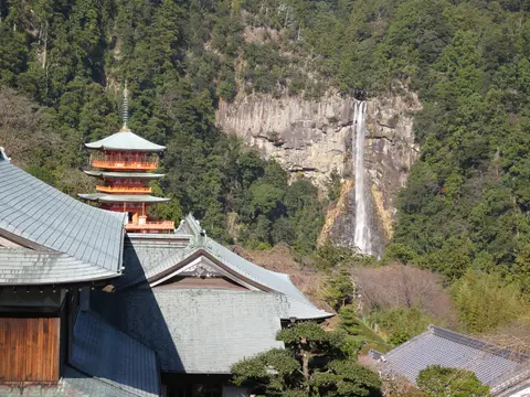
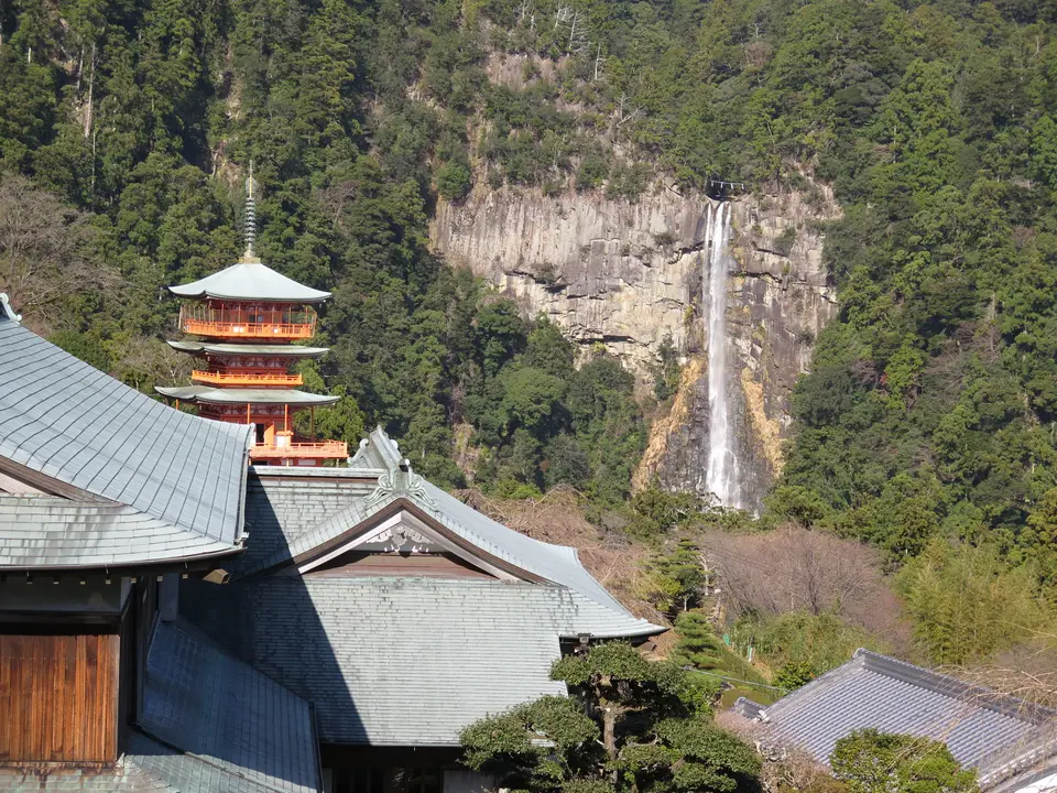
Unlike isolated monasteries elsewhere, these sanctuaries grew directly out of shinbutsu-shugo, the historic fusion between native Shinto nature veneration and Buddhism arriving from China and the Korean Peninsula. Already recorded as sacred ground in the Nihon Shoki (Chronicles of Japan), the Kumano region revered deities called Kumano Gongen as Buddhist bodhisattvas manifesting as kami under the principle of honji suijaku. Natural phenomena formed the living focus of prayer: plunging Nachi Falls, a sacred boulder atop Mount Gongenyama near Shingu, and the sacred Kumano River. Inside shrine compounds such as Kumano Nachi Taisha, Buddhist temples like Seiganto-ji stood directly beside Shinto halls while yamabushi mountain monks guided devotees along sacred mandalas.
Imperial devotion elevated Kumano into national prominence during the Heian period. Recorded imperial visits known as Kumano Gokou opened with Emperor Uda in 908 and ran 94 times over 374 years down to Emperor Kameyama in 1281. Retired Emperor Shirakawa walked the mountains nine times from 1090, and Emperor Go-Shirakawa completed 33 journeys, inspiring court ladies and nobles to follow. Diarist Fujiwara no Teika described accompanying Emperor Go-Toba in 1201 on foot while horses hauled luggage. During the Kamakura era, samurai clans including the Minamoto and Taira, Hojo Masako (making two trips between Kamakura and Kyoto), and priests Ippen and Mongaku travelled these ridges, especially after the Jokyu Disturbance of 1221.
By the Muromachi period (1333 to 1573) and Edo period (1603 to 1867), Kumano Kodo pilgrimage streams swelled so thickly contemporaries called them a pilgrimage of ants. Unlike stricter peaks elsewhere in Japan, Kumano faith welcomed worshippers regardless of social background or gender, allowing women equal entry. Completing the pilgrimage to Hongu's pure land on Earth promised entrance into Kannon's paradise upon death, while local shrines nationwide brought Kumano devotion to distant villagers. Inns near Kumano lodged up to 800 guests in a single day between the 99 Oji wayside prince shrines raised during the 12th and 13th centuries from Osaka's Yodo River mouth down into the mountains. Although Ise Shrine eventually surpassed Kumano's pilgrim numbers and Kumano merged partially into western Japan's 33-site Kannon circuit, traditions stayed alive. After the 1906 Meiji Shrine Combining Order dismantled many local shrines and sacred groves, ecologist Minakata Kumagusu campaigned tirelessly to safeguard forest ecosystems.
Layered folk beliefs remain palpable across the trails. Beside stone Jizo and Kannon statues and buried sutra mounds built to accumulate spiritual merit, small shrines honour Shinto deities Susano, Amaterasu, and Inari. Maritime boatbuilders revered Susano here for fashioning the first boat after watching a spider climb onto a floating leaf. Trail folklore also speaks of invisible serpentine daru spirits and older Koshin all-night vigil stones marking monthly confession beliefs, while grand shrine amulets carry Yatagarasu, the three-legged crow sent from heaven to guide Emperor Jimmu out of Kumano toward Yamato.
Kumano Kodo Routes, Trail Lengths, and the Nakahechi Corridor
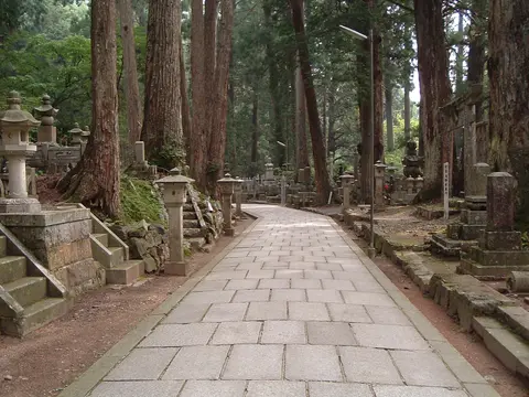
Travellers exploring Kumano Kodo Japan discover six primary mountain roads converging on Kumano Hongu Taisha, Kumano Nachi Taisha, and Kumano Hayatama Taisha. Modern visitors still reach the three Kumano Sanzan sanctuaries by car, regional bus, and foot, moving steadily deeper inland toward the spiritual epicentre at Hongu, where Kumano faith views the basin as a pure land on Earth. Not every kilometre of every path holds World Heritage listing or active trail footing, because national highways built from the Taisho (1912 to 1926) and Showa (1926 to 1989) eras covered lowland valleys. Tropical Storm Talas in September 2011 also damaged remote passes with devastating landslides and floods, leaving selected stretches under repair as recently as 2023 even while towns added modern trail museums such as Chikatsuyu's art museum and visitor displays. Wakayama Prefecture's tourism teams also sustain contemporary interest through trail stamp rallies and interpretive signs across mountain settlements.
Comparing Kumano Kodo routes and Kumano Kodo trail length matches terrain cleanly to time. The popular Kumano Kodo Nakahechi route, the historic imperial road, strikes east from Tanabe across forested passes straight toward Hongu and the coastal shrines. Maritime travellers and earlier emperors also followed the Kiiji coastal artery running south from Kyoto through Osaka's Watanabe-tsu along the western coastline to Tanabe, where the path forks into Nakahechi and the 120-kilometre Ohechi trail skirting Kushimoto's cliffs. Sailors long revered coastal waters here because myth held that Susano built Japan's first boat near Kumano. Further east, the Iseji corridor stretches approximately 160 kilometres from Ise Grand Shrine across paved passes toward Kumano Sanzan.
Two inner alpine corridors link major Buddhist hubs straight toward Hongu. The Kohechi route spans roughly 70 kilometres south from Mount Koya over high mountain ridges to Kumano Hongu Taisha. Meanwhile, the steep Omine Okugakemichi connects Yoshino southward through active Shugendo training grounds around Mount Omine and Mount Tamaki toward Kumano Sanzan. For Shugendo yamabushi ascetics, walking these steep paths physically traces sacred mandalas across the landscape, while coastal Fudarakusan-ji in Nachikatsuura anchors sea-facing Kannon traditions.
Mount Koya (Koyasan) and Preservation Across Three Prefectures
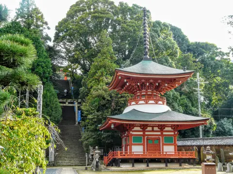
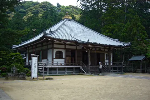
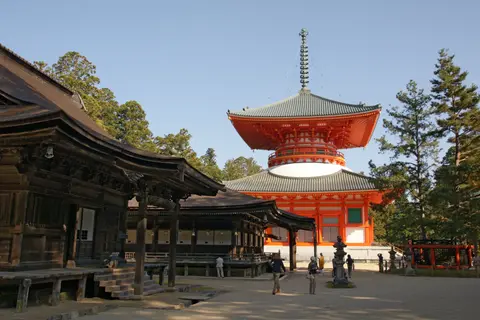
Anchoring the western mountains sits Mount Koya, founded in 819 by monk Kukai (Kobo Daishi) on an 800-metre-high plain surrounded by eight peaks resembling a lotus flower. Colloquially called Koyasan-Issan after head temple Kongobu-ji, built originally by Toyotomi Hideyoshi for his mother as Seigan-ji before Meiji renaming, the plateau town houses a religious studies university, the Koyasan Reihokan treasury museum, and 120 sub-temples offering pilgrim stays with meals and dawn chants. Mount Koya also functions as a common starting point for the Shikoku Pilgrimage linked to Kukai. Inside central Danjogaran rises the 48.5-metre Konpon Daito pagoda symbolising an esoteric mandala across Japan, paired with the Sanno-do assembly hall dedicated to local Shinto guardians, lecture halls, scripture stores, and bell towers.
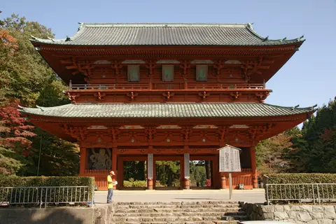
Beyond Daimon, the huge western gate flanked by Kongo guardian statues, forest avenues lead past the Tokugawa Family Tomb, constructed over ten years by shogun Iemitsu to enshrine Ieyasu and Hidetada, and even a replica of China's ancient Nestorian stele within Okunoin. Okunoin leads through Japan's largest cemetery to Kukai's mausoleum, where priests tend his living spirit daily, in addition to modern historical memorials. Japan's Law for the Protection of Cultural Properties safeguards key structures as National Treasures, Important Cultural Properties, Historic Sites, and Natural Monuments, while National and Prefectural Natural Parks restrict building and tree-felling without prior permission. Wooden structures preserve authentic form through periodic traditional timber reconstruction overseen by the 2003 Comprehensive Preservation and Management Plan and three supplementary prefectural plans. Joint academic committees coordinate Wakayama, Nara, and Mie prefectures together with Yoshinoyama's local Board of Education and private landowners.
Access Zones Across the Kii Mountain Sanctuaries
Because the 242 nominated elements span three prefectures, using Osaka as a rail hub and pairing mountain buses with day walks lets travellers sample each sacred sphere smoothly.
| Complex Zone | Key Highlights | Access & Ticket Rule |
|---|---|---|
| Kumano Kodo Nakahechi & Sanzan. | Kumano Hongu Taisha, Kumano Nachi Taisha by Nachi Falls, Kumano Hayatama Taisha, Fudarakusan-ji, and Oji wayside shrines. | Trail corridors and main shrine precincts stay open freely. Local buses connect trailheads while temple treasure halls charge entry fees. |
| Mount Koya (Koyasan) Plateau. | Kongobu-ji, Danjogaran, 48.5-metre Konpon Daito pagoda, Daimon Gate, Okunoin cemetery, and 120 temple lodgings. | Reached by Nankai train from Osaka Namba Station and five-minute Gokurakubashi cable car. Temple stays and halls require bookings. |
| Koyasan Choishi-michi Trail. | Historic stone-marked ascent from Jison-in in Kudoyama displaying granite cho pillars spaced every 109 metres. | Public forest pilgrimage path open year-round. Trailhead connects by local railway south from Osaka before climbing steeply upward. |
| Yoshino & Mount Omine Ridges. | Yoshinoyama cherry ridges, Shugendo halls, and northern mountain sections of the Omine Okugakemichi path. | Lower Yoshino connects by regional railway lines. High alpine Omine trails follow strict mountain weather and Shugendo access checks. |
Three Pilgrimage Features Along the Kii Mountain Trails
- Cho Stone Pillars Ascending Mount Koya: Walk along the Koyasan Choishi-michi trail starting at Jison-in in Kudoyama to count carved granite posts spaced every 109 metres (one cho). Each marker guides climbers uphill into Danjogaran's sacred monastic precinct.
- Wayside Oji Rest Shrines and Yatagarasu Seals: Watch trail junctions along the Kumano Kodo Nakahechi for stone altars marking the 99 Oji waystations built between the 12th and 13th centuries. Inside grand shrines, examine sacred Gyuoh Hoin paper charms printed with three-legged Yatagarasu crows.
- Waterfalls and Coastal Temples Around Nachi: Pair the plunge of Nachi Falls directly behind Kumano Nachi Taisha and Seiganto-ji with coastal Fudarakusan-ji at Nachikatsuura. Viewing upland falls near ocean temples shows how Kumano devotion bridged maritime prayer with mountain asceticism.
Best Time to Visit Kumano Kodo and How to Get There From Osaka
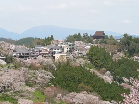
Choosing the best time to visit Kumano Kodo hinges on moderate mountain temperatures and clear trail footing. Spring cloaks Yoshinoyama's slopes in dense cherry blossoms, while crisp autumn months cool long forest climbs along the Nakahechi and Kohechi routes and reduce summer storm landslide risks. On Mount Koya, midweek trips avoid heavy weekend car traffic climbing narrow mountain bends. Planning things to do in Kumano Kodo works best by pairing a couple of Oji-linked Nakahechi stages with a traditional monastery stay on Mount Koya.
Understanding how to get to Kumano Kodo starts at Kansai International Airport (KIX), 65 kilometres from the northern mountain rim, where non-stop highway buses operated by Kansai Airport Transportation and Willer Express also climb directly to Mount Koya. Alternative airports include Kobe (UKB) at 83 kilometres, Osaka Itami (ITM) at 88 kilometres, and Nanki Shirahama (SHM) at 56 kilometres with limited passenger routes, while Daiju Bus operates the Koyasan Marine Liner coach from Wakayamakou port straight to Okunoin. From Namba Station in Osaka (77 kilometres away), Nankai Railway express trains reach Gokurakubashi in 1.5 hours (2 hours non-express) before a five-minute cable car reaches Mount Koya, linking cleanly with other Japanese landmarks in the UNESCO World Heritage Atlas.