


























Quick Field Data
- UNESCO Inscription: Inscribed in 1982 as a Natural heritage site under criteria (ix) and (x) across southern Tanzania in East Africa.
- Scale & Footprint: Massive wilderness sanctuary covering 50,000 square kilometres (with additional buffer zones reaching 54,600 square kilometres) bisected by the Rufiji River.
- Access & Ticketing: Divided between a northern photographic wildlife zone (now renamed in part as Nyerere National Park) and southern hunting sectors; all visitors are registered by the Wildlife Division, so check the official site.
- Arrival Logistics: Reached primarily by small aircraft from Dar es Salaam to airstrips along the Rufiji River, while overland access by rail or four-wheel-drive vehicle is also possible.
Miombo Woodlands alongside Sand Rivers and the Rufiji Floodplain
The wilderness is immense. Seasonal waters reshape every valley. Covering 50,000 square kilometres (19,000 square miles), and up to 54,600 square kilometres when adjoining buffer zones are included, the Selous Game Reserve (now renamed in part as Nyerere National Park) is among the largest protected wilderness areas in Africa. Inscribed by UNESCO in 1982 at its 6th session under natural criteria (ix) and (x) as site number 199bis and classified under IUCN Category IV, the reserve protects a vast southern Tanzanian ecosystem in East Africa that remains largely free from modern human disturbance. Because of the fragility and sensitivity of its many species and ecosystems, no permanent human settlement is allowed inside the reserve boundaries, and every visitor entering or leaving is registered by the Wildlife Division under Tanzania's Ministry of Natural Resources and Tourism. Although total wildlife populations across the sanctuary are exceptionally high, the sheer geographic scale of the reserve means that observable animal densities in any single sector can be lower than in the busier national parks along northern Tanzania's safari circuit, including the Serengeti, offering travellers an uncrowded wilderness setting where animals move freely across unfenced savanna and forest corridors.
The reserve encompasses an exceptionally high variety of habitats that function as a valuable ecological laboratory for ongoing biological processes. Across the park, vegetation zones grade from dense scrub thickets into open wooded grasslands. Deciduous Miombo woodland forms the primary forest cover across the reserve and constitutes a globally important example of this fire-climax forest type, alongside open grasslands, Typical Acacia savanna, rocky acacia-clad hills, and wetlands plus riverine and riparian zones, gallery and groundwater forests, swamps, and lowland rain forest. Because the deciduous Miombo woodlands are shaped by periodic dry-season fires, the underlying soils are subject to rapid erosion whenever heavy seasonal rains arrive. The result of this cycle is an extensive network of seasonal sand rivers that remain dry for much of the year before turning into raging torrents during the rainy season and then subsiding back into winding sandy corridors, one of the most distinctive landscape features of the Selous, celebrated in Peter Matthiessen alongside photographer Hugo van Lawick in their 1981 volume Sand Rivers (published by Aurum Press in London) as well as in Rolf D. Baldus's 2009 study Wild Heart of Africa (published in Johannesburg) and Robert J. Ross's 2015 and 2016 book on the Selous in Africa (published by Officina Libraria in Milan).
Flowing across the northern part of the park into the Indian Ocean opposite Mafia Island is the great Rufiji River, which carves through the canyon of Stiegler Gorge, where steep rock walls drop nearly 100 metres deep and span 100 metres across. Every year, large parts of the northern wooded grasslands are seasonally flooded by the rising waters of the Rufiji River, creating a dynamic floodplain and oxbow lake ecosystem where herds gather during the dry months, sustaining aquatic and riparian food webs across the northern sector. Portions of this interior remain untouched wilderness: German colonial surveyors left the Rufiji Floodplain unmapped, and during 1917 a survey party led by E. William Boville characterised that remote floodplain zone as uninhabitable because of seasonal inundation and dense riverine vegetation.
Conservation History alongside Megafauna Populations and Modern Pressures
In 1896, Hermann von Wissmann, serving as German Governor of Tanganyika, first proclaimed the territory a protected reserve, before it became a hunting reserve in 1905 and was formally established as a game reserve in 1922 as successive administrations consolidated contiguous wildlife blocks across southern Tanzania. The sanctuary was named after Frederick Selous, the famous British big-game tracker and early conservationist who fell in action at Beho Beho inside this territory in 1917 while fighting against German forces during the First World War, near the same locality where Scottish geographer and explorer Keith Johnston had perished at Beho Beho during 1879 while heading a Royal Geographical Society expedition toward the African Great Lakes alongside Joseph Thomson.
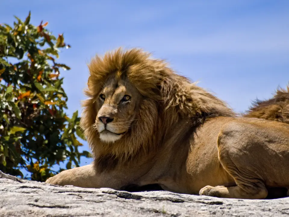
At the time of its UNESCO inscription, the Selous protected one of the most significant concentrations of large mammals on the continent, including globally important populations of 106,300 African bush elephants (Loxodontha africana), 2,135 black rhinoceroses (Diceros bicornis), and endangered African wild hunting dogs or painted dogs (Lycaon pictus), alongside one of the largest recorded concentrations in the world of hippopotamuses (Hippopotamus amphibius, numbering 18,200) and Cape buffaloes (Syncerus caffer, numbering 204,015). Its rich ungulate and predator fauna also includes 7,000 sable antelopes (Hippotragus niger), 52,150 Lichtenstein's hartebeests (Alcelaphus lichtensteinii), 80,815 Nyassa wildebeests (Connochaetes albojubatus) or white-bearded gnu, greater kudus (Tragelaphus strepsiceros), elands (Taurotragus oryx), Masai giraffes, plains zebras, lions (recognised as a Lion Conservation Unit since 2005), leopards, and cheetahs alongside spotted hyenas and giant Nile crocodiles that patrol the sandbanks and channels of the Rufiji River.
In the twenty-first century, acute conservation threats caused the reserve to be placed on the List of World Heritage in Danger from 2014 to the present, with WWF conservation reports warning that elephants could disappear from the site within six years without urgent protection. Whereas the Selous sanctuary supported roughly 109,000 elephants back in 1976, then the largest elephant population in the world, widespread commercial poaching reduced that number to about 13,000 animals by 2013, including a sharp 66 percent drop between 2009 and 2013 alone (an approximate 10 to 11 percent decrease per year over those six years), which many sources blamed on corrupt politicians alongside officials and businessmen aiding illegal hunters and poachers. Further controversy arose when UNESCO approved a boundary modification permitting uranium mining on the reserve margins, a decision seriously criticised by environmental groups such as Uranium-Network and Rainforest Rescue, and when Tanzanian President John Magufuli approved construction of the Stiegler's Gorge Hydroelectric Power Station over the Rufiji River. Started on 26 July 2019 for completion by 2022 to generate an additional 2,100 megawatts of electricity and more than triple Tanzania's existing 562-megawatt installed hydropower capacity, the dam project was criticised by the IUCN (International Union for Conservation of Nature) for failing to consider the impact of flooding nearly 1,000 square kilometres on both biodiversity and the thousands of people downstream who depend on the Rufiji River for fishing and agriculture.
Boat Safaris and Walking Trails Along the Rufiji Today
The river draws every species. While the majority of the reserve territory is allocated to game hunting through privately leased hunting outfitters, a dedicated northern sector bordering the Rufiji River operates strictly as a photographic wildlife zone with high-end lodges and camps situated along the river and lake systems.
- Entry and Route to the Rufiji Camps: Because overland road access into the interior is challenging, most travellers fly in on scheduled light aircraft from Dar es Salaam to bush airstrips along the Rufiji River, though arrival by train or four-wheel-drive car is also possible.
- Tickets, Interiors and Viewpoints: Combine four-wheel-drive game drives through the Miombo woodlands with boat trips among hippos and crocodiles on the Rufiji River and guided walking safaris along the dry sand rivers, an activity offered in the Selous that not every national park allows; check the official site for current conservation fees and entry permits.
- Timing and Onward Connections: Visit during the dry months when animals congregate along the permanent waters of the Rufiji floodplain and oxbow lakes across southern Tanzania, check the official site for seasonal camp operations, and compare other great African wildlife sanctuaries and riverine reserves in our UNESCO World Heritage Atlas.
