


























Quick Field Data
- UNESCO Inscription: 1983 (extended 1990) · Criteria (vii), (viii), (ix), (x).
- Scale & Footprint: 570,045 hectares total across the transboundary Talamanca Range-La Amistad Reserves (including 401,000 hectares inside La Amistad International Park and 221,000 hectares on the Panamanian side, buffered by a 15-kilometre peripheral zone)
- Access & Ticketing: Co-managed by SINAC in Costa Rica (spanning the Caribbean and Pacific conservation sectors) and ANAM in Panama; ranger stations and high-elevation trail networks access the Pacific and Caribbean cloud forests alongside the Cerro Chirripó massif
- Arrival Logistics: Straddles the international frontier of southern Costa Rica and western Panama along the spine of the Cordillera de Talamanca, reached via highland trailheads in Chiriquí and western Panama or the southern Talamanca valleys of Costa Rica
Non-Volcanic Uplift, Quaternary Glaciation, and the Continental Land Bridge
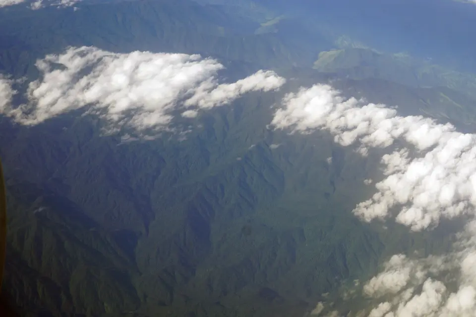
Stretching along the rugged international frontier uniting southern Costa Rica and western Panama, the binational Talamanca Range-La Amistad Reserves and La Amistad National Park (Parque Internacional La Amistad) encompasses 570,045 hectares of contiguous mountain wilderness, of which 221,000 hectares lie in Panama and 401,000 hectares form the core transboundary La Amistad International Park (formally established as a binational park on 6 September 1988 following UNESCO's 1983 inscription of the Costa Rican reserves and extended to include the Panamanian park in 1990 under all four natural criteria (vii alongside viii, ix, and x)). Together with its 15-kilometre buffer zone, the reserve protects the largest block of primary tropical forest in Central America and anchors the Mesoamerican Biological Corridor. Glaciers carved these tropical peaks.
Geologically, the Cordillera de Talamanca is unique in Central America: whereas the rest of the Central American mountain spine was built by active volcanic cones, the Talamanca Range is the highest and wildest non-volcanic mountain chain in the region, uplifted by tectonic compression as oceanic and continental tectonic plates converged. Dozens of sharp granitic and marine-sedimentary summits rise above 3,000 metres on both sides of the border, culminating on the Costa Rican side at Cerro Chirripó, which reaches 3,819 metres above sea level, the highest point in Costa Rica and across all of southern Central America.
Because of this extreme vertical relief, the upper crests of the Talamanca Range preserve a geological phenomenon found nowhere else in Central America: unmistakable landforms of Quaternary glaciation. During the Pleistocene ice ages, alpine glaciers capped the highest summits around Cerro Chirripó and neighbouring high peaks, carving glacial valleys, and cirques, moraines, and high-altitude glacial lakes (tarns) above the 3,000-metre line. As the glaciers retreated, these isolated subalpine summits became sky islands of Talamancan páramo shrubland and dwarf bamboo surrounded by vast expanses of oak-dominated Talamancan montane cloud forest and Isthmian-Atlantic moist lowland rainforest. Nowhere else in the Central American tropics can hikers stand beside cold glacial cirque lakes and moraine ridges while looking down into warm tropical rainforest valleys just a few dozen kilometres away.
Functioning simultaneously as a high-altitude sky archipelago and as the narrow continental land bridge where the flora and fauna of North America and South America converged and interbred during prehistoric continental exchange, La Amistad harbours roughly 20 percent of Central America's total species diversity alongside an extraordinary concentration of single-mountain endemism. Because deep valleys and 3,000-metre ridges subdivide the Cordillera de Talamanca into isolated microclimates with distinct rainfall and temperature regimes on the Caribbean and Pacific slopes, individual mountain ridges have acted as evolutionary islands where amphibians and insects alongside highland birds and cloud-forest plants evolved into distinct localized species.
10,000 Flowering Plants, Five Wild Cat Species, and Four Indigenous Peoples
Across the steep altitudinal gradient from lowland Caribbean rainforests up to the frost-swept páramo at 3,819 metres, botanists have described more than 10,000 species of flowering plants (with non-vascular mosses alongside lichens and ferns thriving in the cloud-drenched oak canopies). Vertebrate diversity is equally prolific: the reserve shelters 215 species of mammals and roughly 250 species of reptiles and amphibians alongside 115 species of freshwater fish and 600 species of birds, earning designation from BirdLife International as an Important Bird Area (IBA).
All five species of wild cats native to Central America roam the unbroken forest corridors of La Amistad: the jaguar and the puma alongside the ocelot, the margay, and the jaguarundi. Beneath the canopy live endangered flagship mammals including the Central American tapir and the ornate spider monkey, while the cloud forests echo with the calls of the resplendent quetzal and the three-wattled bellbird alongside the bare-necked umbrellabird and the endemic yellow-green brushfinch. Herpetological endemism is especially pronounced in the cool, humid leaf litter of the montane zone, where the splendid poison frog lives alongside at least seven amphibian species found nowhere outside the park boundaries, led by the Chiriquí fire salamander.
Because the rugged, trackless gorges of the Talamanca spine hindered scientific access for decades, major portions of the interior remained biologically unmapped until after 2006. Beginning in 2006, a three-year collaborative project funded by the United Kingdom's Darwin Initiative and led by the Natural History Museum in London alongside Costa Rica's INBio and Panama's ANAM (with the University of Panama) mounted seven multi-disciplinary expeditions into the remote heart of La Amistad. Researchers assembled reference collections of more than 7,500 plants alongside 17,000 beetles and 380 reptiles and amphibians, discovering 12 plant species and 15 amphibian species alongside three reptile species and one dung beetle species completely new to science. Those expeditions demonstrated how much undocumented biodiversity still survives inside the unroaded valleys between 3,000 metres and the lower rainforest slopes.
Crucially, La Amistad is also a living cultural landscape with pre-ceramic archaeological sites documenting millennia of human occupation. Four distinct indigenous groups, including the Bribri, and the Naso and the Ngöbe-Buglé, inhabit traditional villages within the reserve and its 15-kilometre buffer zone on both sides of the Costa Rican and Panamanian border, practising traditional forest stewardship alongside buffer-zone coffee and cattle farming. Protecting the integrity of the 570,045-hectare reserve depends on close cross-border coordination between park rangers and these indigenous communities against illegal logging alongside agricultural encroachment and poaching along the forest frontier. Because La Amistad International Park is split across the border of Costa Rica and Panama and unites the Caribbean and Pacific conservation sectors of Costa Rica with the Panamanian mountain sector, its cross-frontier governance model functions as a vital testbed for coordinated bioregional planning and ecological stewardship across Central and Latin America. Inside the surrounding buffer zone, conservation managers also work directly with highland coffee growers alongside beef cattle producers and indigenous subsistence farmers to maintain forest connectivity across the Talamanca mountain divide.
Trekking the Cloud Forests and Glacial Páramo of La Amistad
Exploring the 570,045-hectare Talamanca and La Amistad complex requires choosing between the accessible Pacific and Caribbean ranger stations in western Panama and southern Costa Rica or committing to multi-day high-altitude treks into the glaciated páramo of Cerro Chirripó.
Plan your binational mountain itinerary around the highland cloud-forest trails and permit rules.
- Hike the Panamanian cloud-forest trails in Chiriquí and western Panama: On the Panamanian side (which encompasses 221,000 hectares of the World Heritage reserve), enter La Amistad via the highland ranger stations in Chiriquí Province to walk beneath towering Talamancan oaks draped in bromeliads and orchids. Scan the mid-elevation canopy early in the morning for resplendent quetzals alongside three-wattled bellbirds and bare-necked umbrellabirds while watching the forest trails for ornate spider monkeys and tracks of the Central American tapir.
- Ascend to the Quaternary glacial valleys of Cerro Chirripó in Costa Rica: On the Costa Rican side managed by SINAC, reserve trekking permits well in advance to climb from the Pacific foothills up through the montane cloud forest into the treeless alpine páramo above 3,000 metres. From the 3,819-metre summit of Cerro Chirripó, examine the glacial valleys alongside moraines and cold tarns sculpted by Quaternary glaciers in the middle of the American tropics.
- Respect indigenous territories and seasonal rainfall along the divide: Because the mountain divide splits the reserve into a drier Pacific slope (best hiked between December and April) and a perennially wet Caribbean slope, pack cold-weather layers and rain gear for rapid mountain weather shifts. When visiting buffer-zone trails near Bribri alongside Naso and Ngöbe-Buglé communities, hire certified local indigenous guides and compare La Amistad with other Central American reserves in our UNESCO World Heritage Atlas.
