Quick Field Data
- UNESCO Inscription: Cultural Landscape World Heritage Site (Ref. 422), inscribed in 2017 under Criteria (ii) and (v).
- Scale & Footprint: 229,205.19 hectares covering the original 1951 Lake District National Park area in Cumbria (distinct from the 2016 eastern extension bringing the wider park to 2,362 square kilometres).
- Access & Ticketing: Entry into the Lake District UK stays completely free across 2,159 km of public footpaths, 875 km of bridleways, and right-to-roam open fells. Lake steamers, heritage trains, and historic houses charge operator fares.
- Arrival Logistics: Newcastle International Airport (NCL) sits 109 km east as the primary hub. Teesside (MME) at 107 km has limited flights, Leeds Bradford (LBA) sits 115 km away, Liverpool (LPL) sits 128 km south, and Edinburgh lies 164 km north.
Glaciated Radial Valleys, Tarns, and England's Deepest Lakes
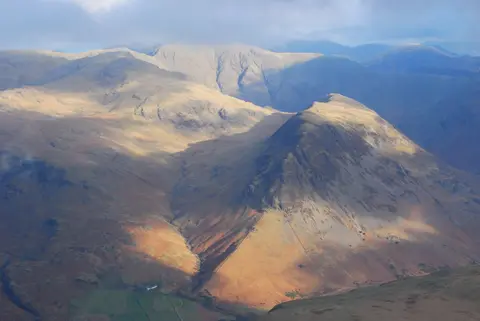
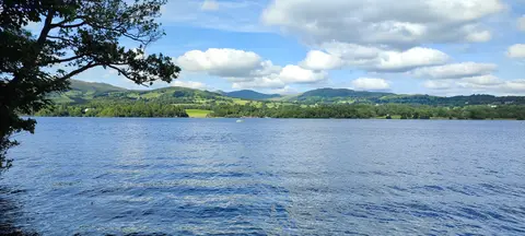
Located in Cumbria across North West England, the Lake District England massif spans roughly 51 km from east to west and nearly 64 km from north to south. Over the past 2 million years, repeated Ice Age glaciers excavated 13 U-shaped valleys radiating outward not from a single dome, but from an east-west watershed running between St Bees Head in the west and Shap in the east. Where ice scoured deep rock basins and lateral tributary streams laid gravel fans across valley floors, 16 major lakes and scores of high cirque tarns settled beneath sharp fells.
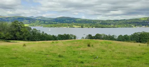
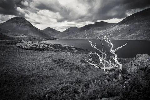
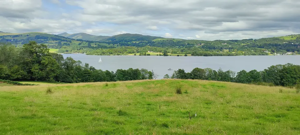
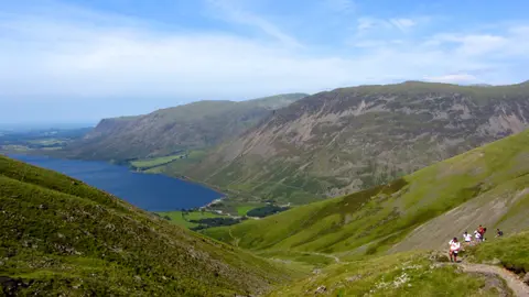
England's highest peaks cluster inside this compact upland massif: Scafell Pike rises to 978 metres, Helvellyn climbs to 950 metres, and Skiddaw reaches 931 metres. Down in the southeastern valleys, Windermere stretches 18 km (11 miles) across 14.73 square kilometres as England's longest and largest lake, contrasting with western Wasdale where Wast Water plunges 79 metres deep beneath steep rock screes as England's deepest lake. Paired valley waters at Buttermere and Crummock Water, and again between Derwent Water and Bassenthwaite Lake, clearly show how tributary gravel divided formerly single glacial lakes.
Between rocky high crags and damp infilled valley bottoms, heather and bracken cloak better-drained moorland slopes while native deciduous oak woods cling to steep banks below the tree line next to conifer plantations in southern Grizedale Forest. To the west and south, the upland massif reaches right out to the Irish Sea coast. Designated on 9 May 1951 just one month after the Peak District, the Lake District became the largest national park in England and Wales and the second largest in the United Kingdom after the Cairngorms.
Following three earlier nominations rejected in the 1980s and 2012, the core 1951 park boundary earned World Heritage listing in 2017, excluding Kendal, the Cartmel and Furness peninsulas, and the 3 percent eastern Lune Valley extension added toward the Yorkshire Dales in 2016. In 2024 alone, the national park recorded 17.73 million tourist visitors generating 26.85 million tourist days across stays exceeding three hours. Preserving quiet fells amid that visitor demand remains central to modern management.
Herdwick Fell Grazing, Dry-Stone Walls, and National Trust Lands
Beneath steep crags, the Lake District UK survives as a working agro-pastoral landscape forged over more than 1,000 years of mountain farming. Independent farmers graze cattle on low meadows and release native Herdwick sheep onto unenclosed common fells, keeping coarse vegetation balanced while maintaining open mountain skylines. About 55 percent of the national park remains registered agricultural land, partitioned by dry-stone field walls, whitewashed farmsteads, and rugged stone barns, with over half farmed directly by owner-occupiers.
Urban settlement stays limited to three main tourism centres inside the mountains: Keswick, Windermere with contiguous Bowness-on-Windermere, and Ambleside. Smaller valley villages include Coniston, Grasmere, Hawkshead, Glenridding, Pooley Bridge, Threlkeld, Staveley, Newby Bridge, Broughton-in-Furness, Lindale, and Gosforth, surrounded outside the perimeter by Carlisle, Kendal, Penrith, Cockermouth, Whitehaven, Workington, Barrow-in-Furness, Ulverston, Dalton-in-Furness, Millom, and Grange-over-Sands. Beyond village lanes lie scattered hamlets and working sheep farms integrated closely with walking hospitality.
Land ownership and statutory oversight draw together local councils, water managers, and conservation charities under the 20-member Lake District National Park Authority headquartered in Kendal, comprising six Westmorland and Furness appointees, four Cumberland appointees, and ten national Ministerial appointees. The National Trust owns around 25 percent of the park plus legal covenants over a further 2 percent, and United Utilities holds 8 percent around reservoirs such as Haweswater. The National Park Authority owns 3.9 percent, roughly 4 percent, while forestry bodies manage timbered slopes. Together with 2,159 km of signposted footpaths and 875 km of bridleways, right-to-roam access covers 50 percent of open mountain and moorland. Only 15 km of restricted byways and 30 km of open motor byways exist, with permits limiting traffic along Gatescarth Pass.
Road access around the massif relies on perimeter trunk highways before smaller valley spurs climb inward. Trunk route A6 traces the eastern border between Kendal and Penrith, while A590 links the M6 to Barrow-in-Furness with A5092 across southern fringes. Across the north, A66 connects Penrith and Workington, and A595 skirts Calder Bridge, Holmrook, and the Whicham Valley to Grizebeck. Inside the hills, B5289 winds through Lorton Vale and Buttermere over Honister Pass to Borrowdale, while B5292 climbs Whinlatter Pass toward Braithwaite near Keswick. Further south, B5322 serves St John's in the Vale and B5343 enters Great Langdale, while minor lanes thread Little Langdale, Dunnerdale, Newlands Valley, Longsleddale, Haweswater, and Kentmere.
Steep mountain passes between those valleys challenge both motorists and cyclists year-round. Newlands Hause connects the Newlands Valley directly with B5289 at Buttermere, while narrow minor roads linking Little Langdale, Eskdale, and Dunnerdale climb the famously steep Wrynose and Hardknott passes. Both gradients rank among the toughest road climbs in Britain, attracting seasoned road cyclists during clear weather while requiring real braking care on wet descents. By contrast, lower southern valleys connecting Kendal, Windermere, and Coniston carry dense webs of quiet rural lanes between stone farmsteads and broadleaf woods.
Conservation ownership also reflects how closely nineteenth-century and twentieth-century stewardship preserved the massif's open character. Surrounding boundary towns such as Penrith, Carlisle, Workington, Whitehaven, Ulverston, Barrow-in-Furness, Millom, and Grange-over-Sands maintain strong economic links with Lakeland valleys while sitting outside the National Park border. Inside the boundary, strict development controls coordinated by the National Park Authority protect rural valleys from intrusive industrial expansion, ensuring the World Heritage cultural landscape retains both its working farms and open skyline views. Even the park's quiet cul-de-sac roads and dry-stone lanes reflect decades of careful rural stewardship across Cumbria.
Scenic Villas, Romantic Poets, and Global Conservation
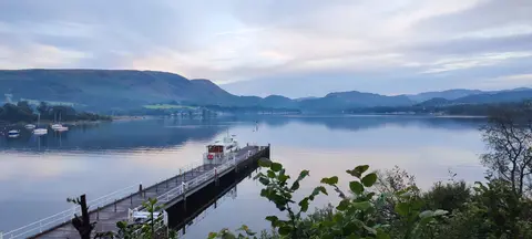
Starting in the late eighteenth century, travellers guided by northern European and Italian landscape painting sought out Lakeland crags and still waters. Patrons added country villas, boathouses, and landscaped parks overlooking Windermere, Rydal, and Coniston specifically to augment scenic harmony. Soon afterwards, nineteenth-century Romantic engagement turned aesthetic touring into a civic ethic: mountain scenery restores the human spirit and holds universal cultural worth transcending private land ownership.
Literary heritage runs deep across the valleys through the Lake Poets, John Ruskin, Arthur Ransome, and Beatrix Potter, whose purchase and bequest of traditional Herdwick farms helped secure vast National Trust tracts. Local campaigns against quarries, overhead power corridors, and unwanted valley railways shaped British national park law and influenced international planners including American landscape architect Frederick Law Olmsted. Under the National Parks and Access to the Countryside Act of 1949, a World Heritage Forum and five-year Management Plan coordinate partner agencies to confront climate pressures, shifting farm subsidies, and peak tourism demand. For travellers browsing things to do Lake District UK, walking historic ridge highways such as High Street or traversing sections of the Coast to Coast Walk directly reflects those early conservation victories.
Roads, Railways, and Access Zones Across the Valleys
Surrounding trunk highways (the A6, A590, A66, and coastal A595) frame the massif, while inner passes and branch lines divide visits cleanly across four valley sectors.
| Complex Zone | Key Highlights | Access & Ticket Rule |
|---|---|---|
| Windermere, Bowness, and Ambleside | 18-kilometre lake, Brockhole Visitor Centre, Windermere cable ferry, and Lakeside steam trains. | Town streets and lake footpaths stay free, while boats, vehicle ferries, and steam rail charge fares. |
| Keswick, Borrowdale, and Northern Valleys | Derwent Water boats, Skiddaw ridge, B5289 Honister Pass, and B5292 Whinlatter Pass. | Open fells and 2,159 km of footpaths remain free; lake launches and car parks charge local fees. |
| Ullswater, Grasmere, and Kirkstone Pass | Scenic A591 Grasmere corridor, A592 Kirkstone Pass, Glenridding pier, and Pooley Bridge. | Valley roads and fells stay freely open; seasonal Ullswater boats and historic villas charge entry. |
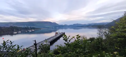
| Wasdale, Eskdale, and Coniston | Scafell Pike, 79-metre Wast Water, Wrynose and Hardknott passes, and Ravenglass steam rail. | Cul-de-sac roads and peaks cost nothing; Ravenglass railway and Coniston Boating Centre charge fares. |
Dry-Stone Walls, Cirque Tarns, and Pre-Beeching Rail Heritage
Moving at walking pace between valley meadows and coastal stations uncovers three telling landscape details across Cumbria.
- Mortar-free dry-stone fell walls: Inspect field boundaries climbing out of Great Langdale (B5343) or Wasdale to see how farmers interlocked cleft local stone without mortar so winter gales pass safely through gaps while Herdwick flocks stay sheltered.
- High glacial cirque tarns above U-shaped troughs: Climb above major lakes toward Scafell Pike or Helvellyn to find round rock-rimmed tarns occupying ice-gouged amphitheatres beneath sharp ridge lines.
- Manual level crossings and narrow-gauge steam rail: Ride the western Cumbrian Coast Line, serving three stations inside the park plus nearby Drigg with pre-Beeching manual crossing gates, before transferring onto the Ravenglass and Eskdale Railway into Dalegarth near Boot.
Best Time to Visit, Rail from London, and Edinburgh Connections
Deciding the best time to visit Lake District valleys requires matching seasonal daylight against upland rainfall and pass conditions. Late spring through early autumn delivers long northern daylight for high ridges plus seasonal passenger launches on Coniston Water, Derwent Water, and Ullswater. Brockhole Visitor Centre on Windermere, housed in a former country estate, and Coniston Boating Centre operate helpful orientation services. Autumn turns bracken rusty gold across Borrowdale and Kentmere, whereas winter ice demands caution on steep gradients over Kirkstone, Honister, Whinlatter, Newlands Hause, Wrynose, and Hardknott passes.
Travellers checking how to get to Lake District from London or planning how to get to Lake District by train use fast West Coast Main Line services skirting the eastern flank to Oxenholme, Penrith, and Carlisle. From Oxenholme, the Windermere Branch Line climbs via Kendal and Staveley straight to Windermere. Historic lines to Coniston closed to passengers in 1958, and the Penrith-to-Keswick railway closed west of Keswick in 1966 and completely in 1972, leaving the improved A66 along part of its trackbed. South of Windermere, the Lakeside and Haverthwaite heritage line connects steam trains with lake cruises up to Bowness, while the Windermere Ferry carries vehicles across mid-lake.
Road travellers also use the A591 between Kendal, Grasmere, and Bassenthwaite Lake, once shortlisted in the 2011 street-view awards. Elsewhere, the A593 and A5084 connect Ambleside and Coniston southward, while the A592 and A5074 link Windermere toward Ullswater and Penrith. Air passengers arrive through Newcastle International Airport (109 km), Leeds Bradford Airport (115 km), or Liverpool John Lennon Airport (128 km) rather than limited Teesside (107 km). Across the Scottish border, Edinburgh sits 164 km north along direct rail lines, pairing naturally with wider listings in the UNESCO World Heritage Atlas.