Quick Field Data
- UNESCO Inscription: 2009 (Ref. 1303), Industrial Revolution waterway spanning Wrexham County Borough and Denbighshire, north-eastern Wales, United Kingdom; Criteria (i), (ii) and (iv).
- Scale & Footprint: 103-hectare linear protected corridor along 18 kilometres of the lock-free Llangollen Canal, anchored by the 307-metre-long, 39-metre-high, 19-span Pontcysyllte Aqueduct.
- Access & Ticketing: Grade I listed structure managed by the Canal & River Trust (Glandŵr Cymru); pedestrian towpath crossings are free, while narrowboat trips, canoe hire and kayak passages require operator or navigation bookings.
- Arrival Logistics: Nearest British commercial flights use Liverpool John Lennon Airport (LPL), 44 kilometres northeast, Manchester Airport (MAN, 68 kilometres) and Birmingham Airport (BHX, 107 kilometres); across the Irish Sea, Dublin sits 216 kilometres west.
Thomas Telford, William Jessop, and the 1795 Ellesmere Canal Plan
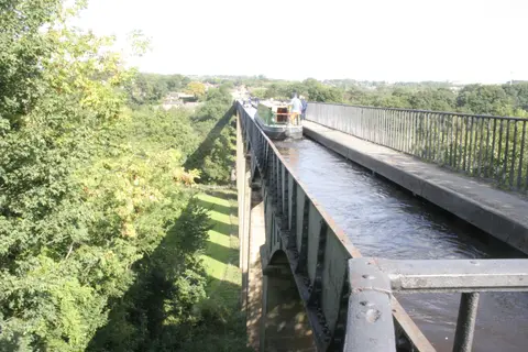
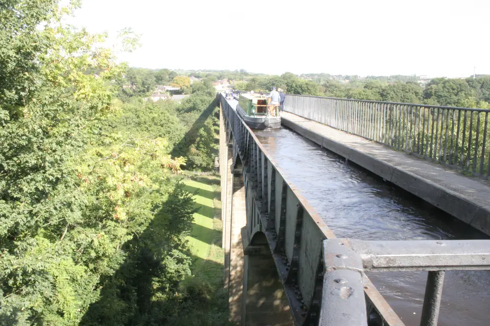
Spanning the wooded Vale of Llangollen between Froncysyllte and Trevor, Pontcysyllte Aqueduct ranks among Britain's boldest Industrial Revolution landmarks. Its Welsh name Traphont Ddŵr Pontcysyllte means Cysyllte Bridge after the southern parish township of Cysyllte rather than any modern word for junction. Completed in 1805 at a cost of roughly £47,000, the 19-arched stone and cast-iron structure carries narrowboats high across the River Dee valley. Today it remains Great Britain's longest aqueduct and the highest navigable canal aqueduct anywhere in the world.
Ambitious commercial geography explains why canal promoters risked such unprecedented engineering across north-eastern Wales. Investors formed the Ellesmere Canal project to open an inland water link joining the River Severn at Shrewsbury with the River Dee and the Port of Liverpool on the River Mersey. Although surveyors mapped an easier, cheaper eastern route avoiding steep Welsh valleys, proprietors approved the westerly high-ground course precisely to tap rich coalfields, ironworks and limestone quarries across Denbighshire and Wrexham. Early designs envisioned descending deep valley slopes through flights of locks onto a low stone embankment crossing the Dee, an approach fraught with water loss and slow cargo delays.
Hired as rising civil engineer under seasoned canal supervisor William Jessop, Thomas Telford persuaded directors to replace valley locks entirely with a fearless single-level crossing straight across the canyon. Drawing confidence from his smaller cast-iron trough at Longdon-on-Tern on the Shrewsbury Canal, Telford laid the foundation stone on 25 July 1795 near an older 18th-century road bridge called Pont Cysyllte. Over ten years of skilled quarrying, ironfounding and masonry construction under contractor John Simpson of Shrewsbury, builders defied widespread public scepticism to raise an unbroken waterway channel 39 metres above floodwaters. When official traffic opened on 26 November 1805, an inaugural stone plaque celebrated the union of England and North Wales across three navigable rivers.
Financial limits prevented finishing the full trunk northward toward Wrexham and Chester after investors cancelled the northern continuation in 1798, leaving isolated feeder remnants near Moss Valley and Gwersyllt where a village street still preserves the Welsh name Heol Camlas. Consequently, Trevor Basin directly north of the aqueduct became the practical canal terminus, fed from 1808 onward by water diverted out of the River Dee near Llangollen via Telford's curved Horseshoe Falls weir at Llantysilio. Industrial spur works such as the 1820s Plas Kynaston Canal and the Ruabon Brook Tramway, climbing through Acrefair and Plas Bennion before steam upgrades reached Rhosllannerchrugog and Wrexham, still fed local freight smoothly onto the elevated trough.
Cast-Iron Trough Engineering, Ox-Blood Mortar, and Trevor Basin
Precision industrial metallurgy made the 307-metre (336-yard) crossing possible without heavy stone arches blocking the winding river gorge below. Eighteen slender hollow masonry piers climb cleanly from bedrock, spaced on 13.6-metre spans to support four cast-iron arched ribs beneath each of the 19 deck openings. Ironfounder William Hazledine cast the main trough segments at nearby Plas Kynaston Foundry in Cefn Mawr, while Coleham Foundry near Shrewsbury produced ironwork including arched ribs formed from three interlocking voussoir sections. Using solid un-pierced outer arch webs allowed cast iron to behave in compression much like dressed stone while remaining far lighter atop lofty hollow piers.
Sitting atop those curved iron ribs stretches the narrow water trough measuring 3.61 metres (roughly 3.7 metres rounded) wide and 1.60 metres deep, flanged in cast-iron plates bolted tightly together. Even the bolted vertical side plates curve into decorative voussoir shapes mimicking traditional stone masonry arches beneath. Builders waterproofed iron joints using traditional Welsh flannel soaked in white lead and iron-boring paste, later refreshed with ordinary tar after 25 years. Equally ingenious locally, masons quarried quartz-rich sandstone from Cefn Mawr outcrops known as The Rock beside Rock Road. They bound tall piers using lime mortar blended with water and ox blood, using haemoglobin colloids to strengthen joints against winter freeze-thaw cycles.
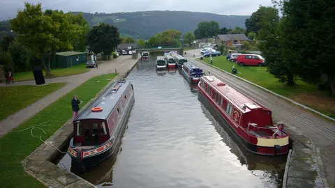
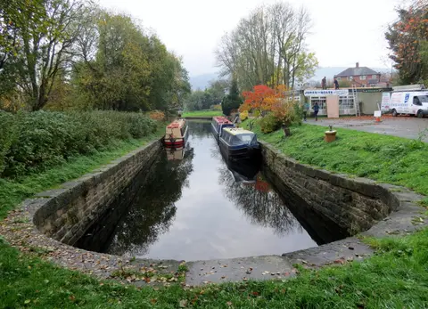
Beside the open trough on its eastern edge runs a cantilevered pedestrian towpath guarded along its outer drop by iron railings, leaving boaters on the opposite side gazing straight down into empty valley air without a parapet beside the hull. Across 18 lock-free kilometres stretching between Chirk engineering works, Froncysyllte, Pontcysyllte, Trevor Basin, Trevor Arm and Llangollen's Horseshoe Falls, the entire protected 103-hectare corridor balances daring metal architecture with gentle pastoral hillsides. Visitors strolling Trevor Basin immediately understand how wharves, feeder branches and narrow canal arms kept Welsh coal and limestone moving down into England's wider inland waterway network.
1945 Canal Breach, Water-Feeder Revival, and Glandŵr Cymru Care
Commercial fortunes fluctuated dramatically over the century following Telford's opening fanfare as steam railways raced across British valleys. Following the Ellesmere and Chester Canal Company Act of 1845 and merger into the Shropshire Union Railways and Canal Company in 1846, railway directors briefly weighed draining canals to lay tracks before opting instead to keep freight floating as profitable feeders. During the First World War after 1914, more than 450 narrowboats of the Shropshire Union fleet kept essential cargoes moving across the Pontcysyllte trough. Decline struck sharply after a 1936 waterway breach near Newtown in Powys severed southern routes, halting boat traffic across the aqueduct toward Llangollen by 1939 and bringing formal navigation closure under a 1944 Act of Parliament.
Tragedy nearly sealed the neglected channel's fate on 6 September 1945 after maintenance lapses triggered a catastrophic breach east of Llangollen near Sun Bank Halt. Hundreds of tons of surging water tore away a steep railway embankment downhill, ripping a 37-metre-wide crater 15 metres deep directly beneath morning tracks. An approaching mail and goods train hauling 16 carriages and two vans plunged straight into the breach, killing one engine crew member and injuring two others. Only one practical lifeline saved Pontcysyllte Aqueduct from demolition despite official navigation closure: it still carried vital drinking water supplies toward Hurleston reservoir, prompting the Mid and South-East Cheshire Water Board to fund long-term upkeep from 1955 onward.
Rising late-20th-century leisure cruising transformed this industrial water feeder into one of Britain's favourite holiday routes, rebranded as the Llangollen Canal by British Waterways during the 1980s. Maintained today as a Grade I listed monument by the Canal & River Trust, branded Glandŵr Cymru across Wales, the 18-kilometre UNESCO zone combines conservation engineering with healthy wildlife habitats where otters have returned along clear water channels. Historic rubble embankments required modern stabilisation during the second half of the 20th century using concrete cores, steel pilings and geotextiles, while masonry repairs increasingly guard original stonework and iron plates against traffic wear and weather. Unified buffer-zone planning and visitor interpretation continue strengthening protection around busy Trevor Basin launch points.
Access Zones Along the 18-Kilometre Pontcysyllte Canal Corridor
Exploring Pontcysyllte Aqueduct Wales works smoothly on foot along flat towpaths, aboard narrowboats or gliding parallel by paddlecraft along calm water reaches. Verify local boat trip schedules and towpath maintenance notices with Canal & River Trust before setting out.
| Complex Zone | Key Highlights | Access & Ticket Rule |
|---|---|---|
| Pontcysyllte Aqueduct & Towpath | 307-metre cast-iron trough 39 metres above the Dee, 19 spans and 18 sandstone piers. | Free pedestrian access year-round along the railed towpath; watch for two-way walkers and keep dogs on short leads. |
| Trevor Basin & Trevor Arm | Northern canal terminus, Llangollen junction, historic wharf buildings, passenger trip boats and visitor information centre. | Main starting wharf for narrowboat hires and Jones the Boat trips; verify boat ticket bookings and car park zones locally. |
| Llangollen Feeder & Horseshoe Falls | Walkable canal reach running west past Sun Bank Halt toward Telford's 1808 curved River Dee weir at Llantysilio. | Level scenic towpath suited to walkers and cyclists; share narrow grassy or surfaced paths courteously with passing boats. |
| Froncysyllte & Southern Canal Corridor | Southern aqueduct embankment approach linking toward Chirk works across the 18-kilometre lock-free World Heritage strip. | Paved and gravel canal towpaths accessible from Froncysyllte village lanes; check local heritage trail notices before hiking. |
Three Cast-Iron and Stone Masonry Details on the Aqueduct
- Voussoir-Shaped Bolted Iron Trough Plates: Look down along the iron trough side walls from the towpath to notice flanged plates cast in curved wedge shapes mimicking stone arch blocks solely as architectural ornament.
- Un-Pierced Outer Cast-Iron Arch Ribs: Peer underneath from River Dee valley paths to compare solid un-pierced outer iron rib webs engineered by William Hazledine for high compressive stability atop hollow sandstone piers.
- Ox-Blood Lime Mortar and Flannel Joint Seals: Examine historic sandstone pier joints strengthened in 1795 with ox-blood haemoglobin mortar against frost, paired with iron trough seams originally bedded in Welsh flannel.
Walking, Canoe Trips, and Boat Routes Over Pontcysyllte Aqueduct
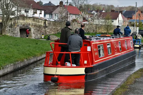
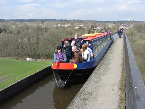
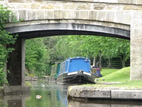
Crossing the Pontcysyllte Aqueduct on foot is free, level and exposed right beside passing narrowboats. A narrow iron-railed towpath carries pedestrians across all 307 metres directly beside the water channel, though visitors sensitive to heights should note the sheer 39-metre drop into the Dee valley and single-side parapet guarding the walkway. Those researching Pontcysyllte Aqueduct boat trips or a Pontcysyllte Aqueduct canoe trip find passenger cruises departing Trevor Basin with licensed narrowboat holidays, canoe hire and kayak passages regulated by Glandŵr Cymru guidelines. Checking safety rules before paddling ensures small canoes and kayaks stay clear of heavy narrowboats inside the tight 3.61-metre cast-iron trough.
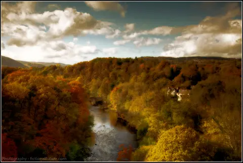
Pacing a visit across half a day to a full day pairs the elevated aqueduct crossing smoothly with surrounding things to do near Pontcysyllte Aqueduct in Denbighshire and Wrexham. Walking west from Trevor Basin along the level towpath reaches Llangollen town and Telford's Horseshoe Falls weir near Llantysilio, while valley footpaths drop beneath the 18 stone piers to frame classic Pontcysyllte Aqueduct photos from riverside grass. Mild late spring through early autumn offers calm dry walking conditions and active boat crossings, while crisp winter days reveal clear leafless gorge views across Cefn Mawr sandstone outcrops.
Knowing where Pontcysyllte Aqueduct is located makes arriving from English and Welsh transport hubs straightforward without long mountain detours. Nearest British commercial airports lie northeast at Liverpool John Lennon Airport (LPL, 44 kilometres), Manchester Airport (MAN, 68 kilometres) and Birmingham Airport (BHX, 107 kilometres southeast), linking west by regional rail toward Ruabon or Chirk stations and local buses serving Trevor and Froncysyllte. Travellers hopping across the Irish Sea can also combine North Wales canal corridors with flights or ferries connecting toward Dublin (216 kilometres west). Setting aside time for calm morning towpath walks before midday boat trips lets visitors absorb both river valley scenery and Telford's engineering geometry smoothly. Discover further Industrial Revolution landmarks and historic waterways inside our UNESCO World Heritage Atlas.