Quick Field Data
- UNESCO Inscription: Ref. 1026 · Cultural Site · Inscribed 2004 · Criterion (iv)
- Scale & Footprint: 61,187.96 hectares matching the Parco Artistico Naturale e Culturale della Val d'Orcia across five municipalities, framed by a 5,660-hectare buffer zone between Siena and Grosseto provinces
- Access & Ticketing: Protected under Italy's Code for Cultural Heritage and Landscape, the park is coordinated jointly by Montalcino, Pienza, San Quirico d'Orcia, Castiglione d'Orcia, and Radicofani. Valley roads and rural trails carry no entry fee, while historic town museums and fortresses operate separate admissions verified locally.
- Arrival Logistics: 87 kilometres south of Florence Airport, Peretola (FLR) and 116 kilometres from Pisa International Airport (PSA); Perugia San Francesco d'Assisi, Umbria International Airport (PEG) sits 78 kilometres east with limited commercial schedules
Sienese Land Tenure and Renaissance Utopian Terrain
Stretching from chalky hills south of Siena toward volcanic Monte Amiata between the provinces of Siena and Grosseto, the Val d'Orcia preserves a working agrarian territory reshaped deliberately during the 14th and 15th centuries. Etruscan settlements and Roman farming left deep archaeological foundations across the valley before early medieval abandonment thinned cultivation. Political stabilisation in the 10th and 11th centuries brought Benedictine monasteries, feudal strongholds, and surging pilgrim and trade caravans along the ancient Roman Via Francigena linking northern Italy to Rome.
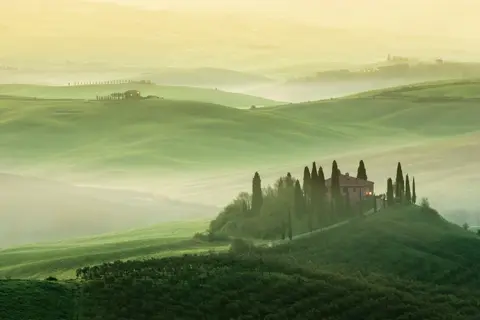
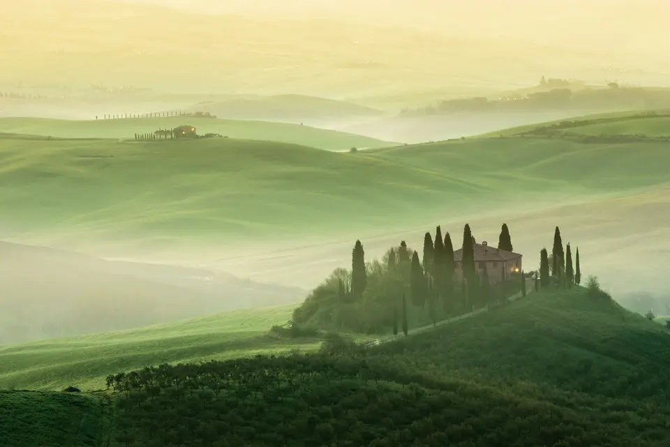
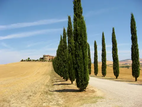
The valley's unmistakable visual order crystallised once the expanding city-state of Siena absorbed this southern hinterland during the 13th and 14th centuries. Wealthy Sienese merchants poured capital into clearing and rationalising rural landholdings, inspired by Renaissance utopian ideals of civic harmony and good governance famously visualised around 1339 in Ambrogio Lorenzetti's town-hall frescoes in Siena. They introduced an innovative share-tenancy land framework whereby small agricultural tenants surrendered half of their seasonal harvest to urban landlords as rent. That system funded durable stone farm complexes, fortified villages, villas, and churches linked by avenues and clusters of cypress pine trees planted deliberately to mark settlements and ridge routes.
This symbiotic bond between agrarian economics and urban culture flowed straight back into painting. Sienese School masters including Ambrogio Lorenzetti, Giovanni di Paolo, and Sano di Pietro turned these sculpted chalk plains, conical hills, and cypress lines into an idealised Renaissance vision of human cultivation harmonised with terrain, later inspiring Grand Tour travellers and twentieth-century cinema.
Hilltop Fortifications Along the Via Francigena
Strategic towns perch conspicuously atop isolated conical summits rising out of open Orcia plains, each guarding historical frontiers or pilgrim crossings along the Via Francigena. At the valley's western anchor, Montalcino was first documented in 814 AD near the Benedictine Abbey of Sant'Antimo and swollen in the tenth century by refugees fleeing coastal Roselle. It rose as a prosperous medieval commune famed for fine tanneries and leather footwear. Absorbed into Siena's orbit after the Battle of Montaperti in 1260 and caught in protracted Guelph-Ghibelline and Florentine wars, Montalcino raised stone walls in the 13th century. In 1361 it crowned its summit with an impregnable pentagonal fortress designed by Sienese architects Mino Foresi and Domenico di Feo, incorporating the Santo Martini keep and San Giovanni tower. Even after Medici Florence conquered Siena in 1555, Montalcino's defenders held out for nearly four additional years before surrendering in the final stand of the Sienese Republic.
Down below the fortress, Montalcino's Romanesque Chiesa di Sant'Agostino borders the Musei Riuniti, a civic and diocesan collection. Its galleries hold a wooden crucifix by an anonymous Sienese master, two 15th-century wooden Madonna sculptures, Della Robbia terracottas, a Saint Peter and Saint Paul by Ambrogio Lorenzetti, and a Virgin and Child by Simone Martini. Nearby, Agostino Fantastici's nineteenth-century Neoclassical facade fronts the 14th-century Duomo dedicated to San Salvatore. On Piazza della Principessa Margherita, Palazzo dei Priori sports Podesta coats of arms and a tall medieval tower next to six-arched La Loggia. Close by stand the 13th-century church of San Francesco with 16th-century Vincenzo Tamagni frescoes, and four historic quarters (contrade: Borghetto, Travaglio, Pianello, and Ruga). Their colour-draped lords and drummers compete twice yearly in archery contests under fortress walls. Beyond the town, palaeontological teams even unearthed fossilised whale skeletons at Castello Banfi (Poggio alle Mura) in 2007.
Eastward along the Via Francigena lies San Quirico d'Orcia, roughly 35 kilometres southeast of Siena and 80 kilometres southeast of Florence with about 2,500 residents. Its Collegiate Church of San Quirico grew from an 8th-century baptismal pieve rebuilt on a Latin cross plan in the 12th century. Its sandstone Lombard main portal rests on sculpted lions with ten animal-and-leaf capitals and twin crocodiles facing across the architrave beneath a high-relief lunette of Saint Quiricus, traditionally linked to Saint Damasus. The church further features a 13th-century side portal attributed to Giovanni Pisano, a 1663 choir, baroque seventeenth-century interior work, and a 1798 to 1806 bell tower. Nearby stand the 1561 Horti Leonini Renaissance garden, Romanesque churches of Santa Maria Assunta and San Biagio a Vignoni, and thermal Bagno Vignoni with San Giovanni Battista. Surrounding ridges hold the 12th-century Salimbeni castle at Vignoni beside Palazzo degli Amerighi (tied to a 1558 anti-Spanish plot) and the hilltop Chapel of Madonna di Vitaleta housing a Madonna attributed to Andrea della Robbia. Further south, Castiglione d'Orcia, Rocca d'Orcia, Monticchiello, and towering Radicofani (notorious haunt of medieval brigand-hero Ghino di Tacco) complete the frontier chain while leaving papal-era Pienza as a separately inscribed urban enclave.
Montalcino Vineyards, Calanchi Gullies, and Cypress Avenues
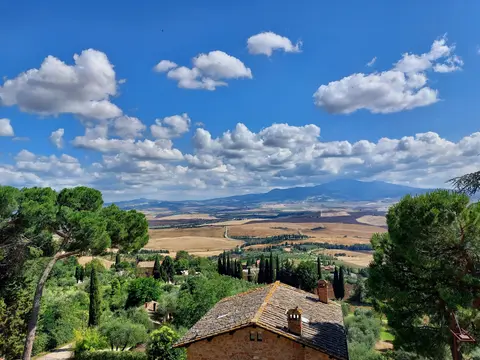
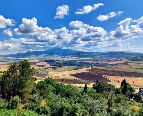
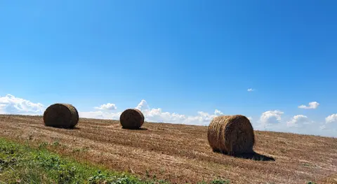
Geography divides the Val d'Orcia into interlocking zones of hay meadows, pasturelands with livestock, olive groves, grain fields, eroded clay badlands known locally as calanchi, and hillside vineyards. This patchwork spans the Orcia, Asso, and Ombrone river valleys across villages such as Camigliano, Castelnuovo dell'Abate, Montisi, San Giovanni d'Asso, Sant'Angelo in Colle, Sant'Angelo Scalo, and Torrenieri. On Montalcino's lower slopes, oak woods gave the town its ancient name while Sangiovese grosso vines transformed modern rural fortunes. Brunello di Montalcino became Italy's first wine awarded Denominazione di Origine Controllata e Garantita (DOCG) status, requiring five years' ageing before release (six years for Riserva). Production expanded from only 11 commercial producers in the 1960s to over 200 today making around 330,000 cases yearly, complemented by one-year Rosso di Montalcino DOC, Super Tuscan blends, and sweet Moscadello whites.
Post-Sixteenth-Century Stasis and Regional Park Governance
Paradoxically, the Val d'Orcia owes its intact Renaissance appearance to centuries of political decline. Once Florence conquered Siena after 1555 and Sienese mercantile investment withered at the close of the 16th century, four centuries of economic marginalisation spared the valley from industrial sprawl, preserving original field boundaries, farmhouses, bridges, inns, and road alignments until modern conservation intervened.
In 1999, five municipalities united to create the Parco Artistico Naturale e Culturale della Val d'Orcia, whose exact boundaries define the World Heritage site (excluding select buffer zones altered by intensive agricultural modernisation). Protected under Italy's Code for Cultural Heritage and Landscape, which covers historic town centres, ten core acres, and individual monumental settings, the park operates as a living landscape balancing public, ecclesiastical, and private land tenure. Regular consultation between the park director and municipal mayors fosters ecological rehabilitation, buried power-line planning, traditional farm promotion, and ecotourism amidst thin rural populations. Current threats remain clear: soil erosion along steep clay slopes, agricultural mechanisation, seasonal visitor congestion, and gentrification of stone farmhouses driving up rural costs for local farming families.
Stretching along the Orcia river corridor between Brunello di Montalcino and Vino Nobile di Montepulciano lies the dedicated Orcia DOC zone. Production regulations require red wines to blend at least 60% Sangiovese with local varieties such as Abrusco, and dry whites plus Vin Santo styles to contain at least 50% Trebbiano, all capped at 10 tonnes per hectare maximum yield and 12% minimum alcohol. Crossing these vine-terraced basins runs a preserved 19th-century railway connecting Asciano with Monte Antico; although normal state passenger service ceased in 1994, heritage steam locomotives and period carriages still run special seasonal excursions during regional festivals.
Creative culture continued documenting this sculpted basin long after Renaissance painters left. Iris Origo's wartime diary War in Val d'Orcia chronicled the 1943 to 1944 conflict on her local estate. Cinema directors from Federico Fellini (1963) and Franco Zeffirelli (1972) through Andrei Tarkovsky (1983) repeatedly chose this landscape. Later directors including Anthony Minghella (1996), Bernardo Bertolucci (1996), Michael Hoffman (1999), and Ridley Scott (2000) filmed landmark scenes amidst the valley's cypress tracks and stone villas.
Post-Sixteenth-Century Stasis and Regional Park Governance
Paradoxically, the Val d'Orcia owes its intact Renaissance appearance to centuries of political decline. Once Florence conquered Siena after 1555 and Sienese mercantile investment withered at the close of the 16th century, four centuries of economic marginalisation spared the valley from industrial sprawl, preserving original field boundaries, farmhouses, bridges, inns, and road alignments until modern conservation intervened.
In 1999, five municipalities united to create the Parco Artistico Naturale e Culturale della Val d'Orcia, whose exact boundaries define the World Heritage site (excluding select buffer zones altered by intensive agricultural modernisation). Managed as a living landscape under a comprehensive Management Plan coordinated with Italy's Code for Cultural Heritage and Landscape, the park balances small-scale mixed farming of grain, olives, fruit, and livestock with ecological rehabilitation, buried power-line planning, ecotourism, and direct dialogue with rural residents. Current threats remain clear: soil erosion along steep clay slopes, agricultural mechanisation, visitor congestion, and gentrification of stone farmhouses driving up rural costs for local farming families.
Heritage Corridors Across the Five Orcia Municipalities
Because Val d'Orcia encompasses a vast 61,187.96-hectare agricultural valley rather than a gated archaeological ruin, access splits naturally between open public hill roads and individual municipal landmarks.
| Complex Zone | Key Highlights | Access & Ticket Rule |
|---|---|---|
| Montalcino Fortezza & Civic Museums | 1361 pentagonal fortress walls, Musei Riuniti Sienese paintings, and historic contrade streets | Town lanes open free year-round; fortress rampart walks and civic museum collections require paid admission |
| San Quirico d'Orcia & Bagno Vignoni | 12th-century Collegiate Church sandstone portals, 1561 Horti Leonini gardens, and thermal spring basin | Churches, main squares, and Horti Leonini walkways allow free entry; modest dress applies inside active parishes |
| Via Francigena & Vitaleta Ridge | Cypress-lined farm roads, Madonna di Vitaleta chapel, and Asciano to Monte Antico heritage rail route | Public walking paths and unpaved strade bianche cross private farms; stay on marked trails and avoid crossing crops |
| Castiglione d'Orcia, Rocca & Radicofani | Conical hilltop fortifications, eroded clay calanchi gullies, and southern pilgrim pass viewpoints | Town lanes open freely; check local municipal portals for seasonal castle tower access schedules |
Calanchi Gullies, Cypress Road Markers, and Pentagonal Ramparts
Travelling slowly across rural ridge lanes between Montalcino, San Quirico, and Radicofani makes three historical and geomorphological patterns unmistakably legible across the terrain.
- Cypress Rows Marking Renaissance Roads and Farmsteads: Watch how lines of slender cypress pines rarely grow at random across open hills. Sienese estate planners planted them systematically along ridge driveways, parish shrines, and farm borders to stabilise embankments, break winds, and signal human routes from miles away across open clay slopes.
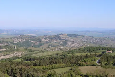
- Calanchi Clay Gullies Beside Cultivated Crestlines: Along the ascent toward Rocca di Radicofani and the Crete dell'Orcia, study the sharp grey-brown gullies slicing steep unplanted slopes. These easily eroded marine clay hills show precisely why Renaissance share-tenancy farms focused cultivation onto terraced crests while leaving fragile vertical banks to natural erosion.
- Montalcino's 1361 Pentagonal Fortress Integration: Walk around the base of Montalcino's Fortezza to examine the design by Sienese architects Mino Foresi and Domenico di Feo. Rather than clearing the hilltop flat, they folded an older keep, the San Giovanni tower, and an ancient church chapel directly into their five-angled outer stone curtain.
Explore rural Val d'Orcia outside peak mid-summer heat during spring grain growth or autumn olive and grape harvests. Base urban explorations just 33 kilometres north via our Siena travel guide or discover additional Tuscan and Italian heritage sites across the UNESCO World Heritage Atlas.