Northern Gallipoli: Gelibolu Town, Kömür Limanı and Diving in the Gulf of Saros
Beyond the 1915 battlefields: the self-cleaning turquoise diving coves of the Gulf of Saros, Kömür Limanı, and Ottoman maritime history in Gelibolu Town.
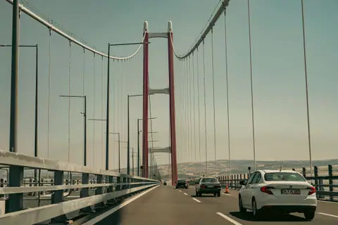
While the southern half of the Gallipoli Peninsula holds the solemn trenches, cemeteries and memorials of the 1915 Gallipoli Campaign, the northern half of the peninsula reveals a completely different landscape and historical era. Stretching forty kilometres north-east from Eceabat toward the European towers of the 1915 Çanakkale Suspension Bridge and bounded on its western flank by the open Aegean waters of the Gulf of Saros (Saros Körfezi), northern Gallipoli combines early Ottoman naval heritage with some of the clearest, cleanest swimming and scuba-diving coves in Turkey. Travellers driving to or from Istanbul, or spending an extra day across the strait from central Çanakkale via the GESTAŞ car and passenger ferries, can easily link the quiet pine-backed bays of Saros with a harbourside afternoon in historic Gelibolu Town.
Why the Gulf of Saros Has the Clearest Water in the Northern Aegean
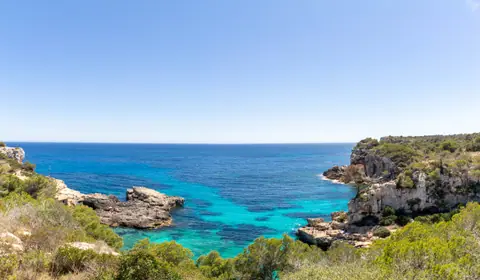
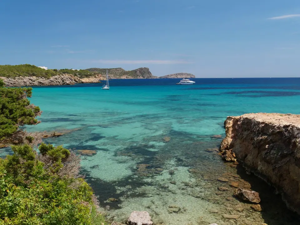
Forming a wide triangular inlet of the northern Aegean Sea between the Gallipoli Peninsula on the south and the Thracian mainland on the north, the Gulf of Saros is known among marine biologists and divers for water clarity that regularly exceeds twenty-five metres. Two geographical factors explain why this coastline remains so pristine compared with busier resort regions further south. First, the shores of the gulf have zero heavy industrial factories, large commercial ports or dense urban runoff draining into the basin. Second, the gulf is shaped around a deep underwater trough swept by three seasonal underwater eddy currents that circulate, flush and self-clean the entire bay three times every year.
Because cold, nutrient-rich deep currents well up along the submarine shelves, the rocky reefs support thriving colonies of red and yellow gorgonian sea fans, sponges, octopuses, groupers, bream and lobsters. Even if you do not scuba dive, bringing a simple mask and snorkel to the pebble coves along the northern Gallipoli shore lets you float above rocky drop-offs with remarkable underwater visibility. Because the northern Aegean breeze keeps summer humidity low, you should still pack a windproof layer and grippy water shoes as noted in our Çanakkale packing guide.
Kömür Limanı, Güneyli, Erikli and Suvla Bay Diving Coves
Reaching the best coves along the Saros shore requires a private car, as public minibuses serve only the inland villages along the main peninsula ridge. Turning north-west off the main Eceabat to Gelibolu highway takes you down winding rural roads through pine forests and sunflower fields to several distinct bays:
- Kömür Limanı (Charcoal Harbour, twelve kilometres off the main highway near Fındıklı village): Situated at the end of a winding descent through pine hills after passing Fındıklı, this remote pebble cove takes its name from the nineteenth-century boats that once loaded oak charcoal here for Istanbul. There are no high-rise hotels or permanent concrete resorts along the shore, only seasonal camping spaces and basic day facilities. Because a steep underwater rock wall drops straight down just a few strokes off the pebbles, Kömür Limanı functions as the premier scuba-diving training bay and snorkelling cove in the northern Aegean.
- Güneyli and Bolayır Coastline: Closer to the narrow neck of the peninsula north of Gelibolu, the village bay of Güneyli offers a long, shallow sandy shoreline backed by summer cottages where the calm morning water warms quickly in July and August.
- Suvla Bay (Büyük Kemikli Burnu) and Erikli: Further west toward the entrance of the gulf, wide sandy beaches curve around Suvla Bay and the northern shore at Erikli. For certified scuba divers travelling with local dive boats, the outer waters of Saros and Suvla provide access to both purposefully sunk artificial reef vessels, such as the former minelayer TCG Nusret / Lundy replica project, and protected historical wrecks from the 1915 naval campaign, including the battleship HMS Majestic off the southern tip and transport vessels resting on the sandy seabed.
Historic Gelibolu Town: Inner Harbour, Castle and Piri Reis Museum
Forty kilometres north-east of Eceabat along the Dardanelles shore sits the historic port town of Gelibolu, whose ancient Greek name, Kallipolis (Beautiful City), gave the entire Gallipoli Peninsula its English name. Long before the twentieth-century trenches were dug further south, Gelibolu held a pivotal place in medieval and early modern history: in 1354, following an earthquake that cracked the Byzantine walls, Ottoman forces under Süleyman Pasha captured Gelibolu, establishing the very first permanent Ottoman stronghold on the European continent and the main naval dockyard for the early empire.
The town was also the birthplace of the sixteenth-century Ottoman admiral, navigator and geographer Piri Reis (1470 to 1553). Walk down to the circular inner fishing harbour (İç Liman), where wooden fishing boats bob beside waterfront tea gardens and fish restaurants. Directly overlooking the harbour mouth stands the restored round keep of Gelibolu Castle, which houses the Piri Reis Museum. Inside, detailed cartographic exhibits display reproductions of Piri Reis's famous 1513 World Map, drawn on gazelle parchment and notable for depicting the newly explored coastlines of South America and western Africa, alongside charts from his Kitab-ı Bahriye (Book of Navigation), which mapped every bay, spring and anchorage across the Aegean and Mediterranean.
While strolling the streets around the inner harbour, stop at one of the traditional family canneries and provision shops that have operated in Gelibolu since the 1920s. Positioned right along the seasonal migration path where Black Sea and Marmara fish enter the Dardanelles, Gelibolu is famous across Turkey for artisanal tins of olive-oil-packed sardines, salted anchovies and bonito, which pair naturally with the regional specialities covered in our Çanakkale food and wine guide.
The 1621 Gelibolu Mevlevihane and Dardanelles Cliff Walk
From the inner harbour, follow the coastal road fifteen minutes north onto the breezy sea cliffs overlooking the widest northern reach of the Dardanelles Strait. Here, surrounded by cypress trees and stone courtyards, stands the Gelibolu Mevlevihane, founded in 1621 by Kara Mehmed Pasha. Of the dozens of Sufi dervish lodges established across the Ottoman Empire to follow the spiritual teachings of Mevlana Celaleddin Rumi, the Gelibolu Mevlevihane boasts the largest Semahane (octagonal ceremonial whirling hall) by floor area in the world.
Constructed of dressed stone and lofty timber arches with viewing galleries for musicians and guests, the hall looks straight out toward the blue water where the Sea of Marmara narrows into the strait. Walking the cliffside promenade between the Mevlevihane, the historic lighthouse and the tomb of the fifteenth-century mystic poet Yazıcızade Mehmed Efendi gives you sweeping views across to the Asian shore at Lapseki and the soaring red towers of the 1915 Çanakkale Bridge. From Gelibolu, drivers can either cross the suspension bridge directly to the Asian highway or take the regular vehicle ferry across to Lapseki to continue a wider three-day Çanakkale itinerary.
Traveller tips
Real advice from people who have been to Northern Gallipoli: Gelibolu Town, Kömür Limanı and Diving in the Gulf of Saros. Every tip is read by our team before it goes live.
No tips yet. Been here? Yours could be the first.
Thank you! Your tip will appear here after a quick review.
More in Canakkale
Continue exploring Canakkale with related neighbourhood, food, and planning guides