Grand Canyon
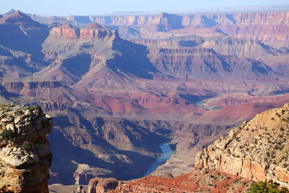
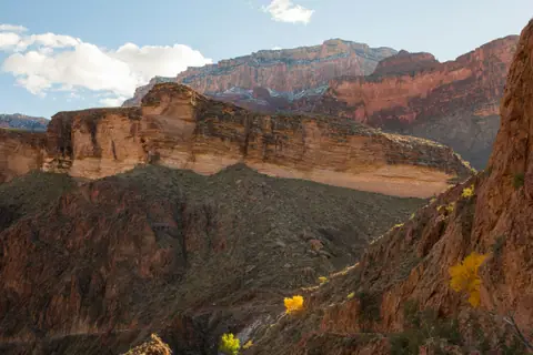
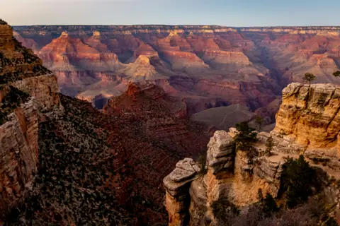
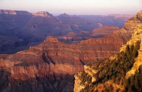
Earth's greatest geological chasm in northern Arizona (UNESCO), where the Colorado River has carved a 446-kilometre-long, 1,800-metre-deep canyon through two billion years of layered crimson and gold rock—viewed from the panoramic South Rim trails of Mather Point, Bright Angel, Desert View Watchtower and Hermit Road.
Quick decisions
How many days?
2 to 3 days at the South Rim: Mather Point, the paved Rim Trail, Yavapai Geology Museum, Grand Canyon Village and the car-free Hermit Road sunset overlooks on day one, hiking partway down the South Kaibab Trail (to Ooh Aah Point) and driving scenic Desert View Drive to the 1932 Watchtower on day two, plus a day trip to Horseshoe Bend and Antelope Canyon (Page) or Sedona on day three. Follow our multi-day route.
Where should I stay?
Inside the Park (Grand Canyon Village): wake up steps from the rim at El Tovar, Bright Angel Lodge or Maswik Lodge. Tusayan (10 mins south of the gate): modern hotels and IMAX theatre with a free summer park shuttle. Williams (1 hour south on I-40): historic Route 66 town at half the price. Compare bases in our accommodation guide.
Do I need a car?
Helpful to reach the park and drive Desert View Drive; not needed once at the South Rim Village. Free colour-coded National Park Shuttle Buses (Blue, Orange, Red and Purple routes) link the Visitor Center, lodges, trailheads and Hermit Road every 15 minutes.
Best for
Monumental canyon vistas: two billion years of exposed geological temples glowing crimson at sunrise and sunset. Bucket-list rim & inner-canyon hikes: flat Rim Trail, Ooh Aah Point and Bright Angel Trail. Dark-sky stargazing & architectural history: Mary Colter's 1905–1932 stone landmarks.
Before you go
Do not confuse the 'South Rim' (National Park) with 'Grand Canyon West' (Skywalk): 90% of visitors want the true 1,800m-deep National Park at the South Rim (4.5 hours from Las Vegas / 3.5 hours from Phoenix), and remember going down is optional—coming back up is mandatory! Read our practical briefing.
Getting around
From Phoenix (PHX), Las Vegas (LAS) or Flagstaff (FLG): approach via Williams (Highway 64 North) or Cameron (Highway 64 West along Desert View Drive). Details in arrival and transport.
Continue your trip
Exit via the East Gate to Page (Horseshoe Bend & Antelope Canyon) and Monument Valley, or head south through Flagstaff and red-rock Sedona.
Overview

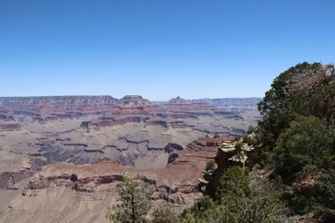
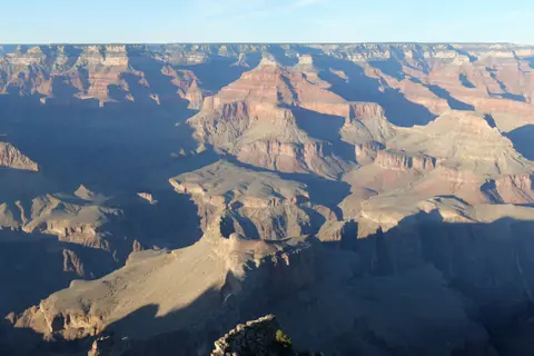
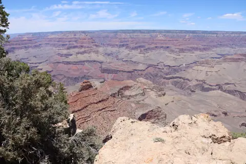
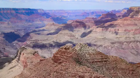
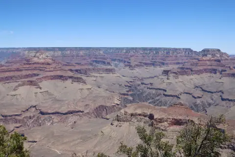
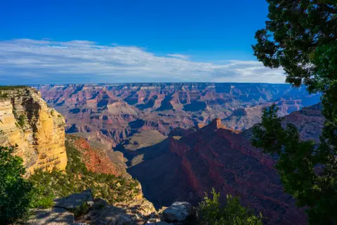
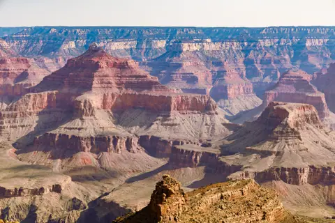
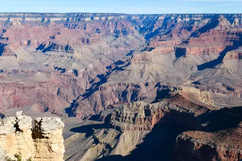
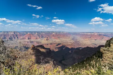
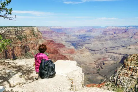
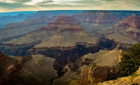
Nothing prepares your eyes or your sense of scale for the moment you walk from the flat ponderosa-pine forest of the Colorado Plateau to the edge of the Grand Canyon and the earth suddenly drops away for 1.6 kilometres (one vertical mile) beneath your feet. Winding for 446 kilometres (277 river miles) across northern Arizona and stretching up to 29 kilometres (18 miles) wide from rim to rim, this UNESCO World Heritage wonder was carved over the past five to six million years by the rushing Colorado River cutting down through nearly two billion years of uplift rock layers—from 270-million-year-old cream Kaibab Limestone at the rim down to 1.84-billion-year-old black Vishnu Schist in the Inner Gorge.
Ninety percent of visitors experience the park at the South Rim (2,134 metres / 7,000 feet elevation, open 365 days a year). Here, the car-free Rim Trail links dramatic Mather Point and Yavapai Geology Museum with historic Grand Canyon Village and Mary Colter's 1905 Hopi House. For hikers, the South Kaibab Trail to Ooh Aah Point and the shaded Bright Angel Trail descend below the rim, while the free Red Shuttle traces Hermit Road's nine sunset overlooks and Desert View Drive leads east to the 1932 Watchtower and Horseshoe Bend. Start with our before-you-go briefing and top things to do at the Grand Canyon.
Getting there
The South Rim of Grand Canyon National Park sits 130 kilometres (80 miles / 90 minutes) north-west of Flagstaff, Arizona; 370 kilometres (3.5 hours via I-17 and I-40) north of Phoenix Sky Harbor Airport (PHX); and 445 kilometres (4 hours 15 minutes via Hoover Dam, Kingman and Route 66) east of Las Vegas (LAS). Inside the South Rim, park your car once at the Visitor Center (or in Tusayan) and ride the 100% FREE National Park Shuttle Buses: the Orange Route (Kaibab/Rim), Blue Route (Village), Red Route (Hermit Road) and Purple Route (Tusayan). See getting to the Grand Canyon and how the free shuttle buses work.
Where to stay
To watch sunrise and stargaze right on the canyon edge without driving at night, book one of the historic lodges inside Grand Canyon Village (El Tovar, Bright Angel Lodge, Kachina/Thunderbird or Maswik Lodge via Xanterra, or Yavapai Lodge via Delaware North—reservations open 12–13 months ahead!). If park lodges are sold out, stay 10 minutes outside the South Entrance Gate in the town of Tusayan (connected by the free Purple Shuttle from spring to autumn), or save 50% by staying 60 minutes south in the nostalgic Route 66 town of Williams. Compare all options in where to stay at the Grand Canyon.
Things to do
Catch your first glimpse of the chasm at Mather Point and walk the paved Rim Trail to Yavapai Geology Museum, hike 30 minutes below the rim on the South Kaibab Trail to Ooh Aah Point and Cedar Ridge, walk down through the rock tunnels of the Bright Angel Trail, explore architect Mary Colter's stone buildings in Grand Canyon Village, hop the free Red Shuttle along Hermit Road to Hopi Point and Powell Point, drive 40 kilometres east along Desert View Drive to the 1932 Watchtower, soar over the Dragon Corridor on a Tusayan helicopter flight, and visit Horseshoe Bend and Antelope Canyon. Full list in things to do at the Grand Canyon.
Food and drink
Dining at the South Rim blends historic Southwestern lodge cuisine with trail-ready picnic stops: prime rib, elk medallions and Navajo tacos (frybread topped with chili, beans, cheddar and green chile) in the 1905 pine-log dining room of El Tovar, Arizona craft beers and burgers at Bright Angel Fountain and Yavapai Tavern, warm cinnamon rolls and hiker box-lunches at Maswik Food Court, and freshly baked cookies at Hermits Rest. Read more in our Grand Canyon dining and trail food guide.
Culture
For thousands of years, the Grand Canyon has been the sacred homeland and place of origin for eleven federally recognized Native American tribes—the Havasupai, Hualapai, Hopi, Navajo (Diné), Kaibab Band of Paiute, Zuni and Yavapai-Apache—honoured today at the Desert View Inter-Tribal Cultural Heritage Site.
Weather by month
Grand Canyon is warmest in July, with average highs around 29°C, and coldest in January, when nights drop to about -8°C. August is the wettest month, with rain on about 7 days. For mild weather with fewer rainy days, aim for May, September and October.
| Month | Low | Range | High | Rain | Rainy days |
|---|---|---|---|---|---|
| Jan | -8°C | 5°C | 34 mm | 5 d | |
| Feb | -6°C | 7°C | 36 mm | 5 d | |
| Mar | -4°C | 11°C | 32 mm | 4 d | |
| Apr | 0°C | 16°C | 18 mm | 3 d | |
| May | 4°C | 21°C | 14 mm | 2 d | |
| Jun | 8°C | 27°C | 8 mm | 1 d | |
| Jul | 12°C | 29°C | 46 mm | 7 d | |
| Aug | 12°C | 28°C | 52 mm | 7 d | |
| Sep | 8°C | 24°C | 32 mm | 4 d | |
| Oct | 2°C | 18°C | 26 mm | 3 d | |
| Nov | -4°C | 11°C | 24 mm | 3 d | |
| Dec | -7°C | 6°C | 32 mm | 5 d |
Averages of daily values from 2015 to 2024. Rainy days are days with at least 1 mm of rain. Source: Open-Meteo · Compare destinations by month.
Grand Canyon on the map
Every place we cover in Grand Canyon. Tap a category or pin to explore.
In-depth Grand Canyon guides
Browse the guides grouped by topic: sights, neighbourhoods, food, transport, day trips and trip planning.
Sights, Landmarks & Parks
Key monuments, viewpoints, museums and nature trails.
- Best Things to Do at the Grand CanyonSunrise over two-billion-year-old rock temples, below-the-rim ridge hikes, Mary Colter landmarks and helicopter flights.
- South Rim vs North Rim vs West Rim (Skywalk): Which Grand Canyon Rim Should You Visit?South Rim vs North Rim vs West Rim: avoiding the #1 visitor mistake and choosing the right rim for your trip.
- Walking the South Rim Trail: Mather Point, Yavapai Geology Museum and Trail of TimeWalking the flat, paved Rim Trail along the South Rim from Mather Point past the 1928 Yavapai Geology Museum and the Trail of Time to Grand Canyon Village.
- The #1 Short Below-the-Rim Hike: South Kaibab Trail to Ooh Aah Point & Cedar RidgeDescending 30 minutes below the rim on the exposed ridgeline of the South Kaibab Trail to stand at 'Ooh Aah Point' and Cedar Ridge.
- Hiking the Bright Angel Trail: Rock Tunnels, 1,000-Year-Old Pictographs & Safety RulesStepping off the Village rim onto the historic Bright Angel Trail—through two hand-carved rock tunnels and beneath 1,000-year-old pictographs.
- Hermit Road (The West Rim Drive): Riding the Free Red Shuttle to Hopi Point & Hermits RestHopping on and off the free Red Shuttle along 11 kilometres of car-free western rim cliffs—from Hopi Point to Mary Colter's 1914 Hermits Rest.
- Driving Desert View Drive (East Rim, Highway 64): Grandview, Moran, Lipan & 1932 WatchtowerDriving 40 kilometres east along the rim—open to personal cars year-round—to Lipan Point and Mary Colter's 70-foot 1932 Watchtower.
- Sunrise, Sunset & Stargazing Guide: Best Photo Viewpoints in an International Dark Sky ParkChoosing the exact east- or west-facing rock point for sunrise alpenglow, golden-hour shadows and Milky Way stargazing.

Neighbourhoods & Where to Stay
Districts, historic quarters and the best bases for your stay.
- South Rim Guide: Viewpoints from Hermits Rest to Desert ViewThe whole South Rim from west to east, in the order we'd see it.
- Historic Grand Canyon Village: 1905 El Tovar Hotel, Mary Colter's Hopi House & Kolb StudioWalking the flat 1.2km historic district of Grand Canyon Village—home to 1905 El Tovar and four masterpieces by pioneer architect Mary Colter.
- Where to Stay at the Grand Canyon: Inside-the-Park Village Lodges vs Tusayan & WilliamsComparing sleeping steps from the canyon edge in Grand Canyon Village versus modern hotels 10 minutes away in Tusayan or budget Williams.
Food & Drink
Local dishes, markets, cafés and dining districts.
Getting Around & Arrival
Airport transfers, public transit, passes and driving rules.
- Getting to the Grand Canyon South Rim from Las Vegas (4.2h), Phoenix (3.5h) & FlagstaffComparing the drive from Las Vegas (via Hoover Dam and Route 66) versus Phoenix (via Sedona) to the South Rim.
- Getting Around the South Rim: The 4 Free Colour-Coded Shuttle Bus Routes & ParkingHow to park your car once at the Visitor Center and use the 4 colour-coded FREE shuttle bus lines to reach every trailhead and sunset overlook.

Day Trips & Excursions
Easy half-day and full-day trips from the city.
- Grand Canyon Day Trips: Horseshoe Bend, Antelope Canyon and MoreFive trips from the South Rim, and which ones earn the drive.
- Bucket-List Adventures: South Rim Helicopter Flights, Smooth-Water Rafting & Mule RidesFlying out over the 1,500-metre drop of the Dragon Corridor by helicopter, floating through Horseshoe Bend on a raft, or riding a mule.
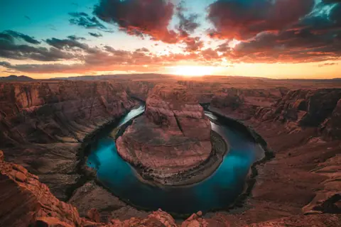
- 2 Hours East of the South Rim: Horseshoe Bend, Antelope Slot Canyon & Lake Powell (Page, AZ)Exiting the East Gate of the Grand Canyon to drive two hours to iconic Horseshoe Bend and the glowing sandstone waves of Antelope Canyon.
- Gateway Towns: Route 66 Williams, the 1901 Grand Canyon Railway, Flagstaff & Red-Rock SedonaRiding the 1901 vintage train from Route 66 Williams to the South Rim—and driving through Oak Creek Canyon to red-rock Sedona.
Trip Planning & Itineraries
When to visit, what to pack and day-by-day routes.
- Grand Canyon: What to Know Before You GoUnderstanding the difference between the South Rim and West Rim, high-altitude rim weather versus inner-canyon heat, and shuttles.
- Grand Canyon Hiking Guide: Trails, Heat and PermitsWhich trail, how far down and the rules that keep hikers alive.
- Grand Canyon 2-Day ItineraryTwo sunsets, one sunrise and a hike, without rushing.
- Best Time to Visit the Grand Canyon: Spring & Fall Hiking Weather, Summer Monsoons & Winter SnowWhy April/May and September/October are the golden months for hiking below the rim without 40°C inner-canyon heat or summer crowds.
- What to Wear at the Grand Canyon: 7,000-Foot Sunrise Layers, Grippy Trail Shoes & Sun GearWhy sunrise at Mather Point feels like winter even in June—and why smooth-soled sneakers slip on the South Kaibab Trail.
- 2 to 3 Days at the Grand Canyon: South Rim, Ooh Aah Point, Hermit Road, Watchtower & PageA step-by-step 2-to-3-day plan covering the South Rim viewpoints, Ooh Aah Point, Hermit Road, Desert View Watchtower and Page.
Need your embassy or consulate in United States? See embassies and consulates in United States.
Reviews
Log in to write a review.
No reviews yet.