Photo: LetiziaConversano · CC BY-SA 4.0
Padua Orientation and History: Canals, Scholars and Frescoes
How river channels, the 1222 university, Venetian rule and two UNESCO World Heritage listings built modern Padua.
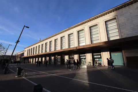
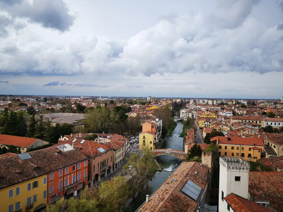
Standing forty kilometres west of Venice on the flat Veneto plain, Padua (Padova) often surprises arrivals expecting a sleepy commuter suburb. Behind the tram tracks outside the railway station sits a dense historic core of roughly 208,202 municipal residents inside 93.03 square kilometres. The wider province holds around 934,540 inhabitants. Walk ten minutes south and stone arcades replace modern blocks, opening into connected market squares and two UNESCO World Heritage treasures.
Because the historic district sits barely twelve metres above sea level, walking between landmarks never feels steep or exhausting. Travellers arriving from Verona (82 kilometres west) or Vicenza (around 30 kilometres away) find a calm civic tempo shaped by lecture bells and morning produce crates. Knowing how rivers, university scholars and four centuries of Venetian rule layered these streets explains why nearly every block hides an older monument.
Bacchiglione Curves and the Brenta Moat
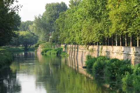
Waterways govern the street plan around central Padua even where asphalt roads hide former quays. Loops of the slow-moving Bacchiglione curve cleanly around the western and southern edge. Eastward, the Canal Piovego joins those inner channels to the Brenta river and the Venetian lagoon. Before locomotives arrived in the nineteenth century, students, silk merchants and timber barges glided right up to city gates on flat-bottomed boats.
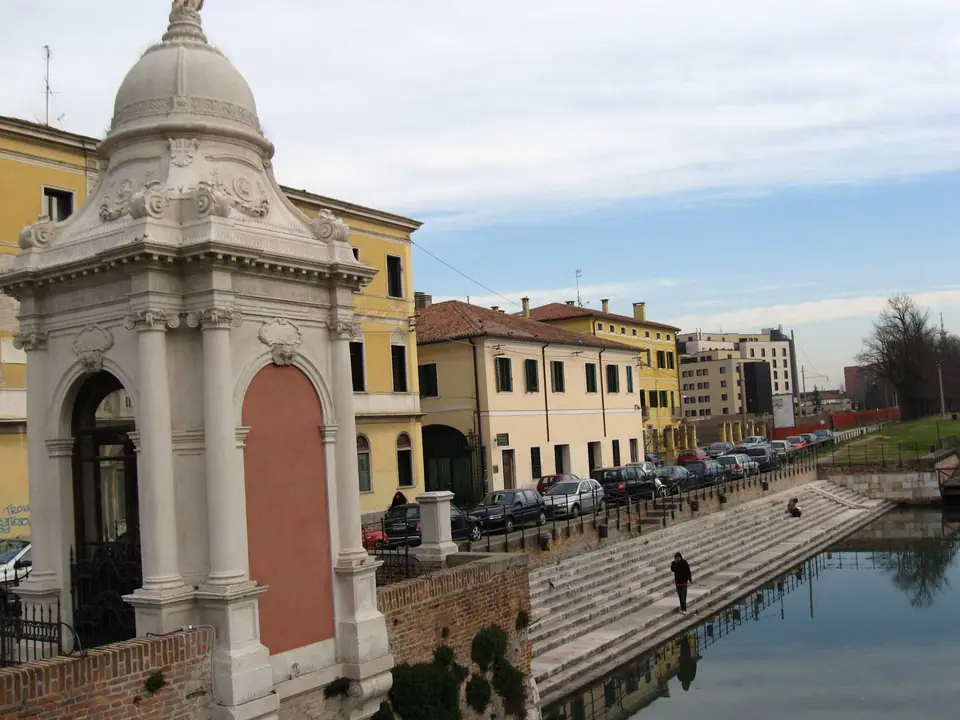
Sixteenth-century Venetian engineers wrapped those channels behind monumental brick Renaissance ramparts known as the Mura rinascimentali. Several gateways still anchor edge neighbourhoods today. Porta Portello (formerly called Porta Ognissanti) stands beside white Istrian stone stairs dropping straight into the Piovego canal, while Porta San Giovanni guards the western approach. Following green canal embankments guides walkers straight into the central monument loop away from traffic.
Antenor, Patavium and Early Civic Pride
Roman poets Virgil and Livy traced city origins to the Trojan prince Antenor. Excavations actually confirm settled villages stretching back to the eleventh and tenth centuries BC. When workers unearthed a large stone sarcophagus in 1274 holding remains dated between the fourth and third centuries BC, medieval citizens claimed it proudly as Antenor's tomb. Roman Patavium grew wealthy on wool and horse breeding before the Lombard sack of 601 triggered a long medieval recovery.
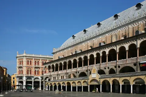
Independent civic magistrates raised the vast Palazzo della Ragione between 1172 and 1219 between twin market squares. Early in the fourteenth century, Fra Giovanni degli Eremitani merged three upper chambers under an 81.5-by-27-metre timber roof curved like an inverted ship's hull. Beneath those upstairs law halls, food traders have run ground-floor stalls for over eight hundred years. Soon after, Florentine master Giotto frescoed the Scrovegni Chapel from 1303 to 1305 before da Carrara lords ruled with brief pauses from 1318 until 1405.
Scholars from Bologna and Palazzo Bo
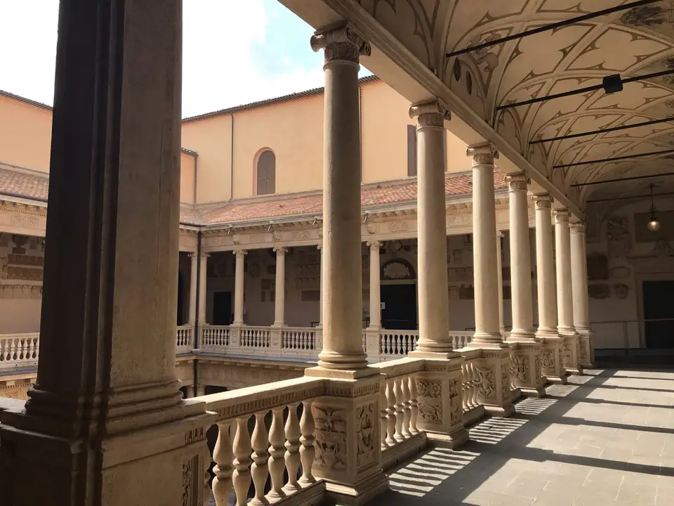
Padua's scholarly reputation took flight in 1222 when students and lecturers left Bologna in search of wider academic freedom. That migration founded Italy's second-oldest university, drawing physicians, jurists and astronomers from across Europe. In 1539 the institution settled permanently inside the former Hospitium Bovis inn, known today as Palazzo Bo. Thousands of painted and carved student coats of arms line its double stone colonnades.
Two milestones inside Palazzo Bo reshaped scientific teaching cleanly. Girolamo Fabrici d'Acquapendente built the world's first permanent carved walnut Anatomical Theatre in 1594 and 1595 so spectators could observe dissections closely. Nearby, Galileo Galilei taught mathematics from a humble wooden podium between 1592 and 1610, the year he turned his telescope onto Jupiter's moons in Padua. Later, in 1678, Paduan scholar Elena Cornaro Piscopia earned the world's first doctorate granted to a woman.
Venetian Rule, the Botanical Garden and Ghetto
Venice absorbed Padua in 1405 and governed the city for 392 years until the Republic fell in 1797. Rather than stifling civic ambition, Venetian funds backed enduring public spaces still defining central walks. In June 1545 the Venetian Senate created Orto Botanico di Padova. Today UNESCO protects it under Reference 824 as the world's oldest academic botanical garden remaining on its original ground.
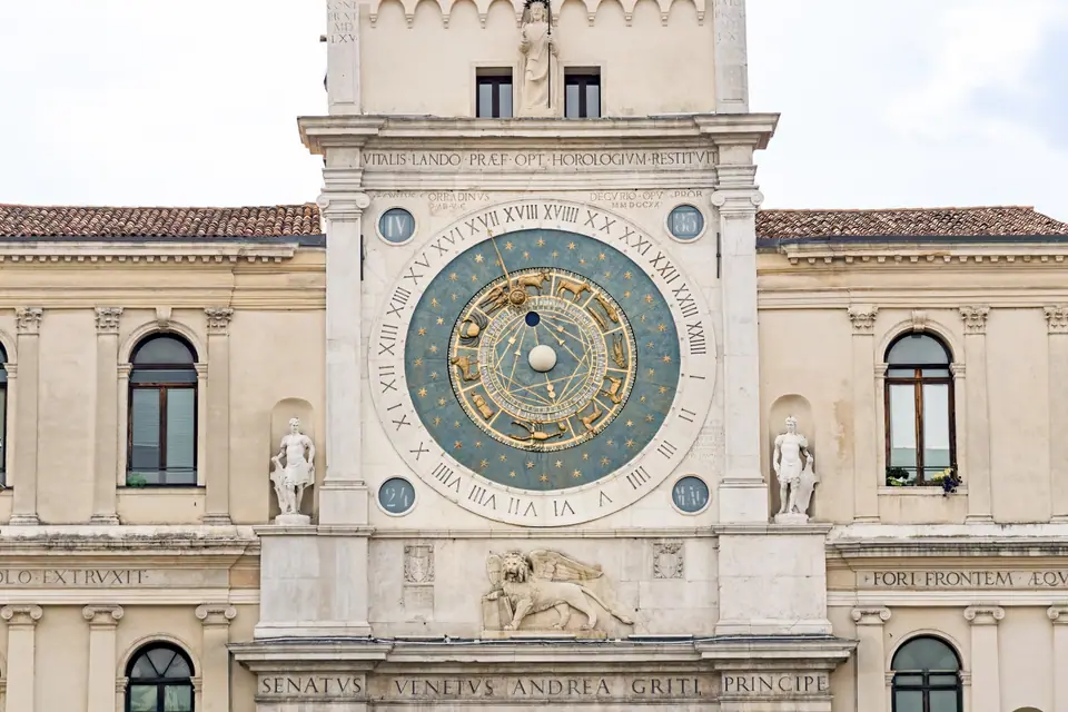
Venetian authorities shaped other historic blocks still visible today. In 1603 rulers walled off the narrow cobbled alleys of the Jewish Ghetto directly south of Piazza delle Erbe. On nearby Piazza dei Signori, an astronomical dial inaugurated on 13 June 1437 from Jacopo Dondi's 1344 design rotates with eleven Ptolemaic zodiac signs, omitting Libra across merged Scorpio scales. Much later, in 1775, superintendent Andrea Memmo drained soggy fairgrounds to build Prato della Valle, before Giuseppe Jappelli opened Caffè Pedrocchi in 1831 shortly ahead of the student clashes of 8 February 1848.
Modern Transit Works and Daily Visitor Rules
A second UNESCO triumph arrived in 2021 when eight fourteenth-century fresco monuments gained joint inscription under Reference 1623 as Padova Urbs Picta. Today, street life blends covered medieval portici with student bicycle lanes and major tram expansion works reaching outer quarters. Picking central postcodes keeps nearly every major hall within an easy walk without complex transit.
Everyday visitor practicals follow uniform Italian national standards across every stay. Italy uses the euro, supplies electricity at 230 volts and 50 hertz via Type L, Type F and Type C wall outlets, and answers emergencies on 112. Non-EU visitors under Schengen allowances receive up to 90 days within any 180-day window on passports issued under ten years ago and valid at least three months beyond exit. Carrying photo identification stays legally required. Historic lanes enforce camera-monitored ZTL Zone A and 24-hour Zone B traffic bans, while central fountains offer free potable tap water and Busitalia trams take contactless bank cards.
Where it is
- 1Padua
- Treviso Airport (TSF) · about 37 km from Padua in a straight line
- Directions in Google Maps
Stations and taxi ranks: OpenStreetMap. Airports: OurAirports. Distances are in a straight line.
Traveller tips
Real advice from people who have been to Padua. Every tip is read by our team before it goes live.
No tips yet. Been here? Yours could be the first.
Thank you! Your tip will appear here after a quick review.
More in Padua
Continue exploring Padua with related neighbourhood, food, and planning guides