


























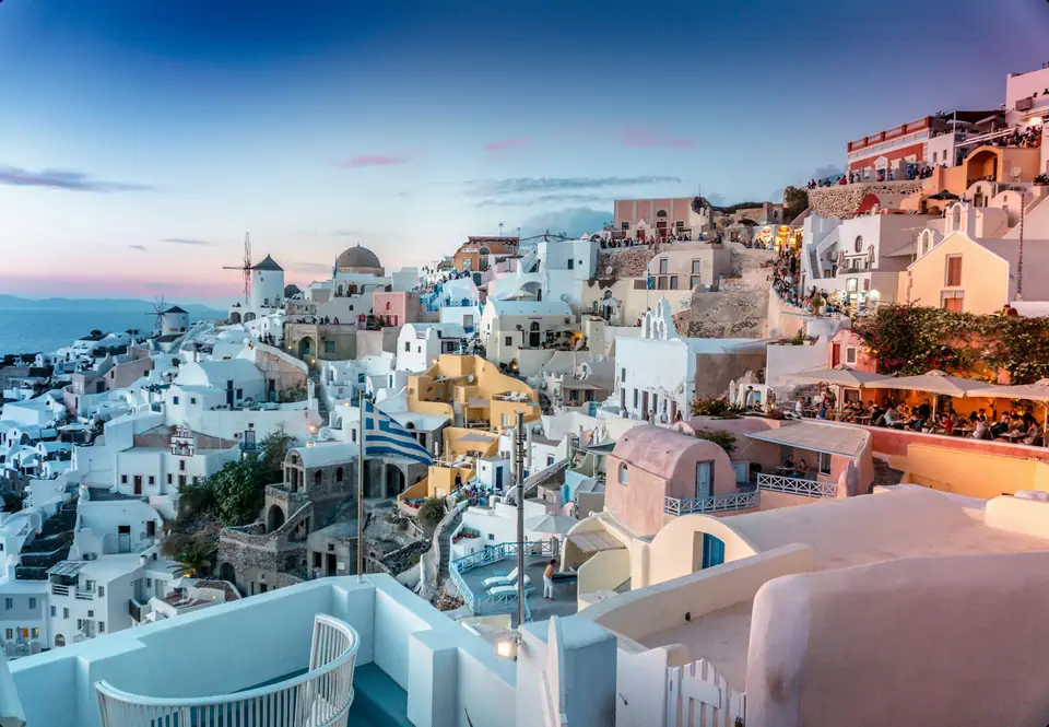
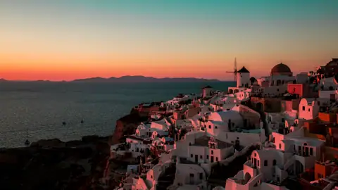
Photo by Pretty Pink on Unsplash
Santorini: Island Layout, 2025/2026 Rules & Tips
How Santorini's crescent geography works, what changed after the 2025 seismic swarm, and how to plan around cruise-ship hours and cliff steps.
Santorini (officially Thira, THEE-rah) covers only 76 square kilometres. It measures barely 18 kilometres from its northern tip at Oia to its southern lighthouse at Akrotiri. You can drive from one end to the other in forty minutes. What makes the island feel challenging on a first visit is its extreme crescent geometry. Almost every visitor tries to squeeze onto the narrow western caldera cliff rim at the exact same hour between late morning and sunset. Understand how the island's four geographical zones fit together and time your days in reverse of the day-tripper crowds. Doing so makes Santorini feel calm and deeply rewarding.
How Santorini's 4 Geographical Zones Fit Together
The island is shaped like a backwards letter C wrapping around the flooded volcanic lagoon of the caldera.
- The Western Caldera Rim (847 00 & 847 02) / The Flat East Coast Beaches (847 00). The western inner edge of the crescent drops 200 to 300 metres straight into the Aegean Sea. Along the central rim sit contiguous Fira (fee-RAH, the capital and bus hub), Firostefani, and Imerovigli (ee-meh-roh-VEE-glee). A scenic 10-kilometre clifftop footpath links all three north to Oia (EE-ah, postcode 847 02). Directly opposite on the outer eastern shore, the volcanic slope flattens into long, step-free promenades of black volcanic sand. Those beach resorts centre on Kamari and Perissa and Perivolos (see our Santorini beaches guide).
- The Inland Wine Villages / The Southern Akrotiri Peninsula. In the centre of the island rise traditional whitewashed hillside villages crowned by medieval Venetian fortifications (kastra). Surrounded by ancient basket-trained vineyards, the best preserved are Pyrgos, Megalochori, Exo Gonia, and Emporio. Curving west at the southern tip is the Akrotiri peninsula, home to the 1600 BCE Bronze Age excavation, Red Beach, and the 1892 lighthouse.
- Thirassia & the Kameni Volcanic Islets. Across the water on the western side of the lagoon sits rural Thirassia (thee-rah-SYAH), which broke away from Thera during the Minoan eruption. In the centre of the flooded crater rise the dark lava domes of Palea Kameni and Nea Kameni, visited daily by excursion boats.
What Changed After the 2025 Earthquakes (2026 to 2027 Safety Rules)
In February 2025, an intense submarine seismic swarm occurred in the Anydros basin between Santorini and Amorgos. It triggered localised cliff rockfalls before subsiding completely by spring. While hotels, wineries, ferries, and the airport operate normally, Greek civil protection authorities renewed targeted rockfall-safety restrictions across specific coastal zones through 31 March 2027.
- Red Beach (Kokkini Paralia) Land Access Closed. Unstable overhanging volcanic cliffs suffered rockslides in early 2025. Walking down the land path to Red Beach is strictly prohibited, so view it safely from the upper lookout or from a boat on the water.
- Ammoudi Bay Vehicle Restrictions & Footpath Closure. Private rental cars are restricted on the steep road descending from Oia to Ammoudi Bay. Only licensed taxis, restaurant transfers, and delivery vehicles may pass. In addition, the coastal rock-ledge path from Ammoudi tavernas out to the Agios Nikolaos swimming rock is closed by safety barriers.
- Fira Old Port (Gialos) & Athinios Ferry Port Controls. A demarcated cliff-base buffer zone inside Fira's Old Port remains cordoned off, though the Fira Cable Car and the 588 Karavolades stairs operate normally. At Athinios Ferry Port, traffic marshals enforce strict vehicle entry windows to prevent bottlenecks on the switchback cliff road.
Advance Bookings, the Climate Resilience Fee & Daily Practicalities
Planning ahead for tickets, local taxes, and cliffside luggage saves both money and energy.
- What to Book Ahead (Caldera Rooms, Akrotiri & Catamarans) / Walk-Up Sightseeing. For travel between May and October, book your caldera accommodation and sunset dinner tables in Oia several months ahead. Reserve your caldera catamaran cruise and winery tasting slots three to seven days in advance. For the Bronze Age site of Akrotiri and the Museum of Prehistoric Thera, buy official state e-tickets at hhticket.gr (or odysseus.culture.gr). Beginning in July 2025, Greece introduced a per-passenger cruise disembarkation levy at Santorini to help cap daily tender numbers at roughly 8,000 cruise visitors.
- Government Climate Crisis Resilience Fee & Payment Habits. All Greek hotels, cave suites, and short-term rentals collect a mandatory per-room, per-night Climate Crisis Resilience Fee at check-in. The fee is graduated by property category and is much lower from November to March than from April to October. Contactless Visa and Mastercard are accepted by law in every taverna, hotel, and shop. Still, carry 5-, 10-, and 20-euro banknotes to pay the conductor on board KTEL buses (see our transport guide).
Finally, note five everyday island realities before you arrive. First, Santorini has no natural freshwater rivers, so tap water comes from desalination plants and tastes slightly salty. It is fine for brushing teeth and showering, but everyone buys bottled water for drinking. Never flush toilet paper down Greek plumbing; always use the small lidded bin beside the toilet instead. Second, traditional caldera hotels sit down dozens of steep volcanic steps where cars cannot reach. Always message your hotel ahead with your flight or ferry number so their luggage porter can meet you at the nearest road drop-off point. Third, electrical sockets use standard European two-round-pin Type C and Type F plugs at 230V, and the European emergency number is 112. Fourth, restaurants along the caldera rim charge a steep premium for the sunset view. Family tavernas ten minutes inland in Pyrgos, Megalochori, or Exo Gonia serve far better fava, white aubergine, and tomato fritters at half the price. Fifth, pharmacies (marked by a green cross) are concentrated in Fira, Kamari, Messaria, and Oia, while the modern General Hospital of Thira sits in Karterados just south of Fira. Pack rubber-soled footwear from our what to wear guide and follow our 3-day Santorini itinerary to beat the midday crush. Keeping twenty euros in small notes and two-euro coins in your pocket makes boarding KTEL village buses and paying cliffside water-taxis effortless.
Where it is
- 1Santorini
- Santorini International Airport (JTR) · about 2 km from Santorini in a straight line
- Heraklion International Nikos Kazantzakis Airport (HER) · about 120 km from Santorini in a straight line
- Directions in Google Maps
Stations and taxi ranks: OpenStreetMap. Airports: OurAirports. Distances are in a straight line.
Traveller tips
Real advice from people who have been to Santorini. Every tip is read by our team before it goes live.
No tips yet. Been here? Yours could be the first.
Thank you! Your tip will appear here after a quick review.
More in Santorini
Continue exploring Santorini with related neighbourhood, food, and planning guides
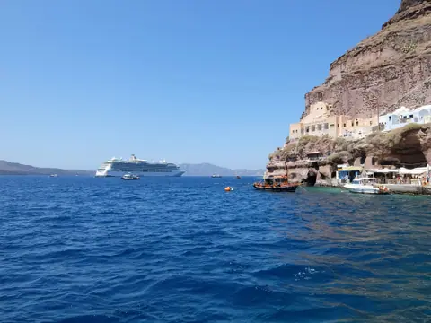
How to Get to Santorini: Airport (JTR), Athinios Port & KTEL Buses
Santorini, Greece
Best Time to Visit Santorini: Weather, Meltemi Winds & Crowds
Santorini, Greece
What to Wear in Santorini: Cliff Steps, Wind, Hot Black Sand & List
Santorini, Greece
Oia Sunset Guide: Best Viewpoints, Timing, Buses & Calm Alternatives
Santorini, Greece
