Quick Field Data
- UNESCO Inscription: 1997 · Criteria (ii) and (iii) · Ref. 794
- Scale & Footprint: 75 hectares perched on a 571-metre hillside plateau bordered east by the Kef Dougga cliff and encircled by a 200-metre protected buffer zone
- Access & Ticketing: Managed as a national archaeological park by Tunisia's Institut national du patrimoine with single-gate admission near the upper theatre entrance
- Arrival Logistics: Located 4.6 kilometres south-southwest of Téboursouk in northwestern Tunisia, 102 kilometres from Tunis Carthage International Airport (TUN) and 96 kilometres west of Tunis
Numidian Hilltop Origins, Dolmen Burials and the Temple of Masinissa
Rising on a defensible limestone spur at 571 metres above the fertile Oued Khalled valley, Dougga (ancient Thugga, recorded in Libyco-Berber script as TBGG) preserved its ancient monuments largely because modern urbanisation never engulfed the hilltop, unlike coastal Carthage. Bordered on the east by the escarpment of Kef Dougga and overlooking the line of the Fossa Regia ditch marking Rome's early territorial border after Carthage fell, the town originated as a natural stronghold. Linguistic scholars trace the Phoenician name tbgg (meaning on the roof terrace) to a Berber root tbg meaning to protect, echoing the plateau's commanding perimeter drop.
Founded around the sixth century BC, the town may correspond to Tocae, captured by a lieutenant of Agathocles of Syracuse late in the fourth century BC. Diodorus of Sicily described it as a settlement of beautiful grandeur. Pre-Roman remains demonstrate that Thugga functioned as a major Numidian royal and urban centre for more than six centuries before Roman annexation, probably serving as the first capital of the Numidian kingdom. Beneath and around the later classical centre stand the oldest structures: a prehistoric dolmen necropolis, a sanctuary dedicated to Ba'al Hammon and neo-Punic steles. Nearby sit a Libyco-Punic tower mausoleum inside an urban necropolis rather than an isolated roadside monument, second-century BC building traces near the central square and the foundations of a temple dedicated to Numidian King Masinissa.
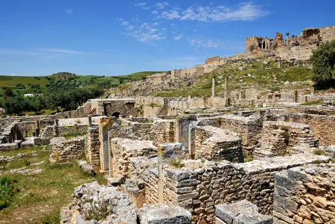
Excavating the 14-by-6.3-metre Temple of Masinissa directly beneath the Roman forum, erected in 139 BC during the tenth year of King Micipsa's reign, joined faint Numidian residential footings under the Temple of Liber. Together, these finds overturned early archaeologist Louis Poinssot's assumption that Numidian and Roman Dougga occupied separate hilltops. In reality, Roman civic monuments rose straight over the pre-existing Numidian agora and residential terraces. Targeted digs have similarly disproved older claims about the so-called Numidian walls, revealing that perimeter ramparts date to late-antique defensive works while incorporating two earlier Numidian funerary monuments reused inside the wall footings. Over 2,000 inscriptions in Libyan, Punic, bilingual, Greek and Latin have proven indispensable for deciphering ancient Libyan script. As noted by Gabriel Camps, they also document sustained Punic cultural traditions well into imperial times, including local Berber administrative councils functioning with dual Punic-style sufetes.
Dual Governance, Municipium Liberum and Hill-Adapted Roman Urbanism
After Rome annexed Numidia and Emperor Augustus established the Roman colony of Carthage, Dougga entered an unusual institutional arrangement lasting more than two centuries. Included within Carthage's wider rural territory (pertica), the existing indigenous town became a native civitas governed by its own council of decurions (documented from the late first century AD) and Punic-style sufetes. On one occasion three magistrates served simultaneously, an extraordinary rarity in the Mediterranean. Meanwhile, a distinct settlement (pagus) of Roman citizens subordinated legally to distant Carthage took root directly on the same hilltop without any physical dividing wall between them. Gradually, leading indigenous residents (peregrini) adopted Roman civic habits and received citizenship until the two councils began issuing unified civic decrees. Under Emperor Marcus Aurelius, the indigenous community won Roman law rights granting automatic citizenship to retiring magistrates while the pagus secured authority to accept bequests and manage public funds independently of Carthage.
In AD 205 under Emperor Septimius Severus, the two coexisting bodies formally merged into a single city named Municipium Septimium Aurelium Liberum Thugga (honouring Septimius Severus and Caracalla as joint refounders while reducing Carthage's rural territory). Historians have devoted intense debate to the meaning of liberum. Early scholars Merlin and Poinssot linked the epithet to the god Liber, whose temple stood at Dougga. Yet Thibursicum Bure, Aulodes and Thysdrus carried similar titles without matching deities, pointing instead to civic liberty (libertas). Inscriptions echo that theme, praising Emperor Alexander Severus as preserver of liberty and Emperor Probus as preserver of liberty and dignity. While Toutain wondered about formal exemption from provincial gubernatorial control, Paul Veyne and Jacques Gascou read liberum as ceremonial civic pride at shedding subjugation. Claude Lepelley linked liberty to preserving Carthage's prized fiscal tax immunity (immunitas perticae Carthaginiensium), earlier defended under Trajan and later appealed under Gallienus by prominent citizen Aulus Vitellius Felix Honoratus. Michel Christol expanded this view, arguing that liberation also reassured anxious Roman citizens inside the pagus, who had earlier hailed Commodus as protector of the community. It also prepared Dougga's elevation in AD 261 under Gallienus to full colonial rank as Colonia Licinia Septimia Aurelia Alexandriana Thuggensis.
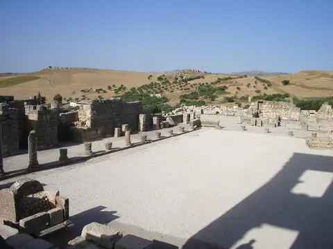
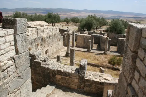
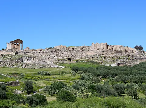
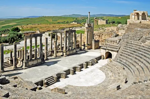
Wealthy local aristocratic families channelled huge private donations (euergetism, at times reaching extraordinary municipal scales) into monuments across the second and third centuries AD, while appealing successfully to emperors in Rome to safeguard city interests. Builders abandoned the flat rectilinear grid seen at Timgad, draping monumental complexes across steep contours to form what archaeologist Hédi Slim described as a compact terraced mass clinging to the hillside. Crowning the summit stand the Forum, the Temple of the Capitol, the Rose of the Winds plaza and market hall. Winding paved streets descend past the hilltop Roman Theatre, circus grounds, public baths, Temple of Juno Caelestis, Temple of Saturn, Temple of Liber and Temple of Caracalla's Victory in Germany. Lower slopes contain the underground vaulted Baths of the Cyclopes and multi-level private townhouses such as the downhill Trifolium Villa, originally uncovered as early trenches expanded outward from public plazas to reveal domestic architecture.
Byzantine Fortifications, Aghlabid Traces and Twentieth-Century Digs
Monumental building continued from Emperor Diocletian into the reign of Theodosius I, before urban prosperity waned from the fourth century onward, leaving comparatively sparse Christian church remains. Under Byzantine rule, military engineers converted the central forum plateau into a compact citadel, dismantling surrounding public temples to supply dressed stone blocks for defensive bastions. Dougga was never wholly deserted following Islamic conquests, as a modest rural village occupied the ruins for centuries. Populated by descendants of the earlier town's residents, villagers worshipped in a small mosque inserted inside the Temple of August Piety and used an Aghlabid-era bathhouse built along the southern flank of the forum.
European travellers sketched the Libyco-Punic mausoleum and standing temple porticos from the seventeenth through early nineteenth centuries, preparing detailed architectural drawings of the best-preserved ruins. Following establishment of the French protectorate in 1881, Tunisia's national antiquities institute (Institut national du patrimoine) launched sustained excavations in 1901 parallel to digs at Carthage, clearing the forum zone steadily until 1939. Restorers re-erected fallen masonry at the Capitoline Temple (whose front portico and lower cella walls had survived) and rebuilt the Libyco-Punic Mausoleum between 1908 and 1910, drawing ongoing scholarly debate over early restoration limits even as later conservation adhered strictly to the 1964 Venice Charter.
After Tunisian independence, authorities excavated further sanctuaries including the Temple of Caracalla's Victory in Germany and relocated the remaining villagers to the modern plain settlement of New Dougga several kilometres away. Tunisia declared the ruins a national archaeological park in 1991 with scientific projects documenting inscriptions and temples. Legal safeguards combine Tunisia's Heritage Code (Law 35-1994 of 24 February 1994) with agricultural protection laws (Law 83-87 of 11 November 1983 and amendments of 1990 and 1996). The Protection and Enhancement Plan (PPMV) further governs a 200-metre outer zone. Dougga remains unusually calm compared with coastal ruins, welcoming roughly 50,000 annual visitors across quiet olive-lined slopes while heritage planners consider adding an on-site museum. In Berber usage the plateau remains Dugga or Tugga, transcribed into French as Dougga and derived from Arabic Duqqah. This name preserves an uninterrupted link between Numidian hill geometry and Tunisian countryside life across 17 centuries of documented occupation.
Complex Access Zones and Excavated Sectors at Dougga
Stepped pathways link the upper plateau monuments down through hillside sanctuaries and residential terraces to the lower valley necropolis, rewarding a top-to-bottom walking route across the 75-hectare hillside. Visitors exploring the countryside plateau should carry water, sun protection and sturdy footwear suited to uneven Roman flagstones and steep terraced lanes.
| Complex Zone | Key Highlights | Access & Ticket Rule |
|---|---|---|
| Upper Theatre & Northern Sanctuaries | Hillside Roman theatre facing the valley, Temple of Saturn overlooking the cliff edge and prehistoric dolmen burial sector | Main gate ticket booth sits immediately beside the upper theatre terraces; paved paths open during daylight park hours |
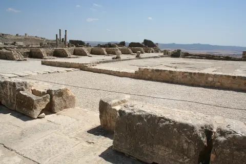
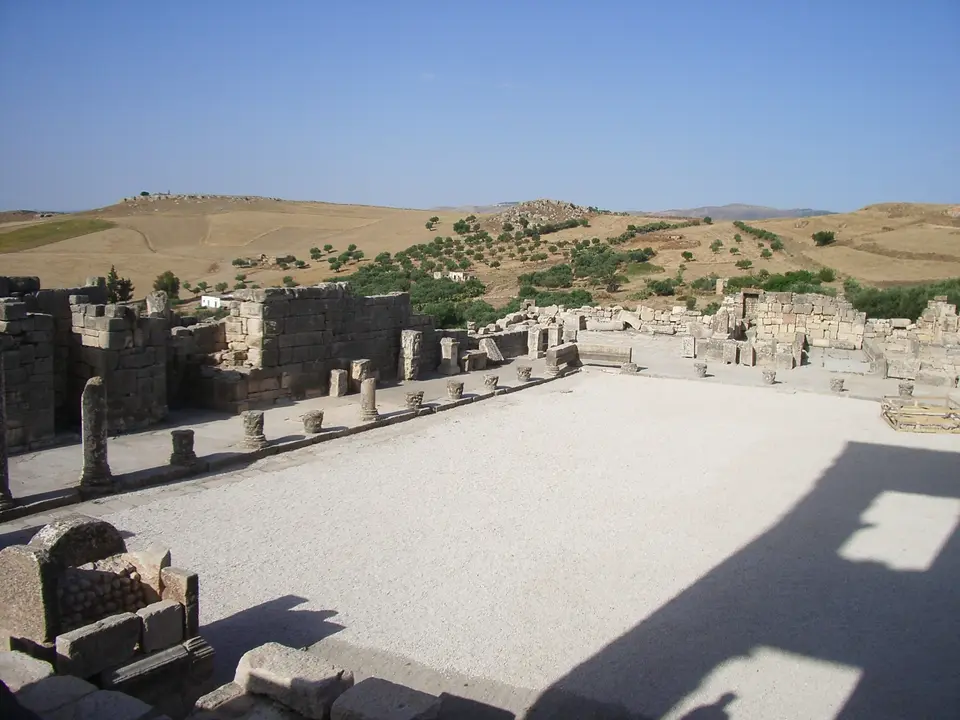
| Forum, Capitol & Byzantine Citadel | Capitoline Temple portico, Rose of the Winds square, Temple of Masinissa foundations, market complex and Byzantine fort walls | Central summit precinct connected directly by Roman flagstone lanes; low stone curbs preserve excavated temple basements |
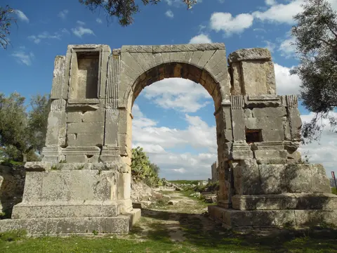
| Lower Residential Slope & Baths | Trifolium Villa peristyle courtyard, vaulted subterranean Baths of the Cyclopes, Temple of Juno Caelestis and triumphal arch | Steep downhill stone tracks requiring sturdy footwear; unshaded hillside terraces remain exposed to midday sun |
| Libyco-Punic Mausoleum Precinct | Three-tier Numidian tower tomb reconstructed 1908 to 1910 inside the southern urban necropolis edge | Reached on foot via the lower paved slope track south of the residential villas under the same site admission ticket |
Three Epigraphic and Architectural Details to Check at Dougga
Walking closely among Dougga's flagstones reveals physical evidence of how Berber, Punic and Roman builders worked on one rugged hill:
- Masinissa Temple Footings Beneath the Forum Pavement: Look carefully along the excavated edge of the central forum terrace to distinguish the 14-by-6.3-metre (46-by-21-foot) pre-Roman masonry belonging to the 139 BC sanctuary of Masinissa sitting directly underneath later Roman imperial marble slabs.
- Semicircular Rose of the Winds Pavement Slab: Near the Capitoline plaza and market square, examine the circular compass rose carved directly into limestone flagstones naming classical Mediterranean winds, demonstrating civic town planning integrated right into public pedestrian plazas.
- Multi-Storey Slope Adaptation in the Trifolium Villa: Walk through the downhill second- or third-century Trifolium residence to observe how builders stacked street-level reception rooms above lower vaulted service levels tucked into the hillside gradient. Their layout linked private drainage and bath chambers cleanly to the adjacent Baths of the Cyclopes.
Seasonal Timing and Connecting Dougga with Tunis
At 571 metres elevation in northwestern Tunisia, Dougga enjoys crisp spring weather and green wheat and olive valleys between March and May, while autumn brings clear long-distance visibility across the Oued Khalled basin without intense midsummer glare across the pale limestone ruins. Arrive early in morning coolness to walk the upper theatre seating, forum porticos and lower residential terraces in near solitude before afternoon breezes build across the limestone ridge.
Located 102 kilometres from Tunis Carthage International Airport (TUN) and 96 kilometres inland from Tunis, Dougga makes an effortless day excursion or overland heritage pairing from our Tunisian capital guide. Compare Dougga's hill-adapted Numidian-Roman urbanism with other Mediterranean ruins across our UNESCO World Heritage Atlas.