


























Quick Field Data
- UNESCO Inscription: 1980 · Criteria (ii), (iii), (iv)
- Scale & Footprint: Palaeoanthropological sedimentary basin in the lower section of the 1,200-kilometre Awash River valley (part of a 69,196 km2 endorheic drainage basin) in the western Afar Depression
- Access & Ticketing: Active open-air fossil research landscapes around Hadar require advance research or regional tour permits and Afar local guides; original hominin skeletons are displayed at the National Museum in Addis Ababa
- Arrival Logistics: Located roughly 300 km northeast of Addis Ababa along the Awash River corridor passing Adama, Metehara, Awash, Gewane, and Asaita toward Lake Abbe on the Djibouti frontier
Endorheic Rift Hydrology and Four Million Years of Hominin Stratigraphy
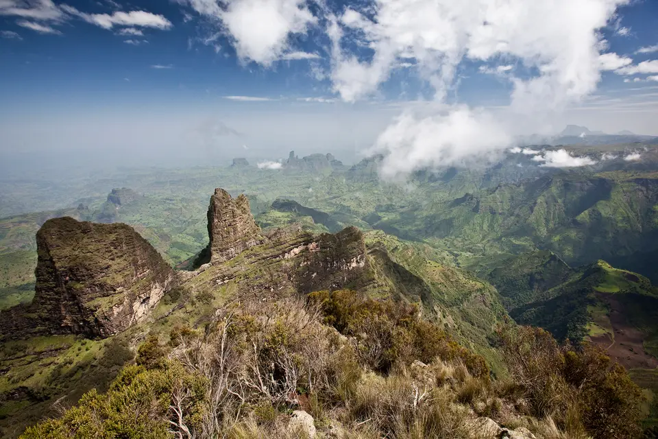
Stretching across the western floor of the Afar Depression roughly 300 kilometres northeast of Addis Ababa, the Lower Valley of the Awash protects one of the richest groupings of palaeontological and pre-historic archaeological sites on the African continent. Fossil bones rewrite human origins here. Placed onto the UNESCO World Heritage List in 1980, this arid sedimentary landscape lies along the lower reaches of the 1,200-kilometre (750-mile) Awash River (known in Oromo as Awaash or Hawaas, in Amharic as ዐዋሽ, in Afar as Hawaash We'ayot, in Somali as Webiga Dir, in Italian as Auasc, and historically in the 16th century as the Great Dir River).
Rising at an elevation of 2,929 to 3,000 metres (9,800 ft) in Ethiopia's central highlands south of Mount Warqe near the town of Ginchi in Dendi woreda (West Shewa Zone, Oromia), the Awash River loops south around Mount Zuqualla into the Main Ethiopian Rift and the Great Rift Valley before flowing northeast across a 69,196 km2 endorheic drainage basin that covers 10% of Ethiopia's land area across 23 administrative zones. Fed by left-bank tributaries including the Akaki and Dukem alongside the Modjo, Keleta, Germama (Kasam), Kabenna, Hawadi, Ataye, Borkana, Mille, and Logiya rivers as well as the right-bank Gololcha, the river never reaches the sea; instead, with an average mouth discharge of 151.9 m3/s (ranging from 37.9 to 510.5 m3/s), it terminates in a chain of interconnected desert basins beginning at Lake Gargori and ending at Lake Abbe (Abhe Bad) at 248 to 250 metres (820 ft) elevation on the Djibouti border, about 100 kilometres (62 miles) inland from the Gulf of Tadjoura.
Divided into upper, middle, and lower hydrological sections, the Awash valley acts as a giant geological sediment trap. Over millions of years during the late Miocene and Pliocene as well as early Pleistocene epochs (spanning roughly 5.6 to 2.5 million years ago), rivers and shallow lakes together with hot springs, swamps, and volcanic ash falls rapidly buried the bones of hominids and prehistoric fauna in mineral-rich clay and sand layers. Because volcanic tuff horizons interbedded within the fluvial clays can be dated precisely through radiometric techniques, every fossil-bearing stratum along the riverbanks and tributary gullies provides an exact chronological benchmark for early hominin anatomy and savannah paleoecology. Subsequent tectonic faulting and seasonal flash flooding along the rift floor eroded these badlands, exposing fossilised strata that date back more than 4 million years.
While the upper highland escarpments above 1,900 metres receive over 1,000 to 1,600 millimetres (39 to 63 in) of annual rainfall and support Ethiopian montane forests alongside grasslands and moorlands, the lower rift floor sits in a semi-arid to arid zone dominated by Somali Acacia and Commiphora bushlands and thorn savannas. Governed by the seasonal movement of the intertropical convergence zone (ITCZ), which brings a short rainy season around March (Belg) followed by a main rainy season between June and September (Kiremt) and a dry season from October to March (Bega), these dry bushlands and the adjacent Mille-Serdo Wildlife Reserve (near Yangudi Rassa National Park) shelter crocodiles along the river channel alongside Beisa oryx and Soemmering's gazelle together with Dorcas gazelle, gerenuk, Grevy's zebra, and one of the last wild populations of the critically endangered African wild ass.
From Wilfred Thesiger's Expeditions to the Discovery of Lucy and Ardi
Long inhabited by the Afar people and the Issa Somali clan across the historical regions of Fatagar, Ifat, and Shewa, the lower river course remained unmapped by foreign explorers until L. M. Nesbitt followed segments of the valley in 1928 before turning north at Asaita, and British explorer Wilfred Thesiger traced the entire river in 1933 and 1934 from the town of Awash through the Aussa oasis to its terminus in Lake Abbe and onward to Tadjoura. Four decades later, the eroded badlands of the Middle and Lower Awash became the epicentre of global palaeoanthropology.
Beginning in 1973, multinational research teams of palaeontologists and pre-historians launched systematic annual excavations in the Lower Awash Valley that continued each field season until 1976 and concluded their initial phase in 1980. Concentrating on the fossil-rich locality of Hadar and neighbouring exposures, researchers uncovered a vast assemblage of exceptionally well preserved hominid and animal fossils alongside prehistoric stone tools, proving that early human ancestors walked upright in the East African rift millions of years earlier than previously assumed.
The most celebrated breakthrough occurred at Hadar in 1974, when palaeontologists recovered 52 bone fragments belonging to a single individual hominid skeleton dated to 3.2 million years ago. Classified as Australopithecus afarensis and nicknamed Lucy, this 3.2-million-year-old fossil provided the most complete early hominid skeleton ever found at the time and established Australopithecus afarensis as a pivotal ancestral link for both the genus Australopithecus and later Homo species, including Homo erectus and Homo sapiens.
Subsequent field investigations across the Awash Valley pushed the evolutionary timeline back even further into the Pliocene and late Miocene. In the Middle Awash sector, researchers recovered a female hominin skeleton of Ardipithecus dated to 4.4 million years old, nicknamed Ardi, standing approximately 1.2 million years older than the 3.2-million-year-old skeleton of Lucy. Today, while the fossil-bearing badlands of the lower valley hold vast palaeontological deposits still awaiting excavation and formal boundary demarcation, the broader Awash River basin, home to nearly 18.6 million people (over 15% to 17% of Ethiopia's population), faces intense environmental pressure from upstream urbanization around Addis Ababa and Sebeta alongside Bishoftu, Gelan, Modjo, and Adama, sedimentation at the 180 km2 Koka Reservoir (Lake Gelila, created by the 1960 Koka Dam 75 km from Addis Ababa), commercial sugarcane irrigation (accounting for 89% of basin water use around Wenji, Metehara, and Kesem), climate-driven droughts monitored by the Awash Basin Authority, and geogenic and industrial water contamination recorded in 2023 and 2024 hydrological studies.
Tracing the Awash Rift Corridor and Viewing the Original Fossils
Because the fossil localities of Hadar and the Lower Valley of the Awash are remote, sun-baked badlands with no tourist lodges or paved trails on the desert floor, experiencing this World Heritage record combines examining the excavated skeletons in Addis Ababa with an overland journey down the Main Ethiopian Rift corridor through Awash and Gewane toward Asaita.
- Inspecting Lucy and Ardi in Addis Ababa before descending the Rift: Before travelling 300 kilometres northeast into the Afar Depression, begin your itinerary in Addis Ababa at the National Museum of Ethiopia, where the 52 reconstructed bone fragments of 3.2-million-year-old Australopithecus afarensis (Lucy) and the 4.4-million-year-old remains of Ardi are curated alongside prehistoric stone tools and fossil fauna excavated from Hadar and the Middle Awash.
- Following the Awash River from Awash National Park to Gewane and Hadar: Drive east from Addis Ababa past Adama and the 1960 Koka Reservoir to Metehara and Awash National Park, where the river cuts a dramatic volcanic gorge before turning northeast past the Germama confluence into the Afar Region. From the highway corridor linking Gewane and Mille with Asaita, authorised visitors travelling with registered 4x4 vehicles and local Afar scouts can view the stratified Pliocene and Miocene clay-and-ash badlands around Hadar and scan the thorn savannas of the adjacent Mille-Serdo Wildlife Reserve for Beisa oryx and Soemmering's and Dorcas gazelles as well as gerenuk and the rare African wild ass.
- Bega dry-season timing and rift desert logistics: Schedule any overland travel into the Lower Awash Valley during the cooler October to March dry season (Bega), avoiding the July and August Kiremt rains when flash floods inundate the lower rift plains and wash out unpaved desert tracks. Carry all drinking water and fuel from major highway towns, never disturb surface bone fragments or stone artefacts in the badlands, and consult our UNESCO World Heritage Atlas to explore Africa's other Rift Valley cradle-of-humankind sites.
