


























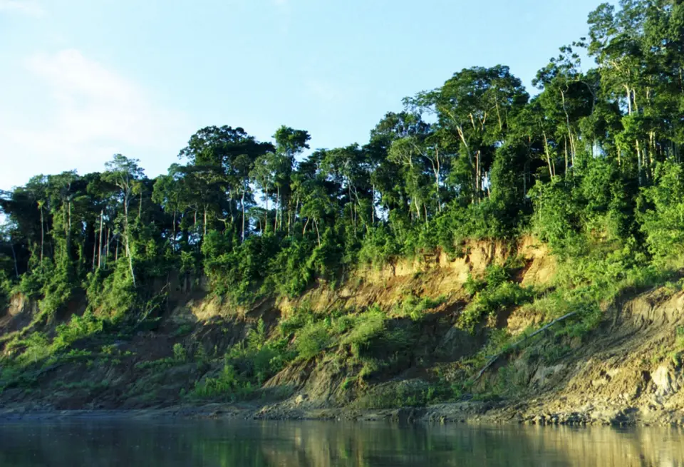
Quick Field Data
- UNESCO Inscription: 1987 (extended 2009) · Criteria (ix), (x).
- Scale & Footprint: 1,716,295.22 ha (17,162.95 square kilometres) spanning the Cusco and Madre de Dios regions of south-western Peru.
- Access & Ticketing: Administered by SERNANP across four management zones; check the official site for authorized tour operators and Reserved Zone entry permits.
- Arrival Logistics: Linked to the Andean highlands via the 190-kilometre Manu road from the Cusco region, where travellers also visit Machu Picchu.
Andean and Amazonian Altitudinal Gradient
Across Peru, the UNESCO World Heritage Atlas in 1987 under Criteria (ix) and (x) across an initial 1.5 million hectares and expanded in 2009 to encompass 1,716,295 hectares (specifically 1,716,295.22 hectares, covering 17,162.95 square kilometres), Manú National Park (Parque Nacional del Manu) protects an entire roadless watershed where the eastern slopes of the Tropical Andes meet the Amazon Basin. No highways cross its interior. Established by decree 644-73-AG on 29 May 1973 under the regime of General Juan Velasco, recognized by UNESCO as a Biosphere Reserve in 1977, and enlarged by the Peruvian government in 2002 before its 2009 World Heritage extension, the park spans the regions of Cusco and Madre de Dios in south-western Peru. For travellers exploring the southern Peruvian highlands around Cusco and Machu Picchu, Manú represents the dramatic eastern descent from high mountain ridges into unbroken lowland rainforest.
What makes Manú one of the richest terrestrial biodiversity refuges on the planet is its complete altitudinal gradient, dropping from 4,200 metres above sea level along the high Andean divide (spanning around 350 to above 4,000 metres in the extended boundary and down to 150 metres in the lower basin) across the Amazonian plains. Fed by numerous whitewater mountain creeks that carve steep valleys through the eastern cordillera, the Manú River meanders through lowland alluvial forests and oxbow lakes before emptying into the Madre de Dios River along the southern boundary. Because the entire watershed is geographically and economically isolated by precipitous mountain ridges, and linked between the highlands and the mouth of the Manú River solely by the 190-kilometre (120-mile) Manu road, the basin has been spared from most human impacts.
Across this steep elevation drop, climate together with annual precipitation varies sharply by elevation and sector. In the high Andean zone, the mean annual temperature is 8 °C and annual rainfall in the mountainous southern section ranges between 1,500 and 2,000 millimetres. Along the middle cloud-forest section, annual precipitation rises to between 3,000 and 3,500 millimetres, while in the north-western section annual precipitation reaches 8,000 millimetres or more under a warm lowland rainforest mean annual temperature of 25.6 °C. Drier weather prevails between May and September, bringing cooler temperatures across the watershed.
Botanical Tiers and Megafauna Sanctuary
As elevation drops from the mountain crests to the Amazonian floodplains, vegetation transitions through successive ecological tiers: high Andean puna grasslands in areas over 4,000 metres alongside high Andean forests, mountain cloud forests, Yunga forests, and lowland Amazon rainforest. Botanists have recorded 4,385 identified species of plants belonging to 1,191 genera and 162 families inside the park, with a forest plot study between the mountain treeline and the lowland forest identifying 1,108 species of trees and up to 250 tree species within a single hectare. Mountain zones support Podocarpus oleifolius alongside Alnus acuminata, Polylepis, Cinchona pubescens, Vallea stipularis, Prunus integrifolia, Escallonia myrtilloides, Cyrtochilum aureum, Baccharis salicifolia, Hesperomeles ferruginea, Oreopanax, Otoglossum scansor, and Retrophyllum rospigliosii. Lowland rainforest plots contain Bertholletia excelsa alongside Ceiba samauma, Cedrela odorata, Hevea brasiliensis, Socratea exorrhiza, Iriartea deltoidea, Mauritia flexuosa, Euterpe precatoria, Calophyllum brasiliense, Ficus, Nectandra, Cedrelinga cateniformis, Eugenia, Brosimum lactescens, Protium, Poulsenia armata, Cecropia, Inga, Margaritaria nobilis, Solanum grandiflorum, Annona excellens, Simarouba amara, Maxillaria, Virola calophylla, Trema micrantha, Piper, Clusia, Jacaranda copaia, and Aenigmanu.
This botanical diversity shelters an unrivalled variety of animal life. Whereas some 850 bird species were identified at the time of inscription, more than 1,000 bird species are now estimated to exist in the park. Mountain zones host the Andean tinamou, great horned owl, torrent duck, yellow-billed pintail, amethyst-throated sunangel, Andean guan, puna ibis, golden-collared tanager, Andean condor, collared inca, solitary eagle, Andean cock-of-the-rock, mountain caracara, mitred parakeet, sapphire-vented puffleg, and giant hummingbird. In the lowland rainforest live the great tinamou, Spix's guan, rufescent tiger-heron, blue-and-yellow macaw, silvery grebe, harpy eagle, long-billed starthroat, snowy egret, king vulture, scarlet macaw, roseate spoonbill, blue-crowned trogon, turquoise tanager, and blue-headed parrot alongside the Amazonian pygmy owl.
About 160 mammal species have been reported in the park. Lowland rainforest mammals include the jaguar (often sighted along the riverbanks), puma (also present in mountainous areas), ocelot, jaguarundi, giant otter, giant armadillo, South American tapir, capybara, marsh deer, red brocket, white-lipped peccary, collared peccary, tayra, southern tamandua, brown-throated sloth, pacarana, water opossum, Southern Amazon red squirrel, Mexican free-tailed bat, and greater bulldog bat alongside primates such as the Peruvian spider monkey, tufted capuchin, black-capped squirrel monkey, and moustached tamarin. Mountain zones support the spectacled bear, Andean fox, white-tailed deer, mountain paca, long-tailed weasel, and montane guinea pig. In addition, researchers have catalogued 155 amphibian species (including Atelopus erythropus alongside Pipa pipa, Bolitoglossa altamazonica, Telmatobius timens, Chiasmocleis ventrimaculata, Oreobates cruralis, Hyalinobatrachium bergeri, Oscaecilia bassleri, Leptodactylus didymus, Rhinella veraguensis, and multiple Dendropsophus and Pristimantis frogs, with highland studies also noting the frogs of Acjanaco), 132 reptile species (spectacled caiman, black caiman, northern caiman lizard, mata mata, boa, shushupe, green anaconda, tree boa, yellow-spotted river turtle, and lancehead alongside the aquatic coral snake), 210 fish species, 300 ant species, 650 beetle species, and 136 dragonfly species alongside more than 1,300 butterfly species.
Indigenous Peoples and SERNANP Park Zoning
Incan and pre-Incan ruins and petroglyphs, including the Petroglyphs of Pusharo, attest to a long history of indigenous occupation and inspired the Paititi tradition, which holds that the "Lost City of the Incas" lies hidden inside the forest, attracting explorers and researchers across the decades. Today, indigenous peoples remain the only permanent inhabitants of the park, including the Matsiguenka, and the Yine, Harakmbut, and Yora as well as the Mashco-Piro. While some communities are sedentary and maintain regular contact with the outside world, others pursue a semi-nomadic hunter-gatherer lifestyle in voluntary isolation or initial contact.
Administered by SERNANP, the national park is divided into four functional areas: the restricted use zone (enclosing pristine forests and native communities, where access is granted to researchers only, supported by research centres such as the Cocha Cashu Biological Station), the reserved zone (open for regulated recreation and scientific study), the recuperation zone (dedicated to restoring disturbed areas), and the cultural zone (allocated for local human settlement and nature tourism). Across five areas open to tourists in the lower basin of the Manú River, visitors observe biodiversity along forest paths alongside swamps together with oxbow lakes and river shores, supported by five camping sites, three lodges, and a canopy walkway alongside four viewing points including an 18-metre tower.
Because motorised river craft and visitor groups are restricted to the lower basin and cultural buffer while the vast upstream headwaters remain reserved for indigenous communities and long-term biological monitoring at Cocha Cashu, the watershed preserves entire predator-prey networks that have disappeared from accessible parts of the Amazon. Groups of giant otters hunt undisturbed across quiet oxbow lakes while jaguars and tapirs patrol the sandy river beaches at dawn and dusk.
This combination of an unbroken 4,000-metre Andean and Amazonian altitudinal gradient, 4,385 plant species, over 1,000 bird species, and living indigenous territories makes Manú National Park an unmatched biological sanctuary in South America.
- 190-Kilometre Manu Road: The only overland link between the Andean highlands of Cusco and the mouth of the Manú River descends from puna grasslands above 4,000 metres into cloud and lowland forests.
- Lower Manú Oxbow Lakes: Five tourist areas in the lower basin feature paths, oxbow lakes, five campsites, three lodges, and a canopy walkway alongside four viewing points including an 18-metre observation tower.
- Four-Zone Biosphere System: SERNANP divides the 1,716,295.22-hectare reserve into the Restricted Use, Reserved, Recuperation, and Cultural zones to safeguard uncontacted indigenous groups and lowland wildlife.
