Quick Field Data
- UNESCO Inscription: 2013 (Ref. 1418), serial cultural site across Yamanashi and Shizuoka prefectures; Criterion (iii). Inscribed on 22 June 2013 across 25 component locations.
- Scale & Footprint: 20,702.1 hectares encompassing the upper 1,500-metre summit tier of the 3,776.24-metre peak. Lower-slope shrines, lodging houses, lakes, springs, lava tree moulds, waterfalls, and coastal pine groves complete the listing.
- Access & Ticketing: Lower shrines, Fuji Five Lakes viewpoints, and volcanic springs remain accessible year-round. Upper climbing routes concentrate pilgrim activity across two summer months, so confirm trail conditions and hut bookings on official prefectural channels.
- Arrival Logistics: Major commercial flights arrive at Tokyo Haneda International Airport (HND), 95 kilometres from the mountain zone. Mount Fuji Shizuoka Airport (FSZ), 84 kilometres away, operates limited passenger routes, while central Tokyo sits 86 to 100 kilometres northeast.
Sacred Ascents and the 25 Component Sites of Mount Fuji Japan
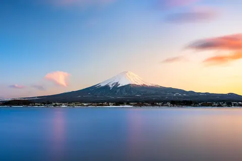
Standing solitary on Honshu between Shizuoka and Yamanashi prefectures, Mount Fuji carries a powerful double identity. Rising to an exact Mount Fuji elevation of 3,776.24 metres, Japan's highest summit ranks seventh among Earth's island peaks and second among Asian island volcanoes after Sumatra's Mount Kerinci. Its symmetrical snow-draped profile and periodic volcanic activity drew mountain ascetics, poets, painters, and organised pilgrim societies across centuries. Rather than isolating one structure, UNESCO inscribed 25 linked components uniting the summit crater with shrines, springs, and beaches below.
By the 12th century, Mount Fuji became a major training ground for ascetic Buddhism intertwined with Shinto worship of Asama no Okami, the deity residing in the crater. Pilgrims began ascents at Sengen-jinja shrines around the base, carrying long staffs through a symbolic cycle of death and rebirth. Before climbing, worshippers performed cold-water mizugori ablutions at mountain springs and lakes, or walked the hakkaimeguri circuit around eight sacred waters including the Fuji Five Lakes. Routes climbed through three recognised zones: the grassy lower skirt, the wooded mid-mountain forest belt, and the burnt volcanic summit tier.
At the top, climbers processed around the crater rim in a ritual called ohachimeguri, meaning going around the bowl. During the 17th century and the wider Edo era, lay societies known as Fuji-ko spread mountain pilgrimage across central Japan. From the 18th century onwards, support bodies built mountain huts, marked climbing trails, and operated Oshi lodging houses at the base to feed and shelter worshippers. Although early taboo barred women from the peak, Tatsu Takayama achieved the first recorded female ascent in autumn 1832, and Grand Council of State Edict 98 formally ended female mountain bans on 4 May 1872.
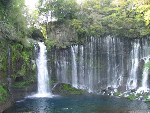
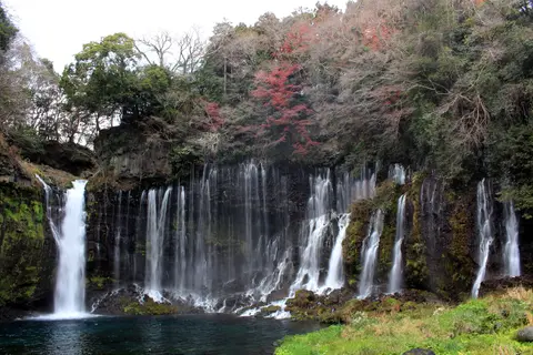
Four cities ring the mountain piedmont: Gotemba east, Fujiyoshida north, Fujinomiya southwest, and Fuji south. Together with Fujisan Hongu Sengen Taisha and Murayama Sengen-jinja, the 25 components protect Oshino Hakkai springs, Shiraito Falls, volcanic lava tree moulds, Lakes Yamanaka, Kawaguchi, Sai, Motosu, and Shoji, and pine-fringed Suruga Bay shores. Earlier samurai history unfolded around Gotemba, where shogun Minamoto no Yoritomo staged yabusame mounted archery contests during the Kamakura period. Because modern hotels and low-rise construction around the lower flanks blur sightlines, Yamanashi and Shizuoka prefectures formed the Fujisan World Cultural Heritage Council in 2012 to enforce strict colour and building height standards.
Conservation planners balance heavy summer footfall against long-standing religious traditions. While Ise Shrine renews buildings every 20 years, certain shrines linked to Fujisan renew wooden structures on a 60-year cycle, rooting authenticity in siting, craft, materials, and living ritual function. National protections inside Fuji-Hakone-Izu National Park expanded in September 2012 to cover Murayama, Fuji Sengen-jinja, and Oshino Hakkai springs. Subsequently, the 2012 Fujisan Comprehensive Preservation and Management Plan, 2014 visitor strategies, and 2016 municipal landscape controls coordinated upper-path supply tractors, rockfall barriers, and shoreline planning near Lakes Kawaguchi and Yamanaka.
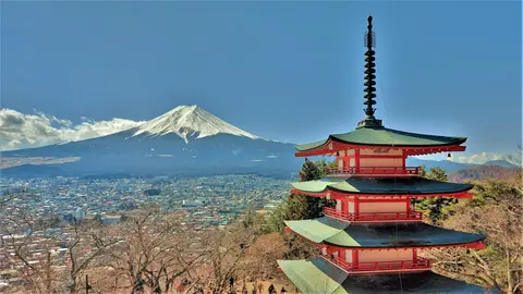
Volcanic Structure, Plate Tectonics, and the 1707 Last Eruption
Beneath its calm profile, Mount Fuji Japan rests on one of the Pacific rim's sharpest tectonic intersections. The volcano sits above a triple junction trench where the Eurasian Plate, North American Plate, and Philippine Sea Plate meet, corresponding to western Japan, eastern Japan, and the Izu Peninsula. Subduction of the Pacific Plate generates magma near the convergence of the Southwestern Japan, Northeastern Japan, and Izu-Bonin-Mariana arcs. Roughly 400 kilometres away lies the Boso triple junction, while older Ashitaka Volcano stands 20 kilometres southeast after erupting between 400,000 and 100,000 years ago.
Earth scientists trace four major volcanic phases shaping the modern stratovolcano. Deep inside lies the andesite core of Sen-komitake, discovered in 2004 following Middle Pleistocene activity 7 kilometres north of the summit. Above it formed the basalt layers of Komitake Volcano several hundred thousand years ago until eruptions paused near 100,000 years ago. Next came Old Fuji (Ko-Fuji) erupting between 100,000 and 17,000 years ago before a massive southwest-flank landslide struck roughly 18,000 years ago. Finally, New Fuji (Shin-Fuji) built today's symmetrical cone over the past 10,000 to 17,000 years through basalt lava, scoria, and volcanic ash deposits.
The Mount Fuji last eruption ran from 1707 to 1708, leaving the summit quiet for over three centuries while geologists still classify the volcano as active. Today the main crater spans 780 metres across and drops 240 metres deep to a flat floor 100 to 130 metres wide. Within 1.5 to 2 kilometres of the rim, dry volcanic gravel rests at steep repose angles between 31 and 35 degrees. Further down, scoria flanks ease near 27 degrees before mid-slope angles flatten from 23 degrees down below 10 degrees across the surrounding piedmont. Historic flank lava flows also moulded hollow lava tree tubes inside surrounding pine forests.
Weather at the 3,776.24-metre peak shifts abruptly into an alpine tundra climate classified ET under the Köppen scale. Staffed meteorological observations ran at the summit for 72 years until automated sensors took over at 3,780 metres in September 2004. Extremes ranged from 17.8 degrees Celsius in August 1942 down to minus 38.0 degrees Celsius in February 1981. Snow normally caps the mountain for around five months annually, appearing on an average date of 2 October, though warm autumn air in 2024 delayed the first snowcap to 6 November, the latest since records started in 1894.
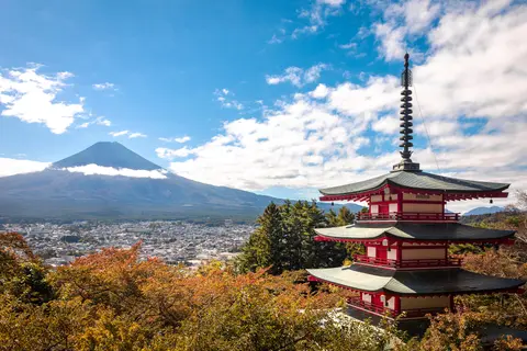
Etymology and Artistic Legacy From Tokaido Prints to World Mountaineering
Japanese speakers call the peak Fuji-san, where san reflects the Sino-Japanese yama mountain reading rather than a polite name suffix. Poetic titles also include Fuyo-ho (Lotus Peak), Fugaku, and Fuji-no-Takane. Because kanji characters were fitted phonetically onto an older spoken name, scholars debate origins across Yamato and Old Japanese roots. Early 9th-century tales like the Tale of the Bamboo Cutter linked the sound to immortality and marching warriors, while Heian scholar Miyako no Yoshika noted a shared county name. Later theorists pointed to never-ending or without-equal meanings, while Edo scholar Hirata Atsutane suggested a shapely rice ear. Toponymist Kanji Kagami compared long graceful slopes to wisteria and rainbows, and linguist Alexander Vovin proposed an Eastern Old Japanese fire-master root, rejecting missionary John Batchelor's Ainu link.
Long before European mountaineers visited Japan, Mount Fuji anchored native poetry and classical prose across the known realms of India, China, and Japan. After 1600, when Edo grew into Japan's political centre, countless travellers glimpsed the cone along the Tokaido highway and carried sketches home. During the 19th century, Ukiyo-e woodblock masters turned the volcano into a global visual emblem. Katsushika Hokusai issued Thirty-Six Views of Mount Fuji across lakes, ferries, pines, and distant bridges, while Utagawa Hiroshige painted matching coastal stations. Exported prints reached Europe and reshaped Western painting through asymmetrical composition and tonal contrast.
Foreign mountaineers soon arrived in person. British diplomat Sir Rutherford Alcock completed the first documented foreign climb in September 1860, ascending in 8 hours and descending in 3 hours before spreading Western accounts in The Capital of the Tycoon. Lady Fanny Parkes became the first non-Japanese woman to summit in 1867, followed two years later by photographer Felix Beato. On 30 April 1936, Mount Rainier National Park in the United States and Fuji-Hakone National Park established an international sister-mountain tie. Near Gotemba New Fifth Station, a stone memorial honours 113 passengers and 11 crew killed on 5 March 1966 when BOAC Flight 911 broke apart in clear-air lee-wave turbulence downwind of the cone, reminding climbers of local saying: wise people climb once, fools climb twice.
Access Zones Across the Fujisan Heritage Landscape
Because the 25 inscribed properties circle all sides of the mountain across two prefectures, separating summit ascent logistics from lower shrines, lakes, and waterfalls clarifies trip planning.
| Complex Zone | Key Highlights | Access & Ticket Rule |
|---|---|---|
| Upper Crater & Pilgrim Trails. | Summit ohachimeguri rim above 1,500 metres, crater shrines, scoria switchbacks, and mountain huts. | Summer climbing concentrates across two warm months. Check trail entry rules and hut bookings via official prefectural channels. |
| Northern Foothills & Fuji Five Lakes. | Lakes Kawaguchi, Yamanaka, Sai, Motosu, and Shoji, Oshino Hakkai springs, Oshi lodgings, and Chureito Pagoda. | Lakeshores, viewpoints, and shrine precincts remain open year-round. Local temple grounds or cultural halls follow municipal entry rules. |
| Southwestern Foothills (Fujinomiya). | Fujisan Hongu Sengen Taisha head shrine, Murayama Sengen-jinja, and snowmelt cascades at Shiraito Falls. | Public shrine courtyards and waterfall trails remain accessible year-round. Check municipal parking and local pathway notices before arrival. |
| Eastern Piedmont & Suruga Bay Rim. | Gotemba New Fifth Station memorial, samurai plains, lava tree moulds, and Suruga Bay pine groves. | Connected by highway and regional rail corridors. Verify upper road conditions on lower flanks during snowy winter months. |
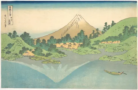
Three Volcanic and Sacred Details Around Mount Fuji
- Lava Tree Moulds Inside the Forest Skirt: Inspect hollow basalt cylinders preserved inside woodland lava flows around the base. Molten lava engulfed standing conifers, hardened around the bark, and left upright stone moulds once the timber burned away, revered by pilgrims as living mountain signs.
- Oshino Hakkai Cold Ablution Springs: Look into the clear spring ponds fed by snowmelt filtering down through permeable basalt layers. Historic Fuji-ko worshippers performed cold mizugori ablutions in these pools before starting their shrine ascents up the flanks.
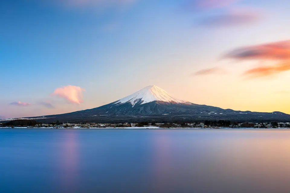
- Symmetrical Scoria Angles and Crater Rim: From lakeshore vantage points at Kawaguchi or Motosu, trace how the upper slopes steepen cleanly to 31 to 35 degrees beneath the 780-metre summit rim. Dry volcanic gravel resting at its natural repose angle creates the sharp cone geometry seen in Hokusai prints.
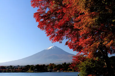
Best Time to Visit Mount Fuji and Planning a Day Trip From Tokyo
Deciding the best time to visit Mount Fuji depends on whether your goal is high-altitude climbing or crisp panoramic views. Dry, cool weather between late autumn and early spring typically keeps the snowcap sharp against clear skies from Tokyo, Yokohama, Lake Ashi, and the Fuji Five Lakes. By contrast, warm summer weather draws heavy pilgrim crowds up the upper tier during two peak climbing months supported by huts, stone barriers, and supply tractors. On a Mount Fuji day trip from Tokyo, early departures help beat afternoon valley clouds gathering around the cone.
Figuring out how to get to Mount Fuji from Tokyo is straightforward across rail and highway corridors running 86 to 100 kilometres southwest into Fujiyoshida, Fujinomiya, and Gotemba. International travellers arrive at Tokyo Haneda International Airport (HND), 95 kilometres away, while Mount Fuji Shizuoka Airport (FSZ) at 84 kilometres handles limited passenger flights. When selecting things to do at Mount Fuji across lower shrines, lakeshores, and waterfalls, combine this page with our Tokyo destination guide and browse additional Asian landmarks inside the UNESCO World Heritage Atlas.