


























Quick Field Data
- UNESCO Inscription: 1981 (extended 1982) · Criteria (ix), (x)
- Scale & Footprint: 17,540 hectares (175.4 square kilometres) across the Nimba Range, comprising 12,540 hectares (125.4 square kilometres) in Guinea and 5,000 hectares (50 square kilometres) in Côte d'Ivoire
- Access & Ticketing: Designated an IUCN Category Ia Strict Nature Reserve where public tourism entry into the core ecological zone is prohibited and access is restricted to authorised scientific research and conservation personnel
- Arrival Logistics: Situated along the remote shared frontier where Guinea meets Côte d'Ivoire and Liberia in the southern Guinea Highlands near the frontier towns of Bossou, N'Zoo, and Yekepa
The Iron-Rich Sky Island and Altitudinal Microclimates
Stretching along a narrow, 40-kilometre-long ridge oriented northeast to southwest at the southern edge of the Guinea Highlands, the Mount Nimba Strict Nature Reserve (Réserve naturelle intégrale du Mont Nimba) spans 17,540 hectares (175.4 square kilometres, or 43,300 acres) across the international border of Guinea and Côte d'Ivoire. First established as a strict nature reserve in Côte d'Ivoire under Order No. 4190 SE/F during 1943 and across Guinea by decree in 1944, the Guinean sector became a UNESCO Biosphere Reserve in 1980 and was inscribed on the World Heritage List in 1981, followed in 1982 by the extension incorporating the Côte d'Ivoire sector. Today, 12,540 hectares (125.4 square kilometres, or 31,000 acres) lie within Guinea and 5,000 hectares (50 square kilometres, or 12,000 acres) lie within Côte d'Ivoire, while the adjacent Liberian third of the ridge lies outside the World Heritage boundary. Altitude governs every habitat here.
Geomorphologically, the Nimba Range rises abruptly like an isolated continental sky island above the surrounding undulating plains of the West Sudanian savanna and the Guinean forest-savanna mosaic. Its quartzitic and iron-bearing crest culminates at Mount Richard-Molard (Mount Nimba) at 1,752 metres (5,750 feet) above sea level, the highest point in both Guinea and Côte d'Ivoire. Five additional major peaks punctuate the narrow Guinean spine of the ridge: Grand Rochers at 1,694 metres (5,558 feet), Mont Sempéré at 1,682 metres (5,518 feet), Mont Tô at 1,675 metres (5,495 feet), Mont Piérré Richaud at 1,670 metres (5,479 feet), and Mont LeClerc at 1,577 metres (5,174 feet). Acting as a regional water tower for the Gulf of Guinea watershed, the fractured slopes feed approximately fifty perennial mountain springs, including the headwaters of the Cavally alongside the Cestos and Sassandra rivers, which sustain a distinct freshwater ecoregion with a high proportion of endemic aquatic species.
This abrupt 1,752-metre elevation gain creates a sub-equatorial montane climate marked by extreme vertical and cardinal microclimatic contrasts. Daytime maximum temperatures range between 24 degrees and 33 degrees in the lower valleys while nighttime minimums on the crest drop below 10 degrees. Because the northeast-southwest ridge intercepts moisture-laden monsoon air from the Atlantic while shielding the leeward slopes, the southern flanks are significantly moister than the northern slopes, which face the desiccating Harmattan wind blowing from the Sahara and strong rain-shadow effects. Consequently, vegetation arranges itself into sharp vertical bands: semi-deciduous Western Guinean lowland forest up to 600 metres (hosting 40 to 70 tree species per hectare with 500 recorded forest tree species), Guinean montane forest between 600 and 1,200 to 1,400 metres (shifting at 900 metres, where clouds envelop the ridge, into Parinari excelsa forests alongside summit forests and groundwater-fed valley tree-fern forests), and an upper transition of Protea bushland leading into isolated subalpine grasslands from 1,200 metres to the 1,752-metre summits.
Viviparous Toads, Tool-Using Chimpanzees, and Iron-Ore Pressures
Because the Nimba Range remained an isolated humid refuge during Pleistocene dry periods when surrounding forests contracted into savannah, its vertical habitat bands evolved into a centre of single-site endemism inside the West Africa Guinean Forests Biodiversity Hotspot. Biological surveys have recorded more than 2,000 vascular plant species, including high-altitude endemics such as Asplenium schnellii alongside Osbeckia porteresii and Blaeria nimbana, plus more than 2,500 invertebrate species and between 317 and 680 vertebrate species, of which 107 to 132 are mammals. Recognising its rich avian communities across forest and savannah edges, BirdLife International has also designated the reserve as an Important Bird Area (IBA), where species ranging from resident forest birds to migratory honey buzzards (tracked passing through on 13 November 2013 from Kempen-Broek) depend on the intact canopy.
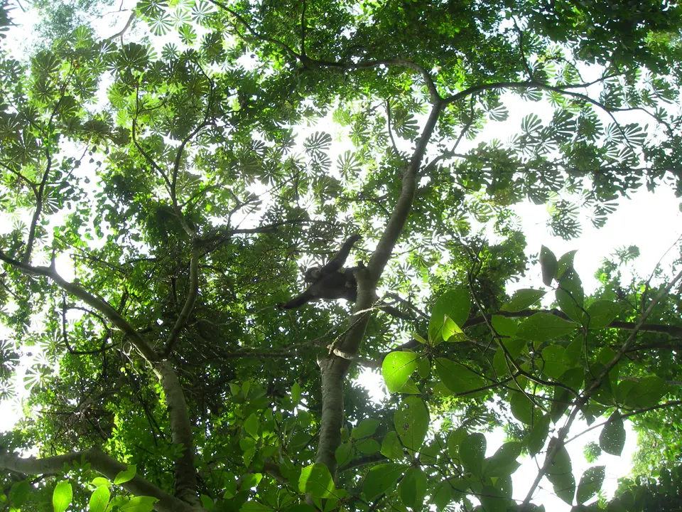
Three critically threatened, range-restricted vertebrates exemplify the evolutionary specialisation of the mountain's micro-niches. In the isolated high-altitude grasslands between 1,200 and 1,752 metres lives the endemic Mount Nimba viviparous toad (Nimbaphrynoides occidentalis); because standing pools of water do not persist on the steep, rocky summit ridges, this amphibian evolved to bypass the free-swimming tadpole stage entirely, gestating its young inside the female's body and giving birth to fully formed live toadlets within a tiny summit breeding zone. Along the fast-flowing mountain streams and wet ravines lives the endemic Mount Nimba otter shrew or micropotamogale (Micropotamogale lamottei), a small, nocturnal semi-aquatic insectivore, while Lamotte's roundleaf bat (Hipposideros lamottei) is known globally from only a single mining site on the massif alongside multiple species of horseshoe bats. In the lower forest-savannah mosaic and montane forests live the pygmy hippopotamus alongside the zebra duiker, the West African lion, and a studied population of western chimpanzees near Bossou that use stones as tools.
Paradoxically, the same geological composition that makes the Nimba ridge rise so steeply above the savannah also poses its greatest existential threat: the mountain crest contains some of the highest-grade iron-ore deposits in West Africa. Across the border in the Liberian third of the range near Yekepa, decades of intensive open-cast iron mining severely degraded the mountain ridge, whereas the Guinean part remained ecologically intact. When iron-ore exploration and mining concessions were proposed inside the vulnerable Guinean montane zone in 1992, UNESCO placed the Mount Nimba Strict Nature Reserve on the List of World Heritage in Danger, where it has remained ever since. To strengthen on-the-ground protection across the Guinean sector, the Guinean Government, CEGENS, and the Guinean Parks Foundation approved the construction of a dedicated conservation management centre in 2016 to coordinate biological surveys and guard the 17,540-hectare public domain of the two States.
Conservation Access Rules and Surrounding Research Zones
Unlike national parks designed for mass recreational trekking, the Mount Nimba Strict Nature Reserve carries an IUCN Category Ia designation, the strictest protection level in international conservation law. Under national legislation in both Guinea and Côte d'Ivoire, all resource exploitation and unregulated recreational entry into the core 17,540-hectare reserve are prohibited to prevent habitat trampling and disturbance in the fragile summit breeding grounds of the viviparous toad. Access inside the strict reserve boundary is limited exclusively to accredited scientific expeditions and park management staff.
Travellers and field researchers visiting the Nimba region should orient themselves around the surrounding buffer communities and legal conservation protocols.
- Respect the IUCN Category Ia strict reserve boundary: Independent hiking onto Mount Richard-Molard and the high Guinean peaks (Grand Rochers alongside Mont Sempéré, Mont Tô, Mont Piérré Richaud, and Mont LeClerc) is strictly controlled by CEGENS and the Guinean Parks Foundation. Visitors must never enter the core reserve without formal scientific or official clearance from the park management centre, ensuring that the high-altitude grasslands above 1,200 metres and the fifty mountain springs feeding the Cavally, Cestos, and Sassandra rivers remain undisturbed.
- Observe the vertical ecology from the Bossou and N'Zoo buffer zones: Authorised visitors and researchers approaching the southern Guinea Highlands travel overland to the peripheral villages of Bossou and N'Zoo at the base of the massif. From the surrounding lowland corridors below 600 metres, observers can view the dramatic 1,752-metre escarpment rising above the Guinean forest-savanna mosaic and learn about long-term behavioural research on the tool-using western chimpanzees of the Bossou hills alongside the conservation work protecting the 2,000 vascular plant species of Forest Guinea.
- Monitor seasonal weather and regional conservation updates: In this remote border zone where Guinea meets Côte d'Ivoire and Liberia, heavy monsoon rains drench the southern slopes while the dry winter Harmattan wind brings dust from the Sahara and sub-10-degree nights on the ridges. Before planning any regional travel toward Forest Guinea, check current World Heritage in Danger conservation reports and explore other West African biodiversity sanctuaries through our UNESCO World Heritage Atlas.
