Quick Field Data
- UNESCO Inscription: Reference 1237, inscribed in 2009 as a Natural World Heritage Site under criteria (vii) and (viii).
- Scale & Footprint: A serial site covering 141,902.8 hectares across nine mountain areas in five northern Italian provinces, including 18 peaks above 3,000 metres and vertical walls rising more than 1,500 metres.
- Access & Ticketing: Mountain passes, valleys, and marked trails inside the national and provincial nature parks remain open-access; mountain lifts, museums such as the Geological Museum of the Dolomites in Predazzo, and rifugi huts operate individually. Check official provincial park portals for seasonal road rules and lift timetables.
- Arrival Logistics: The closest major passenger gateway is Treviso Airport (TSF, 89 km), with Venice Marco Polo Airport (VCE) and Verona Villafranca Valerio Catullo Airport (VRN) offering wider international schedules roughly a hundred kilometres away. Bolzano Airport (BZO) lies closer at thirty-eight kilometres in South Tyrol, though it operates limited passenger routes. Pair regional buses or rental cars with our Dolomites destination guide (15 km).
Triassic Atolls and the Pale Carbonate Towers
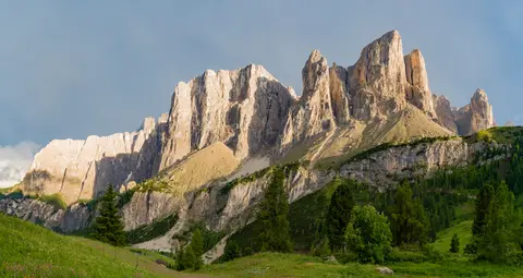
Between the River Adige to the west and the Piave Valley around Pieve di Cadore to the east, the Dolomites form a distinct wing of the Southern Limestone Alps. Bounded to the north by the Puster Valley and to the south by the Sugana Valley (Valsugana), these mountains cross parts of Veneto, Trentino-Alto Adige/Südtirol, and Friuli-Venezia Giulia, touching the wider provinces of Belluno, Vicenza, Verona, Trentino, South Tyrol, Udine, and Pordenone. The range takes its modern name from the carbonate mineral dolomite, first described in the late eighteenth century by French mineralogist Déodat Gratet de Dolomieu (1750 to 1801). Long before geological classification, local inhabitants called the range the Monti Pallidi, or Pale Mountains, after the way the pale carbonate rock shifts toward reddish and purple hues under low evening light during alpenglow.
Beneath that colour lies one of the world's clearest stratigraphic archives of the Triassic period. Exposed cliffs and valley walls reveal Mesozoic carbonate platform systems, often described as fossilised atolls, that grew in shallow tropical seas as reef-building organisms recovered following the Permian-Triassic boundary, the greatest extinction event recorded in Earth's history. Unlike mountain chains where tectonic crushing erased original seabed geometry, the Dolomites preserve intact spatial transitions between dense bio-constructed reef cores, steep submarine slopes, and adjacent basinal sediments. Several internationally recognised type sections for Triassic stratigraphy sit within these valleys, making the range a primary reference point for earth scientists.
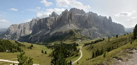
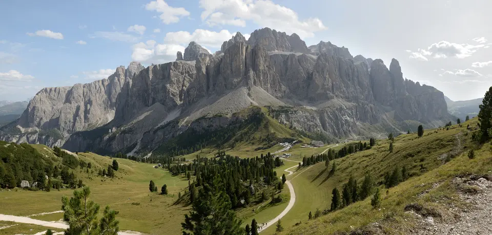
Over millions of years after uplift, differential erosion, glaciation, and karst dissolution carved the layered carbonate rock into two sharply contrasting geometries. Vertical pinnacles, steeples, spires, and sheer limestone cliffs rising over 1,500 metres stand abruptly above broad horizontal ledges, crags, high plateaux, and sprawling aprons of pale talus. Forests and green pastures cushion the foothills, magnifying the chromatic contrast against bare stone walls. Today the landscape remains geomorphologically active, shaped by frequent rockfalls, avalanches, seasonal floods, and landslides, some of which in the Alta Badia basin have been radiocarbon-dated to demonstrate direct links between slope instability and climatic change. Early geological pioneers drew international attention to these landforms through field writing, painting, and photography long before modern tourism arrived.
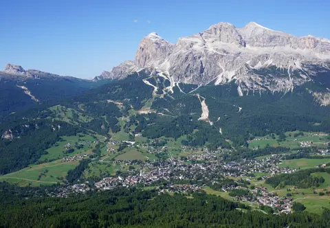
Nine Serial Sectors Across Five Alpine Provinces
Because this stratigraphic archive spans an extensive corridor of northeastern Italy, UNESCO protection applies not to a single continuous national park but to nine serial component areas distributed across five northern Italian provinces. Each component retains defined buffer zones shielding exposed ridge lines, glacial basins, and wilderness valleys from external infrastructure and visitor development pressures. Rather than unified single-agency ownership, the five provincial administrations coordinate conservation within an agreed joint management strategy. They harmonise land-use plans, public access rules, and ecological monitoring across a protected mosaic combining Dolomiti Bellunesi National Park, multiple provincial nature parks, Natura 2000 sites, and a designated natural monument.
Geographically, mountaineers and earth scientists divide the core range into Western and Eastern Dolomites along a corridor following Val Badia, Campolongo Pass, and the Cordevole Valley (Agordino). Across this boundary, comparable carbonate geology continues into the Dolomiti d'Oltrepiave east of the Piave River and the smaller Piccole Dolomiti straddling Trentino, Verona, and Vicenza. Far to the west across the Adige River, the Dolomiti di Brenta (Western Dolomites) also rise within the Adamello-Brenta UNESCO Global Geopark.
Travellers base themselves in historic valley towns and pass settlements strung around the protected massifs without fragmenting high alpine terrain. Main centres include Rocca Pietore beside the Marmolada Glacier on the border between Trentino and Veneto, Alleghe, Falcade, Auronzo, and Cortina d'Ampezzo in Veneto, plus Arabba, Urtijëi, San Martino di Castrozza, and the Ladin-speaking valleys of Fassa, Gardena, and Badia. Predazzo in the Fiemme Valley anchors earth-science interpretation through the Museo Geologico delle Dolomiti, allowing visitors to inspect Triassic reef fossils, carbonate minerals, and volcanic rock specimens before heading up into the mountain passes. From any of these valley bases, marked provincial footpaths carry hikers directly into alpine basins where grazing horses, high scree aprons, and isolated vertical spires remain physically connected.
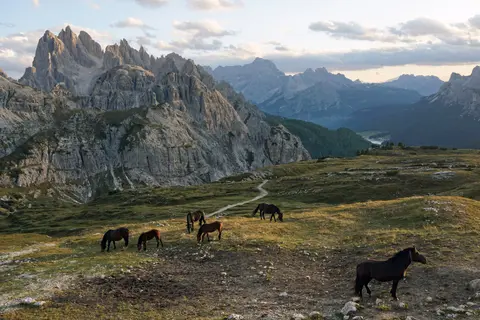
From Victorian First Ascents to the First World War Front
Prehistoric hunters and gatherers entered high limestone basins millennia ago and likely climbed minor summits long before written records. Documented ascents began in the 1790s when Jesuit naturalist Franz von Wulfen from Klagenfurt climbed the Lungkofel and Dürrenstein. Systematic alpine exploration accelerated in 1857 when Irish mountaineer John Ball recorded the first known ascent of Monte Pelmo. Around 1860 Agordin climber Simone de Silvestro stood first on Civetta, followed by Viennese pioneer Paul Grohmann making early ascents of Antelao, Marmolada, Tofana, Monte Cristallo, and Piz Boè. Local mountain guides soon defined Dolomite climbing: Michael Innerkofler pioneered routes on the Tre Cime di Lavaredo, Angelo Dibona and Giovanni Piaz opened major faces, and in 1887 seventeen-year-old Georg Winkler completed a landmark solo free climb up the slender pinnacle of the Vajolet Towers.
During the First World War, the mountain front between the Italian and Austro-Hungarian armies cut straight across high ridges, turning isolated summits into fortified bastions supplied through vertical tunnels and contested by deep mine warfare. Today open-air war museums at Cinque Torri ("Five Towers"), Monte Piana, and Mount Lagazuoi preserve trenches and rock-cut galleries, while nearby Mount Pasubio retains the Strada delle 52 Gallerie, a wartime military mule road driven through 52 stone tunnels. Nearby on the Altopiano di Asiago, the Calà del Sasso rises via 4,444 steps, forming the world's longest staircase open to the public. Many wartime cliff lines later evolved into modern vie ferrate (iron-cable protected paths), while retreating glacial ice continues to expose First World War munitions requiring specialist removal.
Peaceful long-distance crossing today relies on ten numbered alpine footpaths known as the alte vie (Dolomiten Höhenwege, numbered 1 to 10), each taking about a week to walk between valleys via staffed mountain huts called rifugi. Beyond walking and free climbing, winter turns the valleys into major skiing terrain, warmer months draw paragliders, hang gliders, and BASE jumpers, and the first week of July hosts the Maratona dles Dolomites, an annual single-day road bicycle race crossing seven high mountain passes.
Conservation governance stays demanding precisely because the range draws such heavy recreational traffic across mountain passes. Across all nine component areas, local management plans balance public access with strict protection of remote wilderness valleys largely untouched by tarmac or mechanical lifts. Authorities regulate traffic on high passes, maintain adequate provincial park staffing across boundaries, and monitor environmental impacts across all five provincial administrations and their buffer zones.
Access Zones Across the Dolomite Massifs
Because the Dolomites consist of nine serial mountain sectors woven through public valley roads and regional parks, visitors enter trail systems freely while buying tickets individually for cable cars, lifts, huts, and museums. In heavily visited pockets, provincial agencies regulate vehicle traffic and crowd pressure to protect alpine meadows and wilderness character.
| Complex Zone | Key Highlights | Access & Ticket Rule |
|---|---|---|
| Western Massifs (Gardena, Fassa, Badia & Sella) | Pisciadu, Sella towers, Vajolet Towers, and Marmolada Glacier access near Rocca Pietore | Valleys and passes are open-access; mountain cable cars and rifugi huts operate on separate tickets or advance reservations. |
| Eastern Massifs (Tre Cime, Cortina & Lagazuoi) | Tre Cime di Lavaredo walls, Cortina d'Ampezzo valleys, and Parco Naturale Tre Cime pastures | Park trail networks are free on foot; verify seasonal pass road controls and cable-car schedules on official park portals. |
| First World War Open-Air Museums | Cinque Torri trenches, Monte Piana ridges, Mount Lagazuoi tunnels, and Mount Pasubio 52 galleries | Marked historic paths carry open pedestrian access; check official trail bulletins and lift schedules before ascending high ridges. |
| Southern Dolomiti Bellunesi & Pre-Alpine Edges | Dolomiti Bellunesi National Park valleys, Alleghe, Falcade, and nearby Calà del Sasso staircase | National park trails are free to walk; check local weather and snowmelt alerts before entering steep limestone gorges. |
| Fiemme Valley Geological Hub (Predazzo) | Museo Geologico delle Dolomiti interpreting Triassic reefs, carbonate fossils, and mineral specimens | Museum admission requires a standard entry ticket; check seasonal schedule on the official museum website. |
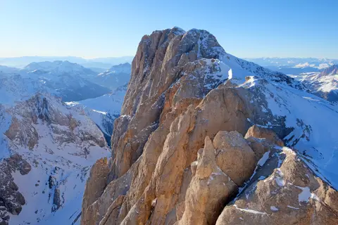
On the Limestone Trail: Dolomite Hue, Fossil Reefs, and Wartime Tunnels
Three specific physical details visible on the ground link the range's mineral chemistry, ancient marine ecosystems, and human mountain history.
- Carbonate Alpenglow at Dusk: Watch bare western faces such as the Sella group, Marmolada, or Cinque Torri during late afternoon. The magnesium-rich dolomite carbonate reflects low-angle sunlight into pale pink, red, and violet tones that earned the range its older vernacular name, Monti Pallidi, contrasting vividly against dark conifer forests and green valley pastures below.
- Exposed Reef-to-Basin Contacts: On valley approaches and inside the Geological Museum in Predazzo, look for abrupt boundary lines separating massive pale reef limestone from darker layered basinal or volcanic rock, preserving the original submarine slopes of ancient Triassic marine lagoons and fossilised atolls.
- Wartime Rock Engineering: Along Mount Lagazuoi, Monte Piana, and the Strada delle 52 Gallerie on Mount Pasubio, inspect hand-cut chisel marks, subterranean supply galleries, and rock-cut loopholes. Blasted directly into vertical walls during First World War alpine campaigns, these military works evolved into modern via ferrata routes.
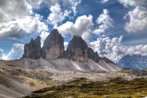
Seasonal Windows, High Routes, and Valley Pairing
Summer and early autumn bring snow-free footpaths across the ten alte vie routes (led by Alta Via 1), staffed rifugi huts, and open vie ferrate. In winter, activity shifts to downhill ski corridors across the Fassa, Gardena, Badia, and Cortina valleys. Spring thaw and late autumn freeze-thaw cycles heighten rockfall, avalanche, and landslide risk along steep talus gullies, so mountain conditions always require verification before climbing above tree line. Travellers arriving via Treviso (89 km), Venice, or Verona can split a multi-day itinerary cleanly between a western valley base such as Urtijëi or Arabba and an eastern hub around Cortina d'Ampezzo or Auronzo. This pacing leaves margin to combine high mountain passes, geological museum visits in Predazzo, and open-air First World War ridge trails without rushing between provinces.
Before entering high limestone terrain, review our Dolomites destination guide for valley transport notes and pass geometry, and browse additional Alpine and European natural entries across our UNESCO World Heritage Atlas. Keeping field time flexible around afternoon mountain storms and seasonal cable-car schedules helps ensure safe crossings between exposed carbonate ridges and forested valley trails.