Quick Field Data
- UNESCO Inscription: 1995 (Ref. 354), transboundary natural reserve uniting Canada and the United States; Criteria (vii) and (ix).
- Scale & Footprint: 457,614 hectares uniting 505 square kilometres of Waterton Lakes in Alberta with 4,100 square kilometres of Montana parkland inside the 41,000-square-kilometre Crown of the Continent Ecosystem.
- Access & Ticketing: Parks Canada and the US National Park Service manage separate park gates and entrance passes; check official park websites for seasonal vehicle reservations, backcountry permits and border rules.
- Arrival Logistics: Travellers flying toward Glacier National Park airport gateways land at Glacier Park International Airport (FCA), 74 kilometres from the park interior, while mountain highways continue 280 kilometres north to Banff.
Transboundary Creation of the 1932 International Peace Park
Stretching across the international boundary between southwestern Alberta and northwestern Montana, Waterton Glacier International Peace Park became the world's first cross-border peace park in 1932. Long before federal treaties linked both reserves, field rangers envisioned unified mountain protection. Early advocate George Kootenay Brown, Waterton's first forest ranger-in-charge, and American ranger Albert Henry Death-on-the-Trail Reynolds championed transboundary wildlife conservation decades before diplomats acted.
Formal action accelerated when Cardston and Montana Rotary Clubs convened jointly at the Prince of Wales Hotel on 4 and 5 July 1931 and endorsed a petition drafted by Samuel H. Middleton. Negotiated by Canadian MP John Smith Stewart and Montana congressman Scott Leavitt, US legislation cleared Congress between December 1931 and March 1932. Canada's Parliament overcame objections from Manitoba-North Dakota International Peace Garden proponents to grant royal assent on 26 May 1932. Dedicated at Glacier Park Lodge on 18 June 1932 by Sir Charles Arthur Mander before a Depression-delayed Canadian ceremony in July 1936 led by Lieutenant Governor William L. Walsh, both parks became UNESCO Biosphere Reserves in 1976 and 1979. World Heritage listing followed in 1995, complemented by Gold Tier International Dark Sky Park status in 2017.
Each country still maintains separate superintendents, entrance tickets and legislative mandates under the 1916 US Organic Act and the Canada National Parks Act. Guided by Glacier's 1999 General Management Plan and Waterton's 2010 Management Plan, over 95 percent of the 457,614-hectare park stays dedicated to wilderness values. Transboundary managers coordinate closely with the Blackfeet Tribe, Confederated Salish and Kootenai Tribes, Blackfoot Confederacy and Ktunaxa Nation through the Crown Managers Partnership and Great Northern Landscape Conservation Cooperative. Protection deepened in 2011 when British Columbia followed a 2010 environmental accord with Montana by banning mining, oil and gas extraction across Canada's adjacent Flathead watershed.
Lewis Overthrust Geology, Glaciers and Tri-Ocean Headwaters
Beneath high ridges of the Lewis and Livingston ranges sits one of Earth's most dramatic geological inversions. Roughly 170 million years ago during the Lewis Overthrust, massive Proterozoic sheets of marine limestone, dolomite and igneous rock dating back 1.5 billion years slid horizontally nearly 100 kilometres eastward atop Cretaceous shale and schist layers only 70 million years old. Exposed cliff strata preserve fossilised sea beds, salt pseudomorphs and 1.3-billion-year-old stromatolites, ranking among the finest early-life marine fossils on Earth.
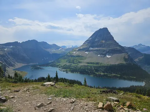
Later Pleistocene and Wisconsin glaciations carved those ancient beds into sharp horns, cirques, hanging valleys, kames, eskers, glacial troughs and more than 130 named lakes. After the last ice age, the Cameron and Blakiston rivers deposited twin broad alluvial fans into Waterton's valley floor. Yet modern warming has accelerated ice loss sharply across Montana's high basins. Out of roughly 150 glaciers exceeding 10 hectares recorded during the mid-nineteenth century, only 25 active glaciers remained by 2010. Researchers warn remaining active ice could vanish entirely by 2030 if warming trends persist.
Because foothills disappear along the eastern front, open prairie collides abruptly against steep rocky mountains. Waterton spans four distinct ecoregions: foothills parkland (covering roughly 10 percent), montane, subalpine and alpine. Across the Continental Divide, Pacific air masses sweep unimpeded through northern ranges, allowing western redcedar and hemlock groves to flourish in southwestern valleys just kilometres from dry eastern aspen parkland and prairie grasslands. Headwaters rising inside the Peace Park divide across three continental watersheds draining toward three separate oceans. Vegetated corridor links sustain over 1,000 vascular plant species, including more than 20 Waterton endemics such as Waterton moonwort, Lewis' mock-orange, white-veined wintergreen and over 50 provincially rare plants like Bolander's quillwort, Lyall's scorpionweed and Brewer's monkeyflower. Native fauna ranges from grizzly bears, black bears, bighorn sheep, mountain goats, elk, moose and plains bison to cougars, Canadian lynx, wolverines, beavers, river otters, pikas, hoary marmots and grey wolf packs, and migratory birds including bald eagles, Canada geese, orange-crowned warblers and MacGillivray's warblers. Meanwhile, the Flathead River bordering Glacier's western and southern edges depends on external watershed protection for native fish.
Blackfeet Homeland, Railway Chalets and Going-to-the-Sun Road
Human stewardship predates modern park gates by thousands of years. Flathead (Salish), Kootenai, Shoshone, Cheyenne and Blackfeet nations moved across adjacent bison plains and sheltered inside mountain valleys, holding Chief Mountain and Two Medicine sacred as the Backbone of the World. When Lewis and Clark explored the Marias River within 50 miles in 1806 and George Bird Grinnell arrived with guide James Willard Schultz in 1885 (followed by Henry L. Stimson climbing Chief Mountain in 1892), US-Blackfeet treaties shifted borders rapidly. Following the 1855 Lame Bull Treaty, Chief White Calf sold 800,000 acres of eastern peaks to Washington in 1895 with retained usage assumptions later overturned by the US Court of Claims in 1935, narrowly avoiding armed standoffs during the 1890s.
After Grinnell coined the phrase Crown of the Continent in 1901 and lobbied Congress with Great Northern Railway president Louis W. Hill and the Boone and Crockett Club, President William Howard Taft established the Montana park on 11 May 1910, succeeding an 1897 forest preserve. Acting supervisor Fremont Nathan Haines handed leadership to first superintendent William Logan in August 1910. Across the border, surveyor William Pearce (1886) and rancher Frederick William Godsal (1893) inspired an unnamed 140-square-kilometre Canadian forest reserve under the Dominion Lands Act on 30 May 1895. After John Lineham's Rocky Mountain Drilling Company sank Alberta's first exploratory oil well near Cameron Creek in 1902 (designated a national historic site in 1965), the 1906 Dominion Forest Reserves Act formed Kootenay Lakes Forest Reserve. When Order-in-Council P.C. 1338 briefly reduced park status to 35 square kilometres in June 1911, Minister William James Roche enlarged Waterton to 1,096 square kilometres in 1914 before settling at its current 505 square kilometres. Golf links designed from 1920 by William Thomson and later Stanley Thompson joined local governance through Improvement Districts 11, 8 and 4 between 1944 and 1969.
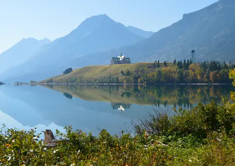
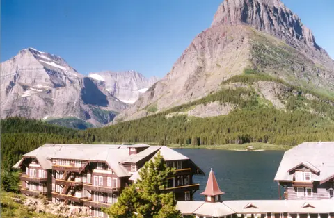
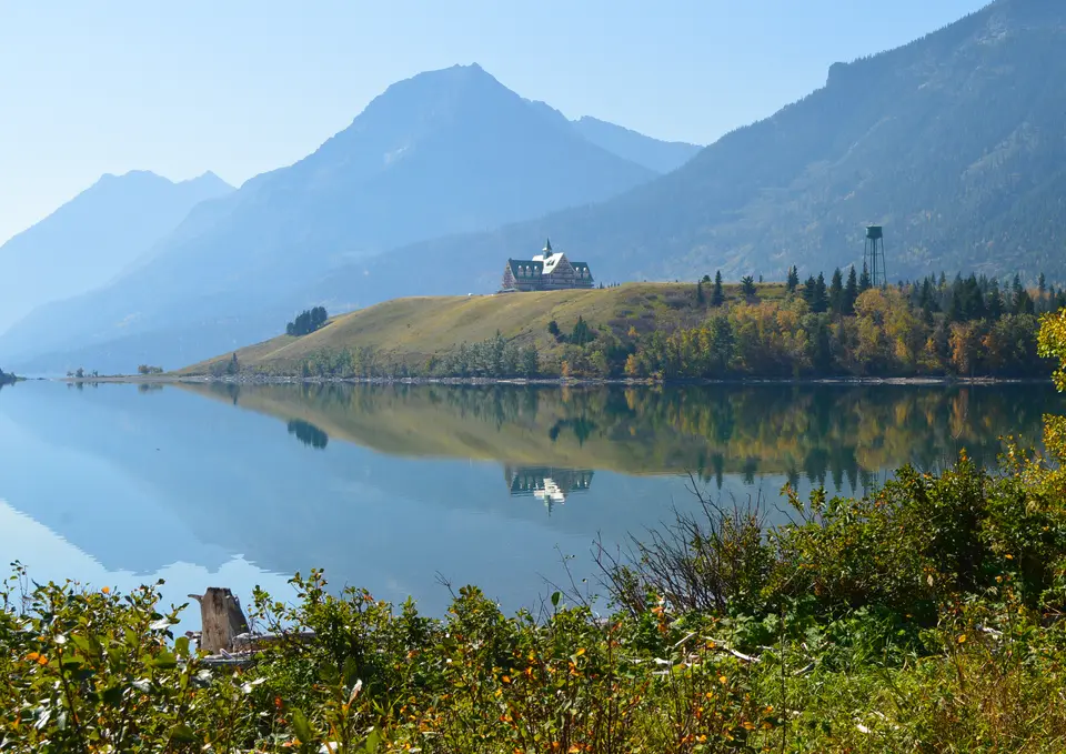
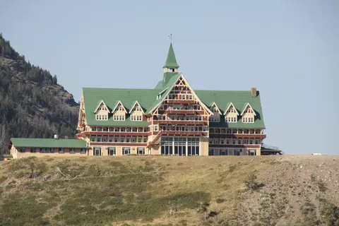
Between 1910 and 1915, the Great Northern Railway promoted Montana's Rockies as America's Switzerland by building Swiss-style lodges and tent camps spaced 10 to 18 miles apart, linked by horse trails and stagecoaches. Prominent stops included Many Glacier Hotel on Swiftcurrent Lake, Lake McDonald Lodge (bought from John Lewis in 1930) and backcountry chalets at Sperry, Granite Park, Red Eagle Lake, Cosley Lake, Fifty Mountain and Goat Haunt. Across the border in 1926 and 1927, the same US railway built the Prince of Wales Hotel above Upper Waterton Lake to draw American travellers during Prohibition, even though its royal namesake preferred his Pekisko ranch. Completed in 1932, the 85-kilometre Going-to-the-Sun Road opened Logan Pass to automobiles, earning National Historic Civil Engineering Landmark status. Today 350 historic buildings, fire lookouts and patrol cabins retain National Register protection despite major wildfires. Severe seasons include Montana's record 64 blazes in 1936 and 2003's 136,000-acre burn, plus Waterton's 200-square-kilometre 2017 wildfire that scarred 80 percent of trails while sparing the townsite and hotel, and the 2017 Sprague Fire preceding Sperry Chalet's 2020 reopening.
Access Zones From Waterton Lakes to Going-to-the-Sun Corridor
Planning how to get to Glacier National Park and neighbouring Alberta valleys requires matching summer pass openings with separate US and Canadian entrance gates. Remember that the Chief Mountain Border Crossing on Montana Highway 17 and Alberta Highway 6 is one of only two seasonal US-Canada road checkpoints closed all winter. Elsewhere along designated international trails, hikers may cross the border temporarily without a standard roadside passport inspection. Drivers using Chief Mountain during warmer months must carry valid passports and border documents for customs checks, whereas off-season crossings divert around the mountain front via all-weather regional highways. Separate Parks Canada and US National Park Service passes remain necessary across respective gates, backed by strict wildlife food-storage rules across grizzly bear, black bear, mountain goat and bighorn sheep habitat.
Check regional forestry, air-quality and road notices carefully, since conservation monitors track residential growth, industrial corridors, timber extraction and climate shifts across surrounding Flathead valleys. Timed vehicle reservations and summer parking restrictions around Logan Pass and Many Glacier also reward arriving early or boarding park shuttles.
| Complex Zone | Key Highlights | Access & Ticket Rule |
|---|---|---|
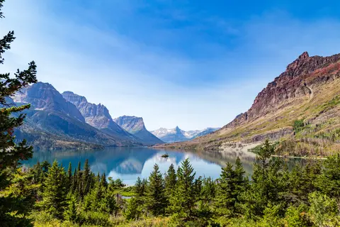
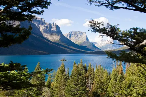
| Going-to-the-Sun Road & Logan Pass | 85-kilometre scenic alpine highway passing Saint Mary Lake and Wild Goose Island. | Open seasonally across summer and early autumn; timed vehicle reservations and park passes checked via NPS. |
| Many Glacier & Eastern Valleys | Historic Many Glacier Hotel on Swiftcurrent Lake, chalets and hanging valley trails. | Accessed from eastern Montana highways; peak summer parking controls regulate busy trailheads. |
| Waterton Park Townsite & Lakes | Prince of Wales Hotel bluff, Crypt Lake trail, Cameron Falls and Upper Waterton Lake. | Reached year-round from southern Alberta roads with separate Parks Canada pass requirements. |
| Chief Mountain Border Corridor | Montana Highway 17 meeting Alberta Highway 6 across eastern prairie-mountain foothills. | Seasonal international road crossing open in warmer months and closed throughout winter. |
Three Geological and Ecological Features Across the Divide
- Inverted Proterozoic Rock Cliffs Above Cretaceous Shale: Inspect banded limestone and deep red argillite cliff walls above Logan Pass and Cameron Falls to trace the 170-million-year-old Lewis Overthrust fault line. Ancient 1.5-billion-year-old ocean sediments rest directly atop rocks over a billion years younger.
- Abrupt Prairie-to-Mountain Edge Without Foothills: Driving north along Montana Highway 17 toward Waterton townsite, watch open fescue grasslands terminate right against sheer glaciated rock walls. Without foothills, elk, bears and rare alpine wildflowers compress tightly along sharp elevation bands.
- Historic Great Northern Railway Timber Architecture: Step inside the tall timber lobbies of Prince of Wales Hotel or Many Glacier Hotel, built between 1910 and 1927 in Swiss chalet styling to turn passenger rail stops into mountain refuges.
Timing Alpine Crossings Between Montana and Banff
July and August mark the peak summer season across Waterton Lakes (drawing roughly 402,542 annual visitors) and Montana's high passes once snowploughs clear Logan Pass. Travellers seeking the best time to visit Glacier National Park to avoid crowds often select early September for quieter trails and crisp golden light. Early autumn also unlocks exceptional stargazing across this 2017 Gold Tier International Dark Sky Park once summer smoke clears and night skies sharpen over Upper Waterton Lake. Contrast damp western redcedar and hemlock forests west of the Continental Divide with brisk winds sweeping open prairie grasslands east of Waterton townsite.
Late June also suits lower valleys around Lake McDonald and Waterton townsite while Cameron Falls snowpack, averaging 481.5 centimetres yearly under humid continental weather, melts back toward high cirques. Weighing how to get to Glacier National Park by plane leads straight to Glacier Park International Airport (FCA) 74 kilometres southwest, pairing smoothly north along the Rockies toward Banff (280 kilometres) or across global reserves in the UNESCO World Heritage Atlas.