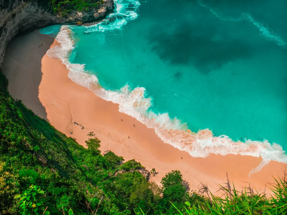
Photo by felfin felfin on Unsplash
Bali Beaches Guide: Where to Swim, Surf and Watch the Sunset
Discover where to swim, surf, and watch sunsets in Bali. Compare west coast breaks, southern cliff coves, and sheltered eastern lagoons with practical safety advice.
Bali possesses an extraordinarily varied coastline shaped by volcanic activity, open ocean swells, and extensive coral barriers. Coastal conditions change markedly depending on which shoreline you select. One stretch may feature mellow shallows sheltered by an offshore reef, while another faces raw ocean breakers running across exposed volcanic reefs. Planning your coastal days around local geography ensures you match your swimming ability or surfing ambitions with the right stretch of sand.
West Coast Swells: Kuta, Seminyak, and Canggu
The western coastline faces the open Indian Ocean, producing continuous wave energy and dramatic golden sunsets. In the 1960s, the Kuta Beach Hotel stood as the solitary tourist property in what was once a quiet village with a sweeping beach. Today, Kuta Beach is renowned for its consistent waves that break over a gently sloping sandy sea bed, making it suitable for beginner surfers taking their first lessons. Visitors can get around Kuta on foot, or by renting a bicycle or motorcycle. Metered taxis are widely available, but driving your own hire car is discouraged because parking is exceptionally tight.
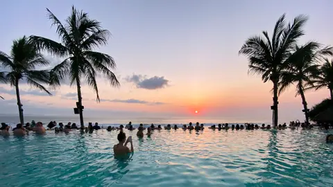
Heading north past Legian, Seminyak Beach offers a quieter atmosphere than Kuta. It features beach clubs and beachfront restaurants where visitors gather on bean bags to watch the evening sky. Further north lies Canggu, where dark volcanic sands at Batu Bolong, Echo Beach, and Berawa draw wave riders from sunrise. Strong currents and powerful shore breaks dominate this entire western corridor. Swimmers must observe lifeguard postings strictly and enter the ocean only between the red and yellow flags. If you want to plan an extended coastal stay, inspect our guide on where to stay in Bali.
The Bukit Peninsula: Dramatic Cliff Roads and Coral Coves
At the southern tip of the island, the limestone cliffs of the Bukit peninsula shelter white sand coves and world-class surfing reef breaks. Padang Padang Beach is small but exotic, framed by rock formations and famous among advanced wave riders. Dreamland Beach offers fine white sand and powerful shore breaks, remaining a favourite spot for experienced surfers. At high tide, several Bukit coves lose much of their dry sand, while low tide exposes sharp coral platforms.
Further south along the limestone headlands, Melasti Beach and Pandawa Beach offer wide sandy spaces reached by dramatic cliff access roads cut directly through the rock. The high vantage points deliver spectacular ocean views before descending to the waterline. At Tegal Wangi Beach, natural rock cavities along the shoreline fill with seawater at certain tidal stages, creating natural sea jacuzzi pools overlooking the ocean. Because many Bukit paths involve steep stone staircases, review our advice on what to wear in Bali to pick stable footwear for climbing cliff paths.
Mellow Waters: Jimbaran Bay and Nusa Dua
Jimbaran was formerly a humble fishing village situated fifteen minutes south of Ngurah Rai International Airport. It has transformed into a beloved coastal destination celebrated for its beachfront dining. The four-kilometre sweep of Jimbaran Bay is protected by an unbroken coral reef, meaning the nearshore waters are noticeably mellower than other open surf beaches in Bali. In the late afternoon, local seafood restaurants set dining tables directly on the sand, serving freshly grilled fish over coconut husks as the sun drops into the ocean. Jimbaran is also home to Jenggala, a quality homeware showroom celebrated for crafted tableware, pottery exhibitions, and ceramic workshops. The bay is roughly a twenty-minute drive from Legian, Seminyak, and Sanur via the toll road connecting Benoa and the airport.
On the southeastern shore, roughly forty kilometres from Denpasar, lies Nusa Dua, a name that translates literally to Two Islands in reference to two small offshore headlands. Nusa Dua Beach features pearly soft white sand, complete resort facilities, and crystal clear shallow waters protected by extensive outer reefs. This sheltered environment makes it exceptionally well suited for families with small children who desire safe paddling conditions without aggressive surf breaks. Sanur Beach, positioned farther north along the eastern shoreline, features a long beachfront promenade and calm lagoon waters that are ideal for watching the sunrise in a relaxing atmosphere. For ideas on structuring your coastal exploration with cultural landmarks, consult our Bali 5-day itinerary.
Comparing Bali Coastal Zones
| Coastal Zone | Primary Character | Swimming Safety | Key Beaches |
|---|---|---|---|
| West Coast | Dark sand, rolling surf, lively sunset dining | Caution required; rip currents present; swim between flags | Kuta, Legian, Seminyak, Canggu |
| The Bukit | White sand coves, dramatic cliffs, famous reef breaks | Variable; strong waves and shallow reef shelves at low tide | Padang Padang, Dreamland, Melasti, Pandawa |
| Jimbaran Bay | Curved sandy bay, grilled seafood, protected waters | Generally calm; sheltered by an unbroken coral reef barrier | Jimbaran Beach, Tegal Wangi |
| East Coast & Nusa Dua | Pearly sand, shallow lagoons, early sunrise vistas | Calm and family friendly; shallow water over inner reefs | Nusa Dua, Sanur |
Seasonal Weather and Ocean Safety
Open-Meteo climate records between 2015 and 2024 highlight marked seasonal changes across Bali. The wet season peaks from December through February, when monthly rainfall ranges from 297 mm to 339 mm across 26 to 28 wet days. Westerly monsoon winds during these months frequently deposit marine debris onto western beaches like Kuta and Legian. The driest months arrive between June and September. August records an average of only 57 mm of rain across 18.5 wet days, accompanied by daytime highs of 27.1°C and nighttime lows of 22.7°C. Clear dry-season weather provides ideal conditions for ocean swimming, diving, and coastal excursions.
Ocean safety requires constant vigilance across every region. A solid red flag planted on any beach means swimming is strictly prohibited due to submerged rip currents or extreme shore dumpers. Many isolated coves lack professional lifeguard towers entirely. When exploring tidal shelves or rocky headlands around the Bukit, wear thick rubber-soled reef shoes to prevent cuts from coral and stonefish spines. Always monitor the incoming tide so you do not find yourself trapped against steep limestone cliffs.
Where it is
- 1Central Bali
- Denpasar I Gusti Ngurah Rai International Airport (DPS) · about 38 km from the central Bali in a straight line
- Directions in Google Maps
Stations and taxi ranks: OpenStreetMap. Airports: OurAirports. Distances are in a straight line.
Traveller tips
Real advice from people who have been to Bali. Every tip is read by our team before it goes live.
No tips yet. Been here? Yours could be the first.
Thank you! Your tip will appear here after a quick review.
More in Bali
Continue exploring Bali with related neighbourhood, food, and planning guides