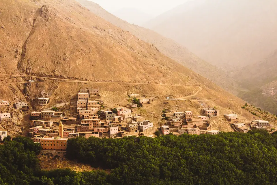
Photo by Louis Hansel on Unsplash
Atlas Mountains Day Trip From Marrakech
Toubkal National Park and the valleys south of Marrakech, the rebuilding after the 2023 earthquake, guides and the practical rules for a safe day out.
Short answer: book a driver or a small-group tour to the High Atlas, walk with a professional guide, and pack warm layers even in summer. The valleys are rebuilding after the 2023 earthquake, and visitors are welcome. Climbing Toubkal itself takes two days, so a day trip means valley walks, not the summit.
The mountains on the horizon
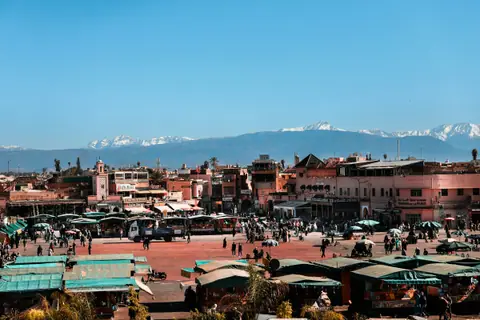
Visit Morocco notes that Marrakech is surrounded by the Atlas Mountains. On clear days you see the peaks from the rooftops of the medina. Toubkal National Park lies between the N'Fiss and Ourika valleys, and Jbel Toubkal rises to 4,167 metres. Visit Morocco says the climb to the summit takes two days.
The 2023 earthquake
The UK government says the last major earthquake in Morocco, in 2023, killed almost 3,000 people. Many villages in the High Atlas south of Marrakech were badly hit. The Great Mosque of Tinmel, built in the 12th century and nearly 900 years old, was levelled. Its minaret toppled and its outer walls fell. In 2024 the AP reported that it was being rebuilt brick by brick.
Rebuilding has continued since then. Check with your driver or guide about current conditions, especially on the road towards Tinmel. Tourism is an important source of income for these valleys, so a respectful visit helps.
The Ourika valley
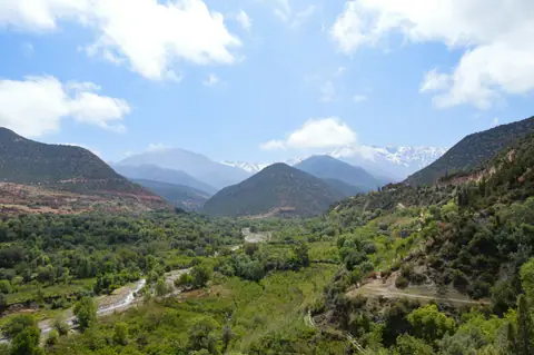
The Ourika valley is one of the closest valleys to the city and marks one edge of Toubkal National Park. It is popular with day trippers, especially on hot summer weekends. Riverside cafés and short walks make it an easy introduction to the mountains. The UK government warns that swimming in open water, including rivers and dams, can be dangerous, so think twice before you jump in.
Toubkal National Park and Imlil
Imlil, reached by the road from Asni, is a common starting point for walks in the Toubkal area. From here, guided walks lead through terraced fields and mountain villages, with lunch on a guesthouse terrace. If you want to climb Jbel Toubkal, plan for two days with a night in the mountains. A day trip is long enough for valley walks only.
The N'Fiss valley
The N'Fiss valley forms the other edge of the national park. The road south leads towards Tinmel, whose mosque is being rebuilt after the earthquake. Ask locally whether the site can be visited before you plan your day around it.
Why a guide matters
The UK government advises anyone hiking in the Atlas Mountains to hire a professional guide. Trails are not always marked, weather changes fast, and paths can be damaged after storms or earthquakes. A local guide also keeps money in the villages. Book through your riad, a licensed agency or a guesthouse in Imlil.
Getting there
Hiring a car and driver for the day gives the most freedom and lets you stop where you like. Shared group tours are cheaper and work well for the Ourika valley. Driving yourself is possible, but the UK advice warns that poor lighting makes driving at night dangerous, so plan to return before dark. Mountain roads are narrow and busy with trucks.
Safety checklist
- Guide: hire a professional guide for any hike.
- Water: avoid swimming in rivers and dams, which can be dangerous.
- Daylight: start early and be back on the main road before dark.
- Drones and photos: do not fly a drone without permission, and ask before photographing villagers.
- Earthquakes: follow local advice, as earthquakes remain a risk in Morocco.
What to pack
The mountains are much cooler than the city. Bring hiking shoes, a fleece and a waterproof layer, even in summer. Add a hat, sunscreen and plenty of water, since the sun is strong at altitude. Carry some cash in small notes for tea, lunch and tips. Dress modestly in the villages, covering shoulders and knees.
When to go
Visit Morocco recommends March to May and September to November for Marrakech, and these months suit the mountains too. Summer in the city is very hot, which makes a cool mountain day attractive, but start early. In winter, check conditions with your guide before you set off.
Respecting the villages
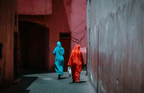
The valleys are home to Amazigh communities, and many families are still rebuilding after the earthquake. Ask before you take photos of people or homes. Buy from local cooperatives and guesthouses where you can. During Ramadan, avoid eating or drinking in public during the day, as the UK government advises.
Fitting the trip into your stay
A mountain day works well on day three of a short visit, after two days in the medina. Our three-day plan shows how, our what to wear guide covers mountain clothing, and our best time to visit guide explains the seasons.
Choosing between the valleys
The right valley depends on your energy and your interests. The Ourika valley is easy to reach and good for a relaxed day with short walks and riverside cafés. The Toubkal area around Imlil suits keener walkers who want terraced fields, mountain villages and big views. The N'Fiss valley side is quieter, and it is the route towards Tinmel, so check locally whether its mosque can be seen.
In each case, give yourself a full day and do not try to combine valleys. Mountain roads are slow, and the best part of the trip is time on foot with your guide.
A sample day
A typical day starts with an early pickup from your riad drop-off point and a drive south towards the mountains. You then walk with your guide for a few hours through villages and terraced fields, stopping for mint tea and lunch at a guesthouse. In the afternoon you head back towards Marrakech, arriving in time for an evening on Jemaa el-Fna. Ask your driver to stop at viewpoints on the way, and allow extra time for slow traffic on the mountain roads.
Supporting the valleys
Choosing a local guide, eating at village guesthouses and buying crafts from cooperatives keeps more of your money in the mountains. After the 2023 earthquake, that support matters even more for families who depend on visitors.
Where it is
- 1Atlas Mountains Day Trip From Marrakech
- Marrakesh Menara Airport (RAK) · about 53 km from here in a straight line
- Directions in Google Maps
Stations and taxi ranks: OpenStreetMap. Airports: OurAirports. Distances are in a straight line.
Traveller tips
Real advice from people who have been to Marrakech. Every tip is read by our team before it goes live.
No tips yet. Been here? Yours could be the first.
Thank you! Your tip will appear here after a quick review.
More in Marrakech
Continue exploring Marrakech with related neighbourhood, food, and planning guides