Punta del Este
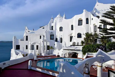
Jutting out along the southern coast of Uruguay where the calm sunset waters of the Río de la Plata meet the open surf of the South Atlantic Ocean, Punta del Este pairs Mario Irarrázabal's iconic beach sculpture La Mano and Carlos Páez Vilaró's cliffside Casapueblo with the undulating bridges of La Barra, Pablo Atchugarry's MACA sculpture park, and the lighthouse village of José Ignacio.
Quick decisions
- How many days? Spend 3 to 4 days to walk the Peninsula from La Mano to the harbour and lighthouse, sail out to Isla Gorriti or Isla de Lobos, watch sunset at Casapueblo on Punta Ballena, and drive east across the undulating bridge of La Barra to MACA, José Ignacio, and the circular Laguna Garzón bridge.
- Where should I stay? Choose La Península for walkable access to both Playa Brava and Playa Mansa, pine-shaded Rinconada and Beverly Hills for quiet garden hotels, or La Barra, Manantiales, and José Ignacio for coastal inns and surf beaches.
- Do I need a car? You can walk the entire Peninsula and ride regular intercity coaches from Montevideo, but hiring a car (or booking a driver) makes exploring Punta Ballena, Arboretum Lussich, MACA in Manantiales, Bodega Garzón, and José Ignacio along Route 10 far easier.
- Best for: Dual-coastline beaches (calm bay vs Atlantic surf), monumental open-air contemporary art (La Mano, Casapueblo, MACA), wild South American sea lions and whales, and ocean-cooled Tannat and Albariño wine country.
- Before you go: Even at the height of the austral summer in January and February, evening ocean breezes along the Rambla and Route 10 call for a light sweater or linen jacket after sunset.
- Getting around: Navigate the beaches by numbered bus stops called Paradas (running outward from Parada 1 on both Playa Mansa and Playa Brava), walk the Rambla General Artigas, and use local buses or taxis along the coast.
- Continue your trip: Travel two hours west along the Ruta Interbalnearia to Montevideo, or connect across the Río de la Plata by ferry or flight to Buenos Aires.
Overview
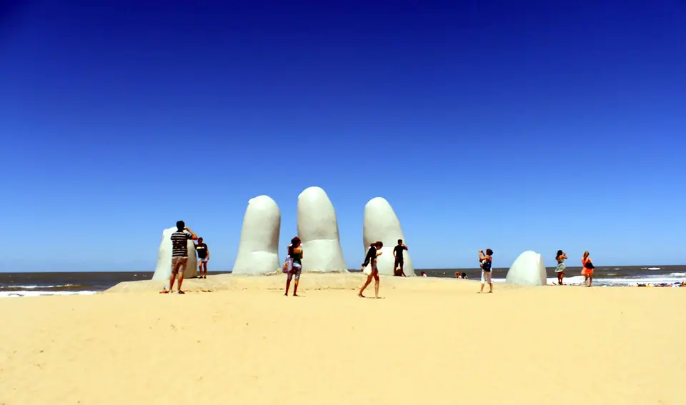
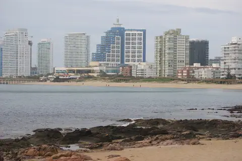
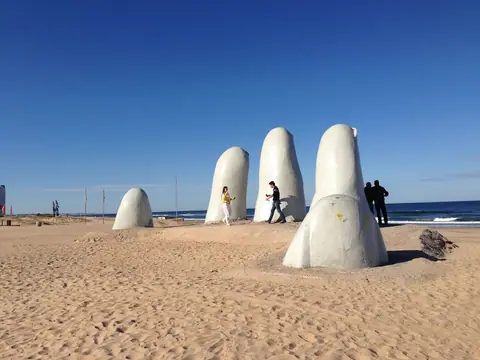
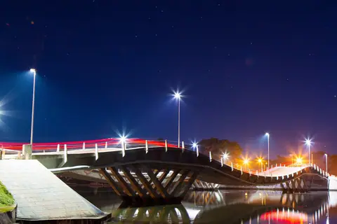
Officially founded on 5 July 1907 on the rocky granite cape originally settled in 1829 as Villa Ituzaingó, Punta del Este marks the geographical boundary where the broad estuary of the Río de la Plata opens into the South Atlantic Ocean. That meeting of waters gives the resort its signature dual identity: to the west curves Playa Mansa ("Calm Beach"), a sheltered, pine-fringed crescent facing the offshore pine groves of Isla Gorriti and blazing crimson sunsets; to the east stretches Playa Brava ("Rough Beach"), where rolling Atlantic swells crash past Mario Irarrázabal's 1982 concrete fingers (La Mano). Beyond the yacht harbour and 1860 Punta del Este Lighthouse of the Peninsula, the coastline unfurls for fifty kilometres from the whitewashed cliffside ateliers of Casapueblo at Punta Ballena to the stressed-ribbon undulating bridges of La Barra, Pablo Atchugarry's MACA contemporary art museum in Manantiales, and the windswept lighthouse and circular lagoon bridge of José Ignacio.
Getting there
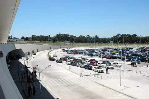
Fly directly into Punta del Este Airport (PDP) at Laguna del Sauce (20 km west) from Buenos Aires or São Paulo, or land at Carrasco International Airport (MVD) near Montevideo and board a direct two-hour COT or COPSA coach along the Ruta Interbalnearia straight to the Playa Brava bus terminal.
Where to stay
Stay on La Península to walk between Playa Mansa, Playa Brava, and the yacht marina, along the pine-shaded avenues of Playa Mansa and Aidy Grill, or east of the Arroyo Maldonado in La Barra, Manantiales, and José Ignacio.
Things to do
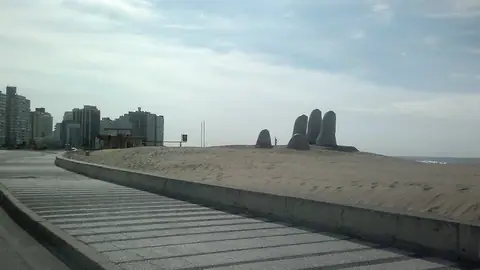
Photograph La Mano on Playa Brava and the 1860 Lighthouse, take a boat to Isla Gorriti or the fur-seal colony of Isla de Lobos, watch the Sun Ceremony at Casapueblo, tour MACA, and drive to José Ignacio.
Food and drink
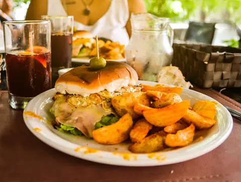
Taste the original Uruguayan chivito (invented in Punta del Este in 1944), wood-grilled corvina negra and mejillones by the port, dulce de leche medialunas, and coastal Albariño and Tannat from Maldonado and Garzón.
Culture
Explore the Dalí bronzes and Latin American surrealist galleries of Museo Ralli, the 18th-century Cuartel de Dragones in Maldonado, and the monumental marble and steel sculptures at Fundación Pablo Atchugarry (MACA).
Weather by month
Punta del Este is warmest in January, with average highs around 25°C, and coldest in July, when nights drop to about 8°C. January is the wettest month, with rain on about 6 days. For mild weather with fewer rainy days, aim for December.
| Month | Low | Range | High | Rain | Rainy days |
|---|---|---|---|---|---|
| Jan | 18°C | 25°C | 42 mm | 6 d | |
| Feb | 18°C | 25°C | 42 mm | 6 d | |
| Mar | 17°C | 24°C | 42 mm | 6 d | |
| Apr | 14°C | 21°C | 42 mm | 6 d | |
| May | 12°C | 18°C | 42 mm | 6 d | |
| Jun | 9°C | 15°C | 42 mm | 6 d | |
| Jul | 8°C | 14°C | 42 mm | 6 d | |
| Aug | 9°C | 15°C | 42 mm | 6 d | |
| Sep | 10°C | 16°C | 42 mm | 6 d | |
| Oct | 12°C | 18°C | 42 mm | 6 d | |
| Nov | 14°C | 21°C | 42 mm | 6 d | |
| Dec | 17°C | 24°C | 35 mm | 5 d |
Averages of daily values from 2015 to 2024. Rainy days are days with at least 1 mm of rain. Source: Open-Meteo · Compare destinations by month.
Punta del Este on the map
Every place we cover in Punta del Este. Tap a category or pin to explore.
In-depth Punta del Este guides
Browse the guides grouped by topic: sights, neighbourhoods, food, transport, day trips and trip planning.
Sights, Landmarks & Parks
Key monuments, viewpoints, museums and nature trails.
- 12 Best Things to Do in Punta del Este: La Mano, Casapueblo, MACA & IslandsDiscover the 12 best things to do in Punta del Este, Uruguay: photograph La Mano at Playa Brava, meet wild sea lions at the Puerto, watch sunset at Casapueblo, tour MACA in Manantiales, and visit José Ignacio.
- Best Time to Visit Punta del Este: Austral Summer, Autumn Wine Harvest & Winter WhalesMonth-by-month weather guide to Punta del Este using official 1991-2020 INUMET/WMO climate normals: compare the high summer beach season (January-February), golden March-April, and July-October whale watching.
- 3 Days in Punta del Este Itinerary: La Península, Casapueblo, La Barra, MACA & José IgnacioPlan the perfect 3 days in Punta del Este, Uruguay: explore La Mano, the Puerto, and Isla Gorriti on Day 1, Arboretum Lussich and Casapueblo on Day 2, and La Barra, MACA, and José Ignacio on Day 3.
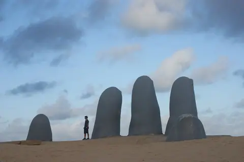
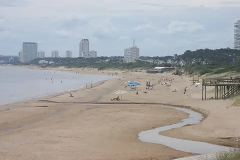
- Playa Brava, La Mano (Los Dedos), 1860 Lighthouse & Peninsula Harbour WalkWalk the complete perimeter of the Punta del Este Peninsula: start at Mario Irarrázabal's 1982 La Mano sculpture on Playa Brava, pass El Emir and the 1860 Lighthouse, and meet wild sea lions at the Puerto.
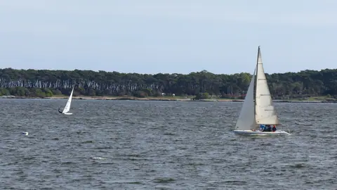
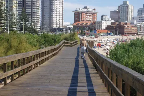
- Playa Mansa Sunset Bay & Isla Gorriti Day Trip Guide, Punta del EsteExplore the calm western bay of Punta del Este: stroll the pine-shaded wooden boardwalk of Playa Mansa from Parada 1 to Parada 24 and take the 15-minute passenger launch to historic Isla Gorriti.
- Punta Ballena, Casapueblo (Carlos Páez Vilaró) & Arboretum Lussich GuideVisit Punta del Este's most famous artistic landmark: explore Carlos Páez Vilaró's cliffside Casapueblo on Punta Ballena during the sunset Sun Ceremony, and walk the 1896 forest trails of Arboretum Lussich.
- La Barra Undulating Bridge, Manantiales & MACA (Atchugarry Museum) GuideExplore Punta del Este's eastern art and surf coast: cross Leonel Viera's 1965 undulating bridges into La Barra, relax on Montoya and Bikini beaches, and tour Pablo Atchugarry's MACA museum in Manantiales.
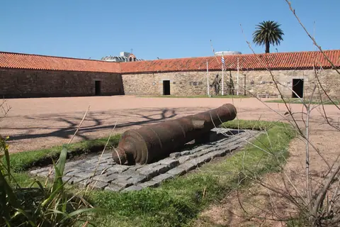
- Museo Ralli (Beverly Hills) & Colonial San Fernando de Maldonado GuideDiscover the art and colonial history behind the beaches of Punta del Este: walk among Salvador Dalí sculptures at Museo Ralli in Beverly Hills and explore the 1771 Cuartel de Dragones in Maldonado.
Neighbourhoods & Where to Stay
Districts, historic quarters and the best bases for your stay.
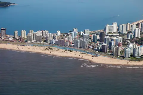
- Punta del Este: Mansa vs Brava, Paradas & Coastal LayoutPlan your visit to Punta del Este, Uruguay: understand how the Peninsula divides calm Playa Mansa from Atlantic Playa Brava, how numbered Paradas work, and how the coast stretches from Punta Ballena to José Ignacio.
- What to Wear in Punta del Este: Resort Linen, Atlantic Wind Layers & Beach Packing GuideWhat to pack and wear in Punta del Este, Uruguay: effortless linen and cotton resort style for José Ignacio beach lunches, UV sun protection, and essential evening layers for breezy Atlantic nights.
- Where to Stay in Punta del Este: La Península, Playa Mansa, La Barra & José IgnacioCompare the best areas to stay in Punta del Este, Uruguay: walkable La Península near the harbour, pine-shaded Playa Mansa and Beverly Hills, surf-focused La Barra and Manantiales, or tranquil José Ignacio.
Food & Drink
Local dishes, markets, cafés and dining districts.
Getting Around & Arrival
Airport transfers, public transit, passes and driving rules.
Day Trips & Excursions
Easy half-day and full-day trips from the city.
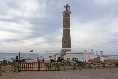
- José Ignacio Lighthouse, Parador La Huella & Circular Laguna Garzón Bridge Day TripPlan a day trip along Route 10 to José Ignacio and Laguna Garzón: climb the 1877 brick lighthouse, walk Playa Brava and Playa Mansa, dine on wood-fired seafood, and cross Rafael Viñoly's circular bridge.
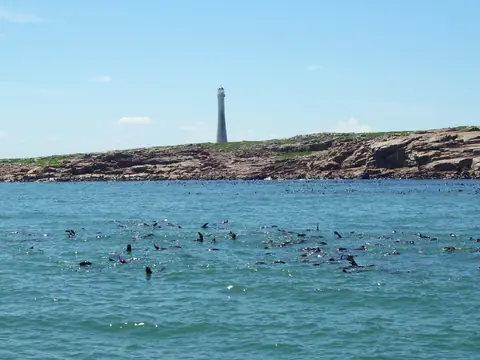
- Isla de Lobos Sea Lion Colony, 1906 Lighthouse & Atlantic Whale Watching GuideExperience Punta del Este's marine wildlife: boat out 8 km into the Atlantic to see 200,000 fur seals and sea lions around the 59m lighthouse of Isla de Lobos, and spot Southern Right Whales from July to October.
Reviews
Log in to write a review.
No reviews yet.