Photo: SIryn · CC BY-SA 4.0
Crossing the Swan: Inside Rotterdam's Erasmus Bridge
Architecture and engineering of Ben van Berkel's 1996 Erasmus Bridge across the Nieuwe Maas: the 139-metre bent pylon, 89-metre bascule span, and river walk.
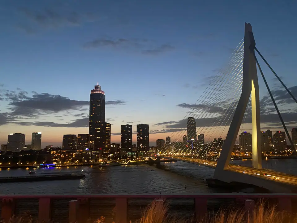
Before Ben van Berkel sketched a bent white steel pylon arching across the Nieuwe Maas, central Rotterdam largely faced away from its southern docks. For decades, commuters crossed downstream tunnels or older eastern bridges while former harbour warehouses sat isolated behind shipping tracks. Opened officially by Queen Beatrix on 6 September 1996 ahead of general traffic in October 1996, the Erasmus Bridge (Erasmusbrug, eh-RAHS-mus-bruk) stitched downtown Leuvehaven and Boompjes straight onto Kop van Zuid. Locals quickly nicknamed the sweeping cable-stayed silhouette De Zwaan ("The Swan"). Within months, one municipal river link became Rotterdam's unmistakable architectural signature.
Ben van Berkel's 1996 Swan Across the Nieuwe Maas
Commissioned as the centrepiece of urban regeneration connecting north and south Rotterdam, architect Ben van Berkel worked with Caroline Bos at Van Berkel & Bos (later UNStudio). Their design rejected symmetrical two-tower highway silhouettes completely. Instead, one pale blue-white asymmetrical steel pylon tilts north-east near the southern shore, pulling forty steel stay cables down toward the northern roadway like taut harp strings. Engineers chose steel cable stays over heavy masonry girders so the central crossing reads airy rather than heavy from street level. Construction totalled roughly 365 million Dutch guilders (over 165 million euro in historical project budgets). That civic investment turned Kop van Zuid and Wilhelminapier from quiet rail sidings into Rotterdam's high-rise riverfront.
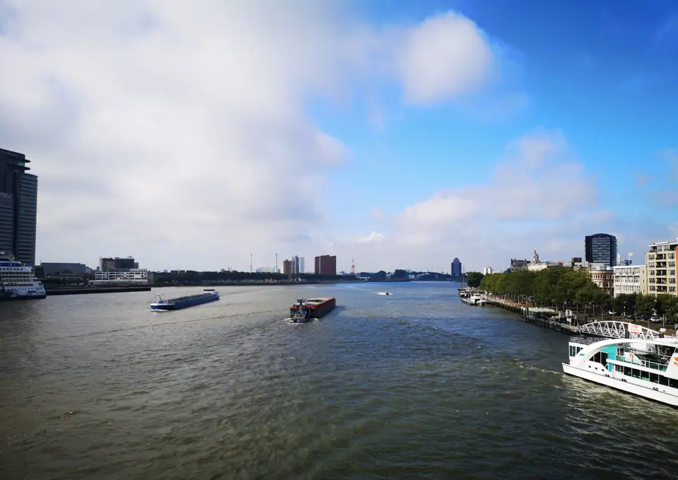
Viewed within the post-war timeline on our city orientation page, the 1996 crossing arrived fifty-six years after the May 1940 bombardment and eighteen years before the 2014 Markthal. Earlier reconstruction decades prioritised pragmatic concrete housing blocks, wide avenues, and retail promenades for displaced families. By the 1990s, civic leaders pursued bold skyline geometry readable from kilometres downriver and along incoming ship channels.
Inside the 139-Metre Pylon and 89-Metre Bascule Span
Structural drawings from UNStudio record an overall length of 802 metres, though municipal handbooks occasionally cite 790 metres excluding shore ramps. Its main cable-stayed span clears 284 to 285 metres of tidal river channel without intermediate mid-stream piers. Rising above the southern pier, the iconic kinked pylon reaches 139 metres above water (sometimes rounded to 138 metres in municipal summaries). Engineers initially sketched a 150-metre concrete tower before switching to hollow sky-toned steel plates. That material change trimmed 11 metres off total height while sharpening the slender cantilevered elbow.
Forty steel stay cables divide cleanly by structural task across both sides of that leaning tower. Thirty-two forward stays fan northward to carry the main river deck, while eight heavier backstays anchor the elbow down into southern concrete foundations. Because ocean-going ships and tall yachts still sail upstream past downtown quays, a low fixed roadway could never operate reliably. South of the steel pylon hinges an 89-metre bascule lifting span, ranked among the largest and heaviest bascule bridges in Western Europe. Heavy hydraulic machinery tilts the southern roadway skyward whenever tall vessels request passage, temporarily halting trams and traffic as crowds gather along railings to watch the leaf lift upright.
Tram Rails, Cycle Tracks and Windy Winter Crossings
Walking or cycling across the bridge delivers Rotterdam's clearest open-air skyline panorama without paying observation-tower admission. The broad deck cleanly separates motor lanes from dedicated two-way RET tram tracks linking Centrum directly with Rotterdam Zuid and Wilhelminapier. Sheltered red cycle paths and outer pedestrian pavements flank both edges cleanly. Covering all 802 metres on foot takes roughly ten minutes at an easy pace. Northward views capture downtown towers and Leuvehaven quays, while western sightlines frame the Euromast spire above Waalhaven shipyards.
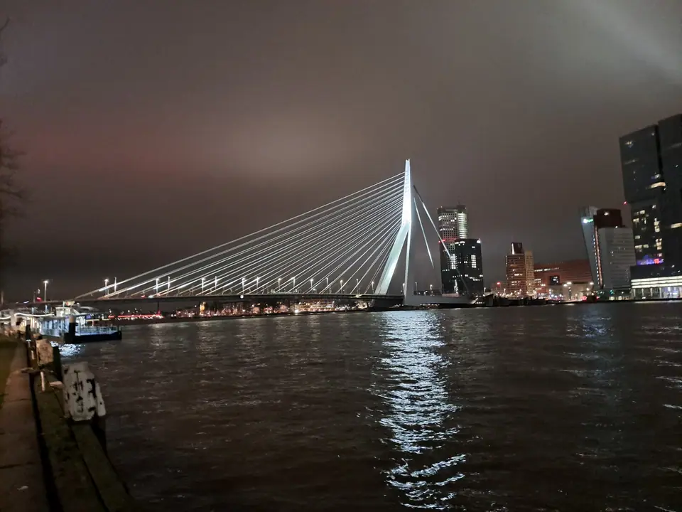
Exposed river winds govern walking comfort across open water, as detailed in our seasonal climate breakdown. With KNMI Station 344 recording mean annual wind speeds near 4.6 metres per second, winter crossings from November through March feel dramatically brisker than sheltered streets around Coolsingel. Stay inside pedestrian pavements clear of fast commuter cyclists, or board RET trams across the deck whenever North Sea rain squalls sweep upstream. Mild spring mornings in April and sunny September afternoons offer calmer, clearer river air for lingering midway above passing barges. From both outer pavements, photographers capture clean vertical frames of the bent white steel elbow catching low sunlight against passing river tugs.
Comparing the Erasmus Bridge With Willemsbrug and De Hef
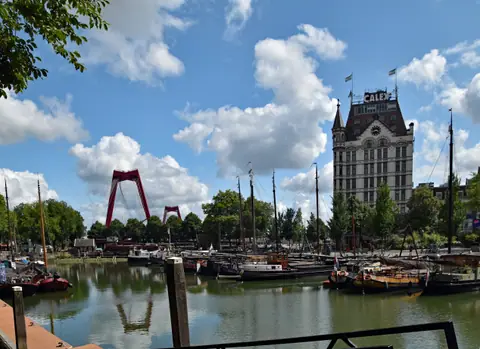
Looking upstream east from the deck aligns three distinct generations of Rotterdam river engineering within one clear glance. Immediately east rises the bright-red 1981 Willemsbrug, a twin-pylon cable-stayed road bridge linking Noordereiland directly onto Oude Haven. Behind Noordereiland stands the retired olive-green steel lattice of De Hef (officially Koningshavenbrug), opened in 1927 as a vertical-lift railway bridge carrying mainline trains across the river.
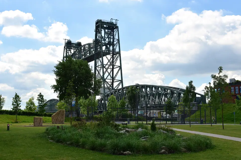
When Dutch railways sank mainline tracks underground into the Willemsspoortunnel in 1993, citizens campaigned successfully to save De Hef from scrapyards. Its twin steel lifting towers remain fixed aloft permanently as an industrial monument spanning Koningshaven. Downstream west hides an invisible pre-war contrast: the 1942 Maastunnel carrying walkers and cyclists under the riverbed via vintage wooden escalators. Crossing south over the Swan, walking along Wilhelminapier quays past Foodhallen Rotterdam, and looping back via Willemsbrug or the Maastunnel shows how three engineering eras shaped Rotterdam's working river corridor.
Where it is
- 1Crossing the Swan
- Rotterdam The Hague Airport (RTM) · about 6 km from here in a straight line
- Amsterdam Airport Schiphol (AMS) · about 48 km from here in a straight line
- Directions in Google Maps
Stations and taxi ranks: OpenStreetMap. Airports: OurAirports. Distances are in a straight line.
Traveller tips
Real advice from people who have been to Rotterdam. Every tip is read by our team before it goes live.
No tips yet. Been here? Yours could be the first.
Thank you! Your tip will appear here after a quick review.
More in Rotterdam
Continue exploring Rotterdam with related neighbourhood, food, and planning guides