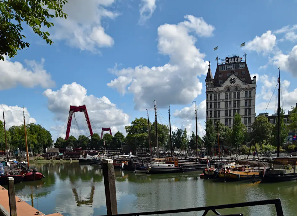
Photo: Thomas Dahlstrøm Nielsen · CC BY 4.0
Rotterdam on the Nieuwe Maas: A Rebuilt Port City
How the 14 May 1940 bombing cleared Rotterdam's core for modern skylines, surviving harbour corners, sub-sea-level polders, and Europe's largest port.
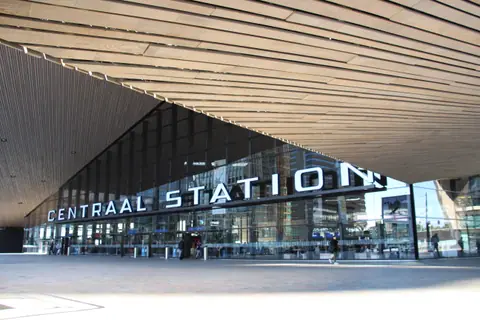
Few European cities explain their skyline as starkly in one afternoon walk as Rotterdam. Step south from Rotterdam Centraal and wide boulevards replace the narrow gabled lanes familiar from Amsterdam. That contrast stems from a single afternoon of wartime destruction rather than nineteenth-century planning fashion. Understanding what survived, what vanished, and how Dutch engineers keep water below street level makes every block legible.
Municipal figures count 672,565 residents on 1 January 2025, reaching 673,804 entering 2026 across 324.14 square kilometres. Roughly 106.59 square kilometres of that territory is open water beside 217.55 square kilometres of land. That footprint makes Rotterdam the second-largest city in the Netherlands by population and the largest Dutch municipality by area. Over half of residents (52.9 percent) have at least one parent born abroad, shaping everything from dockyard street names to local kitchens.
From a 13th-Century Rotte Dam to 14 May 1940
Rotterdam began as a thirteenth-century dam built across the marshy Rotte river around the 1260s, earning formal city rights on 7 July 1340. Over six centuries, maritime trade along the Nieuwe Maas (NYOO-uh MAHS) turned compact brick quays into a dense commercial port. That historic heart vanished on 14 May 1940 when German bombers flattened almost the entire central core in minutes. Around 900 people lost their lives and roughly 80,000 residents became homeless before Dutch forces capitulated on 15 May.
Rather than reconstructing replica gables, post-war municipal planners cleared damaged brick ruins and sketched a spacious modern port capital. Wide traffic arteries, sunlit housing blocks, and commercial plazas replaced cramped medieval alleys between Coolsingel and Blaak. Visitors expecting seventeenth-century canal rings often feel startled until they read the city as an open-air gallery of post-war European architecture. Walking south toward the river shows how deliberately each generation added fresh height and glass.
Laurenskerk, Schielandshuis and the Witte Huis Survivors
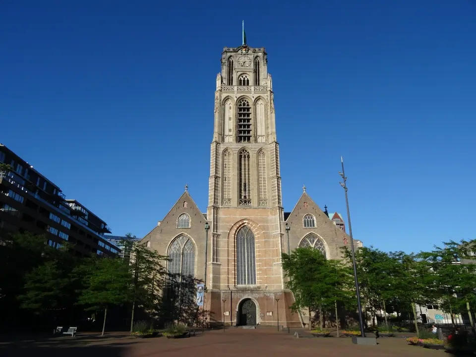
Because fire swept away nearly every downtown street block, the handful of pre-1940 monuments carry unusual civic weight. Anchoring Grotekerkplein stands the Grote of Sint-Laurenskerk (LOW-rens-kerk), constructed between 1449 and 1525 with a sturdy 64-metre stone tower. Fire gutted its nave roof in 1940, leaving stone masonry exposed until 1950s restoration secured it as the only medieval building standing in central Rotterdam. Inside, bright vaulted bays stand steps from modern steel storefronts.
Three more downtown survivors anchor neighbouring streets near the central walking circuit. Off Coolsingel rests the 1665 Classicist Schielandshuis, built by Pieter Post and Jacob Lois for the regional water board. Down beside Oude Haven rises the 1898 Art Nouveau Witte Huis (VIT-uh HOYSS), measuring 43 metres and widely regarded as Europe's first high-rise office building. Facing Coolsingel stands the 1914 to 1920 Town Hall (Stadhuis), whose heavy masonry weathered nearby blasts.
Rotterdam never hides what 1940 erased; instead, one Gothic church tower and three historic survivors stand directly beside cantilevered steel towers and market arches.
Lijnbaan Canopies and Vertical Zalmhaven Towers
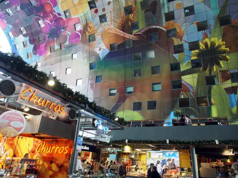
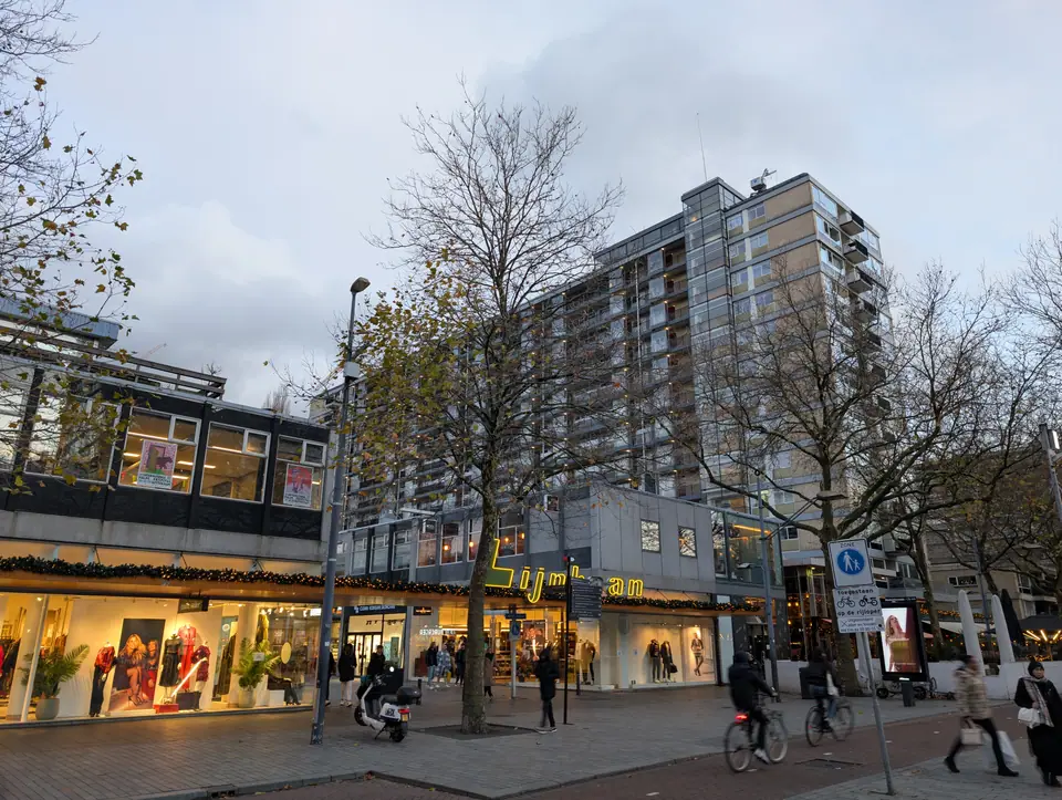
Post-war architects turned empty central lots into urban experiments tested nowhere else in Europe at the time. In 1953, Jo van den Broek and Jaap Bakema opened the car-free Lijnbaan (LYN-bahn), widely recognised as Europe's first purpose-built pedestrian shopping promenade. Continuous concrete canopies sheltered shoppers between low retail pavilions and clean post-war apartment blocks. Later decades brought Piet Blom's tilted 1984 Cube Houses and MVRDV's 2014 Markthal arch across Binnenrotte square.
Height followed steadily toward the Nieuwe Maas waterfront from the 1990s onward. Ben van Berkel's 1996 Erasmus Bridge linked downtown directly to Wilhelminapier, where Rem Koolhaas's studio OMA completed the 149-metre De Rotterdam tower in 2013. In 2022, De Zalmhaven reached 215 metres near Veerhaven as the tallest residential skyscraper in the Netherlands and the Benelux. South across Rijnhaven, Katendrecht welcomed the May 2025 FENIX Museum of Migration inside a restored shipping warehouse.
Sub-Sea-Level Polders and the Nieuwe Maas Divide
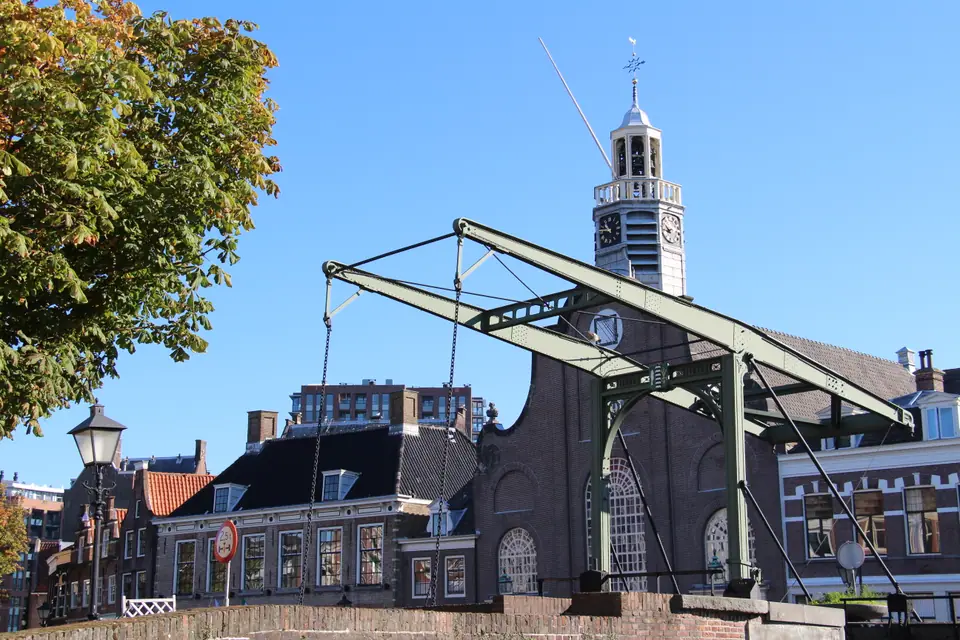
Water geography governs daily infrastructure across every borough in Rotterdam. The broad tidal Nieuwe Maas river cuts east to west, dividing central Cool, Stadsdriehoek, and historic Delfshaven (DELFS-hah-ven) on the north bank from Kop van Zuid and Katendrecht on the south bank. Unlike downtown, Delfshaven escaped the 1940 bombing intact, preserving brick quays and the Pelgrimvaderskerk where English Separatists prayed in July 1620 before sailing aboard the Speedwell.
Behind river levees, much of municipal Rotterdam actually sits below sea level relative to Amsterdam Ordnance Datum (NAP). North-eastern Prins Alexander Polder lies roughly 6 metres below sea level, while the lowest point in the entire Netherlands sits directly east at Nieuwerkerk aan den IJssel (6.76 metres below NAP). Visiting the port and Maeslantkering flood barrier or taking a boat east to Kinderdijk reveals how windmills, locks, and modern storm gates hold back the North Sea.
Euros, Sunday Trading Hours and Evides Tap Water
Daily visitor logistics run smoothly across the city without special preparation. The Netherlands uses the euro (EUR), and contactless bank cards or mobile wallets work at almost every shop, café counter, and museum desk. Wall sockets use standard continental Type C and Type F connections at 230 volts and 50 hertz. Municipal tap water supplied by Evides meets strict quality standards and tastes clean straight from hotel taps.
Unlike strict Sunday retail closures in German cities, central Rotterdam stays open for errands on weekends. Major department stores along Lijnbaan and sunken Koopgoot plus central supermarkets typically open on Sunday afternoons, though hours vary by branch. Non-EU visitors under Schengen rules stay up to 90 days within any 180-day period using passports issued under 10 years earlier and valid at least 3 months past departure. Base yourself near central transit in Centrum or Kop van Zuid before boarding fast trains onward to Antwerp.
Where it is
- 1Rotterdam
- Rotterdam The Hague Airport (RTM) · about 5 km from Rotterdam in a straight line
- Amsterdam Airport Schiphol (AMS) · about 47 km from Rotterdam in a straight line
- Directions in Google Maps
Stations and taxi ranks: OpenStreetMap. Airports: OurAirports. Distances are in a straight line.
Traveller tips
Real advice from people who have been to Rotterdam. Every tip is read by our team before it goes live.
No tips yet. Been here? Yours could be the first.
Thank you! Your tip will appear here after a quick review.
More in Rotterdam
Continue exploring Rotterdam with related neighbourhood, food, and planning guides