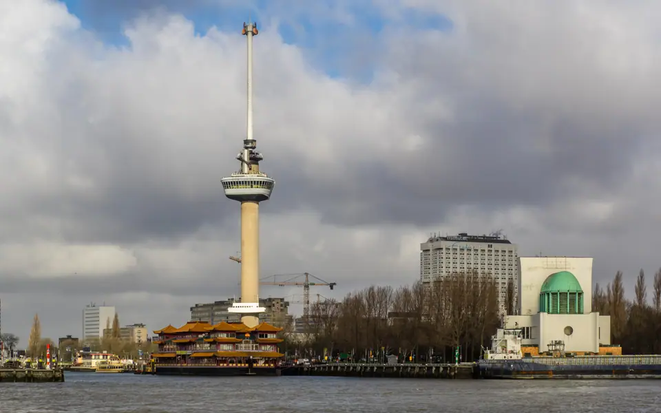
Photo: Frans Berkelaar · CC BY-SA 2.0
Euromast Panorama and Europe's Largest Seaport
Climbing Huig Maaskant's 185-metre Euromast and Euroscoop above Europe's largest seaport, with 2024 to 2025 cargo figures, Maeslantkering gates, Spido, and Portlantis.
Unlike compact inner-city canals elsewhere in Europe, Rotterdam's industrial waterfront stretches far wider than downtown sidewalks suggest. Roughly forty-two kilometres of refineries, container terminals, and deepwater shipyards trace the river channel west toward the North Sea. Pairing a lift ride up the Euromast with a harbour boat cruise or coastal excursion out to Maasvlakte 2 reveals how Europe's largest seaport actually operates.
Huig Maaskant's 1960 Floriade Tower and 1970 Space Spire
Designed by post-war architect Huig Maaskant (with J. van Dommelen, H. Kroos, and M. Senf) for the 1960 Floriade horticultural exhibition, the Euromast rose from 1958 to 1960 inside Het Park. It stands directly beside the green copper-domed ventilation hall of the 1942 Maastunnel, opening on 25 March 1960. Engineers anchored the hollow concrete shaft onto a buried 1,900-tonne concrete block so its centre of gravity rests underground against coastal gales. Originally standing 101 to 107 metres tall, the tower lost its local height crown in 1968 when the 113.5-metre Erasmus MC wing opened nearby.
Rotterdam answered two years later by bolting the sleek 85-metre steel Space Tower spire atop the concrete column in 1970. That extension lifted total height to 185 metres (engineering surveys record 184.6 to 185 metres). It kept the Euromast standing as the tallest structure in the entire Netherlands for more than fifty years until the 215-metre Zalmhaven Tower surpassed it in 2021 and 2022.
Crow's Nest Views and the Rotating Glass Euroscoop
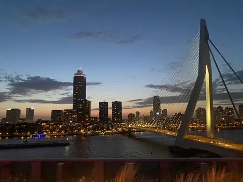
Fast lifts carry visitors straight to the 1960 restaurant and Crow's Nest observation platform positioned between 96 and 104 metres above Het Park lawns. Outer balconies frame sharp panoramas over the green Maas river channel, the Erasmus Bridge, Waalhaven shipyards, and the copper dome of the 1942 Maastunnel ventilation hall. On crisp spring mornings after April showers clear, container cranes across western docks stand sharply visible against the sea horizon.
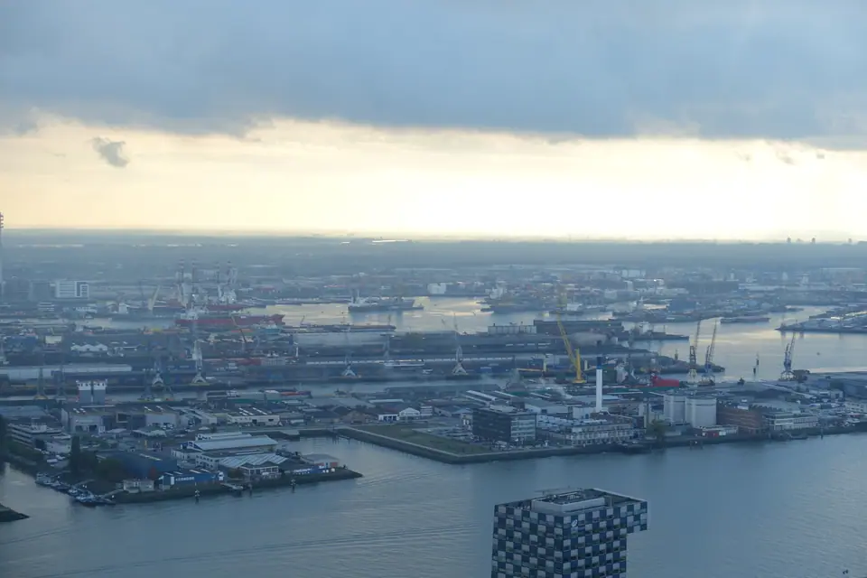
From the platform, step aboard the signature Euroscoop cabin with switchable transparent glass floor panels. It glides upward along the Space Tower mast to 185 metres while rotating smoothly through 360 degrees. Because outdoor decks sit directly exposed to North Sea wind, verify visibility forecasts on euromast.nl before ascending. The tower also hosts World Federation of Great Towers events, seasonal concrete-wall abseiling drops, and boutique overnight suites.
| Landmark or Metric | Verified Specification | Operational Context |
|---|---|---|
| Euromast (1960 / 1970) | 96 to 104 m Crow's Nest; 185 m spire (184.6 m) | Glass-floored rotating Euroscoop cabin to 185 m summit |
| Port Corridor Length & Area | ~42 km length; 12,500 to 12,713 ha total | Stretches from city docks west to Maasvlakte 2 coast |
| Global Cargo Ranking | World's busiest port 1962 to 2004 | Remains Europe's largest seaport; Asian hubs lead globally |
| 2024 / 2025 Port Throughput | 435.8M tonnes / 13.8M TEU (2024); 428.4M / 14.2M TEU (2025) | Container volume grew 3.1% in 2025 across deepwater piers |
| Maeslantkering (1991 to 1997) | Two 210-metre storm-surge swing gates | Final Delta Works barrier shielding Nieuwe Waterweg |
Forty-Two Kilometres of Docks to Maasvlakte 2
Begun as modest fourteenth-century river berths, Rotterdam's harbour migrated steadily seaward whenever ship drafts outgrew inner channels. Engineer Pieter Caland dug the straight Nieuwe Waterweg shipping canal to the North Sea in 1872. That open deepwater channel unlocked staged expansion west through Botlek, Europoort, 1970s Maasvlakte, and reclaimed Maasvlakte 2 (begun in 2008). Covering roughly 12,500 to 12,713 hectares (about 105 to 127 square kilometres, including over 6,000 hectares of industrial sites and 4,810 hectares of water), the corridor transforms empty North Sea shoals into automated piers. Rotterdam ranked as the world's busiest port by cargo tonnage from 1962 to 2004 before Asian ports like Singapore and Shanghai surpassed it.
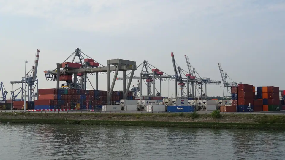
Still Europe's largest seaport, Rotterdam handled 435.8 million tonnes and 13.8 million TEU containers in 2024 (following 468.7 million tonnes and 15.3 million TEU in 2021). Throughput adjusted in 2025 to 428.4 million tonnes while container trade rose 3.1 percent to 14.2 million TEU. Inner docks around Waalhaven and historic shipyards sit clearly within sight from downtown piers and the Euromast summit.
The 1997 Maeslantkering Storm-Surge Gates at Hoek van Holland
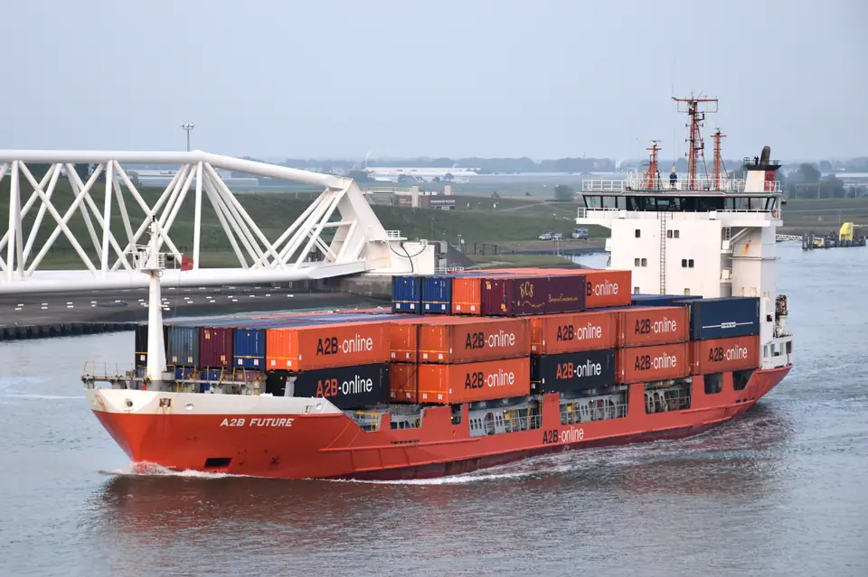
Guarding that deepwater artery near Hoek van Holland (reachable on RET Metro Line B) stands one of Europe's largest moving structures. Built between 1991 and 1997 as the concluding anchor of the Dutch Delta Works, the computer-controlled Maeslantkering (MAHS-lahnt-kay-ring) braces two curved hollow steel swing gates measuring 210 metres wide each. Normally parked dry inside riverside docks so ocean freighters sail past freely, those gates swing shut automatically and sink onto riverbed sills whenever severe North Sea storm tides threaten South Holland polders.
Royal Spido Cruises and Portlantis on Maasvlakte 2
Stepping down onto harbour boats reveals container vessels at striking physical scale. Classic Royal Spido sightseeing vessels depart year-round from Willemsplein piers beside the Erasmus Bridge on 75-minute city harbour circuits past dry docks, shipbuilders, and the moored ss Rotterdam. Travellers wanting automated mega-cranes on the open North Sea coast should look up Portlantis, the interactive port experience centre on Maasvlakte 2 replacing former FutureLand more than forty kilometres west of downtown. Spido runs combined bus-and-boat Portlantis excursions aboard vessels including the Henry Hudson and Portlantis Ferry, tracing Botlek, Europoort, and deepwater terminals straight out toward coastal horizons. Verify seasonal sailing calendars and boarding times on spido.nl and portlantis.nl.
Where it is
- 1Euromast Panorama and Europe's Largest Seaport
- Rotterdam The Hague Airport (RTM) · about 6 km from here in a straight line
- Amsterdam Airport Schiphol (AMS) · about 49 km from here in a straight line
- Directions in Google Maps
Stations and taxi ranks: OpenStreetMap. Airports: OurAirports. Distances are in a straight line.
Traveller tips
Real advice from people who have been to Rotterdam. Every tip is read by our team before it goes live.
No tips yet. Been here? Yours could be the first.
Thank you! Your tip will appear here after a quick review.
More in Rotterdam
Continue exploring Rotterdam with related neighbourhood, food, and planning guides