Photo: Berthold Werner · CC BY-SA 4.0
Mostar and the Olympic Mountains Excursions
Riding the reopened Neretva canyon train to Stari Most, adding Blagaj and Pocitelj, or climbing Bjelasnica, Jahorina and Vrelo Bosne.
Stepping beyond Sarajevo's steep valley ring opens two sharply contrasting worlds within two hours of Old Town. South down the Neretva gorge, mild limestone hills give way to Mediterranean fig gardens and Ottoman stone bridges across Herzegovina. Closer still, within forty minutes of city trams rise three Olympic mountain massifs paired with emerald karst springs below Mount Igman.
| Excursion | Distance | Best transport | Main draw |
|---|---|---|---|
| Mostar | 125 to 130 km south-west | ZFBH Talgo train or M17 coach | Stari Most arch and Neretva canyon. |
| Blagaj Tekke | 12 to 14 km south-east of Mostar | Car, tour or local bus | Dervish lodge over Buna karst spring. |
| Pocitelj | 25 km south-west of Blagaj | Car or regional coach | Terraced Ottoman houses and fort tower. |
| Kravica Waterfalls | 30 to 35 km west of Pocitelj | Car or Herzegovina tour | Broad travertine cascade crescent. |
| Bjelasnica and Igman | 20 to 25 km south-west | Car, taxi or ski shuttle | 2,067 m Olympic alpine and Nordic trails. |
| Jahorina | 28 to 30 km south-east | Car via Pale or shuttle | Bosnia's largest ski resort. |
| Vrelo Bosne | 10 to 12 km west | Tram 3 or 11 plus Velika Aleja | Emerald springs of the Bosna River. |
Is the Talgo train between Sarajevo and Mostar running again?
Yes. Severe flash floods washed out railway embankments near Jablanica in October 2024, suspending trains until ZFBH restored official freight and passenger traffic on 10 February 2025. Confirm current departure times on zfbh.ba ahead of travel in case seasonal track maintenance or summer corridor wildfires prompt temporary timetable notices.
When train timings miss your schedule, frequent buses run down the M17 valley road from central Autobuska stanica in two to two and a half hours. Along that drive sits Konjic, famed for its 1682-1683 Ottoman stone bridge Stara cuprija crossing turquoise canyon rapids above Jablanica Lake.
Which side of the train frames the Neretva gorge?
Arrive early at Sarajevo's main station (Glavna stanica) and pick a window seat on the left-hand side leaving Sarajevo south toward Mostar. Switch to a right-hand window seat for the evening northbound return. Once Spanish Talgo carriages pass through Dinaric mountain tunnels beyond Konjic and Jablanica, tracks cling cleanly to limestone shelves directly above emerald rapids into Herzegovina.
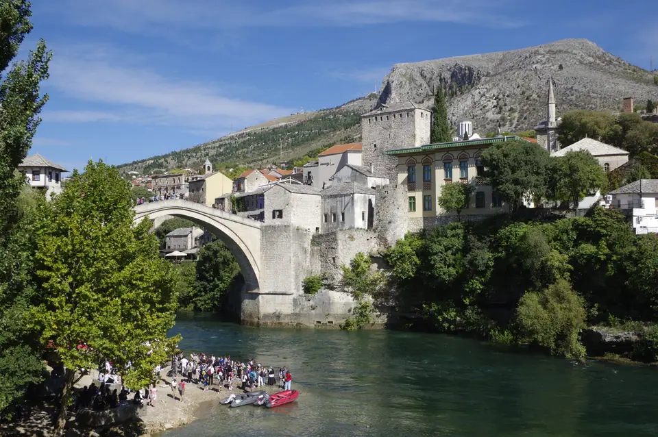
Walking Mostar's reconstructed Stari Most and Old Town
Commissioned in 1566 under Sultan Suleiman the Magnificent and engineered by Ottoman master Mimar Hayruddin, Mostar's single-arch bridge (Stari Most) spans 28 to 28.7 metres across and rises 20 to 21 metres above the Neretva River. Wartime artillery shattered the vault on 9 November 1993. Stonemasons rebuilt it using local Tenelija limestone and traditional iron-and-lead joints before reopening on 23 July 2004, followed by UNESCO inscription in July 2005.
Under the 2013 census, Mostar counts 60,195 urban residents and 105,797 across its wider municipality. Allow three calm hours for slippery cobbled Kujundziluk craft alleys and riverside viewpoints, leaving breathing room before the evening return train. Travellers heading onward south continue smoothly by coach to Dubrovnik, Split and Kotor.
Can you combine Blagaj Tekke, Pocitelj and Kravica in one loop?
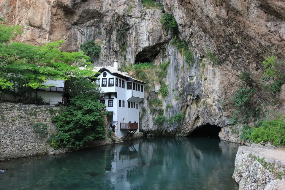
Travellers hiring a car or joining a small Herzegovina day tour link three varied stops south of Mostar without rushing. Twelve to fourteen kilometres south-east of Mostar, whitewashed Blagaj Tekke (Blagajska tekija) sits tucked beneath sheer limestone cliffs where the turquoise Buna River gushes cleanly out of deep karst caverns.
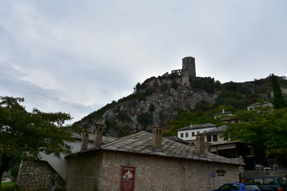
Drive 25 kilometres south-west down the valley (about half an hour) to climb stepped lanes inside Ottoman Počitelj, where stone roofs, a domed mosque and a hill watchtower watch over pomegranate orchards. Continuing 30 to 35 kilometres west near Ljubuski (about 40 kilometres from Mostar) reveals Kravica Waterfalls, where wide travertine ledges drop cool spray into clear summer plunge pools.
How do Bjelasnica, Jahorina and Igman differ across seasons?
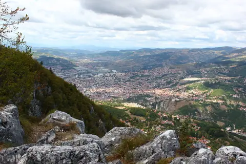
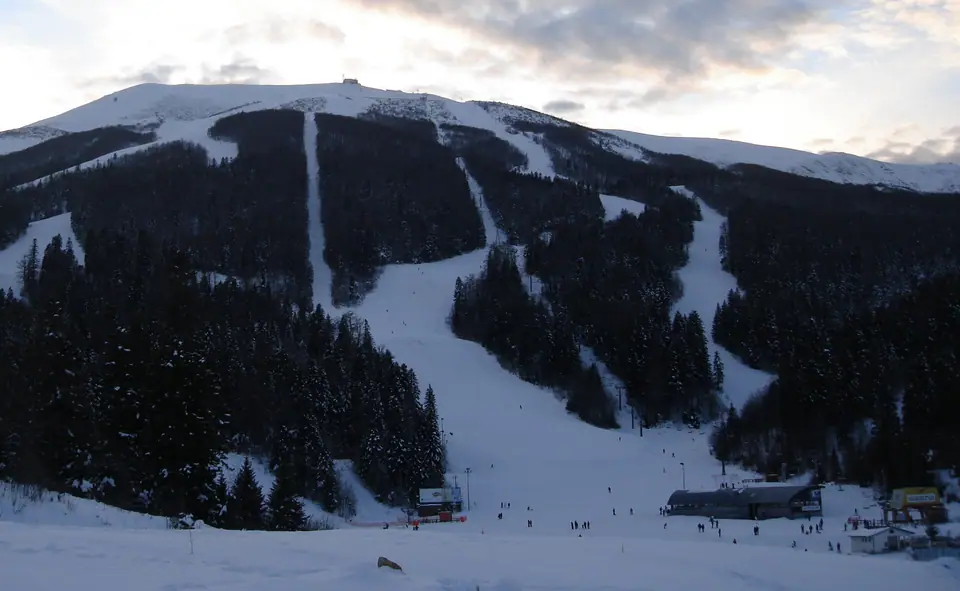
Half an hour south-west of Sarajevo, Mount Bjelasnica climbs to 2,067 metres where men's Olympic downhill races ran in 1984, delivering steep winter pistes and open summer ridges. Bordering it at 1,502 metres, forested Mount Igman keeps flatter cross-country ski trails and historic Nordic jumps across Veliko Polje and Malo Polje pines. South-east via Pale, Mount Jahorina (1,913 to 1,916 metres) runs Bosnia's largest ski resort with modern lifts and snow-making from mid-December into spring.
Check winter valley inversion forecasts before climbing for bright sun above city cloud, since ridge winds feel biting once you step off ski lifts. Summer hikers should wear sturdy trail shoes on loose limestone scree and pack windproof shells even on warm city mornings. Stay strictly on marked trails and alpine access roads respecting Trebevic's demined safety rules.
What about an easy half-day trip without leaving the tram map?
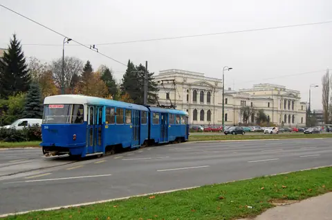
Ride rebuilt Tram Line 3 or Line 11 all the way west to Ilidza terminus, then walk or hire a carriage along the level 3.5-kilometre Velika Aleja chestnut-and-plane-tree promenade into Vrelo Bosne. Set beside Habsburg thermal villas, this flat shaded avenue handles strollers and unhurried afternoon pacing without steep hills. Ten to twelve kilometres from downtown, clear emerald springs pool beneath wooden footbridges and quiet picnic lawns beside Mount Igman's foothills before returning smoothly to Sarajevo's evening streets.
Where it is
- 1Mostar and the Olympic Mountains Excursions
- Split Saint Jerome Airport (SPU) · about 125 km from here in a straight line
- Directions in Google Maps
Stations and taxi ranks: OpenStreetMap. Airports: OurAirports. Distances are in a straight line.
Traveller tips
Real advice from people who have been to Sarajevo. Every tip is read by our team before it goes live.
No tips yet. Been here? Yours could be the first.
Thank you! Your tip will appear here after a quick review.
More in Sarajevo
Continue exploring Sarajevo with related neighbourhood, food, and planning guides