Quick Field Data
- UNESCO Inscription: 2001 (Ref. 1046), cultural winegrowing landscape in northern Portugal; Criteria (iii), (iv) and (v).
- Scale & Footprint: 24,600 hectares spanning the upper Douro River and tributaries Varosa, Corgo, Távora, Torto and Pinhão, cushioned by a 225,400-hectare buffer zone.
- Access & Ticketing: Open valley roads, river piers and Linha do Douro railway stations; individual quintas, wine estates and river cruises set separate tour bookings and tasting fees.
- Arrival Logistics: Major commercial flights arrive at Francisco de Sá Carneiro Airport (OPO), 76 kilometres west near Porto (68 kilometres), while closer Vila Real Airport (VRL) sits 20 kilometres away with limited scheduled services.
Two Millennia of Schist Terracing and the 1756 Port Demarcation
Rising in Spain's Picos de Urbión and running 897 kilometres across northern Iberia, the Douro River drains a 97,290-square-kilometre basin before entering the Atlantic at Porto. Known in antiquity as Durius, whose name linguists trace to an ancient pre-Celtic water root, the river crosses Castile and León past Soria, Burgos, Valladolid, Zamora and Salamanca. Joined by the Pisuerga and Esla tributaries, it carves 112 kilometres of narrow border canyons between Spain and Portugal, protected by the International Douro and Arribes del Duero Natural Parks near Aldeadávila Dam. Entering Portugal below the Águeda confluence, the valley runs past Bragança, Guarda, Viseu, Vila Real, Aveiro and Porto.
Sheltered from damp ocean winds by the Marão and Montemuro mountains, Portugal's Alto Douro Wine Region experiences hot, dry summers and cold winters across deep gorges. Its landscape revolves around the Douro and key tributaries Varosa, Corgo, Távora, Torto and Pinhão, plus the Côa, Tua, Sabor, Paiva, Tâmega and Sousa. Excavated grape seeds and late Roman Empire wine infrastructure from the third and fourth centuries AD confirm two millennia of regional viticulture, expanded from the mid-twelfth century by Cistercian monasteries at Salzedas, São João de Tarouca and São Pedro das Águias.
Commercial expansion gathered force in the seventeenth century, bringing the earliest surviving written reference to Port wine in 1675 before Portugal and England signed the 1703 Methuen Treaty. British wine merchants opened storage cellars in Vila Nova de Gaia opposite Porto, buying fortified casks carried downriver aboard flat-bottomed wooden rabelo boats (replaced in modern times by tanker trucks). On 10 September 1756, a Portuguese royal charter formally mapped the Port production area across western Douro slopes, creating the world's first demarcated wine region before plantings pushed progressively eastward into hotter valleys.
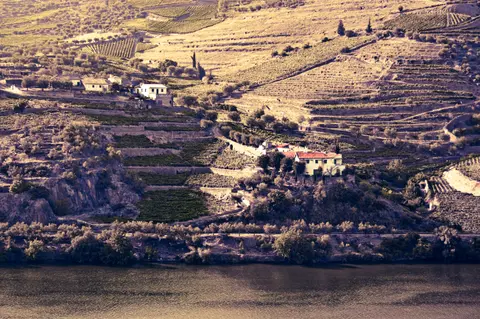
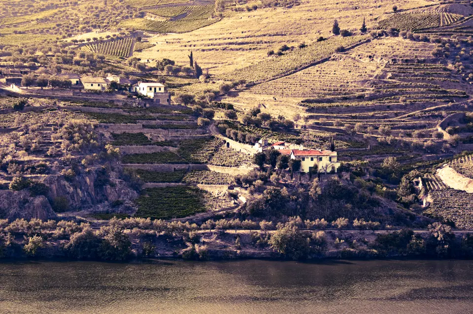
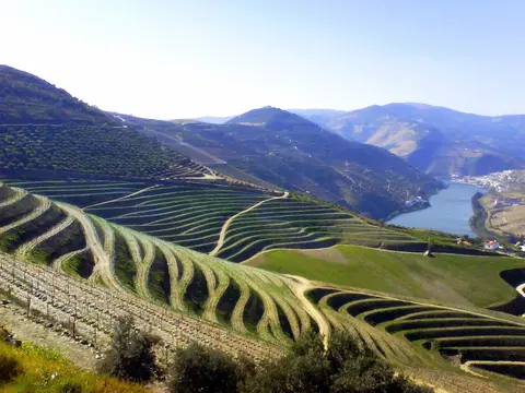
Hillside terraces across the 24,600-hectare UNESCO core record dramatic shifts caused by nineteenth-century vine diseases. Powdery mildew (oidium) struck in 1852 and phylloxera ravaged roots in 1863, compelling growers to rebuild entire slopes. Pre-1860 pre-phylloxera terraces, known as socalcos, formed narrow, irregular ledges propped up by hand-stacked dry-stone schist walls holding just one or two vine rows. Late nineteenth- and early twentieth-century reconstruction replaced many ruined ledges with long, continuous, wider and slightly sloped terraces braced by monumental stone walls to boost sun exposure and streamline drainage.
Three Climate Subregions, Native Grapes, and River Quintas
Classified under Portugal's highest Denominação de Origem Controlada (DOC) status and protected EU and UK geographical rules, Douro vineyards split west to east into three subregions shaped by coastal shelter and rising heat. Closest to the mountain screen sits Baixo Corgo, covering roughly 14,000 hectares of vineyards with the mildest, wettest climate and earliest historic plantings. Upstream lies Cima Corgo, the largest subregion at 19,000 hectares centred around Pinhão and São João da Pesqueira, where steep schist valleys hold the majority of famous estates. Farther east toward Spain stretches Douro Superior, encompassing 8,700 hotter, drier hectares that expanded latest as transport improved.
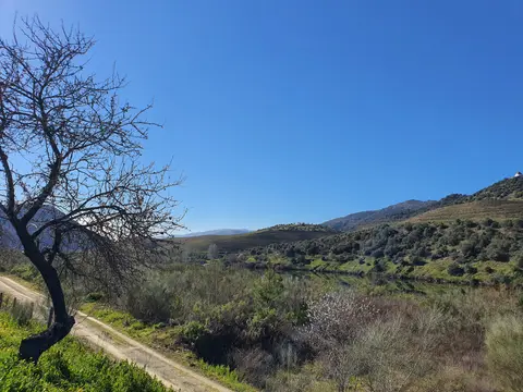
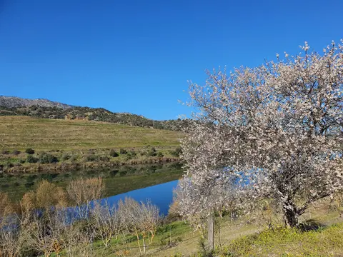
White-walled villages and compact casais clusters sit midway up valley sides around imposing eighteenth-century parish churches and hilltop chapels, punctuated by prominent estates called quintas. Along lower riverbanks and hillside streams grow walled orange groves, olive trees, almonds, Mediterranean scrub, coppice woods and stone water catchments. Though famous worldwide for fortified Port, Douro producers now make roughly equal volumes of unfortified dry table wine ranging from light Bordeaux-style clarets to oak-aged Burgundian styles. For generations, Port shipping houses in Vila Nova de Gaia concentrated almost solely on fortified export wines, leaving local unfortified wines little known outside northern Portugal. Oenologist Fernando Nicolau de Almeida changed that trajectory in 1952 after visiting Bordeaux during the Second World War, creating Barca Velha from grapes grown at Quinta do Vale de Meão in Douro Superior. Further top dry labels emerged in the 1970s before Portugal's 1986 European Economic Community entry abolished Porto lodge export monopolies, freeing valley estates to bottle both Port and dry Douro DOC wines independently.
Soil geology separates vineyard plantings cleanly, with Port vineyards rooted predominantly in heat-retaining schist while cooler granite-based soils yield table wine grapes. For centuries, mixed-field plantations left many growers uncertain which cultivars dominated each slope. Pioneering 1970s vine research singled out Touriga Nacional, Touriga Franca (Touriga Francesa), Tinta Roriz (Tempranillo), Tinta Barroca and Tinta Cão as premier black grapes, later joined by Tinta Amarela and Sousão plus Bastardo and Mourisco tinto. Leading white grapes grown across elevated slopes include Gouveio, Malvasia Fina, Rabigato, Viosinho and Donzelinho branco, while top quintas balance single-variety replantings with enduring old mixed vineyards.
Over recent decades, rising tourist interest upstream from Porto has added vineyard tasting rooms, riverboat excursions and heritage rail rides next to traditional agricultural estates. Careful land management ensures these visitor facilities blend cleanly into working estates across Baixo Corgo, Cima Corgo and Douro Superior.
Post-Phylloxera Walls, Rain Erosion, and Valley Stewardship
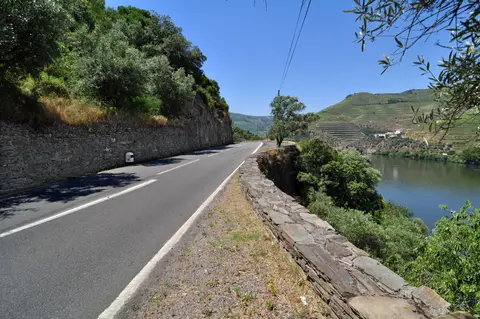
Keeping steep schist mountains productive while protecting historic stone construction demands constant repair and community cooperation. Torrential winter storms in late January 2001 damaged stretches of dry-stone terraces, exposing ongoing vulnerability to extreme weather. Driven by continuous winemaking across generations, including seasonal roga workers descending from nearby mountains to the warm Terra Quente harvest, functional maintenance has kept stone walls inside the 24,600-hectare core far more authentic than settlements inside the vast 225,400-hectare buffer zone.
Protected under Portugal's 2003 Intermunicipal Spatial Plan (IMSP-ADWR) and governed through the Douro Mission created in 2006 with the North Regional Coordination and Development Commission acting as Site Manager supported by permanent advisory committees, valley conservation faces complex multi-owner oversight. Planners coordinate new building permits, guide terrace restoration methods, retain natural tree lines dividing vine plots and curb visual intrusions while sustaining profitable village life. Monitoring teams also survey vernacular manor buildings, rural chapels and dry-stone retaining walls across municipalities so modern vineyard machinery never sweeps away narrow historic ledges.
International cooperation extends upstream under the 1998 Albufeira Convention governing shared Douro river waters between Portugal and Spain, updating earlier 1927, 1964 and 1968 treaties. Maintaining steady water quality, managing reservoir flows across all fifteen Iberian dams and preserving the cultural relationship between river towns, rural wineries and historic Vila Nova de Gaia cellars ensures this working wine landscape continues thriving cleanly. Even as modern transport replaced traditional rabelo cargo boats downriver, shared municipal planning guards the valley's terraced skyline against unsuitable roadside construction.
Education and technical outreach led by regional agricultural boards also help smaller landholders rebuild collapsed schist retaining walls after winter storms using traditional dry-stone drainage methods. By backing small family growers together with larger historic estates, regional policy keeps both dry table winemaking and fortified Port production economically viable across steep canyon slopes.
Across steep terraced rows, viticulturists also monitor seasonal pruning, grape ripening and water catchments carefully between spring frosts and late-summer heatwaves. Because narrow stone shelves prevent heavy mechanical harvesters from climbing older pre-phylloxera and early twentieth-century blocks, manual harvest teams remain essential every autumn across Cima Corgo and Douro Superior.
Access Zones Across the Alto Douro Wine Region
Moving through the Douro Valley follows the river corridor between Peso da Régua, Pinhão and Pocinho using trains, scenic riverside roads and lock-equipped excursion vessels. Always verify estate tasting reservations and seasonal cruise schedules ahead of departure.
| Complex Zone | Key Highlights | Access & Ticket Rule |
|---|---|---|
| Baixo Corgo & Peso da Régua | Western gateway town on the Douro River, historic bridgeheads, Régua lock dam and mildest vineyard slopes. | Town streets and riverfront promenades open freely; check local boat operators and museums for ticketing. |
| Cima Corgo & Pinhão | Heart of Port production, famous riverside quintas, tiled railway station and steep N222 valley viewpoints. | Public roads and river wharves open freely; estate cellar tours and guided tastings require advance booking. |
| Douro Superior & Pocinho | Hottest, driest eastern canyon reaching Pocinho lock dam and railway terminus near Côa Valley rock art. | Reached via Linha do Douro trains or valley highways; confirm rural quinta opening hours in advance. |
| Upland Villages & Chapels | White-walled casais settlements like São João da Pesqueira, eighteenth-century parish churches and ridge viewpoints. | Village lanes and hilltop miradouros remain publicly accessible year-round with no admission charge. |
Three Vineyard and River Engineering Details in the Douro Valley
- Pre-Phylloxera Socalcos vs Post-Phylloxera Terraces: Compare narrow irregular stone ledges clinging to tight bends near Pinhão with broader twentieth-century stepped terraces cut diagonally across slopes to maximise sunlight.
- Schist Stone Retaining Walls: Inspect dry-laid metamorphic schist masonry along road cuts and village paths, stacked neatly without mortar to drain intense winter storms while radiating summer heat onto low vines.
- Five Portuguese Navigation Lock Dams: Watch river cruises climb through massive engineering locks built in the 1960s and 1970s at Crestuma-Lever, Carrapatelo (lifting vessels up to 35 metres), Régua, Valeira and Pocinho.
Best Time to Visit the Douro Valley and Routes From Porto
Deciding when to visit the Douro Valley tracks closely with seasonal harvest traditions and continental weather extremes. Spring warms the valley gently with green vine shoots and quiet roadside viewpoints, while September and October harvest weeks bring vintage activity and rich autumn foliage across terraced hillsides. Midsummer afternoons turn canyon slopes intensely hot and dry, while winter leaves upland towns cold and quiet with shorter estate hours.
Along the river, fifteen dams regulate flow across Iberia, including five navigation lock dams inside Portugal built during the 1960s and 1970s. Excursion vessels measuring up to 83 metres long and 11.4 metres wide climb upstream through locks at Crestuma-Lever, Carrapatelo (with a 35-metre maximum lift), Régua, Valeira and Pocinho (where lake waters sit 125 metres above sea level). However, unannounced upstream water releases from Spanish dams occasionally affect lock passage schedules.
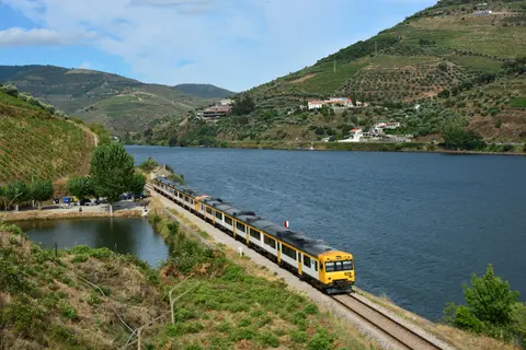
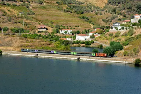
Planning how to get to the Douro Valley from Porto (68 kilometres west) or Lisbon centres on Porto's rail and river links. Completed in 1887, the Linha do Douro railway runs from Porto's São Bento and Campanhã stations through Rio Tinto, Ermesinde, Valongo, Paredes, Penafiel and Livração. Continuing east past Marco de Canaveses, Peso da Régua, Tua and Pinhão, trains terminate at Pocinho near Foz Côa and the UNESCO-listed Côa Valley Palaeolithic rock art site. Drivers combine rail routes with the twisting N222 riverside highway between Régua and Pinhão, while flyers land at Francisco de Sá Carneiro Airport (OPO), 76 kilometres west, or regional Vila Real Airport (VRL) 20 kilometres away with limited services. Many visitors split two to three days between riverside lodges in Porto and hilltop quintas near Pinhão and Peso da Régua. Discover more historic European landscapes inside our UNESCO World Heritage Atlas.