Quick Field Data
- UNESCO Inscription: 1996 (Ref. 770), civil engineering canal network across Haute-Garonne, Aude and Hérault in Occitanie, southern France; Criteria (i), (ii) and (iv).
- Scale & Footprint: 2,007-hectare core corridor spanning 360 navigable kilometres (240-kilometre main Toulouse-to-Étang de Thau trunk plus feeder branches and 328 historic works), buffered by 18,200 hectares of listed landscapes across 74 communes.
- Access & Ticketing: State-owned waterway since 1897 operated by Voies navigables de France (VNF) under Heritage and Environmental Codes; check VNF navigation passes, lock timings and commercial barge or boat rental licences locally.
- Arrival Logistics: Primary commercial flights arrive at Toulouse-Blagnac Airport (TLS), five kilometres northwest of the canal's western junction at Port de l'Embouchure, linking downstream toward Bordeaux (210 kilometres northwest via the Canal de Garonne).
Pierre-Paul Riquet's Summit-Level Feeders and the 1666 Royal Edict
Stretching 240 kilometres across southern France from Toulouse on the Garonne River to Marseillan on the Mediterranean Étang de Thau lagoon, the Canal du Midi fulfilled an age-old engineering dream. Originally built as the Canal royal en Languedoc before French revolutionaries renamed it Canal du Midi in 1789, it joined with the later 193-kilometre Canal de Garonne to form the Canal des Deux Mers linking Atlantic and Mediterranean shipping. Earlier rulers including Augustus, Nero, Charlemagne, Charles IX and Henry IV envisioned sparing trade vessels and royal galleys a perilous month-long voyage past Gibraltar and Barbary pirates. King François I brought Leonardo da Vinci to France in 1516 to survey a Toulouse-to-Carcassonne path, before Cardinal de Joyeuse, Cardinal Richelieu and engineers Nicolas Bachelier (1539), Pierre Reneau (1598) and Bernard Aribat (1617) drafted further plans.
Every earlier scheme collapsed over one stubborn hydraulic problem: keeping enough water flowing year-round across the elevated Seuil de Naurouze watershed crest standing 189.43 metres above sea level. Previous engineers tried complex or unworkable river diversions from the Pyrenees or Ariège near Cintegabelle to Pech-David near Toulouse, fearing huge financial losses and water-lifting impossibilities. Wealthy Languedoc salt-tax collector Pierre-Paul Riquet proposed instead capturing mountain streams across the Montagne Noire (Black Mountains) and feeding them by natural gravity down onto Naurouze or Graissens. Guiding Toulouse Archbishop Charles-François Anglure of Bourlemont and the Bishop of Saint-Papoul across local ridges between Castres and his estate, Riquet demonstrated firsthand how streams could be diverted naturally without complex pumping engines. Writing from Roussillon salt-collection duties to Jean-Baptiste Colbert in 1662, Riquet noted modestly that he lacked Greek, Latin and polished French yet offered exact field measurements. He argued that a dependable Languedoc canal would divert trade from Cadiz and the Straits of Gibraltar while multiplying French commerce across Haute-Garonne, Aude and Hérault.
Thirty years of committee reviews and regional surveys culminated when Jean-Baptiste Colbert issued a royal edict in October 1666 authorising work to expand regional wheat trade. Heavy excavation ran from 1666 to 1681 under Louis XIV and Riquet's personal supervision, reaching final network completion across all branches between 1667 and 1694. Unlike turbulent seasonal rivers, this calm artificial channel assured reliable year-round freight flow between inland Languedoc farms and coastal ports. Climbing 57.18 metres eastward over 52 kilometres from Port de l'Embouchure in Toulouse to Seuil de Naurouze, the waterway drops down over the remaining 188 kilometres past Castelnaudary, Carcassonne, Trèbes, Béziers and Agde to Les Onglous between Agde and Sète. Channel specs feature a two-metre design depth (1.80-metre minimum, 1.50-metre allowed draught with occasional 1.40-metre silt shoals), a 16-to-20-metre surface width, a 10-metre bed, a 53.87-kilometre lock-free stretch between Argens and Fonserannes and a tiny 105-metre pound between twin Fresquel locks. That graduated descent links inland agricultural markets, fortified towns and Mediterranean saltwater lagoons cleanly without hazardous coastal detours around Spain.
Fonserannes Locks, Stone Aqueducts, and the 240-Kilometre Route
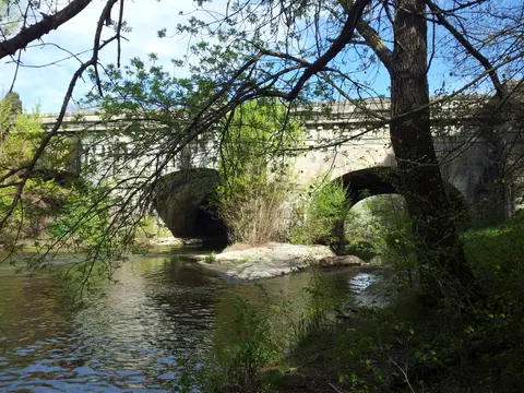
Recognising both hydraulic brilliance and landscape artistry, UNESCO designated the Canal du Midi across five distinct structural elements totalling 360 navigable kilometres and 328 engineering works. First runs the 240-kilometre main Toulouse-to-Marseillan trunk, complemented by the 36.6-kilometre Moussan-to-Port-la-Nouvelle branch incorporating part of the old Canal de la Robine. Third come the twin Montagne Noire feeder channels uniting at Naurouze, anchored by the massive Saint-Ferréol dam across the Laudot River plus the Lampy reservoir holding critical dry-season reserves. Fourth and fifth cover the 1.6-kilometre Saint-Pierre Canal joining Toulouse's Garonne riverfront and the short 0.5-kilometre link joining the Hérault River to Agde's celebrated round lock. Together, Saint-Ferréol dam ranked as the largest civil engineering site of the canal era, storing enough mountain runoff to keep summer lock chambers full. Along this complete water network, builders paired functional sluices, overflow spillways and masonry aqueducts with curved rural stone bridges designed to blend smoothly with southern French valleys.
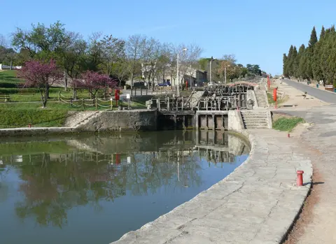
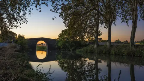
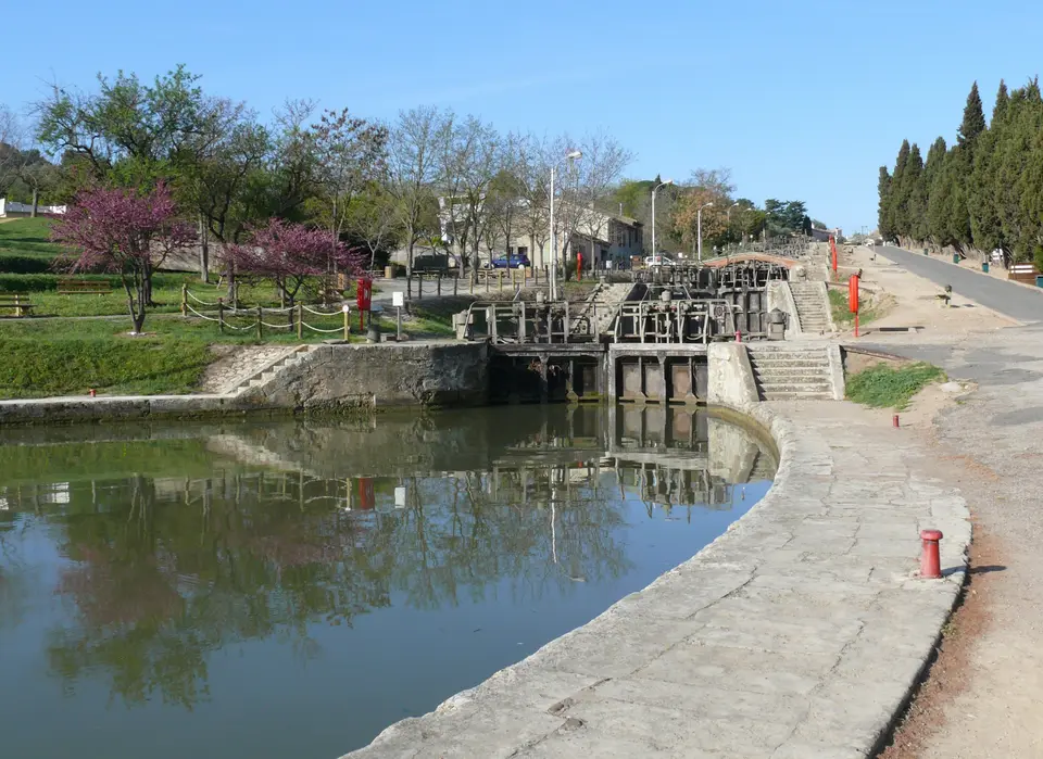
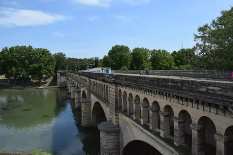
Along the curving 240-kilometre Canal du Midi map with towns, builders paired functional hydraulics with classical French stonework that inspired early-18th-century military engineer Vauban's improvements. Known in Occitan as Canal de las Doas Mars or Canal del Miègjorn, the waterway winds gently through broad agricultural valleys, shaded embankments and stone villages where lock houses mark steady elevation drops toward the sea. Outside Béziers climbs the dramatic Fonserannes lock staircase, lifting or lowering barges across eight interconnected oval lock chambers carved cleanly down a stone hillside. Elsewhere engineers built stone aqueduct bridges such as Pont-canal du Fresquel, the Argent-Double aqueduct and Béziers's wide Pont-canal de l'Orb carrying boats directly across intersecting rivers. Arched stone road bridges like Pont de Caylus near Villeneuve-lès-Béziers and tree-lined village reaches past Poilhes and Vias blend working infrastructure calmly into Languedoc farmland. Later adaptations expanded lock chambers to Freycinet gauge, added modern overflow spillways, built steel gates, reconstructed crossings and introduced automated lock controls while leaving Riquet's original oval geometry intact. Named an International Historic Civil Engineering Landmark in 2016, Europe's oldest major summit canal still links Toulouse toward Bordeaux via the Canal de Garonne and Gironde estuary, drawing river cruisers, cyclists and canal historians year after year.
Coloured Canker Plane-Tree Loss and VNF Landscape Restoration
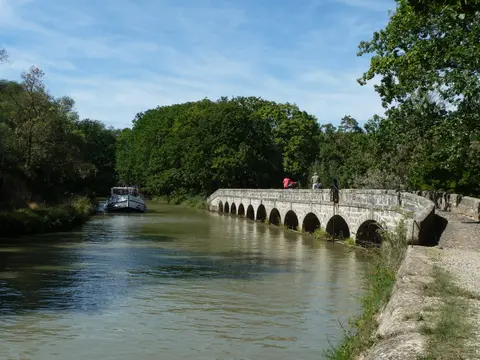
Continuous French public ownership rooted in Pierre-Paul Riquet's original royal fief boundaries codified in 1772 and the State Act of 27 November 1897 secures unified stewardship today. Under Article L. 2111-11 and Articles L. 2124-20 to 25 of France's public waterways code, Voies navigables de France (VNF), attached to the Ministry of Transport, manages lock operations, dredging and bank upkeep with participating communes and waterside landowners. Under those provisions, public domain records track Riquet's fief boundaries plus historic staff quarters, canal warehouses and the Lampy reservoir added to keep dry-summer water reserves steady. National Heritage and Environmental Codes protect individual locks, bridges, spillways, warehouses and keeper quarters as listed historic monuments. Around the narrow 2,007-hectare core corridor extends an 18,200-hectare listed landscape buffer across 74 urban and rural communities governed under VNF's Landscape and Architectural Integration Charter.
Despite robust structural maintenance on masonry locks and aqueducts, one ecological crisis has reshaped the canal's famous shaded green tunnel in recent decades. Coloured canker fungus infection has spread through aging alignment plane trees planted along the banks, forcing arborists to remove diseased trees to curb biological contagion. Under coordinated State and regional Occitanie replanting programmes coordinated by the regional Prefect and VNF, conservation teams are steadily restoring mixed disease-resistant tree alignments along cleared stretches to protect bank stability and summer shade. Completing protective landscape listings around upstream Montagne Noire feeder canals remains an active goal to safeguard the full hydrological basin. Local heritage contracts also guide canal-side municipalities on lighting, bridge upkeep and dockside architecture so modern mooring quays blend respectfully with 17th-century dressed stonework.
Access Zones Along the Canal du Midi From Toulouse to Marseillan
Reviewing a Canal du Midi map shows how cleanly the 240-kilometre route divides into urban departures, quiet summit valleys and dramatic coastal lock complexes. Verify seasonal lock operating hours with Voies navigables de France notices before hiring boats or planning multi-day towpath rides.
| Complex Zone | Key Highlights | Access & Ticket Rule |
|---|---|---|
| Toulouse to Seuil de Naurouze | Port de l'Embouchure, Saint-Pierre Canal, 52-kilometre summit climb and Saint-Ferréol reservoir. | Open public towpath cycle tracks and paved greenways; VNF boating tolls apply to registered river cruisers. |
| Castelnaudary, Carcassonne & Trèbes | Medieval fortified hill backdrops, grand Castelnaudary basin, Fresquel aqueduct and rural Languedoc lock houses. | Direct regional rail stations border towns for easy stage walks or bike rentals; check local lock lunch closures. |
| Minervois & Béziers (Fonserannes) | 53.87-kilometre lock-free Argens-to-Fonserannes reach, Argent-Double aqueduct, Poilhes and eight-basin Fonserannes staircase. | Free pedestrian access beside Fonserannes basins and towpaths; verify scheduled commercial barge tours locally. |
| Orb Aqueduct, Agde & Marseillan | Pont-canal de l'Orb, Agde's round lock, Vias coastal curve, Canal de la Robine branch and Étang de Thau lagoon. | Connected by coastal rail links between Béziers, Agde and Sète; observe lagoon wind safety rules near Les Onglous. |
Three Hydraulic Engineering Details Built Into Riquet's Canal
- Ovoid Stone Lock Chambers Built Against Earth Pressure: Examine curved lock walls at Fonserannes and historic rural chambers, shaped purposefully like bowed ovals so outward water weight pressed stone blocks tighter against hillside soils.
- Montagne Noire Feeder System at Seuil de Naurouze: Trace how Riquet's feeder channels and Saint-Ferréol reservoir redirect distant mountain creeks upward onto the watershed crest to keep both sea slopes watered.
- Round Three-Way Lock at Agde: Observe how circular masonry walls allow vessels entering from three separate approaches to rotate inside one compact basin connecting the main trunk with the Hérault River.
Planning a Canal du Midi Bike Tour, Boat Cruise, and Timing
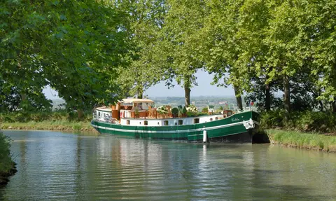
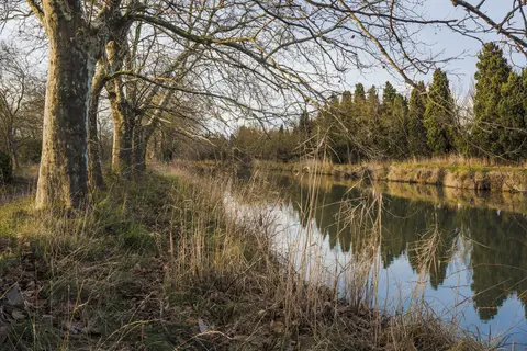
Spring through early autumn marks the best time to visit Canal du Midi. Mild Occitanie daylight pairs cleanly with active navigation lock schedules across these warmer months. Travellers weighing boat rental licences, guided barge cruises or a multi-day Canal du Midi bike tour consistently favour the central-eastern stretches between Carcassonne, Poilhes and Béziers's Fonserannes staircase as the Canal du Midi best route. Cycling gravel towpaths and paved greenways lets visitors explore quiet stone bridges and village basins without waiting in busy summer lock queues. Breaking long cycling or cruising days into gentle stages between market towns like Castelnaudary, Trèbes and Capestang lets travellers pause at shady lock keepers' cottages, examine stone aqueduct arches up close and trace how water levels step steadily down toward the Mediterranean. Historic cargo routes that once hauled grain, wine and local produce across Languedoc now host calm leisure cruises linking riverside cafés, rural vineyards and hilltop fortresses along shaded embankments.
Visitors asking can you swim in the Canal du Midi should note how Voies navigables de France operates this 1.8-to-2.0-metre-deep waterway. Because it functions as an active commercial and leisure boat channel containing moving cruisers, narrow locks and fine bottom silt rather than a bathing lake, swimmers must follow posted VNF and municipal no-swimming safety rules everywhere. International visitors typically land at Toulouse-Blagnac Airport (TLS), five kilometres northwest of Port de l'Embouchure, while French rail connects Toulouse, Castelnaudary, Carcassonne, Béziers, Agde and Sète cleanly along the route. Longer Deux-Mers canal journeys also follow the Canal de Garonne northwest toward Bordeaux (210 kilometres away), connecting inland Occitanie smoothly with Gironde estuary ports. Planning rail drop-offs or bike loops around lock sections keeps multi-day visits flexible across every season. Explore more European waterways inside our UNESCO World Heritage Atlas.