Quick Field Data
- UNESCO Inscription: Reference 1256, inscribed in 2007 as a Cultural site under Criteria (ii) and (iv) in Nouvelle-Aquitaine, France.
- Scale & Footprint: Covers 1,731 hectares (roughly 40% of the entire 49-square-kilometre municipal territory), enclosing 347 listed monuments under the 1913 law and around 5,000 eighteenth-century buildings in the centre.
- Access & Ticketing: Streets, riverside quays, Place de la Bourse, the Miroir d'eau, and bridges remain open for free pedestrian exploration, while museums and performance interiors such as the Grand-Théâtre and the National Museum of Customs operate ticketed entry.
- Arrival Logistics: Bordeaux-Mérignac Airport (BOD) sits 11 kilometres west of the historic crescent, connecting directly into central Bordeaux where trams, footpaths, and river bridges link the port districts to Saint-André Cathedral and the left-bank quays.
Crescent River Geography and the Roman Castrum Roots of Burdigala
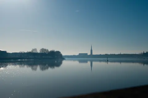
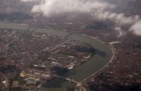
Bordeaux takes its UNESCO title from the medieval name Port de la Lune, given to the sweeping bend of the Garonne River as it curves past the city on its way toward the Atlantic coast. That river crescent became a civic emblem long before the age of modern urban planning, appearing on Bordeaux's coat of arms and later inspiring the three interlaced crescents of the municipal emblem. The inscribed area spans 1,731 hectares of inhabited historic fabric, forming the largest urban area listed by UNESCO as of 2021 and containing more than 362 historic monuments overall, giving Bordeaux more listed or registered monuments than any French city after Paris.
Human settlement along this navigable Garonne bend began around 300 BC when the Celtic tribe of the Bituriges Vivisci established Burdigala, a name thought to carry Aquitanian roots. Roman forces encountered early setbacks near the settlement during the Battle of Burdigala in 107 BC, when the Tigurini led by Divico defeated consul Lucius Cassius Longinus while Rome was defending its Allobroges allies. Around 60 BC, the town passed firmly under Roman rule and developed into an active commercial centre handling tin and lead shipments, gaining civic landmarks that included an amphitheatre and the monumental Piliers de Tutelle.
Late antiquity and the early Middle Ages tested the river port repeatedly. Vandals sacked Bordeaux in 276 AD and attacked again in 409, followed by Visigoth raids in 414 and Frankish conquest in 498. These blows left the settlement diminished for decades before its late sixth-century revival as a Merovingian county seat and archdiocese within the Frankish Duchy of Vasconia. Around 585 Gallactorius became Count of Bordeaux and fought Basque forces, before troops under Abd er Rahman stormed the fortifications in 732. Duke Eudes then engaged the Umayyad army near the Dordogne at the Battle of the River Garonne, preserving enough strength for the Battle of Poitiers. Subsequent Carolingian campaigns between 737 and 768 under Charles, Pepin the Short, and Carloman contested Aquitanian dukes Hunald and Waifer before Charlemagne raised the hilltop fortress of Fronsac in 769 to secure Basque loyalty. From around 844, Viking raids threatened the mouth of the Garonne, capturing and executing Count Seguin II in 845, until political continuity returned under the House of Poitiers.
Plantagenêt Wine Commerce, Enlightenment Trade, and Colonial Wealth
Commercial expansion accelerated sharply from the twelfth to the fifteenth century after Eléonore, Duchess of Aquitaine and last of the House of Poitiers, married Henry II Plantagenêt, grandson of England's King Henry the First. Months after their wedding, Henry succeeded to the English throne and incorporated Bordeaux into an Angevin domain stretching from Ireland to the Pyrenees. Granting tax-free trade status with England turned Bordeaux's wine exports into the backbone of the local economy while drawing regular imports of English cloth and wheat. During this Anglo-Gascon period, civic power and ecclesiastical ambition reshaped the medieval town through the construction of the Grosse Cloche belfry and Saint-André Cathedral in 1227, absorbing the artisan quarter of Saint-Paul. Between 1362 and 1372, Bordeaux briefly served as capital of an independent state under Edward, the Black Prince, under the Treaty of Brétigny, before passing permanently to France after the 1453 Battle of Castillon. The city gained a local parliament in 1462 and submitted fully to royal authority when Louis XIV's army entered Bordeaux in 1653 after the Fronde.
By the eighteenth century, maritime networks made the Port of the Moon the busiest port in France and the second busiest port in the world after London. Ships unloading at the Garonne quays supplied broad swathes of Europe with coffee, cocoa, sugar, cotton, and indigo, generating fortunes that funded approximately 5,000 limestone structures across the city centre. Yet this commercial boom also rested heavily on human exploitation. Bordeaux shipowners organised around 500 slaving expeditions that deported 150,000 Africans, turning colonial plantations in Saint-Domingue into a major profit engine for local merchant houses even as stark poverty and food scarcity persisted among working residents inside the Gironde valley.
That socioeconomic tension erupted during the French Revolution of 1789. Moderate Girondists representing the provincial merchant bourgeoisie opposed the Revolution's egalitarian social wing, clashing with Robespierre and Marat's Montagnards. In 1793, the Montagnards purged and executed many Girondist leaders and temporarily renamed Bordeaux Commune-Franklin in homage to Benjamin Franklin. Meanwhile, the 1791 slave uprising in Saint-Domingue and the abolition decree enacted three years later by the Montagnard Convention upended colonial commerce. Napoleon's 1802 attempt to restore slavery and Haitian independence in 1804 then shattered the trade model on which the eighteenth-century port depended. When British divisions sent by the Duke of Wellington under William Beresford entered Bordeaux with minimal resistance in 1814, anti-Bonapartist merchants welcomed the Bourbon Restoration. They rebuilt the port economy around Bordeaux's first permanent river bridge, new customs warehouses, and emerging African trade, illustrating what historian Suzanne Desan terms the importance of local dynamics in revolutionary history.
Classical Limestone Planning from Place de la Bourse to Prefect Haussmann
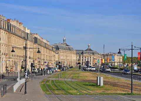
What separates Bordeaux from many European port cities is the architectural continuity maintained across more than two centuries of expansion. Rather than abandoning medieval quarters or fracturing into competing styles, Enlightenment planners, royal intendants, and nineteenth-century engineers integrated the crescent waterfront into one cohesive classical and neoclassical composition, fulfilling the humanist ideals of eighteenth-century philosophers who envisioned cities as centres of culture and civic exchange. Place de la Bourse, constructed between 1730 and 1775 directly beside the river, anchored that shift by tearing open the medieval riverfront wall and presenting a formal civic square towards the water.
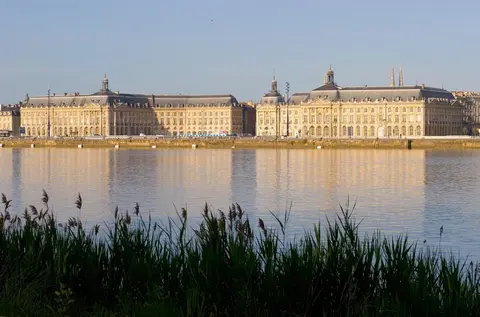
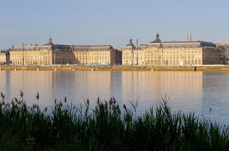
Royal architect Jacques Gabriel designed the ensemble between 1735 and 1739 before his death, after which his son Ange-Jacques Gabriel took charge and completed the buildings. Two symmetrical wings flank the square: the Palais de la Bourse on the north and the Hôtel des Fermes on the south. The northern wing now houses the Chamber of Commerce and Industry of Bordeaux, while the southern building holds regional customs offices and the National Museum of Customs. Their sculptural pediments depict Minerva protecting the arts and Mercury favouring commerce, while the central monument shifted with each political regime. It evolved from a royal statue of Louis XV removed in the Revolution to a Tree of Liberty, a Restoration Corinthian column-fountain, and the Three Graces sculpture installed in 1869.
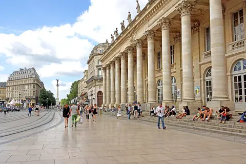
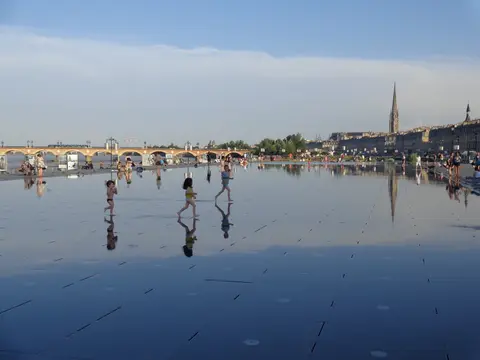
This disciplined eighteenth-century rebuilding later carried national consequences beyond Aquitaine, as longtime Bordeaux prefect Georges-Eugène Haussmann was summoned by Emperor Napoleon III to transform Paris. Haussmann drew directly on Bordeaux's broad avenues, unified cornice lines, and classical stone facades as his urban model. Legal protections kept that fabric intact through modern times, beginning with 347 buildings protected under the law of 31 December 1913. Approved in 1988 and revised in 1998 and 2002, the Plan de sauvegarde et de mise en valeur (PSMV) regulates historic alterations together with national Ministry for Culture oversight and a protective buffer zone. Awarded the 1957 Europe Prize, Bordeaux is linked today across 27 suburban municipalities forming Bordeaux Metropolis. Municipal restoration of the river quays, the Grand-Théâtre (home to the Opéra National and Ballet National de Bordeaux), Place de la Bourse, and the Miroir d'eau reconnected pedestrians directly with the working riverfront.
Access Zones Across the Port of the Moon Historic Perimeter
Because the 1,731-hectare World Heritage zone encompasses an active living city rather than a gated archaeological compound, visitors experience most of Bordeaux's architectural heritage in open public streets and riverfront promenades, reserving tickets only for specific interior monuments and museums.
| Complex Zone | Key Highlights | Access & Ticket Rule |
|---|---|---|
| Riverfront Quays & Place de la Bourse | Quai Richelieu, Quai Louis XVIII, Miroir d'eau, Palais de la Bourse, Hôtel des Fermes | Open pedestrian promenade with free exterior access; National Museum of Customs inside Hôtel des Fermes requires a paid ticket |
| Classical Civic Core & Opera Quarter | Grand-Théâtre portico, Place des Quinconces, eighteenth-century stone streets | Public squares and street elevations freely accessible; Grand-Théâtre interior tours and performances require advance booking |
| Medieval & Cathedral Quarter | Cathedral of Saint-André (1227), Grosse Cloche belfry, Saint-Paul artisan lanes | Cathedral nave accessible during worship-free intervals; bell tower climbs and belfry interiors follow scheduled guided entry |
| Garonne Crossings & Port Bridges | Pont de Pierre (Restoration era), Pont Chaban-Delmas, Pont Saint-Jean panoramas | Free pedestrian and cyclist access across bridge walkways linking the historic left bank with right-bank viewpoints |
Three Architectural Details Along Bordeaux's Quays and Classical Squares
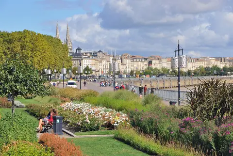
Walking slowly along the riverfront and stepping a few blocks inland reveals technical and decorative details that explain how Bordeaux turned maritime trade into disciplined stone architecture.
- Twin-Wing Symmetry and Regime Shifts on Place de la Bourse: Compare the north and south wings built from Ange-Jacques Gabriel's completion of his father's 1739 plans. Both buildings mirror one another in rusticated ground arcades, giant pilasters, and sculptural reliefs of Minerva and Mercury. At the centre of the square, successive civic monuments record French political history in miniature, replacing King Louis XV's destroyed equestrian statue and culminating in the 1869 Three Graces sculpture.
- Waterfront Facade Break Behind Quai Richelieu and Quai Louis XVIII: Notice how eighteenth-century planners opened Bordeaux toward the Garonne instead of walling off the port. Continuous pale limestone elevations with arched ground-floor warehouses and tall piano nobile windows follow the river's crescent curve, linking commercial shipping directly to formal urban display and supplying the visual template Prefect Haussmann later adapted in Paris.
- Layered Medieval Stonework Inside the Classical Grid: Between the classical avenues of the Enlightenment era, trace the older urban skeleton anchored by Saint-André Cathedral (begun in 1227) and the Grosse Cloche belfry in the Saint-Paul quarter. These medieval stone monuments sit visibly embedded inside the Roman castrum footprint and eighteenth-century street alignments, demonstrating continuous occupation since Celtic Burdigala without wholesale demolition.
Seasonal Pacing and Pairing the Garonne Quays with Regional Guides
Travellers exploring the 1,731-hectare perimeter benefit from splitting walks between the open riverside quays and the shaded interior streets around Saint-André Cathedral. Early mornings offer crisp horizontal light across Place de la Bourse and clear reflections over the Miroir d'eau before daytime crowds gather, while late afternoon illuminates the honey-toned limestone along Quai Richelieu and Quai Louis XVIII as river breezes cool the promenade. Check official cultural calendars before planning interior visits to the Grand-Théâtre, historic belfry, or customs museum, as performance rehearsals and civic restorations occasionally restrict specific rooms.
With Bordeaux-Mérignac Airport only 11 kilometres from the historic centre and tram routes crossing the Pont de Pierre, the World Heritage perimeter integrates smoothly into both short stays and broader wine-country journeys across the Gironde hillsides, home to international events such as Vinexpo. For neighbourhood dining tips, vineyard excursion routes, and day-by-day walking plans beyond the listed monuments, pair this architectural field manual with our dedicated Bordeaux destination guide. Those assembling a broader multi-city European architectural itinerary can browse additional inscribed river ports, planned capitals, and historic ensembles across our full UNESCO World Heritage Atlas.