Quick Field Data
- UNESCO Inscription: 2000 · Criteria (ix), (x)
- Scale & Footprint: 1,032,649 hectares (roughly 10,300 square kilometres) plus an 86,200-hectare buffer zone spanning seven national parks and the Jenolan Caves Karst Conservation Reserve
- Access & Ticketing: Managed by New South Wales environment authorities; highway rim lookouts and town railheads are free, while vehicle entry fees apply inside key national park precincts and guided tickets apply at Jenolan Caves
- Arrival Logistics: 60 to 180 kilometres inland west of Sydney and 112 kilometres from Sydney Kingsford Smith International Airport (SYD); Bathurst Airport (BHS) sits closer at 46 kilometres but carries limited regional services
Sandstone Tablelands, Lapstone Monocline and Eucalypt Blue Haze
Stretching 60 to 180 kilometres west of central Sydney across the Sydney Basin, the Greater Blue Mountains Area covers 1,032,649 hectares of dissected bushland equivalent in land area to Lebanon. As formally defined in 1970, the wider Blue Mountains region spans from the Nepean and Hawkesbury rivers on the east to the Coxs River and Lake Burragorang in the south and west, and north to the Wolgan and Colo rivers. Rather than conventional folded mountain peaks, the landscape forms a deeply incised sandstone tableland rising from under 100 metres above sea level to 1,300 metres at its highest crest, with isolated basalt caps crowning upper ridges. Along the eastern margin near Penrith and Emu Plains, about 50 kilometres west of Sydney, the 95-kilometre Lapstone Structural Complex forms a prominent north-south east-facing monocline above a west-dipping thrust fault, lifting the plateau abruptly above the Cumberland Plain.
Geological layers explain both the vertical scenery and ecological refuges. Beneath the plateau sits 470-million-year-old quartzite, buried during the Permian shallow-sea era by river-borne shales, siltstones and mudstones, and topped in the Mesozoic era by thick sand beds that hardened into sandstone. About one million years ago during the Pliocene epoch, river erosion carved out steep valleys, waterfalls, slot canyons and 300-metre escarpments across the uplifted plateau. Extending roughly 96 kilometres southeast from near Wolgan Gap to Emu Plains, the Blue Mountains Range divides the Coxs River catchment to the south from the Grose and Wolgan river valleys to the north and encompasses both the Explorer Range and the Bell Range.
Volatile organic compounds rising off that forest canopy explain the site's English name. As daytime temperatures climb, abundant eucalyptus trees emit airborne terpenoids that scatter shorter blue light wavelengths across the atmosphere through Mie scattering. This bathes distant sandstone walls and ridges in the pale blue tint already recorded by Captain John Hunter on 5 July 1789 up the Hawkesbury River. Governor Arthur Phillip had earlier glimpsed the Carmarthen and Lansdowne hills from Castle Hill in 1788.
Ninety-One Eucalypt Taxa and Gondwanan Relict Canyons
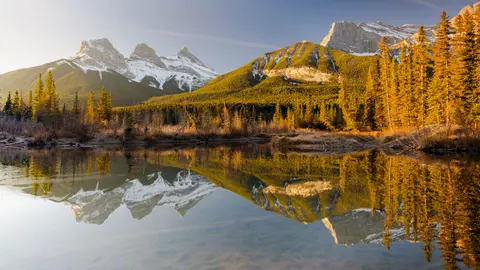
Botanists treat the plateau as a living evolutionary laboratory. Split into two conservation blocks by the Great Western Highway and Main Western railway corridor, the eight protected areas gather ninety-one distinct eucalypt taxa across Eucalyptus, Angophora and Corymbia, representing 13 percent of the global eucalypt total. Detailed lists reach 96 species, comprising 55 widespread and 41 restricted taxa, including twelve confined strictly to the Sydney sandstone region. Elevational gradients and moisture pockets organise those trees into tall margin forests, deep-gully rainforests, open sclerophyll woodland and stunted mallee shrublands on exposed tablelands, plus localised swamps, wetlands and grasslands. Dynamic interactions among eucalypts, understorey plants, animals, soil and natural fire regimes play out across an almost undisturbed bushland matrix largely free of earthworks and roads.
Overall botanical richness spans 152 plant families, 484 genera and around 1,500 vascular plant species, accounting for 10 percent of Australia's vascular flora. Key families include Myrtaceae (150 species), Fabaceae (149 species, including 64 Acacia species) and Proteaceae (77 species), supporting 114 endemic species and 177 threatened plants. Sheltered slot canyons also shelter ancient Gondwanan lineages that survived continental drying, including the Blue Mountains pine (Pherosphaera fitzgeraldii), Lomatia, Dracophyllum, Acrophyllum, Podocarpus, Atkinsonia and the Wollemi pine (Wollemia nobilis). Rediscovered in 1994 inside remote, steep-walled gorges after scientists assumed it had been extinct for millions of years, the Wollemi pine survives naturally in only three tiny wild populations.
More than 400 vertebrate species inhabit these gorges and tablelands, including 40 threatened taxa. Mammals number 52 species, from platypus and echidna to grey kangaroos, dingoes, koalas, tiger quolls, yellow-bellied gliders and long-nosed potoroos. Reptiles reach 63 species, such as the Blue Mountain water skink, alongside over 30 frogs including the green and golden bell frog. Birds total 265 species, representing roughly one third of Australia's avifauna. BirdLife International identifies the region as an Important Bird Area for range-restricted rockwarblers, flame robins, diamond firetails, pilotbirds, endangered regent honeyeaters and migrating yellow-faced honeyeaters. Cave systems hide 67 specialised invertebrate taxa together with an estimated 120 butterfly species and 4,000 moths.
Gundungurra and Darug Custodianship Across Eight Reserves
Long before European surveys, Aboriginal people from six language groups maintained custodial ties across the tablelands and river corridors. Today, the Gundungurra Tribal Council Aboriginal Corporation in Katoomba represents the upper mountains and the Darug Tribal Aboriginal Corporation represents the lower escarpments. Gundungurra creation traditions recount the epic struggle between the half-fish, half-reptile Dreaming figures Mirigan and Garangatch whose movements carved the Jamison Valley. Archaeological sites preserve tangible proof of that continuity, including adult and child hand stencils on rock walls at Red Hands Cave near Glenbrook. At Wentworth Falls, Kings Tableland Aboriginal Place preserves stone-tool grinding grooves, carved animal tracks and an occupation shelter dated to 22,000 years ago. Since 1995, the Gundungurra Tribal Council has held a registered Native Title Claim over traditional lands. In July 2023, the Geographical Names Board of New South Wales examined dual naming under the traditional name Gulumada (Colomatta). Across the broader sandstone plateau, statutory wilderness declarations and drinking-water catchment safeguards around Warragamba Dam restrict road cutting, commercial logging and intrusive settlement from Bilpin Ridge and Mount Victoria down to the Coxs River valleys. These measures ensure Aboriginal cultural landscapes, upland swamps and steep canyon walls stay buffered against Sydney basin urban pressure.
Indigenous knowledge also shaped early access through two principal corridors: Bilpin Ridge (now Bells Line of Road between Richmond and Bell) and the Coxs River valley leading into the open plains of the Kanimbla Valley. Early colonial Sydney treated the sandstone gorges as a natural prison barrier. Former First Fleet convict John Wilson lived in the bush with Aboriginal guides and may have reached the southern Coxs River corridor by 1797, while letters from Matthew Everingham suggest a partial 1795 attempt. Wilson also travelled past Thirlmere Lakes with John Price in 1798. From 11 to 31 May 1813, Gregory Blaxland, William Lawson and William Charles Wentworth traced a continuous ridge route to Mount Blaxland. Surveyor George Evans pushed west toward the Fish and Macquarie rivers and Bathurst later in 1813 during a severe drought. Between 7 July 1814 and 14 January 1815, William Cox's party of 30 convict labourers and 8 guards built the first mountain road in 27 weeks. Nineteenth-century coal and oil-shale mining dotted Hartley Vale (1865), Jamison Valley, upper Grose Valley, Newnes and Glen Davis before failing commercially.
Unanimously inscribed by UNESCO on 29 November 2000 and added to Australia's National Heritage List in 2007, the heritage area unites seven national parks plus the Jenolan Caves Karst Conservation Reserve. The seven national parks are Blue Mountains, Wollemi, Yengo, Nattai, Kanangra-Boyd, Gardens of Stone and Thirlmere Lakes. Three reserves (Wollemi, Blue Mountains and Kanangra-Boyd) make up 80 percent of the total expanse, and 65 percent carries statutory wilderness status under the Wilderness Act 1987. The southern parks enclose the closed, protected drinking-water catchment of Warragamba Dam. Protected under Australia's Environment Protection and Biodiversity Conservation Act 1999 (EPBC Act), the network is managed by the New South Wales Office of Environment and Heritage with reserve plans reviewed every 7 to 10 years. The reserves border 4.5 million metropolitan residents and welcomed 8.4 million visitors in 2018. Following inscription, plans for a second Sydney airport at adjacent Badgerys Creek were abandoned. Strategic management focuses on six ongoing pressures: uncontrolled fire, rising tourism infrastructure, invasive weeds and feral animals, biodiversity loss, human-enhanced climate change and heritage education.
Greater Blue Mountains Access Zones and Reserve Permits
Divided by the urban transport strip linking Springwood, Wentworth Falls, Katoomba, Blackheath and Mount Victoria, the eight reserves range from developed lookouts to strictly gated catchments and secluded caves.
| Complex Zone | Key Highlights | Access & Ticket Rule |
|---|---|---|
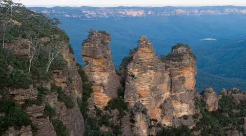
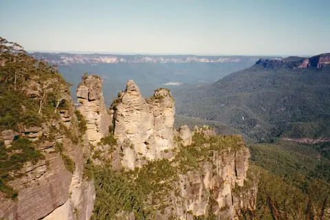
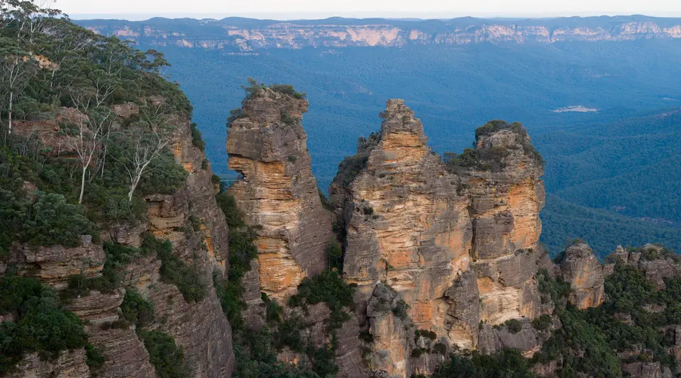
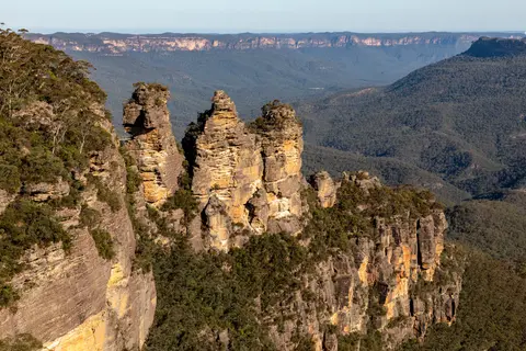
| Central Blue Mountains Escarpment (Katoomba to Blackheath) | Jamison and Grose valley lookouts, Three Sisters cliffs, Wentworth Falls escarpment and Kings Tableland Aboriginal Place | Main town cliff lookouts are free; vehicle day-use fees apply at gated New South Wales National Parks precincts |
| Jenolan Caves Karst Conservation Reserve | Limestone cave chambers, karst hydrology and 67 specialised cave invertebrate taxa along the western margin | Separate guided cave tour tickets required; road approaches close periodically after heavy storms or maintenance |
| Wollemi, Yengo & Gardens of Stone (Northern Block) | Deep slot canyons, basalt ridge outcrops, pagoda sandstone formations and restricted Wollemi pine gorges | Free backcountry bushwalking permits apply in places; the three wild Wollemi pine locations remain strictly closed to public entry |
| Kanangra-Boyd, Nattai & Thirlmere Lakes (Southern Block) | Warragamba Dam closed water catchment, wilderness plateaux and southern wetland basins | Special access restrictions bar public entry inside Inner Catchment Zones around Warragamba Dam; standard park rules apply elsewhere |
Three Ecological and Geological Details Across the Tableland
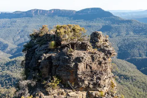
First, look down from the cliff edge at Katoomba (1,010 metres elevation) into Jamison Valley to read the horizontal stratigraphy exposed along the 300-metre walls. Resistant Mesozoic sandstone ledges cap softer Permian shales and mudstones below, explaining why waterfalls undercut vertical cliffs into wide amphitheatres while supporting damp rainforest trees in shaded valley floors.
Second, compare eucalyptus leaves and bark forms as elevation rises from Glenbrook's warm lower slopes toward Blackheath and Mount Victoria. Moving uphill across temperature and soil gradients shifts the canopy from tall wet-gully eucalypts to gnarled mallee forms on exposed sandstone benches, illustrating in one short drive the evolutionary radiation behind the listing's ninety-one eucalypt taxa.
Third, observe the rocky sandstone shelf at Kings Tableland Aboriginal Place near Wentworth Falls, where smooth elliptical grooves worn by stone-axe grinding sit beside carved track impressions. Standing 22,000 years deep in human use, these quiet open sandstone pavements tie living Gundungurra heritage directly to the plateau's geology.
Bushfire-Season Caution and Rail Approaches from Sydney
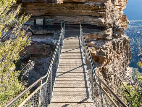
Elevation shapes mountain conditions year-round: summer highs at Katoomba average around 22 degrees Celsius with occasional hot spikes into the 30s, while winter nights fall into single digits and misty troughs settle quickly inside the valleys. Since the early 2010s, severe bushfires have repeatedly impacted vegetation and trail infrastructure across the eight reserves, so checking New South Wales park alerts and fire bans is essential before entering remote gorges, especially during hot summer winds.
Sydney Kingsford Smith International Airport (SYD) sits 112 kilometres east of the core mountains region, while the smaller Bathurst Airport (BHS) 46 kilometres west handles limited regional air traffic. Frequent suburban and intercity trains along the Main Western line climb straight from central Sydney to Springwood, Wentworth Falls, Katoomba, Blackheath and Mount Victoria in comfort without car congestion. Base your trip from our Sydney destination guide, 113 kilometres east, and explore other ecological refuges across Australia and the wider Pacific in our UNESCO World Heritage Atlas.