Quick Field Data
- UNESCO Inscription: 2016 (Ref. 1513), India's first Mixed cultural and natural site, plus a UNESCO Man and the Biosphere Reserve, located in Sikkim; Criteria (iii), (vii) and (x).
- Scale & Footprint: 178,400-hectare (1,784-square-kilometre) core national park spanning Mangan and Gyalshing districts from roughly 1,220 to 8,586 metres elevation, ringed by a 114,712-hectare forest buffer zone.
- Access & Ticketing: Protected under India's Wildlife (Protection) Act 1972 and managed by the Sikkim Forest, Environment and Wildlife Management Department. Check official state permits and trekking rules before entering trails, as Indian summit climbing has been banned since 2000.
- Arrival Logistics: Closest international hub listed for cross-border reference is Paro International Airport (PBH), 111 kilometres southeast across Bhutan, while Indian domestic overland connections link eastward across northern India from Varanasi (602 kilometres).
Sikkim Location, Seven-Kilometre Relief, and the Kangchenjunga Massif
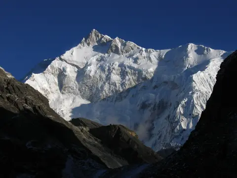
Travellers asking khangchendzonga national park is located in which state find it anchoring western Sikkim in north-eastern India. Occupying 25 percent of Sikkim across Mangan and Gyalshing districts, the 178,400-hectare sanctuary adjoins Qomolangma National Nature Preserve in Tibet to the north and Nepal's Kanchenjunga Conservation Area to the west. Within one narrow mountain belt, terrain drops more than seven kilometres vertically from deep valleys between 1,220 and 1,829 metres up to 8,586 metres at Mount Khangchendzonga. The Himalayan chain reaches its narrowest cross-section here, sharpening contrasts between each ecological zone.
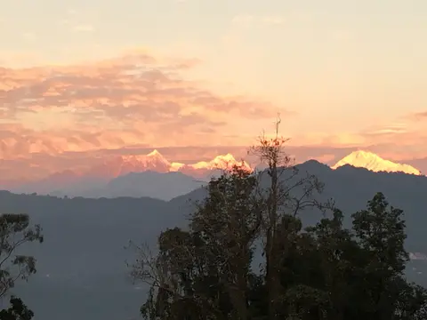
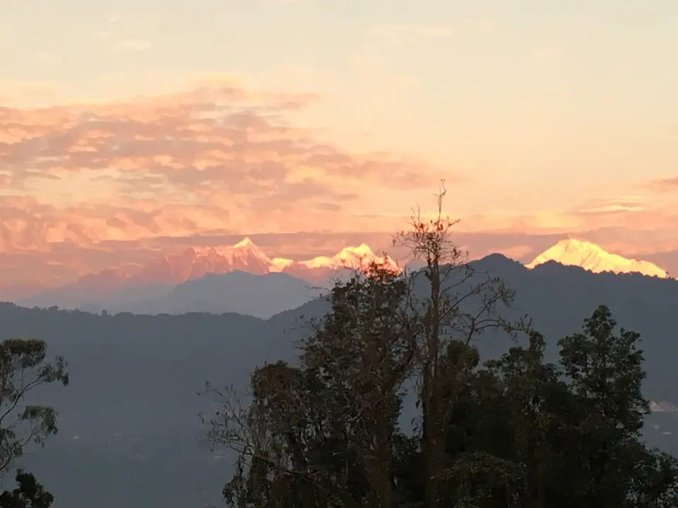
Rising about 20 kilometres south of the main Great Himalayan alignment and 125 kilometres east-southeast of Mount Everest, the Kangchenjunga massif dominates eastern Himalayan geography. Until mid-nineteenth-century trigonometrical work, European geographers assumed Kangchenjunga stood tallest on Earth. Careful measurements by the Great Trigonometrical Survey of India in 1849 proved Mount Everest exceeded it, prompting an official 1856 announcement confirming Kangchenjunga as the world's third-highest peak after Everest and K2. Despite that rank, its key topographic col sits at 4,664 metres in Tibet, ranking Kangchenjunga fourth in Himalayan prominence behind Everest, Nanga Parbat and Namcha Barwa.
Cross-shaped ridges radiate outward across the massif, framing five high summits along international frontiers. Main, Central and South peaks sit directly on the Sikkim-Nepal border, while West and Kangbachen rise inside Nepal's Taplejung District. Northward ridges stretch through Yalung Kang, Kirat Chuli and Gimmigela Chuli toward Jongsang La pass, and eastern spurs hold Siniolchu in Sikkim. Westward ridges culminate at Kumbhakarna (Jannu), while southern borders descend along Kabru I through III into the 3,000-to-3,500-metre Singalila Ridge separating Sikkim from Nepal and northern West Bengal. Boundary rivers frame the wider massif cleanly: the Tamur River borders its west, the Lhonak River and Jongsang La limit its north, and the Teesta River marks its eastern edge.
Across the wider Kangchenjunga Himal, 16 peaks exceed 7,000 metres and 120 glaciers cover roughly 314 square kilometres above 5,000 metres, including 17 debris-covered tongues. Inside Khangchendzonga National Park alone sit 20 peaks topping 6,000 metres, 73 glacial lakes (including 18 clear alpine tarns) and 18 glaciers led by the 26-kilometre, 10,700-hectare Zemu Glacier. Four principal ice streams radiate outward: Zemu and Talung drain east into the Teesta River within the Brahmaputra basin, while Yalung and Kangchen feed the Arun and Kosi rivers into the Ganges basin. Kangchenjunga Main marks the highest elevation of the Brahmaputra basin and ranks among six 8,000-metre peaks inside the Kosi drainage. Glacial inventories between 1958 and 1992 showed over half of 57 monitored glaciers retreating under climate warming.
Early exploration and mountaineering unfolded within strict respect for local sacred beliefs surrounding the mountain. Botanist Joseph Dalton Hooker collected alpine flora up to 4,760 metres in 1848 and 1849, followed by Hermann von Schlagintweit on Singalila Ridge in 1855 and explorer-monks Sarat Chandra Das and Lama Ugyen-gyatso in 1879. In 1883, William Woodman Graham and two Swiss climbers ascended close to Kabru's crest and crossed Kang La pass. Surveyor Rinzin Namgyal mapped the full mountain circuit in 1885 and 1886, before Douglas Freshfield and photographer Vittorio Sella examined the great western face in 1899. Aleister Crowley's 1905 expedition reached Camp 5 on the southwest flank before avalanches forced a retreat. When Joe Brown and George Band completed the first ascent on 25 May 1955, they stopped shy of the highest snow point to honour Chogyal Tashi Namgyal's pledge keeping the summit untouched; Indian authorities closed all Sikkim climbing routes permanently in 2000.
Mayel Lyang, Beyul Traditions, and Sacred Sikkimese Rituals
Inscribed in July 2016 as India's first Mixed UNESCO site and recognised under the Man and the Biosphere Programme, khangchendzonga national park sikkim pairs alpine grandeur with deep multi-ethnic heritage. Brothers Hermann, Adolf and Robert Schlagintweit early recorded local Tibetan-derived wording reading Kangchenjunga as the five treasures of high snow: salt, gold, turquoise and precious stones, sacred scriptures, and invincible armour with grain and medicine. Lhopo tradition holds that these treasures remain hidden in the massif until revealed to the devout during crisis. Across Sikkim, Mount Khangchendzonga embodies Dzonga, guardian deity and protector of the land.
Two distinct sacred cosmologies intertwine across the forests, caves, lakes and peaks of this Khangchendzonga National Park state sanctuary. For indigenous Lepcha communities, the valleys form Mayel Lyang, their ancestral and mythological homeland sustained through specialised oral knowledge of wild medicinal herbs and mountain plants. For Tibetan Buddhists worldwide, Sikkim represents a sacred hidden land (beyul) consecrated in the eighth century by Guru Rinpoche. Prophetic Lama Gongdu scriptures revealed by Terton Sangay Lingpa (1340 to 1396) and the seventeenth-century opening of the beyul led by Lhatsun Namkha Jigme codified sacred pilgrimage sites across the mountain slopes.
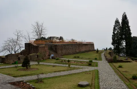
Human-built structures inside the wilderness core remain understated, restricted to sacred caves, stone chortens, small gompas and worshipped natural landforms described in Nay-Sol and Nay-Yik texts. Living communities uphold spiritual bonds through regular Bhutia rituals such as Nay-Sol and Pang Lhabsol, joined by seasonal Lepcha ceremonies. Outlying buffer-zone monuments, including Rabdentse ruins near Pelling, link historic monastic grounds with traditional gya-ra and gya-nak sanctuary perimeters managed by monastic communities. Under these customary management zones, monastery elders and village stewards regulate forest access and ritual cleanliness around sacred springs and peaks. Government of Sikkim notifications 59/Home/98 and 70/Home/2001 legally recognise sacred natural features as protected places of worship.
Altitudinal Forests, Red Pandas, Six Cat Species, and Conservation
Narrow Himalayan valleys compress three major ecoregions into one continuous biological sanctuary: eastern Himalayan broad-leaved and coniferous forests, alpine shrubs and meadows, and lower Terai-Duar savanna grasslands. Because of this vertical sweep, khangchendzonga national park information ranks the park among the highest centres of plant and mammal richness across Central and High Asia. The sanctuary shelters nearly half of India's birds, wild trees, orchids and rhododendrons, one-third of India's flowering plants and the widest continuous krummholz stunted-forest belt in the Himalayas. Temperate woods mingle oaks, firs, birches, maples and willows beneath alpine herbs.
About 550 bird species inhabit park valleys, including blood pheasant, satyr tragopan, impeyan pheasant, chestnut-breasted partridge, Tibetan snowcock, snow pigeon, Asian emerald cuckoo, sunbirds, osprey, lammergeier and Himalayan griffon. Travellers researching khangchendzonga national park is famous for which animal discover an exceptional assemblage of elusive predators and mountain ungulates. Six wild cat species are confirmed inside the park: snow leopard, clouded leopard, Indian leopard, jungle cat, Asian golden cat and leopard cat. Camera traps also confirm dholes between 2,501 and 4,100 metres, Himalayan wolves, Asian black bears, Indian jackals and large Indian civets. They share slopes with red pandas, bharal (blue sheep), Himalayan tahrs, mainland serows, gorals, two musk deer species, northern red muntjacs, four pika species and parti-coloured flying squirrels.
First gazetted as a national park in 1977 and more than doubled during 1997 to protect seasonal wildlife ranges, the 178,400-hectare core anchors a 6,032-square-kilometre transboundary Kangchenjunga landscape spanning 14 protected reserves. Partner reserves link Sikkim's Varsey, Fambong Lho, Kyongnosla, Maenam, Shingba and Pangolakha sanctuaries with Darjeeling's Singalila, Neora Valley, Senchal, Mahananda and Jore Pokhri sanctuaries, Nepal's Kanchenjunga Conservation Area and Bhutan's Torsa Strict Nature Reserve.
Protected under India's Wildlife (Protection) Act 1972 with a 114,712-hectare Forest Reserve buffer, park administration sits with the Sikkim Forest, Environment and Wildlife Management Department. Management teams coordinate with village Eco-Development Committees (EDCs), the Ecclesiastical Department of Sikkim, the Department of Cultural Heritage Affairs and the Namgyal Institute of Tibetology. Expanding scientific biodiversity inventories, monitoring climate change impacts across narrow altitudinal niches and empowering local communities to extend traditional stewardship into buffer zones remain active conservation goals.
Access Zones Across Khangchendzonga National Park Sikkim
Steep terrain restricts roads strictly to outer districts, channelling visitors along regulated trekking trails and buffer heritage valleys. Obtain Sikkim Forest Department entry permits, registered mountain guides and seasonal trail clearances before approaching trailheads.
| Complex Zone | Key Highlights | Access & Ticket Rule |
|---|---|---|
| Gyalshing and Goecha La Corridor | Rathong River valley, red rhododendron slopes, Dzongri La ridge and 4,940-metre Goecha La massif viewpoints. | Regulated trekking corridor requiring official Sikkim Forest Department permits, registered local guides and trekker fees. |
| Mangan and Zemu Glacier Basin | 26-kilometre Zemu Glacier drainage toward the Teesta River, towering Siniolchu walls and alpine moraines. | Restricted high-altitude northern sector subject to strict protected-area entry permits and seasonal weather closures. |
| Buffer Zone Monastic and Historical Belt | Old-growth oak and conifer buffer forests, traditional Lepcha and Bhutia villages and Rabdentse pilgrimage ruins near Pelling. | Accessible via district mountain roads across Gyalshing and Mangan; respect active sacred sites under Sikkim notifications. |
Three Natural and Cultural Features Across the Himalayan Park
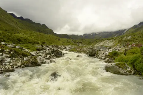
- Zemu Glacier and Teesta Headwater Drainages: Follow glacial melt descending from Kangchenjunga's east ramparts down the 26-kilometre Zemu Glacier. Debris-covered moraines feed straight into Sikkim's Teesta River watershed.
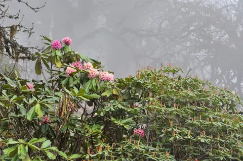
- Compacted Rhododendron and Krummholz Forest Belts: Notice vegetation shifting rapidly during day climbs through oak, birch and May-blooming rhododendrons. Above 4,000 metres, tall trees yield abruptly to wind-sculpted krummholz scrub.
- Sacred Mountain Geometry Protected Since 1955: Respect the 1955 summit pledge and India's 2000 climbing closure keeping Kangchenjunga's upper snow spire untouched in deference to Sikkimese traditions.
Best Time to Visit Khangchendzonga National Park and Entry Rules
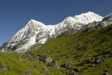
Picking the best time to visit khangchendzonga national park depends on monsoon rainstorms and winter snow blocks across passes exceeding 4,000 metres. Pre-monsoon spring brings vivid red rhododendrons blooming along Dzongri La slopes around May, whereas clearer post-monsoon autumn months typically expose sharp sunrise views across Kangchenjunga, Rathong and Kabru peaks without heavy summer cloud cover or winter blizzards. Check official Sikkim meteorological advisories and Forest Department trail status notices before scheduling multi-day mountain routes.
Active things to do in khangchendzonga national park centre on guided multi-day wilderness treks, high-altitude birdwatching and exploring living Lepcha and Bhutia heritage across outer valleys. Trekkers moving between Rathong River bridges, Dzongri La meadows and Goecha La pass trace intact glacial ecosystems, while travellers preferring gentler roads inspect sunrise peak vistas and buffer monuments such as Rabdentse ruins near Pelling. Because no public roads penetrate the 178,400-hectare wilderness core, meaningful visits require multiple days for safe acclimatisation and local guide logistics.
Reaching Sikkim's western and northern mountain districts pairs overland road corridors with regional air or rail gateways across north-eastern India. For cross-border geographic reference, Paro International Airport (PBH) in neighbouring Bhutan sits 111 kilometres southeast straight-line, while domestic Indian rail and highway links extend eastward across the northern plains from Varanasi (602 kilometres west). Verify current Indian protected-area permit requirements ahead of arrival, and explore additional transboundary Himalayan reserves inside our UNESCO World Heritage Atlas.