Quick Field Data
- UNESCO Inscription: 2001 · Criteria (ii) and (iv) · Ref. 753
- Scale & Footprint: 56.7 hectares enclosed behind Vauban-influenced Atlantic stone ramparts facing the offshore Mogador archipelago (Iles Purpuraires)
- Access & Ticketing: Street avenues, markets and seaward bastions along Sqala de la Kasbah remain open to pedestrians without entry gates, while Sqala du Port and historic museum interiors such as Bayt Dakira operate controlled entry
- Arrival Logistics: Served by Essaouira-Mogador Airport (ESU, 15 kilometres from the medina; regional routes lie 7 to 8 kilometres south of town) and linked overland 171 kilometres west of Marrakech
Phoenician Purple Dyes, Castelo Real and French Naval Expeditions
Sheltered behind the offshore Mogador archipelago (the Iles Purpuraires), the natural Atlantic bay of Essaouira has drawn mariners since antiquity. Protected from heavy ocean swells by Mogador Island while swept by steady trade winds and nutrient-rich Canary Current upwelling, the anchorage saw fifth-century BC Carthaginian explorer Hanno establish a coastal trading station known as Arambys. Centuries later, around the turn of the first century BC into the first century AD, Mauretanian King Juba II constructed a major Tyrian purple dye workshop on the offshore islets. Workers harvested marine murex and purpura sea snails from intertidal rocks to dye the purple senatorial stripes of Imperial Rome. Archaeological trenches on Mogador Island have uncovered a Roman villa, ceramic amphorae and third-century AD coins, displayed today in Essaouira's Sidi Mohammed ben Abdallah Museum and Rabat.
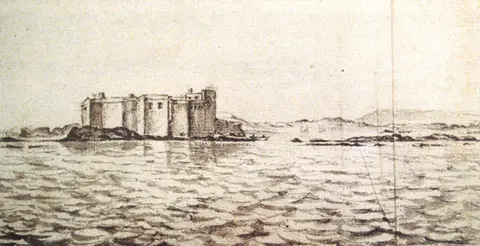
Through the medieval era, the burial shrine of Muslim saint Sidi Mogdoul lent its name to the anchorage, called Amegdul by eleventh-century geographer al-Bakri and rooted in the Phoenician term Migdol (small fortress), yielding the European designation Mogador used until the 1960s. In 1506, Portuguese King Manuel I, ordered construction of Castelo Real de Mogador as one of six fortified strongholds along Morocco's Atlantic littoral. Unlike permanent Portuguese enclaves at Agadir and Mazagan, Castelo Real fell within four years to local resistance led by the Regraga brotherhood in 1510. Throughout the sixteenth century, European powers including Spain, England, the Netherlands and France contested the anchorage while Mogador functioned as a harbour for sugar and molasses exports and corsair shelter.
France attempted direct occupation in 1629 under Cardinal Richelieu's maritime policy. Following earlier reconnaissance in 1619, Admiral Isaac de Razilly proposed in 1626 creating an Atlantic stronghold against the Sultan of Morocco to choke trade out of Safi. On 20 July 1629, Razilly sailed to Salé with a seven-ship squadron comprising the Licorne, Saint-Louis, Griffon, Catherine, Hambourg, Sainte-Anne and Saint-Jean. After bombarding Salé and destroying three corsair vessels, he dispatched Captain Treillebois aboard the Griffon to Mogador Island. Treillebois landed 100 men with timber and provisions beside Castelo Real ruins before re-embarking days later to rejoin the Salé fleet. Diplomatic talks following these expeditions produced the 1631 treaty with Abd el-Malek II granting France capitulation privileges, preferential tariffs, consular representation and freedom of worship.
Sultan Mohammed III, Cornut's Kasbah Grid and the Port of Timbuktu
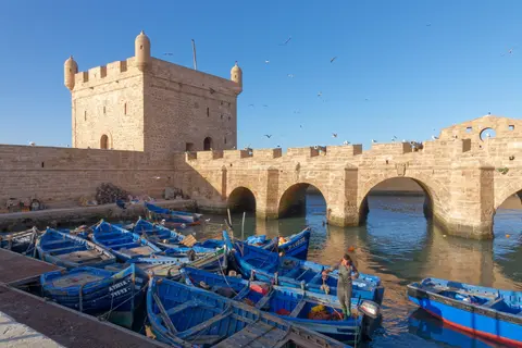
Unlike ancient Moroccan medinas that evolved organically over centuries, Essaouira's 56.7-hectare walled core emerged as a deliberate royal project launched in 1760 by Alaouite Sultan Sidi Mohamed Ben Abdallah (Mohammed III, ruling 1757 to 1790). Determined to reorient Moroccan commerce toward Atlantic sea lanes, he sought the shortest harbour outlet for inland Marrakech, linked across the plains by an almost straight overland road. Mohammed III chose Mogador while simultaneously shutting down rival southern trade at Agadir in 1767 after Agadir favoured a political rival. That move obliged Agadir's residents and European communities in Rabat-Salé (under an ordinance of 21 January 1765) to relocate into his new planned port.
Construction spanned roughly 12 years, uniting Moroccan masons from Fez, Marrakech and Rabat with European specialists, particularly French military architect Théodore Cornut and English convert Ahmed al-Inglizi (Ahmed the Renegade), aided by French captives from the failed 1765 Larache expedition. Cornut applied coastal fortification principles derived from Sébastien Le Prestre de Vauban's defences at Saint-Malo in Brittany, carving straight ceremonial streets inside the royal Kasbah and residential quarters for foreign consuls and merchants, while Ahmed al-Inglizi built the fortified Porte de la Marine harbour entrance. Built from porous local sandstone called manjour, the town shifted name from Souira (the small fortress) to Es-Saouira (the beautifully designed) and in Moroccan Arabic aṣ-Ṣwira.
Connected directly to Marrakech along caravan trails bringing goods from sub-Saharan Africa via Timbuktu and across the High Atlas, Essaouira became Morocco's premier nineteenth-century seaport, handling trade volumes roughly double those of Rabat and earning the nickname Port of Timbuktu. European powers posted consulates directly inside the medina, concentrating international diplomacy between Tangier and Essaouira by the 1820s.
The Mellah Quarter, Nineteenth-Century Bombardments and Craft Trades
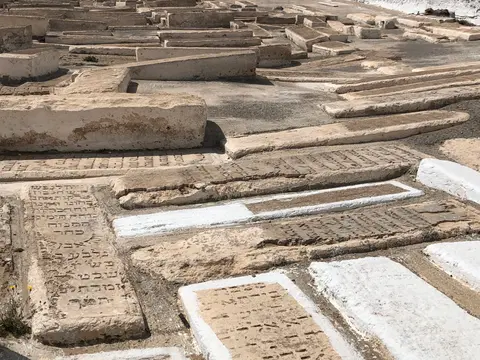
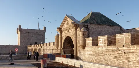
Social cohesion inside the planned city rested on deliberate religious and ethnic diversity uniting Amazigh, Arab, sub-Saharan African and European communities across Muslim, Christian and Jewish neighbourhoods. Mohammed III actively invited Moroccan Jewish merchant families to settle inside the town's Mellah quarter to manage maritime commerce with European ports. By 1867, a visiting French botanist observed that Jewish residents accounted for half of Essaouira's 12,000 inhabitants, worshipping at synagogues including Chaim Pinto and Slat Lkahal and burying relatives in two coastal cemeteries outside the walls. After direct European steam shipping replaced overland caravans and mid-twentieth-century geopolitical shifts spurred emigration, only three Jewish residents remained by 2017. Following King Mohammed VI's 15 January 2020 visit to the restored Bayt Dakira Jewish heritage museum, Essaouira's last lifelong Jewish resident, Josef Sebag, passed away in May 2025.
Two nineteenth-century naval bombardments tested Essaouira's ramparts. During the First Franco-Moroccan War on 16 August 1844, French warships under the Prince de Joinville bombarded and briefly occupied the island and harbour batteries following Morocco's support for Algerian leader Abd-El-Kader. Twenty years later in spring 1864, during the American Civil War, the Confederate commerce raider CSS Georgia anchored off Essaouira. When shore guards forced landing officers back into their cutter at gunpoint, Captain Matthew Fontaine Maury fired a salvo from the vessel's ten-inch turret gun, marking the sole occasion Confederate naval artillery fired outside North America. During the French Protectorate (1912 to 1956), French Generals Franchet d'Esperey and Brulard stationed 8,000 troops outside the city before taking the Kasbah of Dar Anflous on 25 January 1913. In 1930, explorers Michel and Jean Vieuchange launched their desert journey toward Smara from Essaouira, leaving colonial civic architecture including the former Franco-Moroccan school on Derb Dharb street and the French international school Groupe scolaire Eric-Tabarly.
Inside the modern 56.7-hectare medina of 82,962 city inhabitants (as of 2024), traditional crafts and Atlantic fishing keep the urban core economically active. Local livelihoods rest on cabinetmaking in fragrant thuya root wood (Tetraclinis), argan oil pressing, and abundant sardine and conger eel catches driven by cold coastal upwelling currents, even amid maritime competition from Agadir and Safi. Architectural landmarks include the Ben Youssef Mosque, Sidi Mogdoul mosque and lighthouse, Bab Manjana clocktower, Tagart beach dunes and the operational Catholic Church of Notre-Dame-de-l'Assomption. Orson Welles stayed at the Hotel des Iles just south of the town walls in the early 1950s while filming his 1952 screen adaptation of Othello. Later decades brought television and film shoots including Game of Thrones (where harbour ramparts doubled for Astapor) and Christopher Nolan's The Odyssey (2026). Annual events fill historic ramparts and squares, led by the four-day Gnaoua World Music Festival (established 1998, drawing 450,000 spectators each June to hear Gnaoua, rock, jazz and reggae). Founded in 2016, MOGA Festival pairs free MOGA OFF workshops across riads and rooftops with ticketed MOGA IN stages and British Council producer training. Heritage preservation operates under Law 22-80, the 1988 Urban Plan No. 4001 buffer zone, the Safeguarding Plan for the Medina and the Essaouira Urban Agency. This framework coordinates state, municipal, Habous, Israelite Alliance, cooperative and private property owners while balancing Atlantic sea dampness against selective building degradation inside the Mellah quarter.
Complex Access Zones and Fortification Sectors in Essaouira
Because Essaouira was built on an orderly eighteenth-century coastal grid enclosed within low sea walls, walking cleanly connects its artillery platforms, market thoroughfares and outlying harbour landmarks.
| Complex Zone | Key Highlights | Access & Ticket Rule |
|---|---|---|
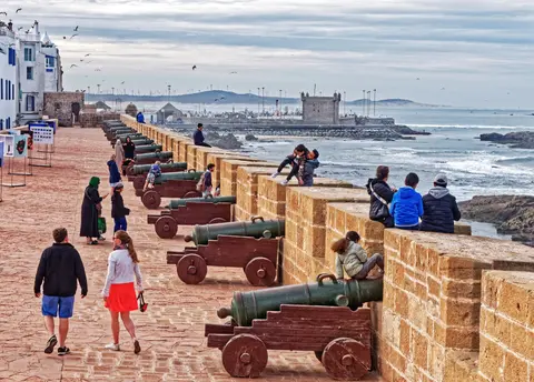
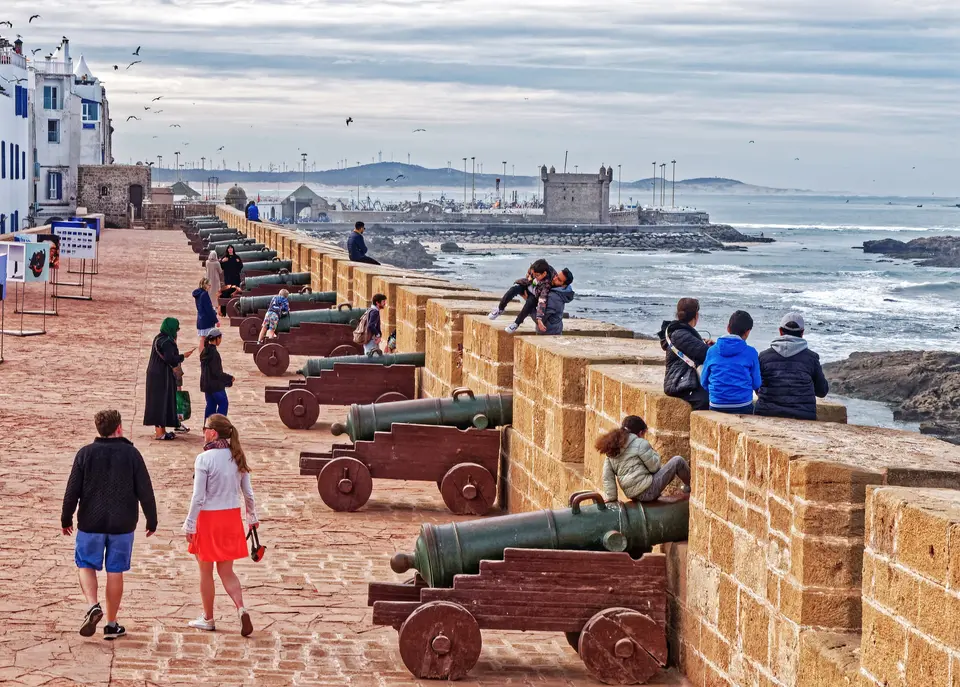
| Sqala de la Kasbah & Rampart Walk | Sea-facing Vauban-influenced cannon battery built in local manjour sandstone, broad stone casemates and views toward the Atlantic surf | Open pedestrian rampart corridor reached straight from the northern Kasbah avenues without an entrance fee |
| Sqala du Port & Porte de la Marine | Harbour bastion engineered by Ahmed al-Inglizi framing the working fishing port, traditional wooden boats and offshore Mogador Island | Port entrance gate remains open; climbing onto the Sqala du Port artillery platform requires a modest municipal entry ticket |
| Kasbah Grid, Derb Dharb & Craft Souks | Orthogonal avenues designed by Théodore Cornut, thuya woodcarving workshops beneath stone arcades, Sidi Mohammed ben Abdallah Museum and Ben Youssef Mosque | Open pedestrian streets free to walk; museum collections charge admission while active mosques restrict entry to worshippers |
| Mellah Quarter & Coastal Cemeteries | Northeastern former Jewish district, restored Bayt Dakira museum, Chaim Pinto and Slat Lkahal synagogues, old and new Jewish cemeteries outside the wall | Mellah lanes are publicly walkable; Bayt Dakira and preserved synagogues manage controlled entry and respectful cemetery visiting |
Three Coastal and Urban Features to Inspect in Essaouira
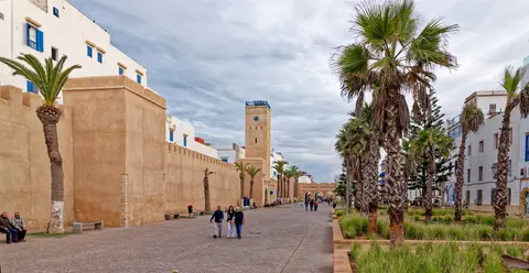
Walking the perimeter walls and straight inner streets highlights how eighteenth-century military theory was adapted to Moroccan urban materials:
- Porous Local Manjour Sandstone Masonry: Inspect the golden-ochre blocks facing the ocean waves along Sqala de la Kasbah; builders cut coastal manjour stone that absorbed mortar tightly yet requires regular maintenance against Atlantic salt spray and rising dampness.
- Orthogonal Kasbah Street Intersections vs Traditional Dead-End Alleys: Contrast the wide straight axes around the former consulates and Porte de la Marine with tighter winding alleys in adjacent residential quarters, illustrating how Cornut combined European defensive sightlines with traditional Moroccan domestic privacy.
- Intertidal Rock Reefs Sheltering the Harbour Basin: Look seaward from Sqala du Port across the low reefs linking the bay toward Mogador Island (Iles Purpuraires). From there, views extend southward past the sandy beach to the Oued Ksob discharge, Diabat village (5 kilometres south) and the Bordj El Berod ruins.
Seasonal Winds and Connecting Essaouira with Marrakech
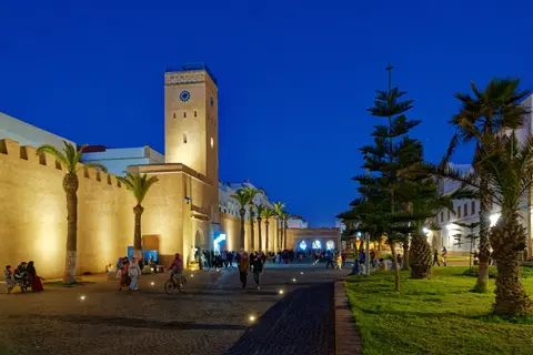
Essaouira enjoys a mild semi-arid coastal climate regulated by the Canary Current, keeping temperature extremes narrow across the year. Winter extremes include a record low of 2.2 degrees Celsius (29 January 2005) and a lowest daytime high of 11.8 degrees Celsius (15 February 2018). Heat peaks reached 35.7 degrees Celsius on 18 April 2017, with a highest recorded minimum of 26.7 degrees Celsius on 13 October 2017. Seasonal precipitation averages 300 to 500 millimetres and occasionally reaches intense daily totals such as 99.1 millimetres on 8 March 2013. Steady Atlantic trade winds keep midsummer afternoons brisk along the ramparts even when inland Morocco swelters, making coastal walking comfortable across every season if windproof layers are carried for evening gusts.
With Essaouira-Mogador Airport (ESU) located 15 kilometres out on the coastal plain and paved highways crossing the plains 171 kilometres inland to the terminus of trans-Saharan caravans, Essaouira pairs naturally with our Marrakech travel guide. Trace more fortified Atlantic and North African ports across our UNESCO World Heritage Atlas.